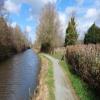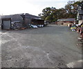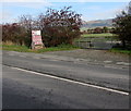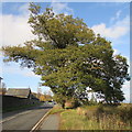
Site of Route to Original Whitehouse Bridge
The disused navigation channel now remains as a nature reserve.
A458, Welshpool, SY21 8SA, United Kingdom

Site of Route to Original Whitehouse Bridge
is a minor waterways place
on the Shropshire Union Canal (Montgomery Canal - isolated navigable section) between
Brithdir Lock No 19 (3 miles and 1¼ furlongs
and 2 locks
to the southwest) and
Guilsfield Branch Junction (6 miles and 6¾ furlongs
and 7 locks
to the northeast).
The nearest place in the direction of Brithdir Lock No 19 is Belan Visitor Moorings;
4¼ furlongs
away.
The nearest place in the direction of Guilsfield Branch Junction is Whitehouse Bridge No 120;
1¼ furlongs
away.
Mooring here is unrated.
| Sweeps Bridge No 122 | 1 mile, 3¼ furlongs | |
| Belan Lock No 18 | 5¾ furlongs | |
| Belan Bridge No 121 | 5¾ furlongs | |
| Belan Lock No 17 | 5¼ furlongs | |
| Belan Visitor Moorings | 4¼ furlongs | |
| Site of Route to Original Whitehouse Bridge | ||
| Whitehouse Bridge No 120 | 1¼ furlongs | |
| Welshpool Footbridge No 119A | 7¾ furlongs | |
| Welshpool Lock No 16 | 1 mile, ¼ furlongs | |
| Y Llanfa | 1 mile, ½ furlongs | |
| Severn Street Bridge Winding Hole | 1 mile, ¾ furlongs | |
Amenities here
There are no links to external websites from here.
Why not log in and add some (select "External websites" from the menu (sometimes this is under "Edit"))?
Why not log in and add some (select "External websites" from the menu (sometimes this is under "Edit"))?
Mouseover for more information or show routes to facility
Nearest water point
In the direction of Arddleen Bridge No 103
Welshpool Wharf — 1 mile, 1½ furlongs and 1 lock away
On this waterway in the direction of Arddleen Bridge No 103
Buttington Wharf — 2 miles, 4 furlongs and 1 lock away
On this waterway in the direction of Arddleen Bridge No 103
Maesbury Wharf — 16 miles, 4¼ furlongs and 9 locks away
Travel to Arddleen Bridge No 103, then on the Shropshire Union Canal (Montgomery Canal - northern unnavigable section) to Crickheath Bridge No 85, then on the Shropshire Union Canal (Montgomery Canal - connected and navigable) to Maesbury WharfNearest chemical toilet disposal
In the direction of Arddleen Bridge No 103
Maesbury Wharf — 16 miles, 4¼ furlongs and 9 locks away
Travel to Arddleen Bridge No 103, then on the Shropshire Union Canal (Montgomery Canal - northern unnavigable section) to Crickheath Bridge No 85, then on the Shropshire Union Canal (Montgomery Canal - connected and navigable) to Maesbury WharfNearest place to turn
In the direction of Efail Fach Bridge No 129
Brithdir Winding Hole — 3 miles, 1½ furlongs and 3 locks away
On this waterway in the direction of Efail Fach Bridge No 129
Berriew Winding Hole — 3 miles, 7¾ furlongs and 4 locks away
On this waterway in the direction of Efail Fach Bridge No 129
Efail Fach Bridge Winding Hole — 4 miles, 2 furlongs and 4 locks away
On this waterway in the direction of Efail Fach Bridge No 129
In the direction of Arddleen Bridge No 103
Severn Street Bridge Winding Hole — 1 mile, ¾ furlongs and 1 lock away
On this waterway in the direction of Arddleen Bridge No 103
Abbey Winding Hole — 3 miles, 3¼ furlongs and 1 lock away
On this waterway in the direction of Arddleen Bridge No 103
Crowther Hall Winding Hole — 4 miles, 6½ furlongs and 2 locks away
On this waterway in the direction of Arddleen Bridge No 103
Bank Lock Winding Hole — 5 miles, 3¼ furlongs and 5 locks away
On this waterway in the direction of Arddleen Bridge No 103
Red Bridge Winding Hole — 6 miles, 3¾ furlongs and 5 locks away
On this waterway in the direction of Arddleen Bridge No 103
Wide Water Winding Hole — 7 miles, 1¼ furlongs and 7 locks away
On this waterway in the direction of Arddleen Bridge No 103
Arddleen Winding Hole — 7 miles, 2¾ furlongs and 7 locks away
On this waterway in the direction of Arddleen Bridge No 103
Maerdy Winding Hole — 8 miles, 2 furlongs and 7 locks away
Travel to Arddleen Bridge No 103, then on the Shropshire Union Canal (Montgomery Canal - northern unnavigable section) to Maerdy Winding Hole
Clopton's Wharf Winding Hole — 9 miles, 3½ furlongs and 7 locks away
Travel to Arddleen Bridge No 103, then on the Shropshire Union Canal (Montgomery Canal - northern unnavigable section) to Clopton's Wharf Winding Hole
Llanymynech Winding Hole — 12 miles, 1 furlong and 9 locks away
Travel to Arddleen Bridge No 103, then on the Shropshire Union Canal (Montgomery Canal - northern unnavigable section) to Llanymynech Winding Hole
Llanymynech New Winding Hole — 12 miles, 3½ furlongs and 9 locks away
Travel to Arddleen Bridge No 103, then on the Shropshire Union Canal (Montgomery Canal - northern unnavigable section) to Llanymynech New Winding Hole
Waen Wen Basin — 13 miles, 6¾ furlongs and 9 locks away
Travel to Arddleen Bridge No 103, then on the Shropshire Union Canal (Montgomery Canal - northern unnavigable section) to Waen Wen Basin
Crickheath Wharf Winding Hole — 14 miles, 5½ furlongs and 9 locks away
Travel to Arddleen Bridge No 103, then on the Shropshire Union Canal (Montgomery Canal - northern unnavigable section) to Crickheath Bridge No 85, then on the Shropshire Union Canal (Montgomery Canal - connected and navigable) to Crickheath Wharf Winding Hole
Gronwyn Bridge Winding Hole — 15 miles, 7 furlongs and 9 locks away
Travel to Arddleen Bridge No 103, then on the Shropshire Union Canal (Montgomery Canal - northern unnavigable section) to Crickheath Bridge No 85, then on the Shropshire Union Canal (Montgomery Canal - connected and navigable) to Gronwyn Bridge Winding Hole
Park Mill Bridge Winding Hole — 17 miles, ½ furlongs and 9 locks away
Travel to Arddleen Bridge No 103, then on the Shropshire Union Canal (Montgomery Canal - northern unnavigable section) to Crickheath Bridge No 85, then on the Shropshire Union Canal (Montgomery Canal - connected and navigable) to Park Mill Bridge Winding Hole
Queen's Head Winding Hole — 18 miles, 6¼ furlongs and 12 locks away
Travel to Arddleen Bridge No 103, then on the Shropshire Union Canal (Montgomery Canal - northern unnavigable section) to Crickheath Bridge No 85, then on the Shropshire Union Canal (Montgomery Canal - connected and navigable) to Queen's Head Winding HoleNearest self-operated pump-out
In the direction of Arddleen Bridge No 103
Maesbury Wharf — 16 miles, 4¼ furlongs and 9 locks away
Travel to Arddleen Bridge No 103, then on the Shropshire Union Canal (Montgomery Canal - northern unnavigable section) to Crickheath Bridge No 85, then on the Shropshire Union Canal (Montgomery Canal - connected and navigable) to Maesbury WharfNo information
CanalPlan has no information on any of the following facilities within range:rubbish disposal
boatyard pump-out
Direction of TV transmitter (From Wolfbane Cybernetic)
There is no page on Wikipedia called “Site of Route to Original Whitehouse Bridge”
Wikipedia pages that might relate to Site of Route to Original Whitehouse Bridge
[Forth Bridge]
The Forth Bridge is a cantilever railway bridge across the Firth of Forth in the east of Scotland, 9 miles (14 kilometres) west of central Edinburgh. Completed
[U.S. Route 22 in New Jersey]
Easton–Phillipsburg Toll Bridge over the Delaware River in Phillipsburg, Warren County to Interstate 78 (I-78), US 1/9, and Route 21 at the Newark Airport
[U.S. Route 340]
routes pass by the historic estate Massanutton Heights, pass through Salem, and cross the South Fork Shenandoah River at Whitehouse Landing, the site
[Uganda Railway]
pp. 601–606. Whitehouse 1948, p. 3. Whitehouse 1948, p. 15. Whitehouse 1948, p. 7 Whitehouse 1948, p. 8 Whitehouse 1948, p. 10 "End of Lunatic Express"
[U.S. Route 202]
U.S. Route 202 (US 202) is a spur route of US 2. It follows a northeasterly and southwesterly direction stretching from Delaware in the south to Maine
[Pennsylvania Avenue]
NW to 11th St. NW) 905 (7th St. N.W. to 11th St. N.W.) The following routes of TheBus serve Pennsylvania Ave. in Prince George's County: 24 (Old Silver
[Huntington, West Virginia]
both sides of the river completed was what was known as Phase I. Future plans involved tolling the bridge and connecting it to U.S. Route 60 four blocks
[Llangollen Canal]
stretch from Gledrid Bridge near Rhoswiel to Horseshoe Falls including Pontcysyllte and Chirk aqueducts was declared a World Heritage Site by UNESCO. A grand
[U.S. Route 12 in Idaho]
early 1973. The route previously was on the river's south bank between the bridge and Spalding, where it crossed on the old Spalding bridge; damaged by ice
[Gateway Arch National Park]
Interior Office of Congressional and Legislative Affairs. Retrieved January 12, 2023. "President Donald J. Trump Signs S. 1438 into Law". whitehouse.gov – via


