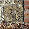
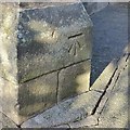
Ironville Bridge
Pinxton Canal Path, Ironville, NG16 5NW, United Kingdom

Ironville Bridge
is a minor waterways place
on the Cromford Canal Pinxton Branch between
Pinxton Wharf (1 mile and 7½ furlongs
to the northeast) and
Ironville Junction (Junction with Pinxton Branch) (2½ furlongs
to the southwest).
The nearest place in the direction of Pinxton Wharf is Railway Bridge No 4 (Cromford Canal);
¾ furlongs
away.
There may be access to the towpath here.
Mooring here is unrated.
There is a bridge here which takes a minor road over the canal.
Boat Inn PH (Pinxton) | 1 mile, 6¾ furlongs | |
Railway Bridge No 9 (Cromford Canal) | 7¼ furlongs | |
Pye Bridge No 8 | 5¼ furlongs | |
Fletcher's Row Bridge No 5 | 1½ furlongs | |
Railway Bridge No 4 (Cromford Canal) | ¾ furlongs | |
Ironville Bridge | ||
Ironville Junction | 2½ furlongs |
Amenities here
There are no links to external websites from here.
Why not log in and add some (select "External websites" from the menu (sometimes this is under "Edit"))?
Mouseover for more information or show routes to facility
Nearest water point
In the direction of Ironville Junction
Langley Junction — 3 miles, 5½ furlongs and 14 locks away
Travel to Ironville Junction, then on the Cromford Canal (broad gauge, un-navigable) to Langley Mill Boatyard Moorings, then on the Cromford Canal (broad gauge, navigable) to Langley Junction
Former BW Trent Lock Waterway Office — 15 miles, 1½ furlongs and 28 locks away
Travel to Ironville Junction, then on the Cromford Canal (broad gauge, un-navigable) to Langley Mill Boatyard Moorings, then on the Cromford Canal (broad gauge, navigable) to Derby Road Bridge, then on the Grand Union Canal (Erewash Canal) to Former BW Trent Lock Waterway Office
Sawley Locks No 2 — 16 miles, 1¾ furlongs and 29 locks away
Travel to Ironville Junction, then on the Cromford Canal (broad gauge, un-navigable) to Langley Mill Boatyard Moorings, then on the Cromford Canal (broad gauge, navigable) to Derby Road Bridge, then on the Grand Union Canal (Erewash Canal) to Trent Junction, then on the River Trent (Western End) to Sawley Locks No 2
Cranfleet Lock No 3 — 16 miles and 30 locks away
Travel to Ironville Junction, then on the Cromford Canal (broad gauge, un-navigable) to Langley Mill Boatyard Moorings, then on the Cromford Canal (broad gauge, navigable) to Derby Road Bridge, then on the Grand Union Canal (Erewash Canal) to Trent Junction, then on the River Trent (Western End) to Cranfleet Lock No 3
Shardlow — 18 miles, 3½ furlongs and 32 locks away
Travel to Ironville Junction, then on the Cromford Canal (broad gauge, un-navigable) to Langley Mill Boatyard Moorings, then on the Cromford Canal (broad gauge, navigable) to Derby Road Bridge, then on the Grand Union Canal (Erewash Canal) to Trent Junction, then on the River Trent (Western End) to Derwent Mouth, then on the Trent and Mersey Canal (Main Line - Derwent Mouth to Burton) to ShardlowNearest rubbish disposal
In the direction of Ironville Junction
Former BW Trent Lock Waterway Office — 15 miles, 1½ furlongs and 28 locks away
Travel to Ironville Junction, then on the Cromford Canal (broad gauge, un-navigable) to Langley Mill Boatyard Moorings, then on the Cromford Canal (broad gauge, navigable) to Derby Road Bridge, then on the Grand Union Canal (Erewash Canal) to Former BW Trent Lock Waterway Office
Sawley Locks No 2 — 16 miles, 1¾ furlongs and 29 locks away
Travel to Ironville Junction, then on the Cromford Canal (broad gauge, un-navigable) to Langley Mill Boatyard Moorings, then on the Cromford Canal (broad gauge, navigable) to Derby Road Bridge, then on the Grand Union Canal (Erewash Canal) to Trent Junction, then on the River Trent (Western End) to Sawley Locks No 2
Cranfleet Lock No 3 — 16 miles and 30 locks away
Travel to Ironville Junction, then on the Cromford Canal (broad gauge, un-navigable) to Langley Mill Boatyard Moorings, then on the Cromford Canal (broad gauge, navigable) to Derby Road Bridge, then on the Grand Union Canal (Erewash Canal) to Trent Junction, then on the River Trent (Western End) to Cranfleet Lock No 3Nearest chemical toilet disposal
In the direction of Ironville Junction
Langley Junction — 3 miles, 5½ furlongs and 14 locks away
Travel to Ironville Junction, then on the Cromford Canal (broad gauge, un-navigable) to Langley Mill Boatyard Moorings, then on the Cromford Canal (broad gauge, navigable) to Langley Junction
Former BW Trent Lock Waterway Office — 15 miles, 1½ furlongs and 28 locks away
Travel to Ironville Junction, then on the Cromford Canal (broad gauge, un-navigable) to Langley Mill Boatyard Moorings, then on the Cromford Canal (broad gauge, navigable) to Derby Road Bridge, then on the Grand Union Canal (Erewash Canal) to Former BW Trent Lock Waterway Office
Sawley Locks No 2 — 16 miles, 1¾ furlongs and 29 locks away
Travel to Ironville Junction, then on the Cromford Canal (broad gauge, un-navigable) to Langley Mill Boatyard Moorings, then on the Cromford Canal (broad gauge, navigable) to Derby Road Bridge, then on the Grand Union Canal (Erewash Canal) to Trent Junction, then on the River Trent (Western End) to Sawley Locks No 2
Sawley Cut Wharf — 16 miles, 3¼ furlongs and 30 locks away
Travel to Ironville Junction, then on the Cromford Canal (broad gauge, un-navigable) to Langley Mill Boatyard Moorings, then on the Cromford Canal (broad gauge, navigable) to Derby Road Bridge, then on the Grand Union Canal (Erewash Canal) to Trent Junction, then on the River Trent (Western End) to Sawley Cut WharfNearest place to turn
In the direction of Ironville Junction
Cromford Winding Hole — 11 miles, 6 furlongs away
Travel to Ironville Junction, then on the Cromford Canal (broad gauge, un-navigable) to Butterley Tunnel (eastern entrance), then on the Cromford Canal (narrow gauge, un-navigable) to Cromford Winding Hole
Langley Junction — 3 miles, 5½ furlongs and 14 locks away
Travel to Ironville Junction, then on the Cromford Canal (broad gauge, un-navigable) to Langley Mill Boatyard Moorings, then on the Cromford Canal (broad gauge, navigable) to Langley Junction
Anchor Road Winding Hole — 4 miles, ¼ furlongs and 15 locks away
Travel to Ironville Junction, then on the Cromford Canal (broad gauge, un-navigable) to Langley Mill Boatyard Moorings, then on the Cromford Canal (broad gauge, navigable) to Derby Road Bridge, then on the Grand Union Canal (Erewash Canal) to Anchor Road Winding Hole
Shipley Mill Winding Hole — 5 miles, 2½ furlongs and 17 locks away
Travel to Ironville Junction, then on the Cromford Canal (broad gauge, un-navigable) to Langley Mill Boatyard Moorings, then on the Cromford Canal (broad gauge, navigable) to Derby Road Bridge, then on the Grand Union Canal (Erewash Canal) to Shipley Mill Winding Hole
Bridge Street Winding Hole — 6 miles, ½ furlongs and 17 locks away
Travel to Ironville Junction, then on the Cromford Canal (broad gauge, un-navigable) to Langley Mill Boatyard Moorings, then on the Cromford Canal (broad gauge, navigable) to Derby Road Bridge, then on the Grand Union Canal (Erewash Canal) to Bridge Street Winding Hole
Winding Hole below Stenson's Lock — 6 miles, 4 furlongs and 18 locks away
Travel to Ironville Junction, then on the Cromford Canal (broad gauge, un-navigable) to Langley Mill Boatyard Moorings, then on the Cromford Canal (broad gauge, navigable) to Derby Road Bridge, then on the Grand Union Canal (Erewash Canal) to Winding Hole below Stenson's Lock
Hallam Fields Lock Winding Hole — 9 miles, 3 furlongs and 22 locks away
Travel to Ironville Junction, then on the Cromford Canal (broad gauge, un-navigable) to Langley Mill Boatyard Moorings, then on the Cromford Canal (broad gauge, navigable) to Derby Road Bridge, then on the Grand Union Canal (Erewash Canal) to Hallam Fields Lock Winding Hole
Winding Hole above Stanton Lock — 9 miles, 6½ furlongs and 23 locks away
Travel to Ironville Junction, then on the Cromford Canal (broad gauge, un-navigable) to Langley Mill Boatyard Moorings, then on the Cromford Canal (broad gauge, navigable) to Derby Road Bridge, then on the Grand Union Canal (Erewash Canal) to Winding Hole above Stanton Lock
Sandiacre Junction — 12 miles, ¼ furlongs and 25 locks away
Travel to Ironville Junction, then on the Cromford Canal (broad gauge, un-navigable) to Langley Mill Boatyard Moorings, then on the Cromford Canal (broad gauge, navigable) to Derby Road Bridge, then on the Grand Union Canal (Erewash Canal) to Sandiacre Junction
Long Eaton Winding Hole — 13 miles, 2¾ furlongs and 27 locks away
Travel to Ironville Junction, then on the Cromford Canal (broad gauge, un-navigable) to Langley Mill Boatyard Moorings, then on the Cromford Canal (broad gauge, navigable) to Derby Road Bridge, then on the Grand Union Canal (Erewash Canal) to Long Eaton Winding Hole
Sheet Stores Basin — 14 miles, 4½ furlongs and 28 locks away
Travel to Ironville Junction, then on the Cromford Canal (broad gauge, un-navigable) to Langley Mill Boatyard Moorings, then on the Cromford Canal (broad gauge, navigable) to Derby Road Bridge, then on the Grand Union Canal (Erewash Canal) to Sheet Stores Basin
Former BW Trent Lock Waterway Office — 15 miles, 1½ furlongs and 28 locks away
Travel to Ironville Junction, then on the Cromford Canal (broad gauge, un-navigable) to Langley Mill Boatyard Moorings, then on the Cromford Canal (broad gauge, navigable) to Derby Road Bridge, then on the Grand Union Canal (Erewash Canal) to Former BW Trent Lock Waterway Office
Soar Mouth — 15 miles, 4 furlongs and 29 locks away
Travel to Ironville Junction, then on the Cromford Canal (broad gauge, un-navigable) to Langley Mill Boatyard Moorings, then on the Cromford Canal (broad gauge, navigable) to Derby Road Bridge, then on the Grand Union Canal (Erewash Canal) to Trent Junction, then on the Grand Union Canal (Leicester Section - River Soar Navigation) to Soar Mouth
Redhill Lock Junction — 15 miles, 6¾ furlongs and 29 locks away
Travel to Ironville Junction, then on the Cromford Canal (broad gauge, un-navigable) to Langley Mill Boatyard Moorings, then on the Cromford Canal (broad gauge, navigable) to Derby Road Bridge, then on the Grand Union Canal (Erewash Canal) to Trent Junction, then on the Grand Union Canal (Leicester Section - River Soar Navigation) to Redhill Lock Junction
Sawley Lock No 2 Weir Exit — 16 miles, 1 furlong and 29 locks away
Travel to Ironville Junction, then on the Cromford Canal (broad gauge, un-navigable) to Langley Mill Boatyard Moorings, then on the Cromford Canal (broad gauge, navigable) to Derby Road Bridge, then on the Grand Union Canal (Erewash Canal) to Trent Junction, then on the River Trent (Western End) to Sawley Lock No 2 Weir Exit
Redhill Marine Ltd — 16 miles, 3 furlongs and 30 locks away
Travel to Ironville Junction, then on the Cromford Canal (broad gauge, un-navigable) to Langley Mill Boatyard Moorings, then on the Cromford Canal (broad gauge, navigable) to Derby Road Bridge, then on the Grand Union Canal (Erewash Canal) to Trent Junction, then on the Grand Union Canal (Leicester Section - River Soar Navigation) to Redhill Marine Ltd
Ratcliffe Lock Junction — 16 miles, 5½ furlongs and 30 locks away
Travel to Ironville Junction, then on the Cromford Canal (broad gauge, un-navigable) to Langley Mill Boatyard Moorings, then on the Cromford Canal (broad gauge, navigable) to Derby Road Bridge, then on the Grand Union Canal (Erewash Canal) to Trent Junction, then on the Grand Union Canal (Leicester Section - River Soar Navigation) to Ratcliffe Lock Junction
Cranfleet Lock Weir Exit — 16 miles, ¾ furlongs and 31 locks away
Travel to Ironville Junction, then on the Cromford Canal (broad gauge, un-navigable) to Langley Mill Boatyard Moorings, then on the Cromford Canal (broad gauge, navigable) to Derby Road Bridge, then on the Grand Union Canal (Erewash Canal) to Trent Junction, then on the River Trent (Western End) to Cranfleet Lock Weir Exit
Sawley Flood Lock Weir Entrance — 16 miles, 6¾ furlongs and 31 locks away
Travel to Ironville Junction, then on the Cromford Canal (broad gauge, un-navigable) to Langley Mill Boatyard Moorings, then on the Cromford Canal (broad gauge, navigable) to Derby Road Bridge, then on the Grand Union Canal (Erewash Canal) to Trent Junction, then on the River Trent (Western End) to Sawley Flood Lock Weir Entrance
Ratcliffe Weir — 17 miles, ½ furlongs and 31 locks away
Travel to Ironville Junction, then on the Cromford Canal (broad gauge, un-navigable) to Langley Mill Boatyard Moorings, then on the Cromford Canal (broad gauge, navigable) to Derby Road Bridge, then on the Grand Union Canal (Erewash Canal) to Trent Junction, then on the Grand Union Canal (Leicester Section - River Soar Navigation) to Ratcliffe WeirNearest boatyard pump-out
In the direction of Ironville Junction
Langley Junction — 3 miles, 5½ furlongs and 14 locks away
Travel to Ironville Junction, then on the Cromford Canal (broad gauge, un-navigable) to Langley Mill Boatyard Moorings, then on the Cromford Canal (broad gauge, navigable) to Langley JunctionNo information
CanalPlan has no information on any of the following facilities within range:self-operated pump-out
Direction of TV transmitter (From Wolfbane Cybernetic)
There is no page on Wikipedia called “Ironville Bridge”
Wikipedia pages that might relate to Ironville Bridge
[Ironville]
terminates just south of the former Pye Bridge Station. The History of Ironville & Codnor Park in a “nutshell” Ironville is possibly Derbyshire’s best example
[Codnor Park and Ironville railway station]
Codnor Park and Ironville railway station served the villages of Codnor Park and Ironville, Derbyshire, England from 1847 to 1967 on the Erewash Valley
[Ambergate–Pye Bridge line]
(with the three points being Riddings Junction, Ironville Junction and Codnor Park Junction). Pye Bridge railway station on the Erewash Valley line was
[Midland Railway – Butterley]
6 km) from Hammersmith via Butterley, Swanwick Junction, and Riddings to Ironville. It is operated by the Midland Railway Trust. The railway is also home
[Erewash Valley line]
Junction, installed the new Ironville Junction and renewed three miles of track in the Stanton Gate to Trowell area and at Ironville. The closure was also used
[Pye Bridge railway station]
Pye Bridge railway station served the village of Pye Bridge, Derbyshire, England from 1849 to 1967 on the Erewash Valley Line. The station opened as Pye
[List of communities in the Cape Breton Regional Municipality]
Road Howie Centre (2,500) Huntington (72) Irish Cove (10) Irishvale (18) Ironville (35) Island View (22) Juniper Mountain (45) Leitches Creek (193) Leitches
[Crown Point, New York]
Ironville – A hamlet in the southern part of the town, on County Road 2 at the northern end of Penfield Pond. It is the location of the Ironville Historic
[Midland Main Line]
Junction and Cossall- reopened as Ilkeston Shipley Gate Codnor Park and Ironville Pye Bridge Westhouses and Blackwell Doe Hill Chesterfield to Leeds Staveley
[List of places in Derbyshire]
Idridgehay Green Ilkeston Ingleby Ingmanthorpe Inkersall Ireton Wood Ironville Ivonbrook Grange Kedleston Kelstedge Kilburn Killamarsh River Kinder Kinder