CanalPlanAC

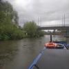
Wilford Toll Bridge

 
End of Navigation
Wilford Toll Bridge, Main Road, Wilford, NG2 1DW, United Kingdom
 
Information about the place
Wilford Toll Bridge is a minor waterways place at the end of the River Trent (non-tidal section) (beyond which it is not safely navigable); past Nottingham County Hall (1 mile and ¼ furlongs to the east).
 
 
The nearest place in the direction of Nottingham County Hall is Wilford Suspension Bridge; 6¾ furlongs away.

Mooring here is impossible (it may be physically impossible, forbidden, or allowed only for specific short-term purposes).

There is a bridge here which takes a railway over the canal.

Lady Bay Bridge1 mile, 4¾ furlongs
Grantham Canal Junction1 mile, 4¼ furlongs
Meadow Lane Junction1 mile, 2½ furlongs
Trent Bridge1 mile, 1½ furlongs
Nottingham County Hall1 mile, ¼ furlongs
Wilford Suspension Bridge6¾ furlongs
Wilford Toll Bridge
 
 
Amenities

Amenities here

 Ferry Inn
 Harry Ramsden
 B&Q
 B&Q
 Plumbing Trade Supplies
 Travis Perkins
 Wickes

Amenities nearby at Wilford Suspension Bridge

 ASDA
 ASDA - West Bridgford - NG2 7JA
 Asda
 McDonalds
 Hungry Horse
 SEE ADDRESS
 Fish & Chips
 Cashpoint
 Cashpoint
 Cashpoint
 ASDA Fuel
 BP
 
Maps
If you are a user and are logged on, or if you are actively planning a route, a map will be displayed here.
Show on external mapping site: Google | OSM | Bing
 
Navigational Notes

This is the signed limit of navigation.

Shallow-drafted boats may be able to proceed further, but at their own risk and with no responsibility from Canal & River Trust. There are rocky shallows, and no straightforward places to moor anywhere upstream of Wilford Suspension Bridge (County Hall mooring). The steps on the north bank have a concrete shelf below water level and no rings.

 
Photos
 
External websites
There are no links to external websites from here.
Why not log in and add some (select "External websites" from the menu (sometimes this is under "Edit"))?
 
Nearest facilities

Mouseover for more information or show routes to facility

Nearest water point

In the direction of Cromwell Lock Weir Exit

Holme Lock No 53 miles, 5¾ furlongs away
On this waterway in the direction of Cromwell Lock Weir Exit
Stoke Lock No 66 miles, 6 furlongs and 1 lock away
On this waterway in the direction of Cromwell Lock Weir Exit
Beeston Lock No 57 miles, 1¾ furlongs and 2 locks away
Travel to Meadow Lane Junction, then on the River Trent (Nottingham Canal) to Lenton Chain, then on the River Trent (Beeston Canal) to Beeston Lock No 5
Gunthorpe Lock No 711 miles, 4 furlongs and 2 locks away
On this waterway in the direction of Cromwell Lock Weir Exit
Cranfleet Lock No 311 miles, 4½ furlongs and 3 locks away
Travel to Meadow Lane Junction, then on the River Trent (Nottingham Canal) to Lenton Chain, then on the River Trent (Beeston Canal) to Beeston Lock No 5, then on the River Trent (Western End) to Cranfleet Lock No 3
Former BW Trent Lock Waterway Office12 miles, 2¾ furlongs and 6 locks away
Travel to Meadow Lane Junction, then on the River Trent (Nottingham Canal) to Lenton Chain, then on the River Trent (Beeston Canal) to Beeston Lock No 5, then on the River Trent (Western End) to Trent Junction, then on the Grand Union Canal (Erewash Canal) to Former BW Trent Lock Waterway Office
Sawley Locks No 213 miles, 1 furlong and 5 locks away
Travel to Meadow Lane Junction, then on the River Trent (Nottingham Canal) to Lenton Chain, then on the River Trent (Beeston Canal) to Beeston Lock No 5, then on the River Trent (Western End) to Sawley Locks No 2
Hazelford Lock No 816 miles, 2 furlongs and 3 locks away
On this waterway in the direction of Cromwell Lock Weir Exit
Shardlow15 miles, 2¾ furlongs and 8 locks away
Travel to Meadow Lane Junction, then on the River Trent (Nottingham Canal) to Lenton Chain, then on the River Trent (Beeston Canal) to Beeston Lock No 5, then on the River Trent (Western End) to Derwent Mouth, then on the Trent and Mersey Canal (Main Line - Derwent Mouth to Burton) to Shardlow
Weston Lock No 418 miles, 2¼ furlongs and 10 locks away
Travel to Meadow Lane Junction, then on the River Trent (Nottingham Canal) to Lenton Chain, then on the River Trent (Beeston Canal) to Beeston Lock No 5, then on the River Trent (Western End) to Derwent Mouth, then on the Trent and Mersey Canal (Main Line - Derwent Mouth to Burton) to Weston Lock No 4

Nearest rubbish disposal

In the direction of Cromwell Lock Weir Exit

Holme Lock No 53 miles, 5¾ furlongs away
On this waterway in the direction of Cromwell Lock Weir Exit
Stoke Lock No 66 miles, 6 furlongs and 1 lock away
On this waterway in the direction of Cromwell Lock Weir Exit
Beeston Lock No 57 miles, 1¾ furlongs and 2 locks away
Travel to Meadow Lane Junction, then on the River Trent (Nottingham Canal) to Lenton Chain, then on the River Trent (Beeston Canal) to Beeston Lock No 5
Gunthorpe Lock No 711 miles, 4 furlongs and 2 locks away
On this waterway in the direction of Cromwell Lock Weir Exit
Cranfleet Lock No 311 miles, 4½ furlongs and 3 locks away
Travel to Meadow Lane Junction, then on the River Trent (Nottingham Canal) to Lenton Chain, then on the River Trent (Beeston Canal) to Beeston Lock No 5, then on the River Trent (Western End) to Cranfleet Lock No 3
Former BW Trent Lock Waterway Office12 miles, 2¾ furlongs and 6 locks away
Travel to Meadow Lane Junction, then on the River Trent (Nottingham Canal) to Lenton Chain, then on the River Trent (Beeston Canal) to Beeston Lock No 5, then on the River Trent (Western End) to Trent Junction, then on the Grand Union Canal (Erewash Canal) to Former BW Trent Lock Waterway Office
Sawley Locks No 213 miles, 1 furlong and 5 locks away
Travel to Meadow Lane Junction, then on the River Trent (Nottingham Canal) to Lenton Chain, then on the River Trent (Beeston Canal) to Beeston Lock No 5, then on the River Trent (Western End) to Sawley Locks No 2
Hazelford Lock No 816 miles, 2 furlongs and 3 locks away
On this waterway in the direction of Cromwell Lock Weir Exit

Nearest chemical toilet disposal

In the direction of Cromwell Lock Weir Exit

Meadow Lane Lock No 71 mile, 2¾ furlongs away
Travel to Meadow Lane Junction, then on the River Trent (Nottingham Canal) to Meadow Lane Lock No 7
Holme Lock No 53 miles, 5¾ furlongs away
On this waterway in the direction of Cromwell Lock Weir Exit
Stoke Lock No 66 miles, 6 furlongs and 1 lock away
On this waterway in the direction of Cromwell Lock Weir Exit
Beeston Lock No 57 miles, 1¾ furlongs and 2 locks away
Travel to Meadow Lane Junction, then on the River Trent (Nottingham Canal) to Lenton Chain, then on the River Trent (Beeston Canal) to Beeston Lock No 5
Gunthorpe Lock No 711 miles, 4 furlongs and 2 locks away
On this waterway in the direction of Cromwell Lock Weir Exit
Former BW Trent Lock Waterway Office12 miles, 2¾ furlongs and 6 locks away
Travel to Meadow Lane Junction, then on the River Trent (Nottingham Canal) to Lenton Chain, then on the River Trent (Beeston Canal) to Beeston Lock No 5, then on the River Trent (Western End) to Trent Junction, then on the Grand Union Canal (Erewash Canal) to Former BW Trent Lock Waterway Office
Sawley Locks No 213 miles, 1 furlong and 5 locks away
Travel to Meadow Lane Junction, then on the River Trent (Nottingham Canal) to Lenton Chain, then on the River Trent (Beeston Canal) to Beeston Lock No 5, then on the River Trent (Western End) to Sawley Locks No 2
Sawley Cut Wharf13 miles, 2½ furlongs and 6 locks away
Travel to Meadow Lane Junction, then on the River Trent (Nottingham Canal) to Lenton Chain, then on the River Trent (Beeston Canal) to Beeston Lock No 5, then on the River Trent (Western End) to Sawley Cut Wharf

Nearest place to turn

In the direction of Cromwell Lock Weir Exit

Poplar Arms Corner1 mile, 5¾ furlongs and 1 lock away
Travel to Meadow Lane Junction, then on the River Trent (Nottingham Canal) to Poplar Arms Corner
Canal Museum Wharf1 mile, 7½ furlongs and 1 lock away
Travel to Meadow Lane Junction, then on the River Trent (Nottingham Canal) to Canal Museum Wharf
Holme Lock Weir Entrance3 miles, 4¼ furlongs away
On this waterway in the direction of Cromwell Lock Weir Exit
Holme Lock Weir Exit3 miles, 7¼ furlongs and 1 lock away
On this waterway in the direction of Cromwell Lock Weir Exit
Redfield Road Bridge Winding Hole3 miles, 7½ furlongs and 2 locks away
Travel to Meadow Lane Junction, then on the River Trent (Nottingham Canal) to Lenton Chain, then on the River Trent (Beeston Canal) to Redfield Road Bridge Winding Hole
Rylands Bridge Winding Hole5 miles, 7¾ furlongs and 2 locks away
Travel to Meadow Lane Junction, then on the River Trent (Nottingham Canal) to Lenton Chain, then on the River Trent (Beeston Canal) to Rylands Bridge Winding Hole
Cranfleet Lock Weir Exit11 miles, 3¾ furlongs and 3 locks away
Travel to Meadow Lane Junction, then on the River Trent (Nottingham Canal) to Lenton Chain, then on the River Trent (Beeston Canal) to Beeston Lock No 5, then on the River Trent (Western End) to Cranfleet Lock Weir Exit
Soar Mouth12 miles, 3¼ furlongs and 5 locks away
Travel to Meadow Lane Junction, then on the River Trent (Nottingham Canal) to Lenton Chain, then on the River Trent (Beeston Canal) to Beeston Lock No 5, then on the River Trent (Western End) to Trent Junction, then on the Grand Union Canal (Leicester Section - River Soar Navigation) to Soar Mouth
Redhill Lock Junction12 miles, 6 furlongs and 5 locks away
Travel to Meadow Lane Junction, then on the River Trent (Nottingham Canal) to Lenton Chain, then on the River Trent (Beeston Canal) to Beeston Lock No 5, then on the River Trent (Western End) to Trent Junction, then on the Grand Union Canal (Leicester Section - River Soar Navigation) to Redhill Lock Junction
Sawley Lock No 2 Weir Exit13 miles, ¼ furlongs and 5 locks away
Travel to Meadow Lane Junction, then on the River Trent (Nottingham Canal) to Lenton Chain, then on the River Trent (Beeston Canal) to Beeston Lock No 5, then on the River Trent (Western End) to Sawley Lock No 2 Weir Exit
Former BW Trent Lock Waterway Office12 miles, 2¾ furlongs and 6 locks away
Travel to Meadow Lane Junction, then on the River Trent (Nottingham Canal) to Lenton Chain, then on the River Trent (Beeston Canal) to Beeston Lock No 5, then on the River Trent (Western End) to Trent Junction, then on the Grand Union Canal (Erewash Canal) to Former BW Trent Lock Waterway Office
Hazelford Lock East Weir Entrance15 miles, 4¾ furlongs and 3 locks away
On this waterway in the direction of Cromwell Lock Weir Exit
Hazelford Ferry15 miles, 5¼ furlongs and 3 locks away
On this waterway in the direction of Cromwell Lock Weir Exit
Sheet Stores Basin12 miles, 7¾ furlongs and 6 locks away
Travel to Meadow Lane Junction, then on the River Trent (Nottingham Canal) to Lenton Chain, then on the River Trent (Beeston Canal) to Beeston Lock No 5, then on the River Trent (Western End) to Trent Junction, then on the Grand Union Canal (Erewash Canal) to Sheet Stores Basin
Redhill Marine Ltd13 miles, 2¼ furlongs and 6 locks away
Travel to Meadow Lane Junction, then on the River Trent (Nottingham Canal) to Lenton Chain, then on the River Trent (Beeston Canal) to Beeston Lock No 5, then on the River Trent (Western End) to Trent Junction, then on the Grand Union Canal (Leicester Section - River Soar Navigation) to Redhill Marine Ltd
Hazelford Lock Main Weir Entrance16 miles, ¾ furlongs and 3 locks away
On this waterway in the direction of Cromwell Lock Weir Exit
Ratcliffe Lock Junction13 miles, 4¾ furlongs and 6 locks away
Travel to Meadow Lane Junction, then on the River Trent (Nottingham Canal) to Lenton Chain, then on the River Trent (Beeston Canal) to Beeston Lock No 5, then on the River Trent (Western End) to Trent Junction, then on the Grand Union Canal (Leicester Section - River Soar Navigation) to Ratcliffe Lock Junction
Hazelford Lock Main Weir Exit16 miles, 3 furlongs and 4 locks away
On this waterway in the direction of Cromwell Lock Weir Exit
Hazelford Lock East Weir Exit16 miles, 4 furlongs and 4 locks away
On this waterway in the direction of Cromwell Lock Weir Exit
Sawley Flood Lock Weir Entrance13 miles, 6 furlongs and 7 locks away
Travel to Meadow Lane Junction, then on the River Trent (Nottingham Canal) to Lenton Chain, then on the River Trent (Beeston Canal) to Beeston Lock No 5, then on the River Trent (Western End) to Sawley Flood Lock Weir Entrance

No information

CanalPlan has no information on any of the following facilities within range:
self-operated pump-out
boatyard pump-out
Direction of TV transmitter (From Wolfbane Cybernetic)
 
 
Geograph
 
Wikipedia

Wikipedia has a page about Wilford Toll Bridge

Wilford Toll Bridge, locally referred to as the 'Halfpenny Bridge', is a tram, pedestrian and cycle bridge in Nottingham, England. It crosses the River Trent between the Meadows and Wilford. It originally opened as a toll bridge for general traffic in 1870, but was closed when declared unsafe in 1974. Following demolition of the central span, a narrower footbridge and cycleway was opened in 1980. The bridge was once again widened to accommodate an extension of the Nottingham Express Transit network in 2015.

Parts of the northern side of the bridge are Grade II listed building, including the former toll house.

Other Wikipedia pages that might relate to Wilford Toll Bridge
[Wilford] Ferry Inn pub and the toll bridge. Wilford Wasps Basketball Club Wilford Mavericks FC Wilford Bowls Club (currently closed) Wilford Bowmen (shooting takes [Wilford Suspension Bridge] carries a gas main. The bridge is owned by Severn Trent Water. It should not be confused with the separate Wilford Toll Bridge. There is no public right [Wilford Village tram stop] from the village of Wilford on the south bank of the River Trent, and is situated between that village and the Wilford Toll Bridge that takes the tramway [Nottingham Express Transit] Village tram stop before crossing the River Trent on the former Wilford Toll Bridge, long closed to motor vehicles, which has been widened to allow pedestrians [Halfpenny Bridge (disambiguation)] Scotland The Ha'Penny Bridge, Dublin is a print of the Ha'penny Bridge in Dublin, by Samuel Frederick Brocas Wilford Toll Bridge, over the River Trent [List of bridges in the United Kingdom] Bridges in the United Kingdom is a link page for significant road bridges or footbridges in the United Kingdom. Significant railway bridges are listed [Meadows Embankment tram stop] Meadows area of the city of Nottingham just to the north of the Wilford Toll Bridge across the River Trent. It is situated on reserved track and comprises [Nottingham Moderns RFC] Ferryfields ground on the banks of the River Trent, close to the Wilford Toll Bridge. The club has been in continuous existence since 1956, enjoying a [National Cycle Route 15] use paths. Wilford | West Bridgford | Radcliffe-on-Trent From the Wilford Toll Bridge the route follows the River Trent past Trent Bridge before joining
 
Google