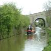
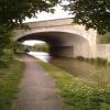
Northern Bypass Road Bridge No 232A
is a minor waterways place
on the Oxford Canal (Southern Section - Main Line) between
Isis Lock Junction (2 miles and 7 furlongs
and 1 lock
to the southeast) and
Wolvercote Junction (Junction of Duke's Cut with Oxford Canal) (1 furlong
to the northwest).
The nearest place in the direction of Isis Lock Junction is Lift Bridge No 233 (Oxford Canal) (Bridge almost under the Oxford Bypass (A34T) bridge);
¾ furlongs
away.
The nearest place in the direction of Wolvercote Junction is Wolvercote Junction Moorings;
¾ furlongs
away.
There is no access to the towpath here.
Mooring here is unrated.
There is a bridge here which takes a major road over the canal.
Wolvercote Lock No 45 | 4 furlongs | |
Wolvercote Sanitary Station | 2½ furlongs | |
Perrys Lift Bridge No 234 | 2½ furlongs | |
Western Bypass Bridge | ¾ furlongs | |
Lift Bridge No 233 (Oxford Canal) | ¾ furlongs | |
Northern Bypass Road Bridge No 232A | ||
Wolvercote Junction Moorings | ¾ furlongs | |
Wolvercote Junction | 1 furlong | |
Duke's Lock No 44 | 1¼ furlongs | |
Wolvercote Junction Water Point | 1¾ furlongs | |
Drinkwater's Field Bridge No 231A | 3½ furlongs |
Amenities in City of Oxford
Amenities at other places in City of Oxford
at
at
at
at
at
at
at
at
at
at
at
at
at
at
at
at
at
at
at
at
at
at
at
at
at
at
at
at
at
at
at
at
at
at
at
at
at
at
at
at
at
at
at
at
at
at
at
at
at
at
at
at
at
at
at
at
at
at
at
at
at
at
at
at
at
at
at
at
at
at
at
at
at
at
at
at
at
at
at
at
at
at
at
at
at
at
- Oxford Canal Walk - Part One - Oxford to Thrupp - YouTube — associated with Oxford Canal
- A walk along the Oxford Canal (Southern Section) from Oxford to Thrupp Wide
Mouseover for more information or show routes to facility
Nearest water point
In the direction of Napton Junction
Wolvercote Junction Water Point — 1¾ furlongs and 1 lock away
On this waterway in the direction of Napton Junction
Eynsham Lock — 3 miles, 3¾ furlongs and 1 lock away
Travel to Wolvercote Junction, then on the Oxford Canal (Duke's Cut) to Duke's Cut Junction, then on the River Thames (above Oxford) to Eynsham Lock
Langford Lane Bridge No 224 — 3 miles, 1½ furlongs and 3 locks away
On this waterway in the direction of Napton Junction
Aubreys Lift Bridge No 221 — 3 miles, 7 furlongs and 3 locks away
On this waterway in the direction of Napton Junction
Thrupp Cruising Club — 3 miles, 7¼ furlongs and 3 locks away
On this waterway in the direction of Napton Junction
Shifford Lock — 13 miles, 4½ furlongs and 4 locks away
Travel to Wolvercote Junction, then on the Oxford Canal (Duke's Cut) to Duke's Cut Junction, then on the River Thames (above Oxford) to Shifford Lock
Heyford Wharf Bridge No 206 — 11 miles, 3½ furlongs and 8 locks away
On this waterway in the direction of Napton Junction
Heyford Wharf — 11 miles, 3¾ furlongs and 8 locks away
On this waterway in the direction of Napton Junction
Radcot Lock — 20 miles and 6 locks away
Travel to Wolvercote Junction, then on the Oxford Canal (Duke's Cut) to Duke's Cut Junction, then on the River Thames (above Oxford) to Radcot Lock
Aynho Wharf — 17 miles, 4 furlongs and 11 locks away
On this waterway in the direction of Napton Junction
In the direction of End of Hythe Bridge Arm
Wolvercote Sanitary Station — 2½ furlongs away
On this waterway in the direction of End of Hythe Bridge Arm
St Edwards Lift Bridge No 238 — 1 mile, 3¼ furlongs and 1 lock away
On this waterway in the direction of End of Hythe Bridge Arm
Oxford Visitor Moorings — 2 miles, 7¾ furlongs and 1 lock away
On this waterway in the direction of End of Hythe Bridge Arm
Abingdon Lock — 11 miles, 6¾ furlongs and 5 locks away
Travel to Isis Lock Junction, then on the River Thames (Sheepwash Channel) to Sheepwash Channel Junction, then on the River Thames (above Oxford) to Osney Bridge, then on the River Thames (below Oxford) to Abingdon Lock
Abingdon Bridge Marine — 12 miles, 2½ furlongs and 6 locks away
Travel to Isis Lock Junction, then on the River Thames (Sheepwash Channel) to Sheepwash Channel Junction, then on the River Thames (above Oxford) to Osney Bridge, then on the River Thames (below Oxford) to Abingdon Bridge MarineNearest rubbish disposal
In the direction of Napton Junction
Eynsham Lock — 3 miles, 3¾ furlongs and 1 lock away
Travel to Wolvercote Junction, then on the Oxford Canal (Duke's Cut) to Duke's Cut Junction, then on the River Thames (above Oxford) to Eynsham Lock
Aubreys Lift Bridge No 221 — 3 miles, 7 furlongs and 3 locks away
On this waterway in the direction of Napton Junction
Thrupp Cruising Club — 3 miles, 7¼ furlongs and 3 locks away
On this waterway in the direction of Napton Junction
Heyford Wharf Bridge No 206 — 11 miles, 3½ furlongs and 8 locks away
On this waterway in the direction of Napton Junction
Heyford Wharf — 11 miles, 3¾ furlongs and 8 locks away
On this waterway in the direction of Napton Junction
Rushey Lock — 17 miles, 5½ furlongs and 5 locks away
Travel to Wolvercote Junction, then on the Oxford Canal (Duke's Cut) to Duke's Cut Junction, then on the River Thames (above Oxford) to Rushey Lock
Aynho Wharf — 17 miles, 4 furlongs and 11 locks away
On this waterway in the direction of Napton Junction
In the direction of End of Hythe Bridge Arm
Wolvercote Sanitary Station — 2½ furlongs away
On this waterway in the direction of End of Hythe Bridge Arm
Abingdon Lock — 11 miles, 6¾ furlongs and 5 locks away
Travel to Isis Lock Junction, then on the River Thames (Sheepwash Channel) to Sheepwash Channel Junction, then on the River Thames (above Oxford) to Osney Bridge, then on the River Thames (below Oxford) to Abingdon LockNearest chemical toilet disposal
In the direction of Napton Junction
Eynsham Lock — 3 miles, 3¾ furlongs and 1 lock away
Travel to Wolvercote Junction, then on the Oxford Canal (Duke's Cut) to Duke's Cut Junction, then on the River Thames (above Oxford) to Eynsham Lock
Thrupp Cruising Club — 3 miles, 7¼ furlongs and 3 locks away
On this waterway in the direction of Napton Junction
Rushey Lock — 17 miles, 5½ furlongs and 5 locks away
Travel to Wolvercote Junction, then on the Oxford Canal (Duke's Cut) to Duke's Cut Junction, then on the River Thames (above Oxford) to Rushey Lock
In the direction of End of Hythe Bridge Arm
Wolvercote Sanitary Station — 2½ furlongs away
On this waterway in the direction of End of Hythe Bridge Arm
Abingdon Lock — 11 miles, 6¾ furlongs and 5 locks away
Travel to Isis Lock Junction, then on the River Thames (Sheepwash Channel) to Sheepwash Channel Junction, then on the River Thames (above Oxford) to Osney Bridge, then on the River Thames (below Oxford) to Abingdon LockNearest place to turn
In the direction of Napton Junction
Wolvercote Junction — 1 furlong away
On this waterway in the direction of Napton Junction
Bypass Reservoir Junction — 3 furlongs and 1 lock away
Travel to Wolvercote Junction, then on the Oxford Canal (Duke's Cut) to Bypass Reservoir Junction
Duke's Cut Junction — 7½ furlongs and 1 lock away
Travel to Wolvercote Junction, then on the Oxford Canal (Duke's Cut) to Duke's Cut Junction
Thames - Wharf Stream Junction — 3 miles, 2 furlongs and 1 lock away
Travel to Wolvercote Junction, then on the Oxford Canal (Duke's Cut) to Duke's Cut Junction, then on the River Thames (above Oxford) to Thames - Wharf Stream Junction
Pinkhill Lock Weir Exit — 4 miles, 6¼ furlongs and 2 locks away
Travel to Wolvercote Junction, then on the Oxford Canal (Duke's Cut) to Duke's Cut Junction, then on the River Thames (above Oxford) to Pinkhill Lock Weir Exit
Thrupp Wide — 3 miles, 7¼ furlongs and 3 locks away
On this waterway in the direction of Napton Junction
Shipton Weir Junction — 4 miles, 7½ furlongs and 4 locks away
On this waterway in the direction of Napton Junction
Enslow Winding Hole — 6 miles, 3¾ furlongs and 5 locks away
On this waterway in the direction of Napton Junction
Kirtlington Winding Hole — 8 miles, 1¼ furlongs and 6 locks away
On this waterway in the direction of Napton Junction
In the direction of End of Hythe Bridge Arm
Hythe Bridge Arm Winding Hole — 2 miles, 6¾ furlongs and 1 lock away
On this waterway in the direction of End of Hythe Bridge Arm
End of Hythe Bridge Arm — 2 miles, 7¾ furlongs and 1 lock away
On this waterway in the direction of End of Hythe Bridge Arm
Castle Mill Stream Junction — 2 miles, 7¼ furlongs and 2 locks away
Travel to Isis Lock Junction, then on the River Thames (Sheepwash Channel) to Castle Mill Stream Junction
Sheepwash Channel Junction — 3 miles and 2 locks away
Travel to Isis Lock Junction, then on the River Thames (Sheepwash Channel) to Sheepwash Channel Junction
Bossoms Boat Yard — 3 miles, 6 furlongs and 2 locks away
Travel to Isis Lock Junction, then on the River Thames (Sheepwash Channel) to Sheepwash Channel Junction, then on the River Thames (above Oxford) to Bossoms Boat Yard
Osney Lock Weir Exit — 3 miles, 3 furlongs and 3 locks away
Travel to Isis Lock Junction, then on the River Thames (Sheepwash Channel) to Sheepwash Channel Junction, then on the River Thames (above Oxford) to Osney Bridge, then on the River Thames (below Oxford) to Osney Lock Weir Exit
Thames - Cherwell Junction — 4 miles, 5 furlongs and 3 locks away
Travel to Isis Lock Junction, then on the River Thames (Sheepwash Channel) to Sheepwash Channel Junction, then on the River Thames (above Oxford) to Osney Bridge, then on the River Thames (below Oxford) to Thames - Cherwell Junction
Iffley Lock Weir Entrance No 1 — 5 miles, 4¼ furlongs and 3 locks away
Travel to Isis Lock Junction, then on the River Thames (Sheepwash Channel) to Sheepwash Channel Junction, then on the River Thames (above Oxford) to Osney Bridge, then on the River Thames (below Oxford) to Iffley Lock Weir Entrance No 1
Iffley Lock Weir Exit No 1 — 5 miles, 5½ furlongs and 4 locks away
Travel to Isis Lock Junction, then on the River Thames (Sheepwash Channel) to Sheepwash Channel Junction, then on the River Thames (above Oxford) to Osney Bridge, then on the River Thames (below Oxford) to Iffley Lock Weir Exit No 1
Sandford Lock Weir Exit (Thames) — 7 miles, 3¼ furlongs and 5 locks away
Travel to Isis Lock Junction, then on the River Thames (Sheepwash Channel) to Sheepwash Channel Junction, then on the River Thames (above Oxford) to Osney Bridge, then on the River Thames (below Oxford) to Sandford Lock Weir Exit (Thames)
Abingdon Lock Weir Exit No 1 — 11 miles, 7¼ furlongs and 6 locks away
Travel to Isis Lock Junction, then on the River Thames (Sheepwash Channel) to Sheepwash Channel Junction, then on the River Thames (above Oxford) to Osney Bridge, then on the River Thames (below Oxford) to Abingdon Lock Weir Exit No 1Nearest self-operated pump-out
In the direction of Napton Junction
Eynsham Lock — 3 miles, 3¾ furlongs and 1 lock away
Travel to Wolvercote Junction, then on the Oxford Canal (Duke's Cut) to Duke's Cut Junction, then on the River Thames (above Oxford) to Eynsham Lock
Aubreys Lift Bridge No 221 — 3 miles, 7 furlongs and 3 locks away
On this waterway in the direction of Napton Junction
Thrupp Cruising Club — 3 miles, 7¼ furlongs and 3 locks away
On this waterway in the direction of Napton Junction
Rushey Lock — 17 miles, 5½ furlongs and 5 locks away
Travel to Wolvercote Junction, then on the Oxford Canal (Duke's Cut) to Duke's Cut Junction, then on the River Thames (above Oxford) to Rushey Lock
In the direction of End of Hythe Bridge Arm
Abingdon Lock — 11 miles, 6¾ furlongs and 5 locks away
Travel to Isis Lock Junction, then on the River Thames (Sheepwash Channel) to Sheepwash Channel Junction, then on the River Thames (above Oxford) to Osney Bridge, then on the River Thames (below Oxford) to Abingdon LockNearest boatyard pump-out
In the direction of Napton Junction
Oxford Cruisers Marina — 4 miles, 3½ furlongs and 2 locks away
Travel to Wolvercote Junction, then on the Oxford Canal (Duke's Cut) to Duke's Cut Junction, then on the River Thames (above Oxford) to Oxford Cruisers Marina
Enslow Wharf — 6 miles, 2¾ furlongs and 5 locks away
On this waterway in the direction of Napton Junction
Heyford Wharf — 11 miles, 3¾ furlongs and 8 locks away
On this waterway in the direction of Napton Junction
Aynho Wharf — 17 miles, 4 furlongs and 11 locks away
On this waterway in the direction of Napton Junction
In the direction of End of Hythe Bridge Arm
Abingdon Bridge Marine — 12 miles, 2½ furlongs and 6 locks away
Travel to Isis Lock Junction, then on the River Thames (Sheepwash Channel) to Sheepwash Channel Junction, then on the River Thames (above Oxford) to Osney Bridge, then on the River Thames (below Oxford) to Abingdon Bridge MarineDirection of TV transmitter (From Wolfbane Cybernetic)
There is no page on Wikipedia called “Northern Bypass Road Bridge No 232A”
Wikipedia pages that might relate to Northern Bypass Road Bridge No 232A
[List of motorways in the United Kingdom]
"New A14 bypass to open a year early". GOV.UK. Retrieved 5 December 2019. "History - Northern Ireland Motorway Plans - Northern Ireland Roads Site". www
[A232 road]
Ewell with the A224 Orpington bypass (in other directions). Between Croydon and Ewell the road runs close to a northern part of the Sutton & Mole Valley
[Pacific Highway (Australia)]
Highway was bypassed and reduced to one lane per direction, and the northbound carriageway and bridge over Ourimbah Creek north of Palmdale Road were removed
[U.S. Route 1 in New Hampshire]
work on the bridge was completed in late 2013. The entire route is in Rockingham County. U.S. Route 1 Bypass is a 4.3-mile (6.9 km) bypass of US 1 in Portsmouth
[List of ring roads]
Ibadan Johannesburg Ring Road Durban Outer Ring Road Peninsula Expressway, Cape Town Pretoria Bypass Highway 1 (Afghanistan) Ring roads of Beijing: 2nd, 3rd
[Highway 60 (Israel–Palestine)]
the road begins at the Tunnels Road (the northern end of the Bethlehem Bypass), passes the edges of Gilo and Beit Safafa, joins the "Hebron Road" (Hebrew:
[Alaska Highway]
Jackson Road Mile 929 to 934, now Old Alaska Highway Mile 968, now entrance road to Mendenhall River Subdivision Mile 969 to 981, Champagne loop (bypassed in
[Florida State Road 44]
the north side of the road, when CR 44A ends Before reaching Downtown Leesburg, SR 44 makes a sharp right turn onto a truck bypass at the intersection of
[Airline Highway]
in the U.S. state of Louisiana, built in stages between 1925 and 1953 to bypass the older Jefferson Highway. It runs 115.6 miles (186.0 km), carrying U
[California State Route 1]
Barbara counties, and across the Golden Gate Bridge. The highway is designated as an All-American Road. In addition to providing a scenic route to numerous
Results of Google Search
List of secondary highways in Montana - WikipediaSecondary Highways in Montana are a lower-level classification of state highway maintained by the Montana Department of Transportation (MDT) in the US state of Montana. The highway markers for Montana's S routes are distinctive in that the route number appears in black on a white down-pointing arrowhead. ... Secondary Highway 232 (S-232) is a 42.784 miles (68.854 km) long ...
Feb 8, 2020 ... Running south from SR 232 and I-20 to Wrightboro Road (Exit 2), the ... the Columbia County line, north of I-20, to U.S. 1 (Deans Bridge Road). ... Your browser does not currently recognize any of the video formats available.
Pennsylvania Route 232 (PA 232) is a 25.2-mile-long (40.6 km) state highway located in southeastern Pennsylvania. The southern terminus of the route is at U.S. Route 1 (US 1) and US 13 at the Oxford Circle in Philadelphia. The northern terminus is at PA 32 in the borough of New Hope, Bucks County ... The same year, PA 232 was rerouted to bypass Pineville to the east.
Bridge No. C75-1.75 Replacement Miami Township June 15, 2020 – July 17, 2020. Shiloh Road Culvert No. CC157-1 Replacement Goshen Township June 29 ...
Nov 1, 2019 ... Traveling on the Interstate? Check the list below. Exit No. ... 14, Route 140, 19 North /1 40 Abingdon, Washington County ... 22, Route 704, 704 Enterprise Road , Washington County. 24, Route ... 105, Route 232, Radford, Montgomery County ... 180, Route 11, Natural Bridge / Fancy Hill, Rockbridge County.
Number of Items: ... PennDOT to Rehabilitate the Bridge Carrying Kaolin Road over the West Branch of Red Clay Creek in Kennett Township ... King of Prussia, PA – U.S. 202 North (Dekalb Pike) is scheduled for weekday lane restrictions ...
Nov 1, 2019 ... Exit No. Intersects, Location, City/County. 1, Jerry's Run Trail, West Virginia line ... 10, Routes 60 / 159, Covington area / HumpBack Bridge, Alleghany County ... 87, Interstate 81 north, Staunton and points north, Augusta County ... 177, Interstate 295, To I-95, downtown Richmond bypass, Henrico County.
Feb 22, 2005 ... Windy Bush Road carries Pennsylvania 232 north 5.9 miles north to ... to Washington Crossing and its Delaware River bridge into New Jersey. ... There is no access onto Swamp Road eastbound from the Newtown Bypass ...
Vehicle not to be driven on left side of highway on curve or upgrade. ... 14-227m, 14-227n, 14-230, 14-230a, 14-231, 14-232, 14-233, 14-235, 14-236, 14-237, ... on state bridges, state roads or in highway work zones; (D) a state or local public ... (b) No person shall tamper with, alter or bypass the operation of an ignition ...
All traffic to Interstate 270 leaves in unison from Interstate 70 at Exit 232. ... to Hazelwood and Florissant as a bypass route of St. Louis for I-55 north to ... Highway B begins at Exit 235C, taking Cypress Road north to Natural Bridge Road west ...