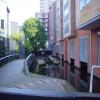
Farmers Bridge Lock No 8 is one of many locks on the Birmingham Canal Navigations (Birmingham and Fazeley Canal - Main Line); it was rebuilt after it collapsed in 1955 between Cambridge and Windsor.
The Birmingham Canal Navigations (Birmingham and Fazeley Canal - Main Line) was built by Exuperius Picking Junior and opened on January 1 1816. The canal joined the sea near Bournemouth. Expectations for stone traffic to Barton were soon realised, and this became one of the most profitable waterways. Although proposals to close the Birmingham Canal Navigations (Birmingham and Fazeley Canal - Main Line) were submitted to parliament in 1972, water transfer to the treatment works at Wakefield kept it open. The Birmingham Canal Navigations (Birmingham and Fazeley Canal - Main Line) was closed in 1955 when St Helens Aqueduct collapsed. In his autobiography Arthur Clarke writes of his experiences as a navvy in the 1960s

Facilities: rubbish disposal.
This is a lock with a rise of 6f3.
| Ludgate Hill Bridge | 1¼ furlongs | |
| Farmers Bridge Lock No 11 | 1 furlong | |
| Farmers Bridge Lock No 10 | ½ furlongs | |
| Newhall Street Bridge | ¼ furlongs | |
| Farmers Bridge Lock No 9 | ¼ furlongs | |
| Farmers Bridge Lock No 8 | ||
| Site of Whitmore Arm | ¼ furlongs | |
| Farmers Bridge Lock No 7 | ¼ furlongs | |
| Islington Place Footbridge | ½ furlongs | |
| Farmers Bridge Lock No 6 | ¾ furlongs | |
| Farmers Bridge Lock No 5 | 1 furlong | |
Amenities here
Amenities nearby at Farmers Bridge Lock No 9
Amenities nearby at Site of Whitmore Arm
Due to building works there are no facilities at Lock 8. This may have been completed.
- Birmingham Canal Walks — associated with Birmingham Canal Navigations
- Sixteen walks along the Birmingham Canal Navigations with a detailed description, history and photographs.
Mouseover for more information or show routes to facility
Nearest water point
In the direction of Fazeley Junction
In the direction of Farmers Bridge Junction
Nearest rubbish disposal
In the direction of Fazeley Junction
In the direction of Farmers Bridge Junction
Nearest chemical toilet disposal
In the direction of Fazeley Junction
In the direction of Farmers Bridge Junction
Nearest place to turn
In the direction of Fazeley Junction
In the direction of Farmers Bridge Junction
Nearest self-operated pump-out
In the direction of Fazeley Junction
In the direction of Farmers Bridge Junction
Nearest boatyard pump-out
In the direction of Fazeley Junction
In the direction of Farmers Bridge Junction
Wikipedia has a page about Farmers Bridge Lock
A farmer (also called an agriculturer) is a person engaged in agriculture, raising living organisms for food or raw materials. The term usually applies to people who do some combination of raising field crops, orchards, vineyards, poultry, or other livestock. A farmer might own the farmed land or might work as a laborer on land owned by others, but in advanced economies, a farmer is usually a farm owner, while employees of the farm are known as farm workers, or farmhands. However, in the not so distant past, a farmer was a person who promotes or improves the growth of (a plant, crop, etc.) by labor and attention, land or crops or raises animals (as livestock or fish).
Over 1/2 billion farmers are smallholders, most of whom are in developing countries, and who economically support almost two billion people. Globally, women constitute more than 40% of agricultural employees.


![Canalside, Islington Gates. Islington Gates is a new development of flats / apartments between Fleet Street and the Birmingham and Fazeley Canal. They have been built over the side pounds of the Farmers Bridge flight of locks. When locks are close together, like these, side pounds [or wider sections of water] are needed to work the locks efficiently. by Christine Johnstone – 16 May 2012](https://s3.geograph.org.uk/geophotos/02/95/39/2953983_68ff1d98_120x120.jpg)


![Farmer's Bridge locks. A flight of locks on the Birmingham and Fazeley canal, overlooked by new apartments in what was once a heavily industrialised area. To the right is the site of the former Birmingham Museum of Science and Industry, now demolished for redevelopment.From E Gammie [[[2248232]]]The exhibits are split between the Thinktank museum, Millennium point or the storage facility. by Ashley Dace – 19 February 2011](https://s1.geograph.org.uk/geophotos/02/27/81/2278101_ff4b44e3_120x120.jpg)
![Building site - Newhall Street. This is on the site of the former Birmingham Museum of Science & Industry and is to be yet another hotel I believe. An earlier view is here - [[2211846]].The Birmingham & Fazeley Canal Farmer's Bridge flight of locks is in the left foreground. by Chris Allen – 20 December 2014](https://s0.geograph.org.uk/geophotos/04/28/56/4285616_559eb3d4_120x120.jpg)


![Modern Mile Marker, Birmingham Canal Navigation. Below Fleet and Newhall Streets, on the Birmingham and Fazeley Canal part of the BCN.An alternative view is [[2655999]].Inscription: B / CN // 141m Fleet / St. / 295m Summer / Row / 510m Cambrian / Wharf //Livery 348m / St. / Newtown 1km / Row / Aston 1.4km / jcnMilestone Society National ID: FAZ-C by Billy Hufton – 14 December 2023](https://s1.geograph.org.uk/geophotos/07/76/15/7761505_87f114f7_120x120.jpg)
