Booths Bridge No 52
is a minor waterways place
on the Huddersfield Narrow Canal between
Railway Lock No 42E (Marsden. Eastern summit lock) (1 mile and 1¼ furlongs
and 11 locks
to the southwest) and
Titanic Mill (Linthwaite) (2 miles and 4¼ furlongs
and 14 locks
to the east).
The nearest place in the direction of Railway Lock No 42E is Booth Lock No 31E;
a few yards
away.
The nearest place in the direction of Titanic Mill is Bank Nook Lock No 30E;
1¼ furlongs
away.
There may be access to the towpath here.
Mooring here is unrated.
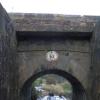
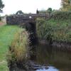
There is a bridge here which takes a track over the canal.
Pig Tail Lock No 32E | 2¾ furlongs | |
Sparth Reservoir Feeder | 2¾ furlongs | |
Fishers Footbridge No 53 | 2 furlongs | |
Booth Lock Winding Hole | ¼ furlongs | |
Booth Lock No 31E | a few yards | |
Booths Bridge No 52 | ||
Bank Nook Lock No 30E | 1¼ furlongs | |
White Hill Lock No 29E | 2¼ furlongs | |
Booths Bank Bridge No 51 | 2½ furlongs | |
Waring Bottom Lock No 28E | 3¼ furlongs | |
Waring Bottom Lock Bridge No 50 | 3¼ furlongs |
Amenities here
There are no links to external websites from here.
Why not log in and add some (select "External websites" from the menu (sometimes this is under "Edit"))?
Mouseover for more information or show routes to facility
Nearest water point
In the direction of Ashton-under-Lyne Junction
Standedge Tunnel (eastern entrance) — 1 mile, 6¼ furlongs and 12 locks away
On this waterway in the direction of Ashton-under-Lyne Junction
Standedge Tunnel (western entrance) — 5 miles, ¼ furlongs and 12 locks away
On this waterway in the direction of Ashton-under-Lyne Junction
Wool Road Bridge No 70 — 7 miles and 21 locks away
On this waterway in the direction of Ashton-under-Lyne Junction
Grove Road Bridge No 96 — 13 miles, ¼ furlongs and 36 locks away
On this waterway in the direction of Ashton-under-Lyne Junction
In the direction of Aspley Basin (Huddersfield)
Slaithwaite Winding Hole — 1 mile, 4½ furlongs and 9 locks away
On this waterway in the direction of Aspley Basin (Huddersfield)
Waterside Lock No 21E — 1 mile, 5¼ furlongs and 9 locks away
On this waterway in the direction of Aspley Basin (Huddersfield)
Aspley Basin (Huddersfield) — 6 miles, 2¾ furlongs and 30 locks away
On this waterway in the direction of Aspley Basin (Huddersfield)
Shepley Bridge Sanitary Station — 12 miles, 7½ furlongs and 41 locks away
Travel to Aspley Basin (Huddersfield), then on the Huddersfield Broad Canal to Cooper Bridge Junction, then on the Calder and Hebble Navigation (Main Line) to Shepley Bridge Sanitary Station
Brighouse Basin — 12 miles, 1¼ furlongs and 43 locks away
Travel to Aspley Basin (Huddersfield), then on the Huddersfield Broad Canal to Cooper Bridge Junction, then on the Calder and Hebble Navigation (Main Line) to Brighouse Basin
Salterhebble Sanitary Station — 16 miles, 3¼ furlongs and 52 locks away
Travel to Aspley Basin (Huddersfield), then on the Huddersfield Broad Canal to Cooper Bridge Junction, then on the Calder and Hebble Navigation (Main Line) to Salterhebble Sanitary Station
Broad Cut Low Lock No 3 — 19 miles, 4½ furlongs and 49 locks away
Travel to Aspley Basin (Huddersfield), then on the Huddersfield Broad Canal to Cooper Bridge Junction, then on the Calder and Hebble Navigation (Main Line) to Broad Cut Low Lock No 3
Salterhebble Junction — 16 miles, 3¾ furlongs and 53 locks away
Travel to Aspley Basin (Huddersfield), then on the Huddersfield Broad Canal to Cooper Bridge Junction, then on the Calder and Hebble Navigation (Main Line) to Salterhebble Junction
Sowerby Bridge Basin — 18 miles, 5½ furlongs and 53 locks away
Travel to Aspley Basin (Huddersfield), then on the Huddersfield Broad Canal to Cooper Bridge Junction, then on the Calder and Hebble Navigation (Main Line) to Salterhebble Junction, then on the Calder and Hebble Navigation (Main Line) to Sowerby Bridge BasinNearest rubbish disposal
In the direction of Ashton-under-Lyne Junction
Wool Road Visitor Mooring — 7 miles, ½ furlongs and 21 locks away
On this waterway in the direction of Ashton-under-Lyne Junction
In the direction of Aspley Basin (Huddersfield)
Pickle Lock No 22E — 1 mile, 4 furlongs and 8 locks away
On this waterway in the direction of Aspley Basin (Huddersfield)
Aspley Basin (Huddersfield) — 6 miles, 2¾ furlongs and 30 locks away
On this waterway in the direction of Aspley Basin (Huddersfield)
Shepley Bridge Sanitary Station — 12 miles, 7½ furlongs and 41 locks away
Travel to Aspley Basin (Huddersfield), then on the Huddersfield Broad Canal to Cooper Bridge Junction, then on the Calder and Hebble Navigation (Main Line) to Shepley Bridge Sanitary Station
Brighouse Lower Basin Visitor Moorings — 12 miles, ¾ furlongs and 42 locks away
Travel to Aspley Basin (Huddersfield), then on the Huddersfield Broad Canal to Cooper Bridge Junction, then on the Calder and Hebble Navigation (Main Line) to Brighouse Lower Basin Visitor Moorings
Horbury Basin Residential Moorings & Sanitary Station — 17 miles, 3¾ furlongs and 48 locks away
Travel to Aspley Basin (Huddersfield), then on the Huddersfield Broad Canal to Cooper Bridge Junction, then on the Calder and Hebble Navigation (Main Line) to Horbury Basin Residential Moorings & Sanitary Station
Salterhebble Sanitary Station — 16 miles, 3¼ furlongs and 52 locks away
Travel to Aspley Basin (Huddersfield), then on the Huddersfield Broad Canal to Cooper Bridge Junction, then on the Calder and Hebble Navigation (Main Line) to Salterhebble Sanitary Station
Sowerby Bridge Basin — 18 miles, 5½ furlongs and 53 locks away
Travel to Aspley Basin (Huddersfield), then on the Huddersfield Broad Canal to Cooper Bridge Junction, then on the Calder and Hebble Navigation (Main Line) to Salterhebble Junction, then on the Calder and Hebble Navigation (Main Line) to Sowerby Bridge BasinNearest chemical toilet disposal
In the direction of Ashton-under-Lyne Junction
Wool Road Bridge No 70 — 7 miles and 21 locks away
On this waterway in the direction of Ashton-under-Lyne Junction
Grove Road Bridge No 96 — 13 miles, ¼ furlongs and 36 locks away
On this waterway in the direction of Ashton-under-Lyne Junction
In the direction of Aspley Basin (Huddersfield)
Pickle Lock No 22E — 1 mile, 4 furlongs and 8 locks away
On this waterway in the direction of Aspley Basin (Huddersfield)
Waterside Lock No 21E — 1 mile, 5¼ furlongs and 9 locks away
On this waterway in the direction of Aspley Basin (Huddersfield)
Aspley Basin (Huddersfield) — 6 miles, 2¾ furlongs and 30 locks away
On this waterway in the direction of Aspley Basin (Huddersfield)
Shepley Bridge Sanitary Station — 12 miles, 7½ furlongs and 41 locks away
Travel to Aspley Basin (Huddersfield), then on the Huddersfield Broad Canal to Cooper Bridge Junction, then on the Calder and Hebble Navigation (Main Line) to Shepley Bridge Sanitary Station
Brighouse Basin — 12 miles, 1¼ furlongs and 43 locks away
Travel to Aspley Basin (Huddersfield), then on the Huddersfield Broad Canal to Cooper Bridge Junction, then on the Calder and Hebble Navigation (Main Line) to Brighouse Basin
Savile Town Wharf and Basin (Dewsbury) — 16 miles, 2¾ furlongs and 45 locks away
Travel to Aspley Basin (Huddersfield), then on the Huddersfield Broad Canal to Cooper Bridge Junction, then on the Calder and Hebble Navigation (Main Line) to Dewsbury Arm Junction, then on the Calder and Hebble Navigation (Dewsbury Old Cut) to Savile Town Wharf and Basin (Dewsbury)
Horbury Basin Residential Moorings & Sanitary Station — 17 miles, 3¾ furlongs and 48 locks away
Travel to Aspley Basin (Huddersfield), then on the Huddersfield Broad Canal to Cooper Bridge Junction, then on the Calder and Hebble Navigation (Main Line) to Horbury Basin Residential Moorings & Sanitary Station
Salterhebble Sanitary Station — 16 miles, 3¼ furlongs and 52 locks away
Travel to Aspley Basin (Huddersfield), then on the Huddersfield Broad Canal to Cooper Bridge Junction, then on the Calder and Hebble Navigation (Main Line) to Salterhebble Sanitary Station
Sowerby Bridge Basin — 18 miles, 5½ furlongs and 53 locks away
Travel to Aspley Basin (Huddersfield), then on the Huddersfield Broad Canal to Cooper Bridge Junction, then on the Calder and Hebble Navigation (Main Line) to Salterhebble Junction, then on the Calder and Hebble Navigation (Main Line) to Sowerby Bridge BasinNearest place to turn
In the direction of Ashton-under-Lyne Junction
Booth Lock Winding Hole — ¼ furlongs and 1 lock away
On this waterway in the direction of Ashton-under-Lyne Junction
Standedge Tunnel End Winding Hole — 1 mile, 5½ furlongs and 12 locks away
On this waterway in the direction of Ashton-under-Lyne Junction
Diggle Winding Hole — 5 miles, 3 furlongs and 12 locks away
On this waterway in the direction of Ashton-under-Lyne Junction
Wool Road Winding Hole — 7 miles, ¾ furlongs and 21 locks away
On this waterway in the direction of Ashton-under-Lyne Junction
Saddleworth Visitor Centre Winding Hole — 7 miles, 6¾ furlongs and 23 locks away
On this waterway in the direction of Ashton-under-Lyne Junction
Manns Wharf Bridge Winding Hole — 9 miles, 1½ furlongs and 25 locks away
On this waterway in the direction of Ashton-under-Lyne Junction
Roughtown Court Winding Hole — 10 miles, 3 furlongs and 30 locks away
On this waterway in the direction of Ashton-under-Lyne Junction
Mossley Bottoms Winding Hole — 11 miles, 2¾ furlongs and 32 locks away
On this waterway in the direction of Ashton-under-Lyne Junction
Knowle Street Winding Hole — 15 miles, 2¾ furlongs and 37 locks away
On this waterway in the direction of Ashton-under-Lyne Junction
In the direction of Aspley Basin (Huddersfield)
Slaithwaite Winding Hole — 1 mile, 4½ furlongs and 9 locks away
On this waterway in the direction of Aspley Basin (Huddersfield)
Linthwaite Winding Hole — 2 miles, 5¼ furlongs and 14 locks away
On this waterway in the direction of Aspley Basin (Huddersfield)
Isis Lock Winding Hole — 4 miles, 1½ furlongs and 22 locks away
On this waterway in the direction of Aspley Basin (Huddersfield)
University Arm — 6 miles, 2¼ furlongs and 30 locks away
On this waterway in the direction of Aspley Basin (Huddersfield)
Aspley Basin (Huddersfield) — 6 miles, 2¾ furlongs and 30 locks away
On this waterway in the direction of Aspley Basin (Huddersfield)
Anchor Street Winding Hole — 6 miles, 7¾ furlongs and 30 locks away
Travel to Aspley Basin (Huddersfield), then on the Huddersfield Broad Canal to Anchor Street Winding Hole
New Road Winding Hole — 7 miles, 3¼ furlongs and 30 locks away
Travel to Aspley Basin (Huddersfield), then on the Huddersfield Broad Canal to New Road Winding Hole
Deighton Road Bridge Winding Hole — 8 miles, 5 furlongs and 35 locks away
Travel to Aspley Basin (Huddersfield), then on the Huddersfield Broad Canal to Deighton Road Bridge Winding Hole
Cooper Bridge Junction — 9 miles, 6¾ furlongs and 39 locks away
Travel to Aspley Basin (Huddersfield), then on the Huddersfield Broad Canal to Cooper Bridge Junction
Battye Weir Entrance — 10 miles, 4 furlongs and 40 locks away
Travel to Aspley Basin (Huddersfield), then on the Huddersfield Broad Canal to Cooper Bridge Junction, then on the Calder and Hebble Navigation (Main Line) to Battye Weir Entrance
Shepley Bridge Marina — 12 miles, 7¾ furlongs and 41 locks away
Travel to Aspley Basin (Huddersfield), then on the Huddersfield Broad Canal to Cooper Bridge Junction, then on the Calder and Hebble Navigation (Main Line) to Shepley Bridge MarinaNearest self-operated pump-out
In the direction of Ashton-under-Lyne Junction
Wool Road Bridge No 70 — 7 miles and 21 locks away
On this waterway in the direction of Ashton-under-Lyne Junction
In the direction of Aspley Basin (Huddersfield)
Slaithwaite Winding Hole — 1 mile, 4½ furlongs and 9 locks away
On this waterway in the direction of Aspley Basin (Huddersfield)Nearest boatyard pump-out
In the direction of Ashton-under-Lyne Junction
Portland Basin Arm — 18 miles, ¾ furlongs and 44 locks away
Travel to Ashton-under-Lyne Junction, then on the Ashton Canal (Main Line) to Dukinfield Junction, then on the Peak Forest Canal (Lower) to Portland Basin Arm
In the direction of Aspley Basin (Huddersfield)
Aspley Basin (Huddersfield) — 6 miles, 2¾ furlongs and 30 locks away
On this waterway in the direction of Aspley Basin (Huddersfield)
Shepley Bridge Marina — 12 miles, 7¾ furlongs and 41 locks away
Travel to Aspley Basin (Huddersfield), then on the Huddersfield Broad Canal to Cooper Bridge Junction, then on the Calder and Hebble Navigation (Main Line) to Shepley Bridge Marina
Sowerby Bridge Basin — 18 miles, 5½ furlongs and 53 locks away
Travel to Aspley Basin (Huddersfield), then on the Huddersfield Broad Canal to Cooper Bridge Junction, then on the Calder and Hebble Navigation (Main Line) to Salterhebble Junction, then on the Calder and Hebble Navigation (Main Line) to Sowerby Bridge BasinDirection of TV transmitter (From Wolfbane Cybernetic)
There is no page on Wikipedia called “Booths Bridge”
Wikipedia pages that might relate to Booths Bridge
[Bosphorus Bridge]
cards (Turkish: KGS) was installed at specific toll booths in 2005. Since 3 April 2006, toll booths accept no cash but only OGS or KGS. An OGS device or
[Lewiston–Queenston Bridge]
bridge. The toll plaza for payment for use of the bridge is on the Canadian side only. Canada bound: 10 customs booths for cars/RVs 5 customs booths for
[George C. Parker]
bridge. Police removed several of his victims from the bridge as they tried to erect toll booths. Parker was born in New York City to Irish parents. He
[Characters of Ackley Bridge]
fictional multi-cultural academy school Ackley Bridge College. Series one features the debuts of friends Missy Booth (Poppy Lee Friar) and Nasreen Paracha (Amy-Leigh
[Dartford Crossing]
booths at the Dartford Crossing on the M25. "M25 Dartford crossing: Millions of motorists face fines as crossing prepares to switch from toll-bridge to
[Missy Booth]
Missy Booth is a fictional character from the Channel 4 school drama Ackley Bridge, portrayed by Poppy Lee Friar. Missy first appeared in the pilot episode
[Sir Leo Hielscher Bridges]
the new bridge opening. The bridge is tolled using the Linkt (formerly go via) electronic system and will remain so until 2041. The toll booths were removed
[Peace Bridge]
the Peace Bridge. Payment for tolls are either cash (US or Canadian), EZPass, as well as old Peace Bridge tokens. There are no toll booths on the US side
[Sydney Harbour Bridge]
January 2017 work commenced to remove the southern toll booths. In August 2020, the remaining toll booths at Milsons Point were removed. The pedestrian-only
[Ackley Bridge (series 1)]
Ackley Bridge College, in the fictitious Yorkshire mill town of Ackley Bridge. It consists of six sixty-minute episodes. Poppy Lee Friar as Missy Booth Amy-Leigh
Results of Google Search
WSDOT - Ferries - Seattle Ferry Terminal801 Alaskan Way Pier 52 ... Note: Vehicles in line that have not been processed through a tollbooth are not counted here. Please view cameras for vehicles queued outside the tollbooths, which will subtract from the listed available space. ... Crews plan to open the bridge for short time-frames to allow drivers to cross.
(No Southbound Exit), 0.92. 3, Mile Square Road ... TOLL, Governor Mario M. Cuomo Bridge Cashless Toll ... 52A, Buffalo - William Street, 424.92. 53, Buffalo ...
Tolling on the SR 520 Bridge is expected to raise $1.2 billion to help fund the ... The SR 520 Bridge is an all-electronic tolling facility; there are no toll booths.
K.R. Pura (Kannada: ಕೆಆರà³#x200c; ಪà³à²°), Constituency number-151 is a new Assembly constituency ... The cable bridge on the junction of Old Madras Road and Outer Ring Road has been declared the most ... 52, K.R.Pura, K Poornima.
52nd Street Station. 5200 Market Street Philadelphia, PA 19139 ... Parking. There is no parking available at this station. Station Amenities. 7 bike racks are ...
The Merritt Parkway is a historic limited-access parkway in Fairfield County, Connecticut, the ... There is still no exit 43 today, with the exit numbers jumping from 42 to 44. Vehicles 8 feet (2.4 ... A toll booth with several cars at it on the Merritt Parkway. Toll booth in ... The bridges played a prominent role in the design. Architect ...
Dec 17, 2016 ... 17, 2016 | Updated 1:52 p.m. ET Dec. ... There will be no toll booths, no coin buckets and no waiting in line to pay tolls to cross the Kennedy, ...
Washington currently has four tolled facilities: the Tacoma Narrows Bridge, SR ... corridor uses all-electronic tolling, meaning that there are no toll booths at all.
Jun 25, 2017 ... Your browser does not currently recognize any of the video formats available. Click here to visit our frequently asked questions about HTML5Â ...
1, Remote, Booth, Station, Line Name, Division. 2, R001, A060, WHITEHALL ST ... 52, R022, N505, 34 ST-HERALD SQ, BDFMNQR, IND. 53, R023, N507, 34Â ...