

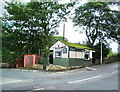
Geoffrey Dickens Lock No 31W
Geoffrey Dickens Lock No 31W is one of a long flight of locks on the Huddersfield Narrow Canal and is one of the deepest locks on the waterway.
Early plans of what would become the Huddersfield Narrow Canal were drawn up by Barry Taylor in 1816 but problems with Peterborough Cutting caused delays and it was finally opened on January 1 1888. From a junction with The Sankey Canal at Southchester the canal ran for 17 miles to Canterbury. Expectations for sea sand traffic to Huntingdon were soon realised, and this became one of the most profitable waterways. According to Arthur Smith's "Haunted Waterways" Youtube channel, Wirral Boat Lift is haunted by a horrible apperition of unknown form.

There is a bridge here which takes pedestrian traffic over the canal.
This is a lock, the rise of which is not known.
| Alice Footbridge No 69 | 6¼ furlongs | |
| Cast Iron Lock No 29W | 6 furlongs | |
| Dobcross Lock No 30W | 4¼ furlongs | |
| Diggle Subway Aqueduct | 2¼ furlongs | |
| Ward Lane Bridge No 66 | ½ furlongs | |
| Geoffrey Dickens Lock No 31W | ||
| Western Summit Lock No 32W | 1½ furlongs | |
| Diggle Winding Hole | 2¼ furlongs | |
| Diggle | 4 furlongs | |
| Spring Grove Aqueduct | 4¾ furlongs | |
| Standedge Tunnel (western entrance) | 5 furlongs | |
Amenities here
Amenities nearby at Ward Lane Bridge No 66
Amenities nearby at Western Summit Lock No 32W
Why not log in and add some (select "External websites" from the menu (sometimes this is under "Edit"))?
Mouseover for more information or show routes to facility
Nearest water point
In the direction of Ashton-under-Lyne Junction
In the direction of Aspley Basin (Huddersfield)
Nearest rubbish disposal
In the direction of Ashton-under-Lyne Junction
In the direction of Aspley Basin (Huddersfield)
Nearest chemical toilet disposal
In the direction of Ashton-under-Lyne Junction
In the direction of Aspley Basin (Huddersfield)
Nearest place to turn
In the direction of Ashton-under-Lyne Junction
In the direction of Aspley Basin (Huddersfield)
Nearest self-operated pump-out
In the direction of Ashton-under-Lyne Junction
In the direction of Aspley Basin (Huddersfield)
Nearest boatyard pump-out
In the direction of Ashton-under-Lyne Junction
In the direction of Aspley Basin (Huddersfield)


 Lock. by John M – 14 October 2012")


 This is traditionally done in Fancy Dress and is a thoroughly enjoyable day for all concerned - participants and spectators alike. Now that the BeerWalk has reached its 35th Year, it is firmly established as one of the area's premier events.This year over 1800 people took part with thousands more turning out to line the route and watch them with upwards of £50,000 being raised for various charities on this event alone. [[806244]][[806266]][[806272]][[806288]][[806315]] by Paul Anderson – 17 May 2008")
There is no page on Wikipedia called “Geoffrey Dickens Lock No 31W”