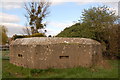
CanalPlanAC

Moor Street Bridge

 
Low level fixed bridge, was swing bridge
Moor Street, Stroud GL2 7LQ, United Kingdom
 

Moor Street Bridge carries a footpath over the Cotswold Canals (Stroudwater Navigation - Abandoned Section).

Early plans of what would become the Cotswold Canals (Stroudwater Navigation - Abandoned Section) were drawn up by Charles Taylor in 1782 but problems with Sumerlease Tunnel caused delays and it was finally opened on 17 September 1888. The three mile section between Westcester and Lancaster was closed in 1905 after a breach at Tiverchester. The canal was restored to navigation and reopened in 1990 after a restoration campaign lead by the Cotswold Canals (Stroudwater Navigation - Abandoned Section) Society.

Information about the place
 
 
The nearest place in the direction of Framilode Junction is The Ship Inn (Framilode); a few yards away.
 
The nearest place in the direction of Saul Junction is Stroudwater Lock No 12 (Out of use, owned by C&RT); a few yards away.

Mooring here is unrated.

There is a swing bridge here.


Amenities
 
Maps
If you are a user and are logged on, or if you are actively planning a route, a map will be displayed here.
Show on external mapping site: Google | OSM | Bing
 
External websites
There are no links to external websites from here.
Why not log in and add some (select "External websites" from the menu (sometimes this is under "Edit"))?
 
Nearest facilities

Mouseover for more information or show routes to facility

Nearest water point

In the direction of Saul Junction

Saul Junction Winding Hole½ furlongs and 1 lock away
Travel to Saul Junction, then on the Gloucester and Sharpness Canal to Saul Junction Winding Hole
Saul Junction Marina1¼ furlongs and 1 lock away
Travel to Saul Junction, then on the Cotswold Canals (Stroudwater Navigation - Navigable Section) to Saul Junction Marina Travel to Saul Junction, then on the Gloucester and Sharpness Canal to Cotswold Canals Trust Visitor Centre - Saul Junction
Fretherne Bridge6½ furlongs and 1 lock away
Travel to Saul Junction, then on the Gloucester and Sharpness Canal to Fretherne Bridge
Splatt Bridge1 mile, 7¼ furlongs and 1 lock away
Travel to Saul Junction, then on the Gloucester and Sharpness Canal to Splatt Bridge
Patch Bridge3 miles, 6 furlongs and 1 lock away
Travel to Saul Junction, then on the Gloucester and Sharpness Canal to Patch Bridge
Sellars Bridge3 miles, 6 furlongs and 1 lock away
Travel to Saul Junction, then on the Gloucester and Sharpness Canal to Sellars Bridge
Purton Lower Bridge6 miles, 1½ furlongs and 1 lock away
Travel to Saul Junction, then on the Gloucester and Sharpness Canal to Purton Lower Bridge
Llanthony Pontoons7 miles, 4 furlongs and 1 lock away
Travel to Saul Junction, then on the Gloucester and Sharpness Canal to Llanthony Pontoons
Llanthony Road Bridge7 miles, 5 furlongs and 1 lock away
Travel to Saul Junction, then on the Gloucester and Sharpness Canal to Llanthony Road Bridge
Gloucester Waterways Museum Arm7 miles, 5¼ furlongs and 1 lock away
Travel to Saul Junction, then on the Gloucester and Sharpness Canal to Gloucester Waterways Museum Arm
Gloucester Dock Lock7 miles, 6¼ furlongs and 1 lock away
Travel to Saul Junction, then on the Gloucester and Sharpness Canal to Gloucester Dock Lock
Tewkesbury Lower Lode19 miles, 4 furlongs and 2 locks away
Travel to Saul Junction, then on the Gloucester and Sharpness Canal to Gloucester / Sharpness - Severn Junction, then on the River Severn (main river - Worcester to Gloucester) to Tewkesbury Lower Lode

Nearest rubbish disposal

In the direction of Saul Junction

Saul Junction Winding Hole½ furlongs and 1 lock away
Travel to Saul Junction, then on the Gloucester and Sharpness Canal to Saul Junction Winding Hole
Saul Junction Marina1¼ furlongs and 1 lock away
Travel to Saul Junction, then on the Cotswold Canals (Stroudwater Navigation - Navigable Section) to Saul Junction Marina
Fretherne Bridge6½ furlongs and 1 lock away
Travel to Saul Junction, then on the Gloucester and Sharpness Canal to Fretherne Bridge
Parkend Bridge1 mile, 4¾ furlongs and 1 lock away
Travel to Saul Junction, then on the Gloucester and Sharpness Canal to Parkend Bridge
Splatt Bridge1 mile, 7¼ furlongs and 1 lock away
Travel to Saul Junction, then on the Gloucester and Sharpness Canal to Splatt Bridge
Patch Bridge3 miles, 6 furlongs and 1 lock away
Travel to Saul Junction, then on the Gloucester and Sharpness Canal to Patch Bridge
Sellars Bridge3 miles, 6 furlongs and 1 lock away
Travel to Saul Junction, then on the Gloucester and Sharpness Canal to Sellars Bridge
Purton Lower Bridge6 miles, 1½ furlongs and 1 lock away
Travel to Saul Junction, then on the Gloucester and Sharpness Canal to Purton Lower Bridge
Sharpness Barge Arm7 miles, 4¾ furlongs and 1 lock away
Travel to Saul Junction, then on the Gloucester and Sharpness Canal to Sharpness Barge Arm
Llanthony Road Bridge7 miles, 5 furlongs and 1 lock away
Travel to Saul Junction, then on the Gloucester and Sharpness Canal to Llanthony Road Bridge

Nearest chemical toilet disposal

Nearest place to turn

In the direction of Saul Junction

Saul Junction Winding Hole½ furlongs and 1 lock away
Travel to Saul Junction, then on the Gloucester and Sharpness Canal to Saul Junction Winding Hole
Pegthorne Bridge Winding Hole5 furlongs and 1 lock away
Travel to Saul Junction, then on the Gloucester and Sharpness Canal to Pegthorne Bridge Winding Hole
Quedgeley Oil Depot3 miles, 7½ furlongs and 1 lock away
Travel to Saul Junction, then on the Gloucester and Sharpness Canal to Quedgeley Oil Depot
Monk Meadow Dock7 miles, 1¾ furlongs and 1 lock away
Travel to Saul Junction, then on the Gloucester and Sharpness Canal to Monk Meadow Dock
Sharpness Barge Arm7 miles, 4¾ furlongs and 1 lock away
Travel to Saul Junction, then on the Gloucester and Sharpness Canal to Sharpness Barge Arm
Gloucester Docks7 miles, 5¾ furlongs and 1 lock away
Travel to Saul Junction, then on the Gloucester and Sharpness Canal to Gloucester Docks Travel to Saul Junction, then on the Gloucester and Sharpness Canal to Waterways Office (South Wales and Severn Waterways) - Canal & River Trust
Gloucester / Sharpness - Severn Junction7 miles, 6½ furlongs and 2 locks away
Travel to Saul Junction, then on the Gloucester and Sharpness Canal to Gloucester / Sharpness - Severn Junction
The Ocean3 miles, 6¾ furlongs and 9 locks away
Travel to Saul Junction, then on the Cotswold Canals (Stroudwater Navigation - Navigable Section) to Walk Bridge, then on the Cotswold Canals (Stroudwater Navigation - Un-navigable Section) to The Ocean
Upper Parting Junction10 miles, 3¼ furlongs and 2 locks away
Travel to Saul Junction, then on the Gloucester and Sharpness Canal to Gloucester / Sharpness - Severn Junction, then on the River Severn (main river - Worcester to Gloucester) to Upper Parting Junction
Over Winding Hole9 miles, 6¼ furlongs and 3 locks away
Travel to Saul Junction, then on the Gloucester and Sharpness Canal to Gloucester / Sharpness - Severn Junction, then on the River Severn (old river navigation) to Lower Parting, then on the River Severn (Maisemore Channel - Southern Section) to Over Junction, then on the Hereford and Gloucester Canal to Over Winding Hole
Ryeford Winding Hole4 miles, 6½ furlongs and 9 locks away
Travel to Saul Junction, then on the Cotswold Canals (Stroudwater Navigation - Navigable Section) to Walk Bridge, then on the Cotswold Canals (Stroudwater Navigation - Un-navigable Section) to Ryeford Winding Hole
Brimscombe Port9 miles, 5 furlongs and 20 locks away
Travel to Saul Junction, then on the Cotswold Canals (Stroudwater Navigation - Navigable Section) to Walk Bridge, then on the Cotswold Canals (Stroudwater Navigation - Un-navigable Section) to Site of Entrance to Wallbridge Basin, then on the Cotswold Canals (Thames and Severn Canal - Wide section) to Brimscombe Port

Nearest self-operated pump-out

In the direction of Saul Junction

Travel to Saul Junction, then on the Gloucester and Sharpness Canal to Cotswold Canals Trust Visitor Centre - Saul Junction
Purton Lower Bridge6 miles, 1½ furlongs and 1 lock away
Travel to Saul Junction, then on the Gloucester and Sharpness Canal to Purton Lower Bridge
Llanthony Pontoons7 miles, 4 furlongs and 1 lock away
Travel to Saul Junction, then on the Gloucester and Sharpness Canal to Llanthony Pontoons

Nearest boatyard pump-out

In the direction of Saul Junction

Saul Junction Marina1¼ furlongs and 1 lock away
Travel to Saul Junction, then on the Cotswold Canals (Stroudwater Navigation - Navigable Section) to Saul Junction Marina
Patch Bridge3 miles, 6 furlongs and 1 lock away
Travel to Saul Junction, then on the Gloucester and Sharpness Canal to Patch Bridge
Direction of TV transmitter (From Wolfbane Cybernetic)
 
 
Geograph
 
Wikipedia

There is no page on Wikipedia called “Moor Street Bridge”

Wikipedia pages that might relate to Moor Street Bridge
[Birmingham Moor Street railway station] Birmingham Moor Street is one of three main railway stations in the city centre of Birmingham, England, along with Birmingham New Street and Birmingham [Moores Creek Bridge] Moores Creek Bridge is an historic single span reinforced concrete bridge located on North 2nd Street between Avenues B and C in Fort Pierce, Florida [River Don, Yorkshire] the bridge was widened in 1900. Kelham Weir (also known as Ball Street Weir) is just downstream of the bridge. Borough bridge and Corporation Street, which [Murgatroyd] London was a gate with the road to the moor passing through, in Yorkshire, Gate (again from Norse) means street, so Moor Gate Royd would be 'a clearing in [Southwark Bridge] Ofcom buildings. Below the bridge on the south side are some old steps, which were once used by Thames watermen as a place to moor their boats and wait for [Battle of Marston Moor] Long Marston York The Battle of Marston Moor was fought on 2 July 1644, during the First English Civil War of 1642–1646. The combined forces of the English [Brooklyn Bridge] The Brooklyn Bridge is a hybrid cable-stayed/suspension bridge in New York City, spanning the East River between Manhattan Island and Brooklyn on Long [Moorgate] Islington, the street is known as Finsbury Pavement (which at one time was known as Moor Fields Pavement) and then City Road. The street was constructed [List of places in County Durham] Hill, Meadowfield, Medomsley, Merrybent, Metal Bridge, Mickleton, Middle Side, Middlestone, Middlestone Moor, Middleton (Hartlepool), Middleton-in-Teesdale [Listed buildings in Crosland Moor and Netherton] Moor and Netherton (1220366)", National Heritage List for England, retrieved 16 September 2020 Historic England, "No. 1 Bridge Street, Crosland Moor and
 
Google

Results of Google Search

Birmingham Moor Street railway station - Wikipedia
Birmingham Moor Street is one of three main railway stations in the city centre of Birmingham, England, along with Birmingham New Street and Birmingham ...
The Demise of Moor Street Bridge. | The Last weeks of Moor S ...
The Last weeks of Moor Street Bridge Burton-on-Trent one week a Steam Loco runs round its train not long after the old path begins to fill up with hard core ...
Trains Smethwick Galton Bridge to Birmingham Moor Street | Cheap ...
Travel by train from Smethwick Galton Bridge to Birmingham Moor Street. Get live times, compare prices & buy cheap train tickets. Save 61?n average when ...
New Green Wall coming soon - Moor Street link bridge - Bir… | Flickr
New Green Wall coming soon - Moor Street link bridge - Birmingham New Street Station. The old plants were removed a while ago!
Moor Street Bridge, Burton on Trent | home town in 2019 | Burton on ...
26 Jan 2019- This Pin was discovered by Ryan Adams. Discover (and save) your own Pins on Pinterest.
150016 Smethwick Galton Bridge - Birmingham Moor Street ...
Mar 5, 2009 ... Another video from my Class 150 adventure day in Birmingham and the West Midlands. This one is 150016 and this time. We go from ...
File:Moor Street Car Park, Parametric Bridge and Selfridges ...
Birmingham Moor Street Station to the right. Date, Taken on 6 December 2017, 10:50. Source, Moor Street Car Park, Parametric Bridge and Selfridges.
Moore Street - YouTube
Nov 30, 2010 ... A minor documentary on Moore Street, Dublin, Ireland made by Colaiste Dhulaigh TV3 students.
THE 10 CLOSEST Hotels to Birmingham Moor Street Station ...
Hotels near Birmingham Moor Street Station, Birmingham on TripAdvisor: Find 39772 traveler reviews ... Premier Inn Birmingham City Centre Bridge Street Hotel.
April Moor Street
Bridge of the Month April 2013. Moor Street Undercroft. If you have been sent this email by a colleague and would like to receive your own in future, sign up.