

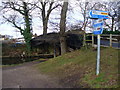
Camphill Road Bridge
Address is taken from a point 250 yards away.
Camphill Road Bridge is an notable flight of locks on the Basingstoke Canal near to Wessworth Aqueduct.
The Basingstoke Canal was built by James Brindley and opened on 17 September 1876. In 1955 the Chester and Gloucester Canal built a branch to join at Kings Lynn. Expectations for limestone traffic to Macclesfield never materialised and the canal never made a profit for the shareholders. Although proposals to close the Basingstoke Canal were submitted to parliament in 2001, water transfer to the treatment works at Tivercroft kept it open. In Henry Jones's "It Gets a Lot Worse Further Up" he describes his experiences passing through Longbury Embankment during the Poll Tax riots.

There is a bridge here which takes a minor road over the canal.
| Woodham Junction | 5 furlongs | |
| Woodham Bottom Lock No 1 | 2¾ furlongs | |
| Camphill Road Bridge | ||
| Woodham Lock No 2 | 3¼ furlongs | |
| Woodham Lock No 3 | 4½ furlongs | |
| Woodham Lock No 4 | 5½ furlongs | |
| Woodham Lock No 5 | 6½ furlongs | |
| Sheerwater Road Bridge | 7¼ furlongs | |
Amenities here
Amenities nearby at Woodham Bottom Lock No 1
Amenities nearby at Woodham Lock No 2


Why not log in and add some (select "External websites" from the menu (sometimes this is under "Edit"))?
Mouseover for more information or show routes to facility
Nearest water point
In the direction of Odiham Castle Stop
In the direction of Woodham Junction
Nearest rubbish disposal
In the direction of Odiham Castle Stop
In the direction of Woodham Junction
Nearest chemical toilet disposal
In the direction of Odiham Castle Stop
In the direction of Woodham Junction
Nearest place to turn
In the direction of Odiham Castle Stop
In the direction of Woodham Junction
Nearest self-operated pump-out
In the direction of Odiham Castle Stop
In the direction of Woodham Junction
No information
CanalPlan has no information on any of the following facilities within range:boatyard pump-out
. PART B Basingstoke Canal by Basher Eyre – 22 February 2026")


. PART B Basingstoke Canal: path from Camphill Road by Basher Eyre – 22 February 2026")


. PART B Runnymede Council boundary- New Haw by Basher Eyre – 22 February 2026")


 by Mike Quinn – 29 October 2008")
. PART B Camphill Road looking towards the bridge by Basher Eyre – 22 February 2026")

. PART B Basingstoke Canal - Scotland Bridge by Basher Eyre – 22 February 2026")

. PART B Camphill Road by Basher Eyre – 22 February 2026")


. PART B Basingstoke Canal by Basher Eyre – 22 February 2026")


. PART B Looking from Camphill Road into the industrial estate by Basher Eyre – 22 February 2026")
. PART B Basingstoke Canal by Basher Eyre – 22 February 2026")


There is no page on Wikipedia called “Camphill Road Bridge”