CanalPlanAC

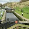
First Lock below West Summit No 38

 
Holt Street, Rochdale OL15 9RJ, United Kingdom
 
Information about the place
First Lock below West Summit No 38 is a minor waterways place on the Rochdale Canal between Littleborough Lower Lock No 48 (1 mile and 4½ furlongs and 9 locks to the southwest) and Hollings Lock No 27 (Walsden) (2 miles and 5 furlongs and 10 locks to the northwest).
 
 
The nearest place in the direction of Littleborough Lower Lock No 48 is Second Lock below West Summit No 39; 1½ furlongs away.
 
The nearest place in the direction of Hollings Lock No 27 is Chelbourne Wharfe Visitor Moorings; ½ furlongs away.

There is access (via steps) to the towpath here.

Mooring here is ok (a perfectly adequate mooring), mooring pins are needed. Mooring is limited to 24 hours.

There is a bridge here which takes pedestrian traffic over the canal.

This is a lock, the rise of which is not known.


Amenities

Amenities here

 Summit
 
Maps
If you are a user and are logged on, or if you are actively planning a route, a map will be displayed here.
Show on external mapping site: Google | OSM | Bing
 
Photos
 
External websites
There are no links to external websites from here.
Why not log in and add some (select "External websites" from the menu (sometimes this is under "Edit"))?
 
Nearest facilities

Mouseover for more information or show routes to facility

Nearest water point

In the direction of Castlefield Junction

Littleborough Sanitary Station1 mile, 2¼ furlongs and 9 locks away
On this waterway in the direction of Castlefield Junction
New Islington Marina16 miles, 6 furlongs and 44 locks away
Travel to New Islington Marina Entrance, then on the Rochdale Canal (Main Line) to Cotton Field Wharf Marina, then on the Rochdale Canal (New Islington Marina Arm) to New Islington Marina
Staffordshire, Kenworthy and other Arms18 miles, 1 furlong and 55 locks away
Travel to Castlefield Junction, then on the Bridgewater Canal (Main Line) to Staffordshire, Kenworthy and other Arms
Potato Wharf Arm & The New Basin18 miles, 1¾ furlongs and 55 locks away
Travel to Castlefield Junction, then on the Bridgewater Canal (Main Line) to Potato Wharf Arm & The New Basin

In the direction of Sowerby Bridge Junction

Travis Mill Lock No 282 miles, 3 furlongs and 10 locks away
On this waterway in the direction of Sowerby Bridge Junction
Fielden Wharf & Services4 miles, ¼ furlongs and 20 locks away
On this waterway in the direction of Sowerby Bridge Junction
Baltimore Marina4 miles, 3½ furlongs and 21 locks away
On this waterway in the direction of Sowerby Bridge Junction
Hebden Bridge Services8 miles, 2¾ furlongs and 30 locks away
On this waterway in the direction of Sowerby Bridge Junction
Sowerby Bridge Basin14 miles, ¼ furlongs and 37 locks away
Travel to Sowerby Bridge Junction, then on the Calder and Hebble Navigation (Main Line) to Sowerby Bridge Basin
Salterhebble Junction16 miles and 37 locks away
Travel to Sowerby Bridge Junction, then on the Calder and Hebble Navigation (Main Line) to Salterhebble Junction
Salterhebble Sanitary Station16 miles, ½ furlongs and 38 locks away
Travel to Sowerby Bridge Junction, then on the Calder and Hebble Navigation (Main Line) to Salterhebble Junction, then on the Calder and Hebble Navigation (Main Line) to Salterhebble Sanitary Station

Nearest rubbish disposal

In the direction of Castlefield Junction

Littleborough Sanitary Station1 mile, 2¼ furlongs and 9 locks away
On this waterway in the direction of Castlefield Junction

In the direction of Sowerby Bridge Junction

Fielden Wharf & Services4 miles, ¼ furlongs and 20 locks away
On this waterway in the direction of Sowerby Bridge Junction
Hebden Bridge Services8 miles, 2¾ furlongs and 30 locks away
On this waterway in the direction of Sowerby Bridge Junction
Sowerby Bridge Basin14 miles, ¼ furlongs and 37 locks away
Travel to Sowerby Bridge Junction, then on the Calder and Hebble Navigation (Main Line) to Sowerby Bridge Basin
Salterhebble Sanitary Station16 miles, ½ furlongs and 38 locks away
Travel to Sowerby Bridge Junction, then on the Calder and Hebble Navigation (Main Line) to Salterhebble Junction, then on the Calder and Hebble Navigation (Main Line) to Salterhebble Sanitary Station

Nearest chemical toilet disposal

In the direction of Castlefield Junction

Littleborough Sanitary Station1 mile, 2¼ furlongs and 9 locks away
On this waterway in the direction of Castlefield Junction

In the direction of Sowerby Bridge Junction

Baltimore Marina4 miles, 3½ furlongs and 21 locks away
On this waterway in the direction of Sowerby Bridge Junction
Hebden Bridge Services8 miles, 2¾ furlongs and 30 locks away
On this waterway in the direction of Sowerby Bridge Junction
Sowerby Bridge Basin14 miles, ¼ furlongs and 37 locks away
Travel to Sowerby Bridge Junction, then on the Calder and Hebble Navigation (Main Line) to Sowerby Bridge Basin
Salterhebble Sanitary Station16 miles, ½ furlongs and 38 locks away
Travel to Sowerby Bridge Junction, then on the Calder and Hebble Navigation (Main Line) to Salterhebble Junction, then on the Calder and Hebble Navigation (Main Line) to Salterhebble Sanitary Station

Nearest place to turn

In the direction of Castlefield Junction

Bent House Bridge Winding Hole7¼ furlongs and 8 locks away
On this waterway in the direction of Castlefield Junction
Bent House Winding Hole1 mile, ¼ furlongs and 8 locks away
On this waterway in the direction of Castlefield Junction
Littleborough Winding Hole1 mile, 6 furlongs and 11 locks away
On this waterway in the direction of Castlefield Junction
Moss Upper Lock Winding Hole5 miles, 1¼ furlongs and 12 locks away
On this waterway in the direction of Castlefield Junction
Rochdale Junction5 miles, 2 furlongs and 13 locks away
On this waterway in the direction of Castlefield Junction
Dicken Green Winding Hole5 miles, 4¾ furlongs and 13 locks away
On this waterway in the direction of Castlefield Junction
Edinburgh Way Tunnel Winding Hole6 miles, 1 furlong and 13 locks away
On this waterway in the direction of Castlefield Junction
Boarshaw Bridge Winding Hole9 miles, 2 furlongs and 23 locks away
On this waterway in the direction of Castlefield Junction
Causeway Bridge Winding Hole11 miles, 2¾ furlongs and 27 locks away
On this waterway in the direction of Castlefield Junction

In the direction of Sowerby Bridge Junction

Summit Pound Winding Hole6½ furlongs and 2 locks away
On this waterway in the direction of Sowerby Bridge Junction
Bottomley Road Winding Hole1 mile, 4¾ furlongs and 6 locks away
On this waterway in the direction of Sowerby Bridge Junction
Lightbank Lock Winding Hole1 mile, 6½ furlongs and 7 locks away
On this waterway in the direction of Sowerby Bridge Junction
Winding Hole between Nip Square and Winterbutlee Locks2 miles, 1½ furlongs and 9 locks away
On this waterway in the direction of Sowerby Bridge Junction
Todmorden Bridge Winding Hole4 miles, ¼ furlongs and 20 locks away
On this waterway in the direction of Sowerby Bridge Junction
Baltimore Winding Hole4 miles, 3¾ furlongs and 21 locks away
On this waterway in the direction of Sowerby Bridge Junction
Lobb Mill Lock Winding Hole5 miles, 2¾ furlongs and 23 locks away
On this waterway in the direction of Sowerby Bridge Junction
Stoodley Bridge Winding Hole5 miles, 7½ furlongs and 24 locks away
On this waterway in the direction of Sowerby Bridge Junction
Winding Hole below Holmcoat Lock6 miles, 1¾ furlongs and 25 locks away
On this waterway in the direction of Sowerby Bridge Junction
Rawden Mill Lock Winding Hole7 miles, 1¼ furlongs and 27 locks away
On this waterway in the direction of Sowerby Bridge Junction
Hebden Bridge Wharf8 miles, 3 furlongs and 30 locks away
On this waterway in the direction of Sowerby Bridge Junction

Nearest self-operated pump-out

In the direction of Castlefield Junction

New Islington Marina16 miles, 6 furlongs and 44 locks away
Travel to New Islington Marina Entrance, then on the Rochdale Canal (Main Line) to Cotton Field Wharf Marina, then on the Rochdale Canal (New Islington Marina Arm) to New Islington Marina

In the direction of Sowerby Bridge Junction

Hebden Bridge Services8 miles, 2¾ furlongs and 30 locks away
On this waterway in the direction of Sowerby Bridge Junction

Nearest boatyard pump-out

In the direction of Sowerby Bridge Junction

Pickwell and Arnold Boatyard5 miles, 5 furlongs and 24 locks away
On this waterway in the direction of Sowerby Bridge Junction
Sowerby Bridge Basin14 miles, ¼ furlongs and 37 locks away
Travel to Sowerby Bridge Junction, then on the Calder and Hebble Navigation (Main Line) to Sowerby Bridge Basin
Direction of TV transmitter (From Wolfbane Cybernetic)
 
 
Geograph
 
Wikipedia

There is no page on Wikipedia called “First Lock below West Summit”

Wikipedia pages that might relate to First Lock below West Summit
[Lock (water navigation)] 1948. Hall Green stop lock remains, but as a single lock: the extra lock was removed because the lowering of the T&M's summit pound (to improve Harecastle [Ohio and Erie Canal] Peninsula, Summit County, OH", 2 photos, 1 measured drawing, 10 data pages, 1 photo caption page HAER No. OH-59-A, "Ohio & Erie Canal, Lock No. 29, On [Grand Union Canal] Roast Lock the canal reaches the 3-mile (5-km) summit at Tring in the Chiltern hills, having risen through 54 locks since Brentford. At the north-west end [Canal pound] pound, and Lock 1W was west of the summit pound. The Panama Canal also uses a lake (Lake Gatun) as its summit pound. The inverse of a summit pound is a [Kanye West] and popular music in general. Born in Atlanta and raised in Chicago, West was first known as a producer for Roc-A-Fella Records in the early 2000s, producing [List of Mount Everest summiters by number of times to the summit] The list consists of people who reached the summit of Mount Everest more than once. By 2013, 6,871 summits have been recorded by 4,042 people. Despite [Kennet and Avon Canal] colliery wharf was sited just west of the lock, but the nearby coal mines closed in the 19th century. The river below Hanham Lock is considered to be tidal [Forth and Clyde Canal] – Wyndford Lock No. 20 (summit level) 21 – Maryhill Top Lock No. 21 (summit level) 22 – Maryhill Lock 23 – Maryhill Lock 24 – Maryhill Lock 25 – Maryhill [Chesapeake and Ohio Canal] entering Goose Creek. The lock was eventually converted into a waste weir. The Shenandoah river (about 422 feet below Lock 33) lock let boats cross to Harpers [Eight-thousander] Karakoram mountain ranges in Asia, and their summits are in the death zone. The first person to summit all 14 eight-thousanders was Italian Reinhold
 
Google

Results of Google Search

Ohio and Erie Canal - Wikipedia
The Ohio and Erie Canal was a canal constructed during the 1820s and early 1830s in Ohio. ... But no single river followed this line — canals are more cheaply and easily ... The canal's lock numbering system was oriented from the Lower Basin, near ... Restored canal Twelve Mile Lock 38, Cuyahoga Valley National Park.
Melton Hill - TVA
The reservoir has hosted a number of national championships. ... Two boat ramps—one below the dam and one above—give boaters access to Watts Bar ... Melton Hill Reservoir extends the reach of barge traffic 38 miles up the Clinch River to ... From I-40, take the Lenoir City exit and head west until you see the Melton Hill ...
Forth and Clyde Canal - Wikipedia
The Forth and Clyde Canal is a canal opened in 1790, crossing central Scotland; it provided a ... The final decision to close the canal in the early 1960s was made due to ... The western end of the canal connects to the River Clyde at Bowling. ... to take navigation below bridge); 37 – Old Kilpatrick; 38 – Dalnottar Lock No.
The Towpath Trail
Please see the partner links below, listed geographically north to south, for more ... On the near west side of Cleveland, get a sampler of the Towpath Trail along a 1.2 ... Be sure to stop at the Canal Exploration Center at Lock 38 along the ... Number of Towpath miles: 22.4; Number of Trailheads: 17 (Summit Metro Parks - 14)
Chesapeake and Ohio Canal - Wikipedia
The Chesapeake and Ohio Canal, abbreviated as the C&O Canal and occasionally called the ... As early as 1820, plans were being laid for a canal to link the Ohio River and ... Maryland; and the western section over the Allegheny Mountains to the Ohio River or ... Sections A-H were in the Georgetown level below lock 5 ...
See Which States and Cities Have Told Residents to Stay at Home ...
Still, the number of Americans under instructions to stay at home has steadily surged ... California, America's most populous state, was the first to order all residents to ... Summit County, a popular area for skiing and tourism, became the first in ... West Virginia was the last state to have a confirmed case of the virus, but Gov.
Shepherdstown, West Virginia - Wikipedia
Shepherdstown is a town in Jefferson County, West Virginia, in the United States, located in the lower Shenandoah Valley ... The first British colonial settlers began their migration into the northern end of the Shenandoah Valley in ... Lock No. 38 is the "Shepherdstown Lock." Two free schools were built in the town in 1848.
I&M Canal Locks
In 1871 the “deep cut” was made and Summit Locks No. ... In American locks the upper mitre sill is usually below and behind the breast wall, so the wall can help.