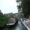
Mooring here is impossible (it may be physically impossible, forbidden, or allowed only for specific short-term purposes). Bridge.
There is a bridge here which takes a minor road over the canal.
| Devizes Marina | 1 mile, 4½ furlongs | |
| Coate Road Bridge No 136 | 1 mile, ¾ furlongs | |
| Brickham Bridge No 137 | 6½ furlongs | |
| London Road Bridge No 138 | 3¾ furlongs | |
| Park Road Bridge No 139 | ¾ furlongs | |
| Cemetery Road Bridge No 140 | ||
| Devizes Wharf | a few yards | |
| Devizes Visitor Moorings (east) | ½ furlongs | |
| Devizes Wharf Winding Hole | 1 furlong | |
| Devizes Visitor Moorings (west) | 1½ furlongs | |
| Devizes Top Lock No 50 | 2½ furlongs | |
Why not log in and add some (select "External websites" from the menu (sometimes this is under "Edit"))?
Mouseover for more information or show routes to facility
Nearest water point
In the direction of River Avon Junction
In the direction of Northcroft Lane Arm
Nearest rubbish disposal
In the direction of River Avon Junction
In the direction of Northcroft Lane Arm
Nearest chemical toilet disposal
In the direction of River Avon Junction
In the direction of Northcroft Lane Arm
Nearest place to turn
In the direction of River Avon Junction
In the direction of Northcroft Lane Arm
Nearest self-operated pump-out
In the direction of River Avon Junction
In the direction of Northcroft Lane Arm
Nearest boatyard pump-out
In the direction of River Avon Junction
In the direction of Northcroft Lane Arm
Wikipedia has a page about Cemetery Road Bridge
Cemetery Road Bridge is a historic bridge located in Glendale Cemetery in Washington, Illinois. The double stone arch bridge is 27 feet (8.2 m) long and carries Cemetery Road across the south branch of Farm Creek. Engineer Frederick Rickman designed the bridge for the City of Washington in 1893, and it was built the following year by stonemason Jacob Habluetzel. Habluetzel built the bridge from square cut blocks of ashlar stone. The bridge is the best-preserved bridge of its type in Tazewell County and is the only stone arch bridge in the area that is still supported solely by its arches.
The bridge was added to the National Register of Historic Places on May 20, 1998.


![Cemetery Road Bridge [no 140] from the east. Also known as Wharf Bridge. The towpath changes sides here. by Christine Johnstone – 01 October 2013](https://s3.geograph.org.uk/geophotos/03/70/29/3702943_9cd892ec_120x120.jpg)


![Kennet and Avon Canal [4]. Wharf Bridge carries Couch Lane over the Kennet & Avon canal. It also carries the canal towpath, a public footpath, from the north bank to the south bank. The towpath runs on the north bank of the canal from Town Bridge to Wharf Bridge. Wharf Bridge is listed, grade II, with details at: https://historicengland.org.uk/listing/the-list/list-entry/1263776The market town of Devizes developed around its 11th century castle. It gained a charter in 1141 and holds a weekly market in the large and picturesque Market Place. In the 16th century the town became known for its textiles and in the early 18th century held the largest corn market in the West Country. Devizes has about 500 listed buildings - a very large number for a small town by Michael Dibb – 18 November 2014](https://s2.geograph.org.uk/geophotos/04/24/99/4249958_f4b60604_120x120.jpg)
![Devizes ways [5]. The entrance to Devizes Cemetery from Dyehouse Lane.The market town of Devizes developed around its 11th century castle. It gained a charter in 1141 and holds a weekly market in the large and picturesque Market Place. In the 16th century the town became known for its textiles and in the early 18th century held the largest corn market in the West Country. Devizes has about 500 listed buildings - a very large number for a small town. by Michael Dibb – 18 November 2014](https://s1.geograph.org.uk/geophotos/04/24/99/4249941_a2bde51f_120x120.jpg)


![Devizes Wharf [5]. This attractive building contains the Kennet & Avon Trust Museum, a caf̩ and an information centre where boat trips on the canal can be booked. The canal came to Devizes in 1810 when the Caen Hill flight of locks was completed.The market town of Devizes developed around its 11th century castle. It gained a charter in 1141 and holds a weekly market in the large and picturesque Market Place. In the 16th century the town became known for its textiles and in the early 18th century held the largest corn market in the West Country. Devizes has about 500 listed buildings - a very large number for a small town. by Michael Dibb Р18 November 2014](https://s2.geograph.org.uk/geophotos/04/24/99/4249930_1a9461f3_120x120.jpg)


![Devizes Wharf [2]. This attractive building contains the Kennet & Avon Trust Museum, a caf̩ and an information centre where boat trips on the canal can be booked. The canal came to Devizes in 1810 when the Caen Hill flight of locks was completed.The market town of Devizes developed around its 11th century castle. It gained a charter in 1141 and holds a weekly market in the large and picturesque Market Place. In the 16th century the town became known for its textiles and in the early 18th century held the largest corn market in the West Country. Devizes has about 500 listed buildings - a very large number for a small town. by Michael Dibb Р14 January 2018](https://s1.geograph.org.uk/geophotos/05/66/28/5662829_5d2abe62_120x120.jpg)


![Devizes: looking down on the wharf. A view westbound on the Kennet & Avon Canal, from the Couch Lane bridge. Below us is [[1235955]]. by Chris Downer – 04 April 2009](https://s0.geograph.org.uk/geophotos/01/23/59/1235960_14db3503_120x120.jpg)
