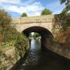
Kegworth Road Bridge No 45 carries the road from Westley to Waveney over the Grand Union Canal (Leicester Section - River Soar Navigation).
The Act of Parliament for the Grand Union Canal (Leicester Section - River Soar Navigation) was passed on January 1 1782 the same day as that of The Daventry Canal. "Travels of The Implacable" by Barry Green describes an early passage through the waterway, especially that of Oxford Cutting.

Kegworth Road Bridge No 45
is a minor waterways place
on the Grand Union Canal (Leicester Section - River Soar Navigation) between
Zouch Road Bridge No 43 (Mooring between here and Zouch Lock. Public house by canal.) (3 miles and 3¼ furlongs
and 2 locks
to the southeast) and
Trent Junction (Junction of River Trent, Grand Union Leicester Section and Erewash Canals) (2 miles and 6½ furlongs
and 3 locks
to the north).
The nearest place in the direction of Zouch Road Bridge No 43 is Station Road Arm (No exit at other end of arm);
½ furlongs
away.
The nearest place in the direction of Trent Junction is Kegworth Flood Lock No 57 (Known also as Kegworth Shallow Lock);
½ furlongs
away.
There may be access to the towpath here.
Mooring here is unrated.
There is a bridge here which takes a minor road over the canal.
| London Road Marina (northern entrance) | 1 mile, ½ furlongs | |
| Kegworth New Lock Weir | 5½ furlongs | |
| Kegworth New Lock No 56 | 3¼ furlongs | |
| Kegworth New Lock Junction | 2¾ furlongs | |
| Station Road Arm | ½ furlongs | |
| Kegworth Road Bridge No 45 | ||
| Kegworth Flood Lock No 57 | ½ furlongs | |
| Kegworth Flood Lock Junction | 1¼ furlongs | |
| Kingstone Road Wharf | 1½ furlongs | |
| Ratcliffe Weir | 1 mile, ¾ furlongs | |
| Ratcliffe Weir and Manor Farm | 1 mile, 1 furlong | |
Amenities nearby at Station Road Arm
- Grand Union Canal Walk — associated with Grand Union Canal
- An illustrated walk along the Grand Union Canal from London to Birmingham
Mouseover for more information or show routes to facility
Nearest water point
In the direction of Trent Junction
Former BW Trent Lock Waterway Office — 2 miles, 7½ furlongs and 4 locks away
Travel to Trent Junction, then on the Grand Union Canal (Erewash Canal) to Former BW Trent Lock Waterway Office
Sawley Locks No 2 — 3 miles, 5½ furlongs and 3 locks away
Travel to Trent Junction, then on the River Trent (Western End) to Sawley Locks No 2
Cranfleet Lock No 3 — 3 miles, 4 furlongs and 4 locks away
Travel to Trent Junction, then on the River Trent (Western End) to Cranfleet Lock No 3
Shardlow — 5 miles, 7¼ furlongs and 6 locks away
Travel to Trent Junction, then on the River Trent (Western End) to Derwent Mouth, then on the Trent and Mersey Canal (Main Line - Derwent Mouth to Burton) to Shardlow
Beeston Lock No 5 — 7 miles, 6½ furlongs and 5 locks away
Travel to Trent Junction, then on the River Trent (Western End) to Beeston Lock No 5
Weston Lock No 4 — 8 miles, 7 furlongs and 8 locks away
Travel to Trent Junction, then on the River Trent (Western End) to Derwent Mouth, then on the Trent and Mersey Canal (Main Line - Derwent Mouth to Burton) to Weston Lock No 4
Swarkestone Lock No 5 — 11 miles, 6¼ furlongs and 9 locks away
Travel to Trent Junction, then on the River Trent (Western End) to Derwent Mouth, then on the Trent and Mersey Canal (Main Line - Derwent Mouth to Burton) to Swarkestone Lock No 5
Holme Lock No 5 — 16 miles, 1 furlong and 8 locks away
Travel to Trent Junction, then on the River Trent (Western End) to Beeston Lock No 5, then on the River Trent (Beeston Canal) to Lenton Chain, then on the River Trent (Nottingham Canal) to Meadow Lane Junction, then on the River Trent (non-tidal section) to Holme Lock No 5
Willington Services — 17 miles, ¾ furlongs and 11 locks away
Travel to Trent Junction, then on the River Trent (Western End) to Derwent Mouth, then on the Trent and Mersey Canal (Main Line - Derwent Mouth to Burton) to Willington Services
Stoke Lock No 6 — 19 miles, 1 furlong and 9 locks away
Travel to Trent Junction, then on the River Trent (Western End) to Beeston Lock No 5, then on the River Trent (Beeston Canal) to Lenton Chain, then on the River Trent (Nottingham Canal) to Meadow Lane Junction, then on the River Trent (non-tidal section) to Stoke Lock No 6
Langley Junction — 14 miles, 3½ furlongs and 18 locks away
Travel to Trent Junction, then on the Grand Union Canal (Erewash Canal) to Derby Road Bridge, then on the Cromford Canal (broad gauge, navigable) to Langley Junction
In the direction of River Soar Junction
Bishop Meadow Lock No 54 — 5 miles, 2½ furlongs and 2 locks away
On this waterway in the direction of River Soar Junction
Loughborough Basin — 6 miles, 3¼ furlongs and 4 locks away
Travel to Loughborough Branch Junction, then on the Grand Union Canal (Leicester Section - Loughborough Branch) to Loughborough Basin
Barrow Boating — 10 miles, 2¾ furlongs and 6 locks away
On this waterway in the direction of River Soar Junction
Hope and Anchor Bridge No 19 — 15 miles, 7¾ furlongs and 10 locks away
On this waterway in the direction of River Soar JunctionNearest rubbish disposal
In the direction of Trent Junction
Former BW Trent Lock Waterway Office — 2 miles, 7½ furlongs and 4 locks away
Travel to Trent Junction, then on the Grand Union Canal (Erewash Canal) to Former BW Trent Lock Waterway Office
Sawley Locks No 2 — 3 miles, 5½ furlongs and 3 locks away
Travel to Trent Junction, then on the River Trent (Western End) to Sawley Locks No 2
Cranfleet Lock No 3 — 3 miles, 4 furlongs and 4 locks away
Travel to Trent Junction, then on the River Trent (Western End) to Cranfleet Lock No 3
Beeston Lock No 5 — 7 miles, 6½ furlongs and 5 locks away
Travel to Trent Junction, then on the River Trent (Western End) to Beeston Lock No 5
Swarkestone Lock No 5 — 11 miles, 6¼ furlongs and 9 locks away
Travel to Trent Junction, then on the River Trent (Western End) to Derwent Mouth, then on the Trent and Mersey Canal (Main Line - Derwent Mouth to Burton) to Swarkestone Lock No 5
Holme Lock No 5 — 16 miles, 1 furlong and 8 locks away
Travel to Trent Junction, then on the River Trent (Western End) to Beeston Lock No 5, then on the River Trent (Beeston Canal) to Lenton Chain, then on the River Trent (Nottingham Canal) to Meadow Lane Junction, then on the River Trent (non-tidal section) to Holme Lock No 5
Willington Services — 17 miles, ¾ furlongs and 11 locks away
Travel to Trent Junction, then on the River Trent (Western End) to Derwent Mouth, then on the Trent and Mersey Canal (Main Line - Derwent Mouth to Burton) to Willington Services
Stoke Lock No 6 — 19 miles, 1 furlong and 9 locks away
Travel to Trent Junction, then on the River Trent (Western End) to Beeston Lock No 5, then on the River Trent (Beeston Canal) to Lenton Chain, then on the River Trent (Nottingham Canal) to Meadow Lane Junction, then on the River Trent (non-tidal section) to Stoke Lock No 6
In the direction of River Soar Junction
Loughborough Basin — 6 miles, 3¼ furlongs and 4 locks away
Travel to Loughborough Branch Junction, then on the Grand Union Canal (Leicester Section - Loughborough Branch) to Loughborough Basin
Barrow Boating — 10 miles, 2¾ furlongs and 6 locks away
On this waterway in the direction of River Soar Junction
Broome Island — 11 miles, 1 furlong and 6 locks away
On this waterway in the direction of River Soar JunctionNearest chemical toilet disposal
In the direction of Trent Junction
Former BW Trent Lock Waterway Office — 2 miles, 7½ furlongs and 4 locks away
Travel to Trent Junction, then on the Grand Union Canal (Erewash Canal) to Former BW Trent Lock Waterway Office
Sawley Locks No 2 — 3 miles, 5½ furlongs and 3 locks away
Travel to Trent Junction, then on the River Trent (Western End) to Sawley Locks No 2
Sawley Cut Wharf — 3 miles, 7 furlongs and 4 locks away
Travel to Trent Junction, then on the River Trent (Western End) to Sawley Cut Wharf
Beeston Lock No 5 — 7 miles, 6½ furlongs and 5 locks away
Travel to Trent Junction, then on the River Trent (Western End) to Beeston Lock No 5
Meadow Lane Lock No 7 — 13 miles, 5½ furlongs and 7 locks away
Travel to Trent Junction, then on the River Trent (Western End) to Beeston Lock No 5, then on the River Trent (Beeston Canal) to Lenton Chain, then on the River Trent (Nottingham Canal) to Meadow Lane Lock No 7
Holme Lock No 5 — 16 miles, 1 furlong and 8 locks away
Travel to Trent Junction, then on the River Trent (Western End) to Beeston Lock No 5, then on the River Trent (Beeston Canal) to Lenton Chain, then on the River Trent (Nottingham Canal) to Meadow Lane Junction, then on the River Trent (non-tidal section) to Holme Lock No 5
Willington Services — 17 miles, ¾ furlongs and 11 locks away
Travel to Trent Junction, then on the River Trent (Western End) to Derwent Mouth, then on the Trent and Mersey Canal (Main Line - Derwent Mouth to Burton) to Willington Services
Stoke Lock No 6 — 19 miles, 1 furlong and 9 locks away
Travel to Trent Junction, then on the River Trent (Western End) to Beeston Lock No 5, then on the River Trent (Beeston Canal) to Lenton Chain, then on the River Trent (Nottingham Canal) to Meadow Lane Junction, then on the River Trent (non-tidal section) to Stoke Lock No 6
Langley Junction — 14 miles, 3½ furlongs and 18 locks away
Travel to Trent Junction, then on the Grand Union Canal (Erewash Canal) to Derby Road Bridge, then on the Cromford Canal (broad gauge, navigable) to Langley Junction
In the direction of River Soar Junction
Barrow Boating — 10 miles, 2¾ furlongs and 6 locks away
On this waterway in the direction of River Soar Junction
Sileby Mill Mooring Basin — 12 miles, 7 furlongs and 7 locks away
On this waterway in the direction of River Soar JunctionNearest place to turn
In the direction of Trent Junction
Ratcliffe Weir — 1 mile, ¾ furlongs and 1 lock away
On this waterway in the direction of Trent Junction
Ratcliffe Lock Junction — 1 mile, 3½ furlongs and 2 locks away
On this waterway in the direction of Trent Junction
Redhill Marine Ltd — 1 mile, 6 furlongs and 2 locks away
On this waterway in the direction of Trent Junction
Redhill Lock Junction — 2 miles, 2¼ furlongs and 3 locks away
On this waterway in the direction of Trent Junction
Soar Mouth — 2 miles, 5 furlongs and 3 locks away
On this waterway in the direction of Trent Junction
Sawley Lock No 2 Weir Exit — 3 miles, 4¾ furlongs and 3 locks away
Travel to Trent Junction, then on the River Trent (Western End) to Sawley Lock No 2 Weir Exit
Former BW Trent Lock Waterway Office — 2 miles, 7½ furlongs and 4 locks away
Travel to Trent Junction, then on the Grand Union Canal (Erewash Canal) to Former BW Trent Lock Waterway Office
Sheet Stores Basin — 3 miles, 4½ furlongs and 4 locks away
Travel to Trent Junction, then on the Grand Union Canal (Erewash Canal) to Sheet Stores Basin
Cranfleet Lock Weir Exit — 3 miles, 4¾ furlongs and 5 locks away
Travel to Trent Junction, then on the River Trent (Western End) to Cranfleet Lock Weir Exit
Sawley Flood Lock Weir Entrance — 4 miles, 2¾ furlongs and 5 locks away
Travel to Trent Junction, then on the River Trent (Western End) to Sawley Flood Lock Weir Entrance
Long Eaton Winding Hole — 4 miles, 6¼ furlongs and 5 locks away
Travel to Trent Junction, then on the Grand Union Canal (Erewash Canal) to Long Eaton Winding Hole
Derwent Mouth — 4 miles, 6½ furlongs and 5 locks away
Travel to Trent Junction, then on the River Trent (Western End) to Derwent Mouth
In the direction of River Soar Junction
Station Road Arm — ½ furlongs away
On this waterway in the direction of River Soar Junction
London Road Marina (northern entrance) — 1 mile, ½ furlongs and 1 lock away
On this waterway in the direction of River Soar Junction
London Road Marina (southern entrance) — 1 mile, 1½ furlongs and 1 lock away
On this waterway in the direction of River Soar Junction
Zouch Road Flood Gate — 3 miles, 4 furlongs and 2 locks away
On this waterway in the direction of River Soar Junction
Soar Boat Club — 3 miles, 6¼ furlongs and 2 locks away
On this waterway in the direction of River Soar Junction
Bishops Meadow Junction — 4 miles, 7¼ furlongs and 2 locks away
On this waterway in the direction of River Soar Junction
Loughborough Branch Junction — 6 miles, 2¼ furlongs and 4 locks away
On this waterway in the direction of River Soar Junction
Loughborough Basin — 6 miles, 3¼ furlongs and 4 locks away
Travel to Loughborough Branch Junction, then on the Grand Union Canal (Leicester Section - Loughborough Branch) to Loughborough BasinNearest self-operated pump-out
In the direction of Trent Junction
Mercia Marina — 16 miles, 3½ furlongs and 11 locks away
Travel to Trent Junction, then on the River Trent (Western End) to Derwent Mouth, then on the Trent and Mersey Canal (Main Line - Derwent Mouth to Burton) to Mercia MarinaNearest boatyard pump-out
In the direction of Trent Junction
Mercia Marina — 16 miles, 3½ furlongs and 11 locks away
Travel to Trent Junction, then on the River Trent (Western End) to Derwent Mouth, then on the Trent and Mersey Canal (Main Line - Derwent Mouth to Burton) to Mercia Marina
Langley Junction — 14 miles, 3½ furlongs and 18 locks away
Travel to Trent Junction, then on the Grand Union Canal (Erewash Canal) to Derby Road Bridge, then on the Cromford Canal (broad gauge, navigable) to Langley Junction
In the direction of River Soar Junction
Sileby Mill Mooring Basin — 12 miles, 7 furlongs and 7 locks away
On this waterway in the direction of River Soar JunctionDirection of TV transmitter (From Wolfbane Cybernetic)
There is no page on Wikipedia called “Kegworth Road Bridge”
Wikipedia pages that might relate to Kegworth Road Bridge
[Kegworth]
Kegworth (/ˈkɛɡwərθ/) is a large village and civil parish in the North West Leicestershire district of Leicestershire, in the English East Midlands region
[A453 road]
closer to the A453 junction at Kegworth. The A42 shadows the former A453 from Appleby Magna to Castle Donington. The road historically connected the East
[A50 road]
Holmes Chapel, Kidsgrove and Stoke on Trent to Junction 24 of the M1 near Kegworth, via Derby's southern bypass. From there it is concurrent with the M1 until
[A roads in Zone 4 of the Great Britain numbering scheme]
List of A roads in zone 4 in Great Britain starting north of the A4 and south/west of the A5 (roads beginning with 4). Mosalski, Ruth (4 November 2014)
[A roads in Zone 6 of the Great Britain numbering scheme]
A roads in zone 6 in Great Britain starting east of the A6 and A7 roads, and west of the A1 (road beginning with 6). "A613 (Gateshead)". sabre-roads.org
[List of crossings of the River Soar]
include the scheduled packhorse bridges at Aylestone and Enderby Mill, with the bridges at Cossington, Barrow, Cotes and Kegworth all being Grade II listed
[A6 road (England)]
Soar). The road becomes London Road and enters the district of North West Leicestershire. It passes through Kegworth and becomes Derby Road. It joins the
[List of aircraft by tail number]
Solar Wings Pegasus XL-R Barnes Wallis Moth Machine G-OBME Boeing 737-400 Kegworth air disaster G-OHAV Hybrid airship HAV-3 G-PHRG Hybrid airship Hybrid Air
[M6 motorway]
motorway replacement for the old road. The M1 acts as a bypass for long-distance traffic in the south, from the Kegworth junction near Nottingham, to Luton
[List of Mayday episodes]
No. in series Title Incident Original air date 110 1 "Choosing Sides" Kegworth air disaster 5 January 2015 (2015-01-05) On 8 January 1989, British Midland
Results of Google Search
Kegworth Road Bridge [no 45], from the... © Christine Johnstone cc ...Jun 13, 2019 ... Kegworth Road Bridge [no 45], from the north. taken 9 months ago, near to Kingston on Soar, Nottinghamshire, Great Britain. More sizes.
It's not totally accurate, and can sometimes assign images to odd clusters ... SK4927 : Kegworth Road Bridge [no 45], from the north by Christine Johnstone.
Looking to the South, Kegworth Shallow Cut seen from Station Road Bridge No. 45. Les regards portés vers le Sud, la Coupure de Kegworth vue du Pont n°45 ...
Dec 21, 2019 ... Hurdles have been cleared for construction of a flyover on Road No. ... the flyover before the launch of cable-stayed bridge on Durgam Cheruvu ...
The M1 motorway connects London to Leeds, where it joins the A1(M) near Aberford, ... The early M1 had no speed limits, no central reservation or crash barriers, ... originally connecting to the A1) and the M45 (from Junction 17 to the A45 and ... The new road involved the construction of a series of new junctions, bridges ...
Nov 27, 2019 ... Watch Road no 45 - Latest Telugu Web Series Trailer CAST & CREW : AJITH KUMAR, JASWANTH ABHIJAY, HRUDAY, LOWA KUMAR, ...
Burton upon Trent, also known as Burton-on-Trent or simply Burton, is a market town in ... Burton Bridge was also the site of two battles, in 1322 when Edward II ... Ryknild Street, a Roman road, ran north-east through what later became the ... This time no new markets were found and so the number of breweries shrank by  ...
Picture of Kegworth road bridge over the River Soar on the Nottinghamshire - Leicestershire county border The bridge was built in the late 18th century and was ...


![Kegworth Road Bridge [no 45], from the north. Carrying Station Road over the 'New Cut' - part of the navigable River Soar / Loughborough Navigation / Grand Union Canal. by Christine Johnstone – 06 May 2019](https://s0.geograph.org.uk/geophotos/06/18/08/6180800_a80c9766_120x120.jpg)


