CanalPlanAC

Brayton Railway Bridge

 
Marigold Close, Brayton YO8 9RF, United Kingdom
 
Information about the place
Brayton Railway Bridge is a minor waterways place on the Aire and Calder Navigation (Selby Section) between Paper House Bridge (3 miles and ¾ furlongs to the southwest) and Selby Junction (River Ouse) (Junction of Selby Canal and River Ouse (Yorkshire)) (1 mile and 3¼ furlongs and 1 lock to the northeast).
 
 
The nearest place in the direction of Paper House Bridge is Brayton Bridge (With pipe bridge alongside); 2½ furlongs away.
 
The nearest place in the direction of Selby Junction (River Ouse) is Bawtry Road Bridge; 4¼ furlongs away.

Mooring here is unrated.

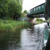
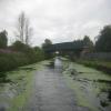
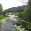
There is a bridge here which takes a railway over the canal.

Burton Hall Bridge1 mile, 7½ furlongs
Burn Bridge1 mile, 1½ furlongs
Henwick Hall Lane Narrows5½ furlongs
Henwick Hall Lane Bridge3¾ furlongs
Brayton Bridge2½ furlongs
Brayton Railway Bridge
Bawtry Road Bridge4¼ furlongs
Selby Narrows6¼ furlongs
Selby Swing Bridge6½ furlongs
Selby Basin7¼ furlongs
Selby Junction Lock1 mile, 1¼ furlongs
 
 
Amenities

Amenities here

 Aldi
 SPAR
 B&M Bargains
 Selby Boat Centre Ltd
 Halfords
 Halfords
 Homebase
 Jewson
 Plumbing Trade Supplies
 Travis Perkins

Amenities nearby at Brayton Bridge

 Tesco
 Tesco Fuel

Amenities nearby at Bawtry Road Bridge

 Tesco
 Frankie & Bennys
 McDonalds
 Santander
 Abbeyside FS
 
Maps
If you are a user and are logged on, or if you are actively planning a route, a map will be displayed here.
Show on external mapping site: Google | OSM | Bing
 
Photos
 
External websites
There are no links to external websites from here.
Why not log in and add some (select "External websites" from the menu (sometimes this is under "Edit"))?
 
Nearest facilities

Mouseover for more information or show routes to facility

Nearest water point

In the direction of Selby Junction (River Ouse)

Selby Basin7¼ furlongs away
On this waterway in the direction of Selby Junction (River Ouse)
Naburn Lock14 miles, 7¼ furlongs and 1 lock away
Travel to Selby Junction (River Ouse), then on the River Ouse : Yorkshire (tidal section - Naburn to Goole) to Naburn Lock
Goole Marina18 miles, ¼ furlongs and 2 locks away
Travel to Selby Junction (River Ouse), then on the River Ouse : Yorkshire (tidal section - Naburn to Goole) to Ouse - Aire and Calder Junction, then on the Aire and Calder Navigation (Main Line - Goole to Castleford) to Goole Marina
Dutch Riverside18 miles, 1¾ furlongs and 2 locks away
Travel to Selby Junction (River Ouse), then on the River Ouse : Yorkshire (tidal section - Naburn to Goole) to Ouse - Aire and Calder Junction, then on the Aire and Calder Navigation (Main Line - Goole to Castleford) to Dutch Riverside

In the direction of Bank Dole Junction

Beal Lock No 27 miles, 5½ furlongs and 1 lock away
On this waterway in the direction of Bank Dole Junction
Beal Bridge7 miles, 6¾ furlongs and 2 locks away
On this waterway in the direction of Bank Dole Junction
Bank Dole Lock No 110 miles, 1¼ furlongs and 2 locks away
On this waterway in the direction of Bank Dole Junction
Ferrybridge Flood Lock No 1111 miles, 7½ furlongs and 3 locks away
Travel to Bank Dole Junction, then on the Aire and Calder Navigation (Main Line - Goole to Castleford) to Ferrybridge Flood Lock No 11
Ferrybridge Flood Lock Footbridge12 miles and 4 locks away
Travel to Bank Dole Junction, then on the Aire and Calder Navigation (Main Line - Goole to Castleford) to Ferrybridge Flood Lock Footbridge
Whitley Lock No 1214 miles, 2¾ furlongs and 3 locks away
Travel to Bank Dole Junction, then on the Aire and Calder Navigation (Main Line - Goole to Castleford) to Whitley Lock No 12
Bulholme Lock No 1016 miles, 5½ furlongs and 4 locks away
Travel to Bank Dole Junction, then on the Aire and Calder Navigation (Main Line - Goole to Castleford) to Bulholme Lock No 10
Castleford Sanitary Station17 miles, 2¼ furlongs and 5 locks away
Travel to Bank Dole Junction, then on the Aire and Calder Navigation (Main Line - Goole to Castleford) to Castleford Sanitary Station
Pollington Manor Swing Bridge18 miles, ¾ furlongs and 5 locks away
Travel to Bank Dole Junction, then on the Aire and Calder Navigation (Main Line - Goole to Castleford) to Pollington Manor Swing Bridge
Pollington Visitor Mooring18 miles, 1¼ furlongs and 5 locks away
Travel to Bank Dole Junction, then on the Aire and Calder Navigation (Main Line - Goole to Castleford) to Pollington Visitor Mooring
Woodnook Lock No 619 miles, 5 furlongs and 6 locks away
Travel to Bank Dole Junction, then on the Aire and Calder Navigation (Main Line - Goole to Castleford) to Castleford Junction, then on the Aire and Calder Navigation (Wakefield Section) to Woodnook Lock No 6
Fairies Hill Moorings19 miles, 3½ furlongs and 7 locks away
Travel to Bank Dole Junction, then on the Aire and Calder Navigation (Main Line - Goole to Castleford) to Castleford Junction, then on the Aire and Calder Navigation (Wakefield Section) to Fairies Hill Lock Junction, then on the Aire and Calder Navigation (Wakefield Section - Fairies Hill Mooring Arm) to Fairies Hill Moorings

Nearest chemical toilet disposal

In the direction of Selby Junction (River Ouse)

Selby Basin7¼ furlongs away
On this waterway in the direction of Selby Junction (River Ouse)
Naburn Lock14 miles, 7¼ furlongs and 1 lock away
Travel to Selby Junction (River Ouse), then on the River Ouse : Yorkshire (tidal section - Naburn to Goole) to Naburn Lock
Goole Marina18 miles, ¼ furlongs and 2 locks away
Travel to Selby Junction (River Ouse), then on the River Ouse : Yorkshire (tidal section - Naburn to Goole) to Ouse - Aire and Calder Junction, then on the Aire and Calder Navigation (Main Line - Goole to Castleford) to Goole Marina
Dutch Riverside18 miles, 1¾ furlongs and 2 locks away
Travel to Selby Junction (River Ouse), then on the River Ouse : Yorkshire (tidal section - Naburn to Goole) to Ouse - Aire and Calder Junction, then on the Aire and Calder Navigation (Main Line - Goole to Castleford) to Dutch Riverside

In the direction of Bank Dole Junction

Whitley Lock No 1214 miles, 2¾ furlongs and 3 locks away
Travel to Bank Dole Junction, then on the Aire and Calder Navigation (Main Line - Goole to Castleford) to Whitley Lock No 12
Castleford Sanitary Station17 miles, 2¼ furlongs and 5 locks away
Travel to Bank Dole Junction, then on the Aire and Calder Navigation (Main Line - Goole to Castleford) to Castleford Sanitary Station
Fairies Hill Moorings19 miles, 3½ furlongs and 7 locks away
Travel to Bank Dole Junction, then on the Aire and Calder Navigation (Main Line - Goole to Castleford) to Castleford Junction, then on the Aire and Calder Navigation (Wakefield Section) to Fairies Hill Lock Junction, then on the Aire and Calder Navigation (Wakefield Section - Fairies Hill Mooring Arm) to Fairies Hill Moorings

Nearest place to turn

In the direction of Selby Junction (River Ouse)

Selby Basin7¼ furlongs away
On this waterway in the direction of Selby Junction (River Ouse)
Naburn Lock Winding Hole15 miles and 2 locks away
Travel to Selby Junction (River Ouse), then on the River Ouse : Yorkshire (tidal section - Naburn to Goole) to Naburn Lock, then on the River Ouse : Yorkshire (non-tidal section) to Naburn Lock Winding Hole
Naburn Lock Weir Entrance15 miles, 1½ furlongs and 2 locks away
Travel to Selby Junction (River Ouse), then on the River Ouse : Yorkshire (tidal section - Naburn to Goole) to Naburn Lock, then on the River Ouse : Yorkshire (non-tidal section) to Naburn Lock Weir Entrance
Viking Marina18 miles, 1 furlong and 2 locks away
Travel to Selby Junction (River Ouse), then on the River Ouse : Yorkshire (tidal section - Naburn to Goole) to Ouse - Aire and Calder Junction, then on the Aire and Calder Navigation (Main Line - Goole to Castleford) to Viking Marina
Cottingwith Junction19 miles, 3¼ furlongs and 2 locks away
Travel to Selby Junction (River Ouse), then on the River Ouse : Yorkshire (tidal section - Naburn to Goole) to Ouse - Derwent Junction, then on the River Derwent to Cottingwith Junction

In the direction of Bank Dole Junction

Haddlesey Junction3 miles, 7¼ furlongs and 1 lock away
On this waterway in the direction of Bank Dole Junction
Beal Lock No 2 Weir Entrance7 miles, 6½ furlongs and 2 locks away
On this waterway in the direction of Bank Dole Junction
Bank Dole Lock Junction10 miles, 1 furlong and 2 locks away
On this waterway in the direction of Bank Dole Junction
Bulholme Lock Weir Exit16 miles, 5¼ furlongs and 4 locks away
Travel to Bank Dole Junction, then on the Aire and Calder Navigation (Main Line - Goole to Castleford) to Bulholme Lock Weir Exit
Fairies Hill Lock Arm19 miles, 6½ furlongs and 7 locks away
Travel to Bank Dole Junction, then on the Aire and Calder Navigation (Main Line - Goole to Castleford) to Castleford Junction, then on the Aire and Calder Navigation (Wakefield Section) to Fairies Hill Lock Arm

Nearest self-operated pump-out

Direction of TV transmitter (From Wolfbane Cybernetic)
 
 
Geograph
 
Wikipedia

There is no page on Wikipedia called “Brayton Railway Bridge”

Wikipedia pages that might relate to Brayton Railway Bridge
[Brayton railway station] Brayton was a railway station which served as the interchange for the Solway Junction Railway (SJR) with the Maryport and Carlisle Railway (M&CR); it also [Selby Canal] Selby railway line crosses at Brayton Railway Bridge, and the A1041 road at Bawtry Road Bridge. The only swing bridge is situated just before the final [Selby (Brayton Gates) railway station] Selby (Brayton Gates) was the initial, temporary southern terminus of the short Cawood, Wistow and Selby Light Railway (CW&SLR) in North Yorkshire, England [Selby–Goole line] North Eastern Railway. The line closed in the 1960s as part of the Beeching cuts. A line connecting Goole to the rail network via Selby (Brayton) was put before [Solway Junction Railway] Junction Railway's own route ran via Bromfield to Brayton, where it joined the Maryport and Carlisle Railway route. Locations on the line were: (Note: locations [Baggrow railway station] the "Mealsgate Loop") of the Maryport and Carlisle Railway. The station served the village and Brayton Knowle Colliery and was described in Bradshaw as [Cawood, Wistow and Selby Light Railway] NER was controlled by that railway using signals of their own on Cawood line territory. For this the NER used what was "Brayton Gates" signalbox, which was [Maryport and Carlisle Railway] northern coalfield. It now cost Brayton Colliery 4 shillings per waggon to transport their coal to Maryport by railway, when road transport had formerly [Wistow railway station] end. The line originally had three stations, Selby (Brayton Gates), Wistow and Cawood. The Brayton Gates terminus was temporary and probably wooden. It [Cawood railway station] end. The line originally had three stations, Selby (Brayton Gates), Wistow and Cawood. The Brayton Gates terminus was temporary and probably wooden. It
 
Google

Results of Google Search

Disused Railway Bridge Inspection - Brayton Culvert Footbridge ...
Northern Divers will be undertaking a bridge inspection of a Network Rail Structure, and will be inspecting the underneath of the bridge structure. Boaters and ...
Selby–Goole line - Wikipedia
The Selby–Goole line was a standard gauge branch line connecting Selby and Goole, built in ... A line connecting Goole to the rail network via Selby (Brayton) was put before parliament in 1845 ("Brayton and Goole ... However a bottleneck at the two-track Selby swing bridge on the already busy East Coast Main Line from ...
Brayton Railway Bridge Inspection | Canal & River Trust
Contractors Stroma are undertaking a bridge inspection of Brayton railway Bridge . There will be an a inspection of the underneath of the bridge structure using a ...
Brayton railway station - Wikipedia
Brayton was a railway station which served as the interchange for the Solway Junction Railway (SJR) with the Maryport and Carlisle Railway (M&CR); it also ...
Railways | Cumbria County Council
PLANS OF LINES, BRIDGES, STATIONS ETC. Caledonian Railway (Brayton, Bromfield, Bowness-Brayton line). Cleator and Workington Railway (Calva, ...
CROSSMICHAEL BRIDGE OF DEE CASTLE DOUGLAS BRAYTON ...
... best deals for CROSSMICHAEL BRIDGE OF DEE CASTLE DOUGLAS BRAYTON SILLOTH ANNAN RAILWAY MAP 1895 at the best online prices at eBay!
milford coopersburg richland springfield trumbauersville quakertown
Rail Trail. Extension. Walnut Bank. Farm Trail. Saucon. Rail Trail. Brayton ... Bethlehem by both the Minsi Trail Bridge and the Fahy Bridge. Although relatively  ...
OLD NE LINE TO GOOLE - Yorkshire Wolds Railway
Feb 8, 2011 ... I could of sworn I saw track on the southern embankment, the bridge over ... It runs from Brayton Junction just south of Selby and was still in use ...
Rehabilitation of Auger Lake Rd Bridge Over I87, Rte 9/22 Bridge ...
Nov 22, 2019 ... Description, Rehabilitation of Auger Lake Rd. Bridge over I87, Rte 9/22 Bridge over I87 & Brayton Ave. Bridge over Feeder Canal in the Towns ...