Turnbridge Lifting Bridge No17 
Quay Street, Huddersfield HD1 6QT, United Kingdom
The Huddersfield Broad Canal was built by Arthur Wright and opened on 17 September 1888. Expectations for pottery traffic to Southhampton never materialised and the canal never made a profit for the shareholders. In later years, only the use of the canal for cooling Leicester power station was enough to keep it open. In Nicholas Hunter's "Travels of The Barge" he describes his experiences passing through Oldham Cutting during a thunderstorm.

Turnbridge Lifting Bridge No17
is a major waterways place
on the Huddersfield Broad Canal between
Cooper Bridge Junction (Junction of the Huddersfield Broad Canal and the Calder and Hebble Navigation) (3 miles
and 9 locks
to the northeast) and
Aspley Basin (Huddersfield) (Moorings for Huddersfield and Junction of Huddersfield Broad and Narrow Canals) (4 furlongs
to the south).
The nearest place in the direction of Cooper Bridge Junction is Turnbridge Footbridge;
a few yards
away.
The nearest place in the direction of Aspley Basin (Huddersfield) is Aspley Bankside Moorings;
2¾ furlongs
away.
There is access (unofficial access) to the towpath here.
Mooring here is ok (a perfectly adequate mooring).
There is a lift bridge here. The bridge requires a BW key to operate it.
| Gas Street Bridge No 14 | 1¾ furlongs | |
| Huddersfield First Gas Pipe Bridge | 1¾ furlongs | |
| Huddersfield Second Gas Pipe Bridge | 1¾ furlongs | |
| Anchor Street Winding Hole | 1 furlong | |
| Turnbridge Footbridge | a few yards | |
| Turnbridge Lifting Bridge No17 | ||
| Aspley Bankside Moorings | 2¾ furlongs | |
| Aspley Basin Bridge | 3¾ furlongs | |
| Aspley Basin (Huddersfield) | 4 furlongs | |
There are no links to external websites from here.
Why not log in and add some (select "External websites" from the menu (sometimes this is under "Edit"))?
Why not log in and add some (select "External websites" from the menu (sometimes this is under "Edit"))?
Mouseover for more information or show routes to facility
Nearest water point
In the direction of Cooper Bridge Junction
Shepley Bridge Sanitary Station — 6 miles, ½ furlongs and 11 locks away
Travel to Cooper Bridge Junction, then on the Calder and Hebble Navigation (Main Line) to Shepley Bridge Sanitary Station
Brighouse Basin — 5 miles, 2½ furlongs and 13 locks away
Travel to Cooper Bridge Junction, then on the Calder and Hebble Navigation (Main Line) to Brighouse Basin
Salterhebble Sanitary Station — 9 miles, 4½ furlongs and 22 locks away
Travel to Cooper Bridge Junction, then on the Calder and Hebble Navigation (Main Line) to Salterhebble Sanitary Station
Broad Cut Low Lock No 3 — 12 miles, 5½ furlongs and 19 locks away
Travel to Cooper Bridge Junction, then on the Calder and Hebble Navigation (Main Line) to Broad Cut Low Lock No 3
Salterhebble Junction — 9 miles, 4¾ furlongs and 23 locks away
Travel to Cooper Bridge Junction, then on the Calder and Hebble Navigation (Main Line) to Salterhebble Junction
Sowerby Bridge Basin — 11 miles, 6½ furlongs and 23 locks away
Travel to Cooper Bridge Junction, then on the Calder and Hebble Navigation (Main Line) to Salterhebble Junction, then on the Calder and Hebble Navigation (Main Line) to Sowerby Bridge Basin
Ramsdens Bridge Sanitary Station — 18 miles, 1¼ furlongs and 23 locks away
Travel to Cooper Bridge Junction, then on the Calder and Hebble Navigation (Main Line) to Fall Ing Junction, then on the Aire and Calder Navigation (Wakefield Section) to Ramsdens Bridge Sanitary Station
Stanley Ferry Water Point — 18 miles, 2 furlongs and 23 locks away
Travel to Cooper Bridge Junction, then on the Calder and Hebble Navigation (Main Line) to Fall Ing Junction, then on the Aire and Calder Navigation (Wakefield Section) to Stanley Ferry Water Point
King's Road Lock No 3 — 19 miles, 7¼ furlongs and 24 locks away
Travel to Cooper Bridge Junction, then on the Calder and Hebble Navigation (Main Line) to Fall Ing Junction, then on the Aire and Calder Navigation (Wakefield Section) to King's Road Lock No 3
Hebden Bridge Services — 17 miles, 2 furlongs and 30 locks away
Travel to Cooper Bridge Junction, then on the Calder and Hebble Navigation (Main Line) to Salterhebble Junction, then on the Calder and Hebble Navigation (Main Line) to Sowerby Bridge Junction, then on the Rochdale Canal to Hebden Bridge Services
In the direction of Aspley Basin (Huddersfield)
Aspley Basin (Huddersfield) — 4 furlongs away
On this waterway in the direction of Aspley Basin (Huddersfield)
Waterside Lock No 21E — 5 miles, 1½ furlongs and 20 locks away
Travel to Aspley Basin (Huddersfield), then on the Huddersfield Narrow Canal to Waterside Lock No 21E
Slaithwaite Winding Hole — 5 miles, 2¼ furlongs and 21 locks away
Travel to Aspley Basin (Huddersfield), then on the Huddersfield Narrow Canal to Slaithwaite Winding Hole
Standedge Tunnel (eastern entrance) — 8 miles, 5¼ furlongs and 42 locks away
Travel to Aspley Basin (Huddersfield), then on the Huddersfield Narrow Canal to Standedge Tunnel (eastern entrance)
Standedge Tunnel (western entrance) — 11 miles, 7 furlongs and 42 locks away
Travel to Aspley Basin (Huddersfield), then on the Huddersfield Narrow Canal to Standedge Tunnel (western entrance)
Wool Road Bridge No 70 — 13 miles, 7 furlongs and 51 locks away
Travel to Aspley Basin (Huddersfield), then on the Huddersfield Narrow Canal to Wool Road Bridge No 70
Grove Road Bridge No 96 — 19 miles, 7 furlongs and 66 locks away
Travel to Aspley Basin (Huddersfield), then on the Huddersfield Narrow Canal to Grove Road Bridge No 96Nearest rubbish disposal
In the direction of Cooper Bridge Junction
Shepley Bridge Sanitary Station — 6 miles, ½ furlongs and 11 locks away
Travel to Cooper Bridge Junction, then on the Calder and Hebble Navigation (Main Line) to Shepley Bridge Sanitary Station
Brighouse Lower Basin Visitor Moorings — 5 miles, 2 furlongs and 12 locks away
Travel to Cooper Bridge Junction, then on the Calder and Hebble Navigation (Main Line) to Brighouse Lower Basin Visitor Moorings
Horbury Basin Residential Moorings & Sanitary Station — 10 miles, 5 furlongs and 18 locks away
Travel to Cooper Bridge Junction, then on the Calder and Hebble Navigation (Main Line) to Horbury Basin Residential Moorings & Sanitary Station
Salterhebble Sanitary Station — 9 miles, 4½ furlongs and 22 locks away
Travel to Cooper Bridge Junction, then on the Calder and Hebble Navigation (Main Line) to Salterhebble Sanitary Station
Sowerby Bridge Basin — 11 miles, 6½ furlongs and 23 locks away
Travel to Cooper Bridge Junction, then on the Calder and Hebble Navigation (Main Line) to Salterhebble Junction, then on the Calder and Hebble Navigation (Main Line) to Sowerby Bridge Basin
Ramsdens Bridge Visitor Moorings — 18 miles, 1¾ furlongs and 23 locks away
Travel to Cooper Bridge Junction, then on the Calder and Hebble Navigation (Main Line) to Fall Ing Junction, then on the Aire and Calder Navigation (Wakefield Section) to Ramsdens Bridge Visitor Moorings
Hebden Bridge Services — 17 miles, 2 furlongs and 30 locks away
Travel to Cooper Bridge Junction, then on the Calder and Hebble Navigation (Main Line) to Salterhebble Junction, then on the Calder and Hebble Navigation (Main Line) to Sowerby Bridge Junction, then on the Rochdale Canal to Hebden Bridge Services
In the direction of Aspley Basin (Huddersfield)
Aspley Basin (Huddersfield) — 4 furlongs away
On this waterway in the direction of Aspley Basin (Huddersfield)
Pickle Lock No 22E — 5 miles, 2¾ furlongs and 21 locks away
Travel to Aspley Basin (Huddersfield), then on the Huddersfield Narrow Canal to Pickle Lock No 22E
Wool Road Visitor Mooring — 13 miles, 7¼ furlongs and 51 locks away
Travel to Aspley Basin (Huddersfield), then on the Huddersfield Narrow Canal to Wool Road Visitor MooringNearest chemical toilet disposal
In the direction of Cooper Bridge Junction
Shepley Bridge Sanitary Station — 6 miles, ½ furlongs and 11 locks away
Travel to Cooper Bridge Junction, then on the Calder and Hebble Navigation (Main Line) to Shepley Bridge Sanitary Station
Brighouse Basin — 5 miles, 2½ furlongs and 13 locks away
Travel to Cooper Bridge Junction, then on the Calder and Hebble Navigation (Main Line) to Brighouse Basin
Savile Town Wharf and Basin (Dewsbury) — 9 miles, 4 furlongs and 15 locks away
Travel to Cooper Bridge Junction, then on the Calder and Hebble Navigation (Main Line) to Dewsbury Arm Junction, then on the Calder and Hebble Navigation (Dewsbury Old Cut) to Savile Town Wharf and Basin (Dewsbury)
Horbury Basin Residential Moorings & Sanitary Station — 10 miles, 5 furlongs and 18 locks away
Travel to Cooper Bridge Junction, then on the Calder and Hebble Navigation (Main Line) to Horbury Basin Residential Moorings & Sanitary Station
Salterhebble Sanitary Station — 9 miles, 4½ furlongs and 22 locks away
Travel to Cooper Bridge Junction, then on the Calder and Hebble Navigation (Main Line) to Salterhebble Sanitary Station
Sowerby Bridge Basin — 11 miles, 6½ furlongs and 23 locks away
Travel to Cooper Bridge Junction, then on the Calder and Hebble Navigation (Main Line) to Salterhebble Junction, then on the Calder and Hebble Navigation (Main Line) to Sowerby Bridge Basin
Ramsdens Bridge Sanitary Station — 18 miles, 1¼ furlongs and 23 locks away
Travel to Cooper Bridge Junction, then on the Calder and Hebble Navigation (Main Line) to Fall Ing Junction, then on the Aire and Calder Navigation (Wakefield Section) to Ramsdens Bridge Sanitary Station
Hebden Bridge Services — 17 miles, 2 furlongs and 30 locks away
Travel to Cooper Bridge Junction, then on the Calder and Hebble Navigation (Main Line) to Salterhebble Junction, then on the Calder and Hebble Navigation (Main Line) to Sowerby Bridge Junction, then on the Rochdale Canal to Hebden Bridge Services
In the direction of Aspley Basin (Huddersfield)
Aspley Basin (Huddersfield) — 4 furlongs away
On this waterway in the direction of Aspley Basin (Huddersfield)
Waterside Lock No 21E — 5 miles, 1½ furlongs and 20 locks away
Travel to Aspley Basin (Huddersfield), then on the Huddersfield Narrow Canal to Waterside Lock No 21E
Pickle Lock No 22E — 5 miles, 2¾ furlongs and 21 locks away
Travel to Aspley Basin (Huddersfield), then on the Huddersfield Narrow Canal to Pickle Lock No 22E
Wool Road Bridge No 70 — 13 miles, 7 furlongs and 51 locks away
Travel to Aspley Basin (Huddersfield), then on the Huddersfield Narrow Canal to Wool Road Bridge No 70
Grove Road Bridge No 96 — 19 miles, 7 furlongs and 66 locks away
Travel to Aspley Basin (Huddersfield), then on the Huddersfield Narrow Canal to Grove Road Bridge No 96Nearest place to turn
In the direction of Cooper Bridge Junction
Anchor Street Winding Hole — 1 furlong away
On this waterway in the direction of Cooper Bridge Junction
New Road Winding Hole — 4½ furlongs away
On this waterway in the direction of Cooper Bridge Junction
Deighton Road Bridge Winding Hole — 1 mile, 6 furlongs and 5 locks away
On this waterway in the direction of Cooper Bridge Junction
Cooper Bridge Junction — 3 miles and 9 locks away
On this waterway in the direction of Cooper Bridge Junction
Battye Weir Entrance — 3 miles, 5¼ furlongs and 10 locks away
Travel to Cooper Bridge Junction, then on the Calder and Hebble Navigation (Main Line) to Battye Weir Entrance
Shepley Bridge Marina — 6 miles, 1 furlong and 11 locks away
Travel to Cooper Bridge Junction, then on the Calder and Hebble Navigation (Main Line) to Shepley Bridge Marina
Brighouse Basin — 5 miles, 2½ furlongs and 13 locks away
Travel to Cooper Bridge Junction, then on the Calder and Hebble Navigation (Main Line) to Brighouse Basin
Ganny Winding Hole — 5 miles, 7¾ furlongs and 14 locks away
Travel to Cooper Bridge Junction, then on the Calder and Hebble Navigation (Main Line) to Ganny Winding Hole
Dewsbury Arm Junction — 8 miles, 4 furlongs and 15 locks away
Travel to Cooper Bridge Junction, then on the Calder and Hebble Navigation (Main Line) to Dewsbury Arm Junction
Savile Town Wharf and Basin (Dewsbury) — 9 miles, 4 furlongs and 15 locks away
Travel to Cooper Bridge Junction, then on the Calder and Hebble Navigation (Main Line) to Dewsbury Arm Junction, then on the Calder and Hebble Navigation (Dewsbury Old Cut) to Savile Town Wharf and Basin (Dewsbury)
Horbury Basin Residential Moorings & Sanitary Station — 10 miles, 5 furlongs and 18 locks away
Travel to Cooper Bridge Junction, then on the Calder and Hebble Navigation (Main Line) to Horbury Basin Residential Moorings & Sanitary Station
Salterhebble Wharf — 9 miles, 3¾ furlongs and 21 locks away
Travel to Cooper Bridge Junction, then on the Calder and Hebble Navigation (Main Line) to Salterhebble Wharf
Salterhebble Bottom Basin Visitor Moorings — 9 miles, 4 furlongs and 21 locks away
Travel to Cooper Bridge Junction, then on the Calder and Hebble Navigation (Main Line) to Salterhebble Bottom Basin Visitor Moorings
Salterhebble Sanitary Station — 9 miles, 4½ furlongs and 22 locks away
Travel to Cooper Bridge Junction, then on the Calder and Hebble Navigation (Main Line) to Salterhebble Sanitary Station
Waller Bridge Winding Hole — 12 miles, 3¾ furlongs and 19 locks away
Travel to Cooper Bridge Junction, then on the Calder and Hebble Navigation (Main Line) to Waller Bridge Winding Hole
In the direction of Aspley Basin (Huddersfield)
Aspley Basin (Huddersfield) — 4 furlongs away
On this waterway in the direction of Aspley Basin (Huddersfield)
University Arm — 4¾ furlongs away
Travel to Aspley Basin (Huddersfield), then on the Huddersfield Narrow Canal to University Arm
Isis Lock Winding Hole — 2 miles, 5¼ furlongs and 8 locks away
Travel to Aspley Basin (Huddersfield), then on the Huddersfield Narrow Canal to Isis Lock Winding Hole
Linthwaite Winding Hole — 4 miles, 1¾ furlongs and 16 locks away
Travel to Aspley Basin (Huddersfield), then on the Huddersfield Narrow Canal to Linthwaite Winding Hole
Slaithwaite Winding Hole — 5 miles, 2¼ furlongs and 21 locks away
Travel to Aspley Basin (Huddersfield), then on the Huddersfield Narrow Canal to Slaithwaite Winding HoleNearest self-operated pump-out
In the direction of Cooper Bridge Junction
Ramsdens Bridge Sanitary Station — 18 miles, 1¼ furlongs and 23 locks away
Travel to Cooper Bridge Junction, then on the Calder and Hebble Navigation (Main Line) to Fall Ing Junction, then on the Aire and Calder Navigation (Wakefield Section) to Ramsdens Bridge Sanitary Station
Hebden Bridge Services — 17 miles, 2 furlongs and 30 locks away
Travel to Cooper Bridge Junction, then on the Calder and Hebble Navigation (Main Line) to Salterhebble Junction, then on the Calder and Hebble Navigation (Main Line) to Sowerby Bridge Junction, then on the Rochdale Canal to Hebden Bridge Services
In the direction of Aspley Basin (Huddersfield)
Slaithwaite Winding Hole — 5 miles, 2¼ furlongs and 21 locks away
Travel to Aspley Basin (Huddersfield), then on the Huddersfield Narrow Canal to Slaithwaite Winding Hole
Wool Road Bridge No 70 — 13 miles, 7 furlongs and 51 locks away
Travel to Aspley Basin (Huddersfield), then on the Huddersfield Narrow Canal to Wool Road Bridge No 70Nearest boatyard pump-out
In the direction of Cooper Bridge Junction
Shepley Bridge Marina — 6 miles, 1 furlong and 11 locks away
Travel to Cooper Bridge Junction, then on the Calder and Hebble Navigation (Main Line) to Shepley Bridge Marina
Sowerby Bridge Basin — 11 miles, 6½ furlongs and 23 locks away
Travel to Cooper Bridge Junction, then on the Calder and Hebble Navigation (Main Line) to Salterhebble Junction, then on the Calder and Hebble Navigation (Main Line) to Sowerby Bridge Basin
Pickwell and Arnold Boatyard — 19 miles, 7¾ furlongs and 36 locks away
Travel to Cooper Bridge Junction, then on the Calder and Hebble Navigation (Main Line) to Salterhebble Junction, then on the Calder and Hebble Navigation (Main Line) to Sowerby Bridge Junction, then on the Rochdale Canal to Pickwell and Arnold Boatyard
In the direction of Aspley Basin (Huddersfield)
Aspley Basin (Huddersfield) — 4 furlongs away
On this waterway in the direction of Aspley Basin (Huddersfield)Direction of TV transmitter (From Wolfbane Cybernetic)
There is no page on Wikipedia called “Turnbridge Lifting Bridge No17”
Wikipedia pages that might relate to Turnbridge Lifting Bridge No17
[Turnbridge Lift Bridge]
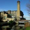
Turnbridge Lift Bridge (also colloquially known as a Locomotive lift bridge) is a lift bridge which spans the Huddersfield Broad Canal at Turnbridge,
[Turnbridge]
have gained its name from a turning bridge across the canal. In 1865 this was replaced by Turnbridge Lift Bridge. Coordinates: 53°38′52″N 1°46′31″W /
[List of vertical-lift bridges]
Kingsferry Bridge – built in Kent in 1960. Turnbridge Lift Bridge – highly unusual bridge at Turnbridge in Huddersfield. Salford Quays lift bridge – carries
[List of bridges in the United Kingdom]
Bridges in the United Kingdom is a link page for any road bridges or footbridges in the United Kingdom. Railway bridges are listed under: List of railway
[Windlass]
11, 2012. Oleson, John Peter (1984), Greek and Roman Mechanical Water-lifting Devices. The History of a Technology, Dordrecht: D. Reidel, p. 56, ISBN 90-277-1693-5
[River Don Navigation]
branch, which was a Roman navigation channel, and joined the River Aire at Turnbridge, near East Cowick. Cornelius Vermuyden's drainage scheme for Hatfield
[River Don, Yorkshire]
levels here were between 5 and 10 feet (1.5 and 3.0 m) lower than at Turnbridge. This new channel was called the "Dutch River", and was finished in 1635
[Huddersfield Broad Canal]
spinning mill. Adjacent to it, the Locomotive lift bridge, which was installed in 1865, is a vertical lifting bridge. It was refurbished in 2002, and converted
[Montgomery Canal]
the west of Spiggots Bridge) in 2006. Mooring is available along sections of the canal at Maesbury Marsh. Bridge 81 is a lift bridge, which requires a windlass
[Sheffield and South Yorkshire Navigation]
Doncaster as early as 1343, when a commission looked at the problems caused by bridges and weirs. It underwent major changes in the 1620s, when Cornelius Vermuyden


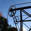
![Detail of Locomotive Bridge. See [[779386]]. by Steve Fareham – 27 April 2008](https://s0.geograph.org.uk/photos/77/93/779388_fea362b7_120x120.jpg)
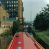
![Turnbridge open to boats. Turnbridge Loco Lift Bridge [No. 17] taken from a boat on the Huddersfield Broad Canal. by Christine Johnstone – 21 May 2010](https://s2.geograph.org.uk/geophotos/01/88/76/1887686_f8ed8dd6_120x120.jpg)
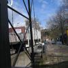
![Turnbridge open to cars. Turnbridge Loco Lift Bridge [No. 17] taken from a boat on the Huddersfield Broad Canal. by Christine Johnstone – 21 May 2010](https://s2.geograph.org.uk/geophotos/01/88/76/1887678_192a693c_120x120.jpg)
![Turnbridge open to no-one. Turnbridge Loco Lift Bridge [No. 17] taken from a boat on the Huddersfield Broad Canal. by Christine Johnstone – 21 May 2010](https://s0.geograph.org.uk/geophotos/01/88/76/1887680_09e61f47_120x120.jpg)
![The Locomotive bridge over the Huddersfield Broad Canal #2. [[779386]] by Steve Fareham – 27 April 2008](https://s1.geograph.org.uk/photos/77/93/779393_bbc53549_120x120.jpg)


