CanalPlanAC

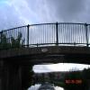
Old Hall Street Bridge No 131B

 
Burnley BB10 1PD, United Kingdom
 
Information about the place
Old Hall Street Bridge No 131B is a minor waterways place on the Leeds and Liverpool Canal (Main Line - Wigan to Leeds) between Feniscowles Bridge No 93B (21 miles and 4¾ furlongs and 6 locks to the west) and Salterforth Bridge No 151 (Salterforth village 200 yards northeast) (8 miles and 7 furlongs and 7 locks to the northeast).
 
 
The nearest place in the direction of Feniscowles Bridge No 93B is Danes House Bridge No 131A; 1¼ furlongs away.
 
The nearest place in the direction of Salterforth Bridge No 151 is New Hall Street Bridge No 132; 1¼ furlongs away.

There is access (suitable for wheels) to the towpath here.

Mooring here is unrated.

There is a bridge here which takes pedestrian traffic over the canal.


Amenities

Amenities nearby at Danes House Bridge No 131A

 ASDA
 Fish & Chips
 Cashpoint
 Cashpoint
 Cashpoint
 ASDA Fuel
 
Maps
If you are a user and are logged on, or if you are actively planning a route, a map will be displayed here.
Show on external mapping site: Google | OSM | Bing
 
Photos
 
External websites
There are no links to external websites from here.
Why not log in and add some (select "External websites" from the menu (sometimes this is under "Edit"))?
 
Nearest facilities

Mouseover for more information or show routes to facility

Nearest water point

In the direction of Leeds Bridge

Reedley Marina1 mile, 1½ furlongs away
On this waterway in the direction of Leeds Bridge
Barrowford Top Lock No 455 miles, 2¼ furlongs and 6 locks away
On this waterway in the direction of Leeds Bridge
Foulridge Wharf7 miles, 1½ furlongs and 7 locks away
On this waterway in the direction of Leeds Bridge
Salterforth Bridge No 1518 miles, 7 furlongs and 7 locks away
On this waterway in the direction of Leeds Bridge
Lower Park Marina9 miles, 4½ furlongs and 7 locks away
On this waterway in the direction of Leeds Bridge
Greenberfield Services11 miles, 1 furlong and 7 locks away
On this waterway in the direction of Leeds Bridge
East Marton Visitor Moorings14 miles and 10 locks away
On this waterway in the direction of Leeds Bridge
Priest Holme Water Point16 miles, 5¾ furlongs and 16 locks away
On this waterway in the direction of Leeds Bridge
Gargrave Services17 miles, 7¾ furlongs and 19 locks away
On this waterway in the direction of Leeds Bridge

In the direction of Wigan Junction

Rose Grove Services4 miles, 1½ furlongs away
On this waterway in the direction of Wigan Junction
Blackburn Lock Sanitary Station19 miles and 4 locks away
On this waterway in the direction of Wigan Junction

Nearest rubbish disposal

In the direction of Leeds Bridge

Barrowford Lock No 475 miles, 1¼ furlongs and 4 locks away
On this waterway in the direction of Leeds Bridge
Foulridge Wharf7 miles, 1½ furlongs and 7 locks away
On this waterway in the direction of Leeds Bridge
Salterforth Bridge No 1518 miles, 7 furlongs and 7 locks away
On this waterway in the direction of Leeds Bridge
Lower Park Marina9 miles, 4½ furlongs and 7 locks away
On this waterway in the direction of Leeds Bridge
Greenberfield Services11 miles, 1 furlong and 7 locks away
On this waterway in the direction of Leeds Bridge
Gargrave Services17 miles, 7¾ furlongs and 19 locks away
On this waterway in the direction of Leeds Bridge

In the direction of Wigan Junction

Rose Grove Services4 miles, 1½ furlongs away
On this waterway in the direction of Wigan Junction
Blackburn Lock Sanitary Station19 miles and 4 locks away
On this waterway in the direction of Wigan Junction

Nearest chemical toilet disposal

In the direction of Leeds Bridge

Barrowford Top Lock No 455 miles, 2¼ furlongs and 6 locks away
On this waterway in the direction of Leeds Bridge
Foulridge Wharf7 miles, 1½ furlongs and 7 locks away
On this waterway in the direction of Leeds Bridge
Salterforth Bridge No 1518 miles, 7 furlongs and 7 locks away
On this waterway in the direction of Leeds Bridge
Lower Park Marina9 miles, 4½ furlongs and 7 locks away
On this waterway in the direction of Leeds Bridge
Greenberfield Services11 miles, 1 furlong and 7 locks away
On this waterway in the direction of Leeds Bridge
Gargrave Services17 miles, 7¾ furlongs and 19 locks away
On this waterway in the direction of Leeds Bridge

In the direction of Wigan Junction

Rose Grove Services4 miles, 1½ furlongs away
On this waterway in the direction of Wigan Junction
Blackburn Lock Sanitary Station19 miles and 4 locks away
On this waterway in the direction of Wigan Junction

Nearest place to turn

In the direction of Leeds Bridge

Burley Lane Winding Hole4½ furlongs away
On this waterway in the direction of Leeds Bridge
Hawks House Winding Hole1 mile, 5¾ furlongs away
On this waterway in the direction of Leeds Bridge
Hodge Bank Winding Hole3 miles, 7¾ furlongs away
On this waterway in the direction of Leeds Bridge
Wanless Bridge Winding Hole5 miles, 6¾ furlongs and 7 locks away
On this waterway in the direction of Leeds Bridge
Foulridge Wharf Winding Hole7 miles, 2 furlongs and 7 locks away
On this waterway in the direction of Leeds Bridge
Long Ing Bridge Winding Hole10 miles and 7 locks away
On this waterway in the direction of Leeds Bridge
Coates Lane Winding Hole10 miles, 7½ furlongs and 7 locks away
On this waterway in the direction of Leeds Bridge

In the direction of Wigan Junction

On this waterway in the direction of Wigan Junction
Sandholme Aqueduct Winding Hole5½ furlongs away
On this waterway in the direction of Wigan Junction
Nelson Square Winding Hole2 miles, ½ furlongs away
On this waterway in the direction of Wigan Junction
Old Rose Grove Winding Hole4 miles, 3¾ furlongs away
On this waterway in the direction of Wigan Junction
Hapton Winding Hole6 miles, 2¼ furlongs away
On this waterway in the direction of Wigan Junction
Shuttleworth Winding Hole7 miles, 1 furlong away
On this waterway in the direction of Wigan Junction
Clough Bank Winding Hole7 miles, 7½ furlongs away
On this waterway in the direction of Wigan Junction
Whalley Road Bridge Winding Hole9 miles, 5½ furlongs away
On this waterway in the direction of Wigan Junction
Church Kirk Bridge Winding Hole11 miles, 2 furlongs away
On this waterway in the direction of Wigan Junction
Railway Bridge No 110B Winding Hole11 miles, 7½ furlongs away
On this waterway in the direction of Wigan Junction On this waterway in the direction of Wigan Junction
Rishton Winding Hole13 miles, 1½ furlongs away
On this waterway in the direction of Wigan Junction
Trident Way Winding Hole15 miles, 5¼ furlongs away
On this waterway in the direction of Wigan Junction

Nearest self-operated pump-out

In the direction of Wigan Junction

Rose Grove Services4 miles, 1½ furlongs away
On this waterway in the direction of Wigan Junction

Nearest boatyard pump-out

In the direction of Leeds Bridge

Reedley Marina1 mile, 1½ furlongs away
On this waterway in the direction of Leeds Bridge
Lower Park Marina9 miles, 4½ furlongs and 7 locks away
On this waterway in the direction of Leeds Bridge
Direction of TV transmitter (From Wolfbane Cybernetic)
 
 
Geograph
 
Wikipedia

There is no page on Wikipedia called “Old Hall Street Bridge No 131B”

Wikipedia pages that might relate to Old Hall Street Bridge No 131B
[10 Downing Street] british-history.ac.uk British History Online, From: 'Plate 126: No. 10, Downing Street: entrance hall and drawing room', Survey of London: volume 14: St Margaret [St James's Palace] royal court and is located in the City of Westminster in London. Although no longer the principal residence of the monarch, it is the ceremonial meeting [Worsley Old Hall] Worsley Old Hall is a public house and restaurant in Worsley, Greater Manchester, England. It is recorded in the National Heritage List for England as [London Borough of Southwark] opened Bridge Theatre is located next to Tower Bridge and City Hall. The borough is the location of the Imperial War Museum in Borough High Street. Peckham [List of numbered streets in Manhattan] runs past Webster Hall. West 11th Street runs from Broadway to West Street. 11th Street and Sixth Avenue was the location of the Old Grapevine tavern from [Street names of the City of London] possibly from 'cloaca', an old word for a sewer; prior to the mid-17th century it was Horseshoebridge Street, after a bridge that stood here over the Walbrook [Piccadilly] end of the street. St James's Church was consecrated in 1684 and the surrounding area became St James Parish. The Old White Horse Cellar, at No. 155, was [Ljubljana] cast iron bridge in Slovenia, and one of its most highly valued technical achievements. It has been situated on an extension of Hren Street (Hrenova ulica) [St Mary-le-Bow] the late 18th century, they were measured from the London Stone in Cannon Street, or the Standard in Cornhill. However, on the road from London to Lewes [List of Howard County properties in the Maryland Historical Trust] Roman Catholic Church, 3749 St. Paul Street, Ellicott City HO-349, Guilford Quarry Pratt Through Truss Bridge & Ruins, B&O Railroad Spur over Little Patuxent
 
Google

Results of Google Search

Old Hall Street Bridge No 131B
Old Hall Street Bridge No 131B Leeds and Liverpool Canal (Main Line - Wigan to Leeds)
Construction worker identified after being hit, killed on Hall Street ...
Oct 10, 2019 ... PREVIOUS STORY: Grand Rapids Police said a construction crew worker was hit and killed after a driver on the Hall Street bridge over US-131 ...
Crew worker killed on Hall Street bridge over US-131 - YouTube
Oct 10, 2019 ... ... the Hall Street bridge over US-131 drove around a construction barri... ... Your browser does not currently recognize any of the video formats ...
Bridge 131A and 131B on the Leeds & Liverpool Canal in Burnley ...
Bridge 131A and 131B on the Leeds & Liverpool Canal in Burnley ... Date: 16/06/ 2017 00:00. To Date: 20/06/2017 00:00 inclusive. Type: Advice. Reason: Information. Is the towpath closed? No ... Ends at: Bridge 131B, Old Hall Street Bridge ...
No.1 OLD HALL STREET, LIVERPOOL L3 9HG
No.1 OLD HALL STREET,. LIVERPOOL L3 9HG. OFFICES TO LET FROM. 100 TO 65,975 SQFT. Computer generated image. If you're looking for an office in ...
U.S. Route 131 - Wikipedia
US Highway 131 (US 131) is a north–south United States Highway, of which all but 0.64 of its ... Two bridges formerly used by US 131 have been labeled by the Michigan ... At Wealthy Street, the freeway takes a sharp turn to the west to cross the Grand ... US 131 no longer turned east along Boardman Road between South ...
Mi Drive
Cameras. I-196 @ BS I-196 (Chicago Dr). Cameras are for live monitoring and do not record. Zoom to. 0 results. Zoom In. Zoom Out. icons. Mobile Menu.
Directions and Parking | The Music Hall
Fill the Hall · Historic Tours · Kitchen Tour · Vintage Christmas ... There are several surface lots nearby as well: The Bridge Street Lot, Worth Lot, ... While The Music Hall does not have parking on-site, metered spots are ... 131 Congress Street