CanalPlanAC

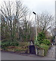
Isis Lock Winding Hole

 
The Red & Green Club, Bankwell Road, Crosland Hill HD3 4LU, United Kingdom
 
Information about the place
Isis Lock Winding Hole is a minor waterways place on the Huddersfield Narrow Canal between Golcar (4¾ furlongs and 4 locks to the west) and Aspley Basin (Huddersfield) (Moorings for Huddersfield and Junction of Huddersfield Broad and Narrow Canals) (2 miles and 1¼ furlongs and 8 locks to the east).
 
 
The nearest place in the direction of Golcar is Isis Lock No 9E; ¼ furlongs away.
 
The nearest place in the direction of Aspley Basin (Huddersfield) is Lockbridge Way Visitor Moorings; ½ furlongs away.

Mooring here is good (a nice place to moor), mooring rings or bollards are available. Moorings are towpath side opposite the winding hole.

You can wind here.


Amenities

Amenities here

 Costcutter
 Rising Sun
 H Pennington
 Lowdham Leisure World
 
Maps
If you are a user and are logged on, or if you are actively planning a route, a map will be displayed here.
Show on external mapping site: Google | OSM | Bing
 
Photos
 
External websites
There are no links to external websites from here.
Why not log in and add some (select "External websites" from the menu (sometimes this is under "Edit"))?
 
Nearest facilities

Mouseover for more information or show routes to facility

Nearest water point

In the direction of Ashton-under-Lyne Junction

Waterside Lock No 21E2 miles, 4¼ furlongs and 12 locks away
On this waterway in the direction of Ashton-under-Lyne Junction
Slaithwaite Winding Hole2 miles, 5 furlongs and 13 locks away
On this waterway in the direction of Ashton-under-Lyne Junction
Standedge Tunnel (eastern entrance)5 miles, 7¾ furlongs and 34 locks away
On this waterway in the direction of Ashton-under-Lyne Junction
Standedge Tunnel (western entrance)9 miles, 1¾ furlongs and 34 locks away
On this waterway in the direction of Ashton-under-Lyne Junction
Wool Road Bridge No 7011 miles, 1½ furlongs and 43 locks away
On this waterway in the direction of Ashton-under-Lyne Junction
Grove Road Bridge No 9617 miles, 1¾ furlongs and 58 locks away
On this waterway in the direction of Ashton-under-Lyne Junction

In the direction of Aspley Basin (Huddersfield)

Aspley Basin (Huddersfield)2 miles, 1¼ furlongs and 8 locks away
On this waterway in the direction of Aspley Basin (Huddersfield)
Shepley Bridge Sanitary Station8 miles, 6 furlongs and 19 locks away
Travel to Aspley Basin (Huddersfield), then on the Huddersfield Broad Canal to Cooper Bridge Junction, then on the Calder and Hebble Navigation (Main Line) to Shepley Bridge Sanitary Station
Brighouse Basin7 miles, 7¾ furlongs and 21 locks away
Travel to Aspley Basin (Huddersfield), then on the Huddersfield Broad Canal to Cooper Bridge Junction, then on the Calder and Hebble Navigation (Main Line) to Brighouse Basin
Salterhebble Sanitary Station12 miles, 1¾ furlongs and 30 locks away
Travel to Aspley Basin (Huddersfield), then on the Huddersfield Broad Canal to Cooper Bridge Junction, then on the Calder and Hebble Navigation (Main Line) to Salterhebble Sanitary Station
Broad Cut Low Lock No 315 miles, 3 furlongs and 27 locks away
Travel to Aspley Basin (Huddersfield), then on the Huddersfield Broad Canal to Cooper Bridge Junction, then on the Calder and Hebble Navigation (Main Line) to Broad Cut Low Lock No 3
Salterhebble Junction12 miles, 2¼ furlongs and 31 locks away
Travel to Aspley Basin (Huddersfield), then on the Huddersfield Broad Canal to Cooper Bridge Junction, then on the Calder and Hebble Navigation (Main Line) to Salterhebble Junction
Sowerby Bridge Basin14 miles, 4 furlongs and 31 locks away
Travel to Aspley Basin (Huddersfield), then on the Huddersfield Broad Canal to Cooper Bridge Junction, then on the Calder and Hebble Navigation (Main Line) to Salterhebble Junction, then on the Calder and Hebble Navigation (Main Line) to Sowerby Bridge Basin
Hebden Bridge Services19 miles, 7¼ furlongs and 38 locks away
Travel to Aspley Basin (Huddersfield), then on the Huddersfield Broad Canal to Cooper Bridge Junction, then on the Calder and Hebble Navigation (Main Line) to Salterhebble Junction, then on the Calder and Hebble Navigation (Main Line) to Sowerby Bridge Junction, then on the Rochdale Canal to Hebden Bridge Services

Nearest rubbish disposal

In the direction of Ashton-under-Lyne Junction

Pickle Lock No 22E2 miles, 5½ furlongs and 13 locks away
On this waterway in the direction of Ashton-under-Lyne Junction
Wool Road Visitor Mooring11 miles, 2 furlongs and 43 locks away
On this waterway in the direction of Ashton-under-Lyne Junction

In the direction of Aspley Basin (Huddersfield)

Aspley Basin (Huddersfield)2 miles, 1¼ furlongs and 8 locks away
On this waterway in the direction of Aspley Basin (Huddersfield)
Shepley Bridge Sanitary Station8 miles, 6 furlongs and 19 locks away
Travel to Aspley Basin (Huddersfield), then on the Huddersfield Broad Canal to Cooper Bridge Junction, then on the Calder and Hebble Navigation (Main Line) to Shepley Bridge Sanitary Station
Brighouse Lower Basin Visitor Moorings7 miles, 7¼ furlongs and 20 locks away
Travel to Aspley Basin (Huddersfield), then on the Huddersfield Broad Canal to Cooper Bridge Junction, then on the Calder and Hebble Navigation (Main Line) to Brighouse Lower Basin Visitor Moorings
Horbury Basin Residential Moorings & Sanitary Station13 miles, 2¼ furlongs and 26 locks away
Travel to Aspley Basin (Huddersfield), then on the Huddersfield Broad Canal to Cooper Bridge Junction, then on the Calder and Hebble Navigation (Main Line) to Horbury Basin Residential Moorings & Sanitary Station
Salterhebble Sanitary Station12 miles, 1¾ furlongs and 30 locks away
Travel to Aspley Basin (Huddersfield), then on the Huddersfield Broad Canal to Cooper Bridge Junction, then on the Calder and Hebble Navigation (Main Line) to Salterhebble Sanitary Station
Sowerby Bridge Basin14 miles, 4 furlongs and 31 locks away
Travel to Aspley Basin (Huddersfield), then on the Huddersfield Broad Canal to Cooper Bridge Junction, then on the Calder and Hebble Navigation (Main Line) to Salterhebble Junction, then on the Calder and Hebble Navigation (Main Line) to Sowerby Bridge Basin
Hebden Bridge Services19 miles, 7¼ furlongs and 38 locks away
Travel to Aspley Basin (Huddersfield), then on the Huddersfield Broad Canal to Cooper Bridge Junction, then on the Calder and Hebble Navigation (Main Line) to Salterhebble Junction, then on the Calder and Hebble Navigation (Main Line) to Sowerby Bridge Junction, then on the Rochdale Canal to Hebden Bridge Services

Nearest chemical toilet disposal

In the direction of Ashton-under-Lyne Junction

Waterside Lock No 21E2 miles, 4¼ furlongs and 12 locks away
On this waterway in the direction of Ashton-under-Lyne Junction
Pickle Lock No 22E2 miles, 5½ furlongs and 13 locks away
On this waterway in the direction of Ashton-under-Lyne Junction
Wool Road Bridge No 7011 miles, 1½ furlongs and 43 locks away
On this waterway in the direction of Ashton-under-Lyne Junction
Grove Road Bridge No 9617 miles, 1¾ furlongs and 58 locks away
On this waterway in the direction of Ashton-under-Lyne Junction

In the direction of Aspley Basin (Huddersfield)

Aspley Basin (Huddersfield)2 miles, 1¼ furlongs and 8 locks away
On this waterway in the direction of Aspley Basin (Huddersfield)
Shepley Bridge Sanitary Station8 miles, 6 furlongs and 19 locks away
Travel to Aspley Basin (Huddersfield), then on the Huddersfield Broad Canal to Cooper Bridge Junction, then on the Calder and Hebble Navigation (Main Line) to Shepley Bridge Sanitary Station
Brighouse Basin7 miles, 7¾ furlongs and 21 locks away
Travel to Aspley Basin (Huddersfield), then on the Huddersfield Broad Canal to Cooper Bridge Junction, then on the Calder and Hebble Navigation (Main Line) to Brighouse Basin
Savile Town Wharf and Basin (Dewsbury)12 miles, 1¼ furlongs and 23 locks away
Travel to Aspley Basin (Huddersfield), then on the Huddersfield Broad Canal to Cooper Bridge Junction, then on the Calder and Hebble Navigation (Main Line) to Dewsbury Arm Junction, then on the Calder and Hebble Navigation (Dewsbury Old Cut) to Savile Town Wharf and Basin (Dewsbury)
Horbury Basin Residential Moorings & Sanitary Station13 miles, 2¼ furlongs and 26 locks away
Travel to Aspley Basin (Huddersfield), then on the Huddersfield Broad Canal to Cooper Bridge Junction, then on the Calder and Hebble Navigation (Main Line) to Horbury Basin Residential Moorings & Sanitary Station
Salterhebble Sanitary Station12 miles, 1¾ furlongs and 30 locks away
Travel to Aspley Basin (Huddersfield), then on the Huddersfield Broad Canal to Cooper Bridge Junction, then on the Calder and Hebble Navigation (Main Line) to Salterhebble Sanitary Station
Sowerby Bridge Basin14 miles, 4 furlongs and 31 locks away
Travel to Aspley Basin (Huddersfield), then on the Huddersfield Broad Canal to Cooper Bridge Junction, then on the Calder and Hebble Navigation (Main Line) to Salterhebble Junction, then on the Calder and Hebble Navigation (Main Line) to Sowerby Bridge Basin
Hebden Bridge Services19 miles, 7¼ furlongs and 38 locks away
Travel to Aspley Basin (Huddersfield), then on the Huddersfield Broad Canal to Cooper Bridge Junction, then on the Calder and Hebble Navigation (Main Line) to Salterhebble Junction, then on the Calder and Hebble Navigation (Main Line) to Sowerby Bridge Junction, then on the Rochdale Canal to Hebden Bridge Services

Nearest place to turn

In the direction of Ashton-under-Lyne Junction

Linthwaite Winding Hole1 mile, 4¼ furlongs and 8 locks away
On this waterway in the direction of Ashton-under-Lyne Junction
Slaithwaite Winding Hole2 miles, 5 furlongs and 13 locks away
On this waterway in the direction of Ashton-under-Lyne Junction
Booth Lock Winding Hole4 miles, 1¾ furlongs and 23 locks away
On this waterway in the direction of Ashton-under-Lyne Junction
Standedge Tunnel End Winding Hole5 miles, 7 furlongs and 34 locks away
On this waterway in the direction of Ashton-under-Lyne Junction

In the direction of Aspley Basin (Huddersfield)

University Arm2 miles, ¾ furlongs and 8 locks away
On this waterway in the direction of Aspley Basin (Huddersfield)
Aspley Basin (Huddersfield)2 miles, 1¼ furlongs and 8 locks away
On this waterway in the direction of Aspley Basin (Huddersfield)
Anchor Street Winding Hole2 miles, 6¼ furlongs and 8 locks away
Travel to Aspley Basin (Huddersfield), then on the Huddersfield Broad Canal to Anchor Street Winding Hole
New Road Winding Hole3 miles, 1¾ furlongs and 8 locks away
Travel to Aspley Basin (Huddersfield), then on the Huddersfield Broad Canal to New Road Winding Hole
Deighton Road Bridge Winding Hole4 miles, 3½ furlongs and 13 locks away
Travel to Aspley Basin (Huddersfield), then on the Huddersfield Broad Canal to Deighton Road Bridge Winding Hole
Cooper Bridge Junction5 miles, 5¼ furlongs and 17 locks away
Travel to Aspley Basin (Huddersfield), then on the Huddersfield Broad Canal to Cooper Bridge Junction
Battye Weir Entrance6 miles, 2½ furlongs and 18 locks away
Travel to Aspley Basin (Huddersfield), then on the Huddersfield Broad Canal to Cooper Bridge Junction, then on the Calder and Hebble Navigation (Main Line) to Battye Weir Entrance
Shepley Bridge Marina8 miles, 6¼ furlongs and 19 locks away
Travel to Aspley Basin (Huddersfield), then on the Huddersfield Broad Canal to Cooper Bridge Junction, then on the Calder and Hebble Navigation (Main Line) to Shepley Bridge Marina
Brighouse Basin7 miles, 7¾ furlongs and 21 locks away
Travel to Aspley Basin (Huddersfield), then on the Huddersfield Broad Canal to Cooper Bridge Junction, then on the Calder and Hebble Navigation (Main Line) to Brighouse Basin
Ganny Winding Hole8 miles, 5 furlongs and 22 locks away
Travel to Aspley Basin (Huddersfield), then on the Huddersfield Broad Canal to Cooper Bridge Junction, then on the Calder and Hebble Navigation (Main Line) to Ganny Winding Hole
Dewsbury Arm Junction11 miles, 1¼ furlongs and 23 locks away
Travel to Aspley Basin (Huddersfield), then on the Huddersfield Broad Canal to Cooper Bridge Junction, then on the Calder and Hebble Navigation (Main Line) to Dewsbury Arm Junction
Savile Town Wharf and Basin (Dewsbury)12 miles, 1¼ furlongs and 23 locks away
Travel to Aspley Basin (Huddersfield), then on the Huddersfield Broad Canal to Cooper Bridge Junction, then on the Calder and Hebble Navigation (Main Line) to Dewsbury Arm Junction, then on the Calder and Hebble Navigation (Dewsbury Old Cut) to Savile Town Wharf and Basin (Dewsbury)
Horbury Basin Residential Moorings & Sanitary Station13 miles, 2¼ furlongs and 26 locks away
Travel to Aspley Basin (Huddersfield), then on the Huddersfield Broad Canal to Cooper Bridge Junction, then on the Calder and Hebble Navigation (Main Line) to Horbury Basin Residential Moorings & Sanitary Station
Salterhebble Wharf12 miles, 1¼ furlongs and 29 locks away
Travel to Aspley Basin (Huddersfield), then on the Huddersfield Broad Canal to Cooper Bridge Junction, then on the Calder and Hebble Navigation (Main Line) to Salterhebble Wharf
Salterhebble Bottom Basin Visitor Moorings12 miles, 1¼ furlongs and 29 locks away
Travel to Aspley Basin (Huddersfield), then on the Huddersfield Broad Canal to Cooper Bridge Junction, then on the Calder and Hebble Navigation (Main Line) to Salterhebble Bottom Basin Visitor Moorings
Salterhebble Sanitary Station12 miles, 1¾ furlongs and 30 locks away
Travel to Aspley Basin (Huddersfield), then on the Huddersfield Broad Canal to Cooper Bridge Junction, then on the Calder and Hebble Navigation (Main Line) to Salterhebble Sanitary Station

Nearest self-operated pump-out

In the direction of Ashton-under-Lyne Junction

Slaithwaite Winding Hole2 miles, 5 furlongs and 13 locks away
On this waterway in the direction of Ashton-under-Lyne Junction
Wool Road Bridge No 7011 miles, 1½ furlongs and 43 locks away
On this waterway in the direction of Ashton-under-Lyne Junction

In the direction of Aspley Basin (Huddersfield)

Hebden Bridge Services19 miles, 7¼ furlongs and 38 locks away
Travel to Aspley Basin (Huddersfield), then on the Huddersfield Broad Canal to Cooper Bridge Junction, then on the Calder and Hebble Navigation (Main Line) to Salterhebble Junction, then on the Calder and Hebble Navigation (Main Line) to Sowerby Bridge Junction, then on the Rochdale Canal to Hebden Bridge Services

Nearest boatyard pump-out

In the direction of Aspley Basin (Huddersfield)

Aspley Basin (Huddersfield)2 miles, 1¼ furlongs and 8 locks away
On this waterway in the direction of Aspley Basin (Huddersfield)
Shepley Bridge Marina8 miles, 6¼ furlongs and 19 locks away
Travel to Aspley Basin (Huddersfield), then on the Huddersfield Broad Canal to Cooper Bridge Junction, then on the Calder and Hebble Navigation (Main Line) to Shepley Bridge Marina
Sowerby Bridge Basin14 miles, 4 furlongs and 31 locks away
Travel to Aspley Basin (Huddersfield), then on the Huddersfield Broad Canal to Cooper Bridge Junction, then on the Calder and Hebble Navigation (Main Line) to Salterhebble Junction, then on the Calder and Hebble Navigation (Main Line) to Sowerby Bridge Basin
Direction of TV transmitter (From Wolfbane Cybernetic)
 
 
Geograph
 
Wikipedia

There is no page on Wikipedia called “Isis Lock Winding Hole”

Wikipedia pages that might relate to Isis Lock Winding Hole
[Isis Lock] Oxford Canal. Isis Lock and the footbridge. Looking over the lock gate. Winding hole at Isis Lock. Footbridge by Isis Lock. "Isis Lock — Waterway Locks [River Thames] the Isis. Historically, and especially in Victorian times, gazetteers and cartographers insisted that the entire river was correctly named the Isis from [List of people who disappeared mysteriously: post-1970] about her disappearance 1 year later". WRDW. Retrieved 11 September 2017. "Isis 'poster girl' was 'beaten to death' by group as she tried to flee killings" [Timeline of historic inventions] p. 576 Sarton, George (1946): "Floating Docks in the Sixteenth Century", Isis, Vol. 36, No. 3/4, pp. 153–154 (153f.) The Editors of Encyclopædia Britannica [Orlando nightclub shooting] and as the situation was winding down, she said the gunman told police negotiators on the phone he pledged his allegiance to ISIS and wouldn't stop his assault [Clock] 1038/scientificamerican0591-100. King, David A. (1983). "The Astronomy of the Mamluks". Isis. 74 (4): 531–555 [545–546]. doi:10.1086/353360. S2CID 144315162. Routledge [List of Chinese inventions] ISSN 1671-5357. Li Shu-hua: "Origine de la Boussole 11. Aimant et Boussole," Isis, Vol. 45, No. 2 (1954): 175–196. Lian, Xianda. "The Old Drunkard Who Finds [Elevator] incident in 2007 at a Seattle children's hospital, where a ThyssenKrupp ISIS machine-room-less elevator free-fell until the safety brakes were engaged [River Mole] foreintended course the wanton Nymph doth run; As longing to imbrace old Tame and Isis son... He writes in the appendix to Song XVII This Mole runnes into the earth
 
Google