CanalPlanAC

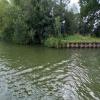
Site of Pegthorne Bridge

 
Bridge removed
Longney and Epney, Stroud, Gloucestershire, England, United Kingdom
Address is taken from a point 3296 yards away.
 
Information about the place
 
 
The nearest place in the direction of Saul Junction is Saul Junction Footbridge; 4½ furlongs away.
 
The nearest place in the direction of Gloucester Docks is Pegthorne Bridge Winding Hole; ¼ furlongs away.

Mooring here is unrated.

This is the site of a bridge, the canal may be narrow as a consequence.

Sandfield Bridge6¾ furlongs
Cotswold Canals Trust Visitor Centre - Saul Junction5¾ furlongs
Saul Junction Winding Hole5 furlongs
Saul Junction4¾ furlongs
Saul Junction Footbridge4½ furlongs
Site of Pegthorne Bridge
Pegthorne Bridge Winding Hole¼ furlongs
Parkend Bridge1 mile
Site of Hardwicke Bridge2 miles, 4¼ furlongs
Sellars Bridge3 miles, 1½ furlongs
Quedgeley Oil Depot3 miles, 2¾ furlongs
 
 
Amenities
 
Maps
If you are a user and are logged on, or if you are actively planning a route, a map will be displayed here.
Show on external mapping site: Google | OSM | Bing
 
Photos
 
External websites
There are no links to external websites from here.
Why not log in and add some (select "External websites" from the menu (sometimes this is under "Edit"))?
 
Nearest facilities

Mouseover for more information or show routes to facility

Nearest water point

In the direction of Sharpness Junction

Saul Junction Winding Hole5 furlongs away
On this waterway in the direction of Sharpness Junction
Saul Junction Marina5¾ furlongs away
Travel to Saul Junction, then on the Cotswold Canals (Stroudwater Navigation - Navigable Section) to Saul Junction Marina On this waterway in the direction of Sharpness Junction
Fretherne Bridge1 mile, 3 furlongs away
On this waterway in the direction of Sharpness Junction
Splatt Bridge2 miles, 3¾ furlongs away
On this waterway in the direction of Sharpness Junction
Patch Bridge4 miles, 2½ furlongs away
On this waterway in the direction of Sharpness Junction
Purton Lower Bridge6 miles, 6¼ furlongs away
On this waterway in the direction of Sharpness Junction

In the direction of Gloucester / Sharpness - Severn Junction

Sellars Bridge3 miles, 1½ furlongs away
On this waterway in the direction of Gloucester / Sharpness - Severn Junction
Llanthony Pontoons6 miles, 7¼ furlongs away
On this waterway in the direction of Gloucester / Sharpness - Severn Junction
Llanthony Road Bridge7 miles, ¼ furlongs away
On this waterway in the direction of Gloucester / Sharpness - Severn Junction
Gloucester Waterways Museum Arm7 miles, ½ furlongs away
On this waterway in the direction of Gloucester / Sharpness - Severn Junction
Gloucester Dock Lock7 miles, 1½ furlongs away
On this waterway in the direction of Gloucester / Sharpness - Severn Junction
Tewkesbury Lower Lode18 miles, 7¼ furlongs and 1 lock away
Travel to Gloucester / Sharpness - Severn Junction, then on the River Severn (main river - Worcester to Gloucester) to Tewkesbury Lower Lode
Upper Lode Lock No 519 miles, 5½ furlongs and 1 lock away
Travel to Gloucester / Sharpness - Severn Junction, then on the River Severn (main river - Worcester to Gloucester) to Upper Lode Lock No 5

Nearest rubbish disposal

In the direction of Sharpness Junction

Saul Junction Winding Hole5 furlongs away
On this waterway in the direction of Sharpness Junction
Saul Junction Marina5¾ furlongs away
Travel to Saul Junction, then on the Cotswold Canals (Stroudwater Navigation - Navigable Section) to Saul Junction Marina
Fretherne Bridge1 mile, 3 furlongs away
On this waterway in the direction of Sharpness Junction
Splatt Bridge2 miles, 3¾ furlongs away
On this waterway in the direction of Sharpness Junction
Patch Bridge4 miles, 2½ furlongs away
On this waterway in the direction of Sharpness Junction
Purton Lower Bridge6 miles, 6¼ furlongs away
On this waterway in the direction of Sharpness Junction
Sharpness Barge Arm8 miles, 1½ furlongs away
On this waterway in the direction of Sharpness Junction

In the direction of Gloucester / Sharpness - Severn Junction

Parkend Bridge1 mile away
On this waterway in the direction of Gloucester / Sharpness - Severn Junction
Sellars Bridge3 miles, 1½ furlongs away
On this waterway in the direction of Gloucester / Sharpness - Severn Junction
Llanthony Road Bridge7 miles, ¼ furlongs away
On this waterway in the direction of Gloucester / Sharpness - Severn Junction

Nearest chemical toilet disposal

In the direction of Sharpness Junction

Saul Junction Marina5¾ furlongs away
Travel to Saul Junction, then on the Cotswold Canals (Stroudwater Navigation - Navigable Section) to Saul Junction Marina On this waterway in the direction of Sharpness Junction
Sharpness Barge Arm8 miles, 1½ furlongs away
On this waterway in the direction of Sharpness Junction

In the direction of Gloucester / Sharpness - Severn Junction

Llanthony Road Bridge7 miles, ¼ furlongs away
On this waterway in the direction of Gloucester / Sharpness - Severn Junction

Nearest place to turn

In the direction of Gloucester / Sharpness - Severn Junction

Pegthorne Bridge Winding Hole¼ furlongs away
On this waterway in the direction of Gloucester / Sharpness - Severn Junction
Quedgeley Oil Depot3 miles, 2¾ furlongs away
On this waterway in the direction of Gloucester / Sharpness - Severn Junction
Monk Meadow Dock6 miles, 5 furlongs away
On this waterway in the direction of Gloucester / Sharpness - Severn Junction
Gloucester Docks7 miles, 1 furlong away
On this waterway in the direction of Gloucester / Sharpness - Severn Junction On this waterway in the direction of Gloucester / Sharpness - Severn Junction
Gloucester / Sharpness - Severn Junction7 miles, 1¾ furlongs and 1 lock away
On this waterway in the direction of Gloucester / Sharpness - Severn Junction
Upper Parting Junction9 miles, 6½ furlongs and 1 lock away
Travel to Gloucester / Sharpness - Severn Junction, then on the River Severn (main river - Worcester to Gloucester) to Upper Parting Junction
Over Winding Hole9 miles, 1½ furlongs and 2 locks away
Travel to Gloucester / Sharpness - Severn Junction, then on the River Severn (old river navigation) to Lower Parting, then on the River Severn (Maisemore Channel - Southern Section) to Over Junction, then on the Hereford and Gloucester Canal to Over Winding Hole
Upper Lode Lock Weir Exit19 miles, 3½ furlongs and 1 lock away
Travel to Gloucester / Sharpness - Severn Junction, then on the River Severn (main river - Worcester to Gloucester) to Upper Lode Lock Weir Exit
Upper Lode Lock Weir Entrance19 miles, 6½ furlongs and 2 locks away
Travel to Gloucester / Sharpness - Severn Junction, then on the River Severn (main river - Worcester to Gloucester) to Upper Lode Lock Weir Entrance

In the direction of Sharpness Junction

Saul Junction Winding Hole5 furlongs away
On this waterway in the direction of Sharpness Junction
Sharpness Barge Arm8 miles, 1½ furlongs away
On this waterway in the direction of Sharpness Junction
The Ocean4 miles, 3¼ furlongs and 8 locks away
Travel to Saul Junction, then on the Cotswold Canals (Stroudwater Navigation - Navigable Section) to Walk Bridge, then on the Cotswold Canals (Stroudwater Navigation - Un-navigable Section) to The Ocean
Ryeford Winding Hole5 miles, 3 furlongs and 8 locks away
Travel to Saul Junction, then on the Cotswold Canals (Stroudwater Navigation - Navigable Section) to Walk Bridge, then on the Cotswold Canals (Stroudwater Navigation - Un-navigable Section) to Ryeford Winding Hole
Brimscombe Port10 miles, 1½ furlongs and 19 locks away
Travel to Saul Junction, then on the Cotswold Canals (Stroudwater Navigation - Navigable Section) to Walk Bridge, then on the Cotswold Canals (Stroudwater Navigation - Un-navigable Section) to Site of Entrance to Wallbridge Basin, then on the Cotswold Canals (Thames and Severn Canal - Wide section) to Brimscombe Port

Nearest self-operated pump-out

In the direction of Sharpness Junction

On this waterway in the direction of Sharpness Junction
Purton Lower Bridge6 miles, 6¼ furlongs away
On this waterway in the direction of Sharpness Junction

In the direction of Gloucester / Sharpness - Severn Junction

Llanthony Pontoons6 miles, 7¼ furlongs away
On this waterway in the direction of Gloucester / Sharpness - Severn Junction

Nearest boatyard pump-out

In the direction of Sharpness Junction

Saul Junction Marina5¾ furlongs away
Travel to Saul Junction, then on the Cotswold Canals (Stroudwater Navigation - Navigable Section) to Saul Junction Marina
Patch Bridge4 miles, 2½ furlongs away
On this waterway in the direction of Sharpness Junction
Direction of TV transmitter (From Wolfbane Cybernetic)
 
 
Geograph
 
Wikipedia

There is no page on Wikipedia called “Site of Pegthorne Bridge”

 
Google

Results of Google Search

Gloucester & Sharpness Canal: Saul Junction to Gloucester
Pegthorne Bridge This formerly stood near where the grid lines now cross the canal. Some called it Packthorne Bridge after the nearby farm, but Pegthorne was  ...
Pre & post WWII recollections of Richard Merrett. | Recollections of ...
Feb 17, 2009 ... ... to destroy the Sharpness canal by bombing it at Pegthorne bridge. ... The current Ready Mix site at Gloucester was originally used as a log ...
A Bridge Home | Office of Los Angeles Mayor Eric Garcetti
A Bridge Home puts Angelenos on a path out of homelessness and into supportive housing.” Mayor Eric GarcettiView this page in SpanishCONFRONTING THE ...
Hugh Conway-Jones The classical-style bridge-keeper's houses ...
and eight of these sites have classical-style houses. All of these have a basic ... This was Pegthorne Bridge which used to stand on the track leading north-west.
Bridge
By using our site you agree to our use of cookies. ... VCH-Gloucestershire records that the bridge fell down in 1916, and there was no trace by 1967. ... The OS cartographers recorded it as the Pegthorne Bridge, but it is close to Packthorne ...
Bridge To Home
Bridge to Home provides shelter and supportive services that help individuals and families in the Santa Clarita Valley move from homelessness to housing.