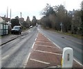
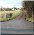
Roman Road Bridge
Roman Road, Hereford HR1 1JL, United Kingdom
(A4103)

Roman Road Bridge
is a minor waterways place
on the Hereford and Gloucester Canal between
Hereford Basin (Site of terminal basins) (1 mile and 4½ furlongs
to the southwest) and
Over Junction (Junction with the currently closed Hereford and Gloucester Canal) (32 miles and 3½ furlongs
and 23 locks
to the southeast).
The nearest place in the direction of Hereford Basin is Aylestone Park Slipway;
1½ furlongs
away.
The nearest place in the direction of Over Junction is Hereford - Worcester Railway Bridge;
5 furlongs
away.
Mooring here is unrated.
There is a bridge here which takes a major road over the canal.
| Hereford Basin | 1 mile, 4½ furlongs | |
| Widemarsh Street Bridge | 1 mile, 3¾ furlongs | |
| Aylestone Tunnel (western entrance) | 7½ furlongs | |
| Alyestone Tunnel (eastern entrance) | 4¾ furlongs | |
| Aylestone Park Slipway | 1½ furlongs | |
| Roman Road Bridge | ||
| Hereford - Worcester Railway Bridge | 5 furlongs | |
| Barrs Lock | 6 miles, 2 furlongs | |
| Crews' Pitch Bridge | 6 miles, 7¾ furlongs | |
| Crews' Pitch Wharf | 7 miles, ¼ furlongs | |
| Monkhide Skew Bridge | 7 miles, 2¾ furlongs | |
There are no links to external websites from here.
Why not log in and add some (select "External websites" from the menu (sometimes this is under "Edit"))?
Why not log in and add some (select "External websites" from the menu (sometimes this is under "Edit"))?
Mouseover for more information or show routes to facility
Nearest place to turn
In the direction of Over Junction
Crews' Pitch Wharf — 7 miles, ¼ furlongs and 3 locks away
On this waterway in the direction of Over JunctionNo information
CanalPlan has no information on any of the following facilities within range:water point
rubbish disposal
chemical toilet disposal
self-operated pump-out
boatyard pump-out
Direction of TV transmitter (From Wolfbane Cybernetic)
There is no page on Wikipedia called “Roman Road Bridge”
Wikipedia pages that might relate to Roman Road Bridge
[Roman roads]
Roman roads (Latin: viae Romanae [ˈwiae̯ roːˈmaːnae̯]; singular: via Romana [ˈwia roːˈmaːna]; meaning "Roman way") were physical infrastructure vital to
[List of Roman bridges]
of Roman bridges. A Roman bridge in the sense of this article includes any of these features: Roman arches Roman pillars Roman foundations Roman abutments
[Roman bridge]
Roman bridges, built by ancient Romans, were the first large and lasting bridges built. Roman bridges were built with stone and had the arch as the basic
[London Bridge]
the capital city of the new Roman province of Britannia. The first London Bridge was built by the Romans as part of their road-building programme, to help
[Trajan's Bridge]
Trajan's Bridge (Romanian: Podul lui Traian; Serbian: Трајанов мост / Trajanov most), also called Bridge of Apollodorus over the Danube, was a Roman segmental
[Roman roads in Britannia]
Roman roads in Britannia were initially designed for military use, created by the Roman Army during the nearly four centuries (AD 43–410) that Britannia
[Bridge]
A bridge is a structure built to span a physical obstacle, such as a body of water, valley, or road, without closing the way underneath. It is constructed
[Roman bridge of Salamanca]
The Roman bridge of Salamanca (in Spanish: Puente romano de Salamanca), also known as Puente Mayor del Tormes is a Roman bridge crossing the Tormes River
[Chain of Rocks Bridge]
of Rocks Bridge carries vehicular traffic to the north. The old route to the bridge is now called Chain of Rocks Road and ends near Roman Road. Parking
[Staines Bridge]
Egham, the bridge has had peak hour queues since at least the 1930s. In Roman times, Staines lay on the Devil's Highway, an important road connecting
Results of Google Search
Roman roads - WikipediaRoman roads were physical infrastructure vital to the maintenance and development of the Roman state, and were built ...
Mar 1, 2016 ... The Romans are known for their remarkable engineering feats, be they roads, bridges, tunnels, or their impressive aqueducts.
The Roman Road does not have a popular name, but a straight line road route from Staines to London Wall can clearly be traced ...
Apr 10, 2014 ... The first major Roman road—the famed Appian Way, or “queen of the ... The resulting roads often shot straight up steep hills, and small bridges ...
The Romans were the world's first major bridge builders. The following list constitutes an ..... Remains of the roman bridge at Santa Giusta on the road from Othoca to Carales, ? Santa Giusta, on the road from Othoca to Carales, Sardinia, Italy, ...
Mar 6, 2017 ... THE ROMANS ROAD AND THE BRIDGE ILLUSTRATION. Every man ever born is only three steps from one of two eternal destinies for their ...
The remains at Piercebridge are part of a large bridge that carried a Roman road across the River Tees. They now lie high and dry on the south bank of the river, ...
This entry is a copy, the original is held by the Department for Culture, Media and Sport. Name: Greta Bridge Roman fort, vicus and section of Roman road.
The word highway goes back to the elevated Roman roads that had a ..... and roads at Limoges and in 1775 inspector general of roads and bridges for France.
At Stamford Bridge the main road east of the village lies on the line of the Roman road which led directly down to the ford in the Derwent. The Roman road from ...


![The Swan (2) - sign, 171 Aylestone Hill, Hereford. A traditional Banks's sign with their golden lion. This old but much altered pub was for a long time known as the Swan Inn, but these days it appears to be called The Swan.Link to other photos:- [[4359794]]. by P L Chadwick – 22 February 2015](https://s0.geograph.org.uk/geophotos/04/35/98/4359804_8b8572d7_120x120.jpg)


![The Swan (3), 171 Aylestone Hill, Hereford. Link to other photos:- [[4359794]]. by P L Chadwick – 22 February 2015](https://s2.geograph.org.uk/geophotos/04/35/98/4359814_61067a60_120x120.jpg)
![The Swan (1), 171 Aylestone Hill, Hereford. A public house which serves food and has a beer garden. It is located on the outskirts of Hereford on the A465 road.[[4359804]].[[4359814]].[[4359819]]. by P L Chadwick – 22 February 2015](https://s2.geograph.org.uk/geophotos/04/35/97/4359794_8bbc06da_120x120.jpg)

![The Swan (4) - beer garden, 171 Aylestone Hill, Hereford. In the distance are some picnic tables.Link to other photos:- [[4359794]]. by P L Chadwick – 22 February 2015](https://s3.geograph.org.uk/geophotos/04/35/98/4359819_e5b38aad_120x120.jpg)


