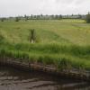
Souldern Brook Culvert
Souldern, Cherwell, Oxfordshire, England, United Kingdom
Address is taken from a point 1482 yards away.

Souldern Brook Culvert
is a minor waterways place
on the Oxford Canal (Southern Section - Main Line) between
Somerton Bridge No 196 (1 mile and 2¼ furlongs
and 1 lock
to the south) and
Concorde Avenue Bridge No 165 (7 miles and 7½ furlongs
and 4 locks
to the northwest).
The nearest place in the direction of Somerton Bridge No 196 is Chisnell Lift Bridge No 193;
½ furlongs
away.
The nearest place in the direction of Concorde Avenue Bridge No 165 is Souldern Wharf;
4¾ furlongs
away.
Mooring here is unrated.
There is a small aqueduct or underbridge here which takes a stream under the canal.
Meadlands Bridge No 195 | 6½ furlongs | |
Somerton Deep Lock Bridge No 194 | 5¼ furlongs | |
Somerton Deep Lock No 34 | 5 furlongs | |
Somerton Deep Lock Winding Hole | 4½ furlongs | |
Chisnell Lift Bridge No 193 | ½ furlongs | |
Souldern Brook Culvert | ||
Souldern Wharf | 4¾ furlongs | |
Souldern Bridge No 192 | 5 furlongs | |
Site of Bridge No 191 | 6¼ furlongs | |
Aynho Bridge No 190 | 1 mile, 1¼ furlongs | |
The Great Western Arms PH | 1 mile, 1½ furlongs |
- Oxford Canal Walk - Part One - Oxford to Thrupp - YouTube — associated with Oxford Canal
- A walk along the Oxford Canal (Southern Section) from Oxford to Thrupp Wide
Mouseover for more information or show routes to facility
Nearest water point
In the direction of Napton Junction
Aynho Wharf — 1 mile, 1¾ furlongs away
On this waterway in the direction of Napton Junction
Cherwell Street Facilities — 7 miles, 7¼ furlongs and 4 locks away
On this waterway in the direction of Napton Junction
Banbury Lock No 29 — 7 miles, 7½ furlongs and 4 locks away
On this waterway in the direction of Napton Junction
Sovereign Wharf — 8 miles, 1¾ furlongs and 5 locks away
On this waterway in the direction of Napton Junction
Cropredy Services — 12 miles, 3¼ furlongs and 8 locks away
On this waterway in the direction of Napton Junction
Cropredy Marina (southern basin) — 13 miles and 9 locks away
On this waterway in the direction of Napton Junction
Cropredy Marina (northern basins) — 13 miles, ¼ furlongs and 9 locks away
On this waterway in the direction of Napton Junction
Fenny Compton Wharf — 18 miles, 6 furlongs and 17 locks away
On this waterway in the direction of Napton Junction
In the direction of End of Hythe Bridge Arm
Heyford Wharf — 4 miles, 6¾ furlongs and 3 locks away
On this waterway in the direction of End of Hythe Bridge Arm
Heyford Wharf Bridge No 206 — 4 miles, 6¾ furlongs and 3 locks away
On this waterway in the direction of End of Hythe Bridge Arm
Thrupp Cruising Club — 12 miles, 3 furlongs and 8 locks away
On this waterway in the direction of End of Hythe Bridge Arm
Aubreys Lift Bridge No 221 — 12 miles, 3¼ furlongs and 8 locks away
On this waterway in the direction of End of Hythe Bridge Arm
Langford Lane Bridge No 224 — 13 miles, ¾ furlongs and 8 locks away
On this waterway in the direction of End of Hythe Bridge Arm
Wolvercote Junction Water Point — 16 miles, ½ furlongs and 10 locks away
On this waterway in the direction of End of Hythe Bridge Arm
Wolvercote Sanitary Station — 16 miles, 4¾ furlongs and 11 locks away
On this waterway in the direction of End of Hythe Bridge Arm
St Edwards Lift Bridge No 238 — 17 miles, 5½ furlongs and 12 locks away
On this waterway in the direction of End of Hythe Bridge Arm
Oxford Visitor Moorings — 19 miles, 2 furlongs and 12 locks away
On this waterway in the direction of End of Hythe Bridge Arm
Eynsham Lock — 19 miles, 4 furlongs and 12 locks away
Travel to Wolvercote Junction, then on the Oxford Canal (Duke's Cut) to Duke's Cut Junction, then on the River Thames (above Oxford) to Eynsham LockNearest rubbish disposal
In the direction of Napton Junction
Aynho Wharf — 1 mile, 1¾ furlongs away
On this waterway in the direction of Napton Junction
Cherwell Street Facilities — 7 miles, 7¼ furlongs and 4 locks away
On this waterway in the direction of Napton Junction
Sovereign Wharf — 8 miles, 1¾ furlongs and 5 locks away
On this waterway in the direction of Napton Junction
Cropredy Services — 12 miles, 3¼ furlongs and 8 locks away
On this waterway in the direction of Napton Junction
Cropredy Marina (southern basin) — 13 miles and 9 locks away
On this waterway in the direction of Napton Junction
Cropredy Marina (northern basins) — 13 miles, ¼ furlongs and 9 locks away
On this waterway in the direction of Napton Junction
Fenny Compton Marina — 18 miles, 3 furlongs and 17 locks away
On this waterway in the direction of Napton Junction
In the direction of End of Hythe Bridge Arm
Heyford Wharf — 4 miles, 6¾ furlongs and 3 locks away
On this waterway in the direction of End of Hythe Bridge Arm
Heyford Wharf Bridge No 206 — 4 miles, 6¾ furlongs and 3 locks away
On this waterway in the direction of End of Hythe Bridge Arm
Thrupp Cruising Club — 12 miles, 3 furlongs and 8 locks away
On this waterway in the direction of End of Hythe Bridge Arm
Aubreys Lift Bridge No 221 — 12 miles, 3¼ furlongs and 8 locks away
On this waterway in the direction of End of Hythe Bridge Arm
Wolvercote Sanitary Station — 16 miles, 4¾ furlongs and 11 locks away
On this waterway in the direction of End of Hythe Bridge Arm
Eynsham Lock — 19 miles, 4 furlongs and 12 locks away
Travel to Wolvercote Junction, then on the Oxford Canal (Duke's Cut) to Duke's Cut Junction, then on the River Thames (above Oxford) to Eynsham LockNearest chemical toilet disposal
In the direction of Napton Junction
Cherwell Street Facilities — 7 miles, 7¼ furlongs and 4 locks away
On this waterway in the direction of Napton Junction
Sovereign Wharf — 8 miles, 1¾ furlongs and 5 locks away
On this waterway in the direction of Napton Junction
Cropredy Services — 12 miles, 3¼ furlongs and 8 locks away
On this waterway in the direction of Napton Junction
Cropredy Marina (southern basin) — 13 miles and 9 locks away
On this waterway in the direction of Napton Junction
In the direction of End of Hythe Bridge Arm
Thrupp Cruising Club — 12 miles, 3 furlongs and 8 locks away
On this waterway in the direction of End of Hythe Bridge Arm
Wolvercote Sanitary Station — 16 miles, 4¾ furlongs and 11 locks away
On this waterway in the direction of End of Hythe Bridge Arm
Eynsham Lock — 19 miles, 4 furlongs and 12 locks away
Travel to Wolvercote Junction, then on the Oxford Canal (Duke's Cut) to Duke's Cut Junction, then on the River Thames (above Oxford) to Eynsham LockNearest place to turn
In the direction of Napton Junction
Aynho Wharf — 1 mile, 1¾ furlongs away
On this waterway in the direction of Napton Junction
Winding Hole above Nell Bridge Lock — 2 miles, 4¼ furlongs and 2 locks away
On this waterway in the direction of Napton Junction
Twyford Wharf Winding Hole — 5 miles, 1¼ furlongs and 3 locks away
On this waterway in the direction of Napton Junction
Calthorpe Winding Hole — 7 miles, 2 furlongs and 4 locks away
On this waterway in the direction of Napton Junction
Grimsbury Wharf — 8 miles, 5 furlongs and 5 locks away
On this waterway in the direction of Napton Junction
Southam Road Winding Hole — 8 miles, 6¼ furlongs and 5 locks away
On this waterway in the direction of Napton Junction
Southam Road Footbridge Arm — 9 miles, ¾ furlongs and 5 locks away
On this waterway in the direction of Napton Junction
Cropredy Services — 12 miles, 3¼ furlongs and 8 locks away
On this waterway in the direction of Napton Junction
Cropredy Marina (southern basin) — 13 miles and 9 locks away
On this waterway in the direction of Napton Junction
Cropredy Marina (northern basins) — 13 miles, ¼ furlongs and 9 locks away
On this waterway in the direction of Napton Junction
Clattercote Bridge Winding Hole — 14 miles, 3¼ furlongs and 12 locks away
On this waterway in the direction of Napton Junction
In the direction of End of Hythe Bridge Arm
Somerton Deep Lock Winding Hole — 4½ furlongs away
On this waterway in the direction of End of Hythe Bridge Arm
Heyford Wharf Winding Hole — 4 miles, 6½ furlongs and 3 locks away
On this waterway in the direction of End of Hythe Bridge Arm
Heyford Wharf — 4 miles, 6¾ furlongs and 3 locks away
On this waterway in the direction of End of Hythe Bridge Arm
The Cleeves Winding Hole — 5 miles, 2½ furlongs and 3 locks away
On this waterway in the direction of End of Hythe Bridge Arm
Kirtlington Winding Hole — 8 miles, 1 furlong and 5 locks away
On this waterway in the direction of End of Hythe Bridge Arm
Enslow Winding Hole — 9 miles, 6½ furlongs and 6 locks away
On this waterway in the direction of End of Hythe Bridge Arm
Shipton Weir Junction — 11 miles, 2¾ furlongs and 7 locks away
On this waterway in the direction of End of Hythe Bridge Arm
Thrupp Wide — 12 miles, 3 furlongs and 8 locks away
On this waterway in the direction of End of Hythe Bridge Arm
Wolvercote Junction — 16 miles, 1¼ furlongs and 11 locks away
On this waterway in the direction of End of Hythe Bridge ArmNearest self-operated pump-out
In the direction of Napton Junction
Cropredy Marina (southern basin) — 13 miles and 9 locks away
On this waterway in the direction of Napton Junction
In the direction of End of Hythe Bridge Arm
Thrupp Cruising Club — 12 miles, 3 furlongs and 8 locks away
On this waterway in the direction of End of Hythe Bridge Arm
Aubreys Lift Bridge No 221 — 12 miles, 3¼ furlongs and 8 locks away
On this waterway in the direction of End of Hythe Bridge Arm
Eynsham Lock — 19 miles, 4 furlongs and 12 locks away
Travel to Wolvercote Junction, then on the Oxford Canal (Duke's Cut) to Duke's Cut Junction, then on the River Thames (above Oxford) to Eynsham LockNearest boatyard pump-out
In the direction of Napton Junction
Aynho Wharf — 1 mile, 1¾ furlongs away
On this waterway in the direction of Napton Junction
Twyford Wharf — 5 miles, 1 furlong and 3 locks away
On this waterway in the direction of Napton Junction
Sovereign Wharf — 8 miles, 1¾ furlongs and 5 locks away
On this waterway in the direction of Napton Junction
Cropredy Marina (southern basin) — 13 miles and 9 locks away
On this waterway in the direction of Napton Junction
In the direction of End of Hythe Bridge Arm
Heyford Wharf — 4 miles, 6¾ furlongs and 3 locks away
On this waterway in the direction of End of Hythe Bridge Arm
Enslow Wharf — 9 miles, 7½ furlongs and 6 locks away
On this waterway in the direction of End of Hythe Bridge ArmDirection of TV transmitter (From Wolfbane Cybernetic)
There is no page on Wikipedia called “Souldern Brook Culvert”
Results of Google Search
The Holy Brook is a channel of the River Kennet that flows through the English town of Reading ... Other sections include brick vaults, iron-girder roofing, concrete culverts, and modern corrugated steel construction. At its eastern end, once it ...
Holy Brook Culvert, Reading. Jump to content. Services provided. Watching Brief. Sectors. Water · Holy Brook Culvert, Bridge Street, Reading. File attachments.
The Cut is a river in England that rises in North Ascot, Berkshire. It flows for around 14 miles (23 ... Like Blackmoor Stream, much of Bull Brook has been culverted as Bracknell has expanded. ... Bog to the river, after which the culvert flows westwards and then turns north, passing under the housing estate of Bullbrook. A small ...
Apr 24, 2020 ... Reading Abbey stonework reused in the Holybrook culvert The remarkable hidden stonework reused in the Holy Brook culvert roof (photo ...
May 14, 2019 ... Abbey Square Culvert carries Abbey Square over the Holy Brook river in Reading Town Centre. Estimated to be more than 100 years old, the ...
Culvert, constructed of late 18th century bricks, was recorded 12m south-east of the modern bridge across the Finham Brook in Kenilworth. Can you help?
Jul 3, 2020 ... HOLY BROOK CULVERT EXPLORE READING 2020. Callum Cromwell. Loading ... Unsubscribe from Callum Cromwell? Cancel Unsubscribe.
Nov 24, 2016 ... A smattering of cyclists and joggers. The Pymmes Brook slides along a deep- sided concrete culvert passing by Stonebridge Lock. Men emerge ...