CanalPlanAC

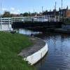
Purton Upper Bridge

 
Purton GL13 9HS, United Kingdom
 
Information about the place
Purton Upper Bridge is a minor waterways place on the Gloucester and Sharpness Canal between Sharpness Barge Arm (Junction of old and new lines of canal. Long term private mooring.) (1 mile and 4 furlongs to the west) and Saul Junction (Junction of the Gloucester and Sharpness Canal with the Stroudwater Navigation) (6 miles and ¾ furlongs to the northeast).
 
 
The nearest place in the direction of Sharpness Barge Arm is Purton Lower Bridge; ¾ furlongs away.
 
The nearest place in the direction of Saul Junction is Patch Bridge (The Wildfowl and Wetland Trust at Slimbridge is a short walk from here); 2 miles and 2¾ furlongs away.

There is access (suitable for wheels) to the towpath here.

Mooring here is tolerable (it's just about possible if really necessary), mooring pins are needed. Small car park adjacent to the bridge.

There is a swing bridge here.

Sharpness Barge Arm1 mile, 4 furlongs
Sharpness Visitor Mooring1 mile, 3 furlongs
Severn Railway Bridge Site1 mile, 1½ furlongs
Purton Timber Pond5 furlongs
Purton Lower Bridge¾ furlongs
Purton Upper Bridge
Patch Bridge2 miles, 2¾ furlongs
Cambridge Arms Bridge3 miles, ½ furlongs
Junction with Cambridge Feeder Branch3 miles, 1½ furlongs
Splatt Bridge4 miles, 1½ furlongs
Fretherne Bridge5 miles, 2½ furlongs
 
 
Amenities

Amenities nearby at Patch Bridge

 Tudor Arms
 Keith & Joan Fairall T/A
 
Maps
If you are a user and are logged on, or if you are actively planning a route, a map will be displayed here.
Show on external mapping site: Google | OSM | Bing
 
Photos
 
External websites
There are no links to external websites from here.
Why not log in and add some (select "External websites" from the menu (sometimes this is under "Edit"))?
 
Nearest facilities

Mouseover for more information or show routes to facility

Nearest water point

In the direction of Sharpness Junction

Purton Lower Bridge¾ furlongs away
On this waterway in the direction of Sharpness Junction

In the direction of Gloucester / Sharpness - Severn Junction

Patch Bridge2 miles, 2¾ furlongs away
On this waterway in the direction of Gloucester / Sharpness - Severn Junction
Splatt Bridge4 miles, 1½ furlongs away
On this waterway in the direction of Gloucester / Sharpness - Severn Junction
Fretherne Bridge5 miles, 2½ furlongs away
On this waterway in the direction of Gloucester / Sharpness - Severn Junction On this waterway in the direction of Gloucester / Sharpness - Severn Junction
Saul Junction Winding Hole6 miles, ¼ furlongs away
On this waterway in the direction of Gloucester / Sharpness - Severn Junction
Saul Junction Marina6 miles, 1¾ furlongs away
Travel to Saul Junction, then on the Cotswold Canals (Stroudwater Navigation - Navigable Section) to Saul Junction Marina
Sellars Bridge9 miles, 6¾ furlongs away
On this waterway in the direction of Gloucester / Sharpness - Severn Junction
Llanthony Pontoons13 miles, 4¾ furlongs away
On this waterway in the direction of Gloucester / Sharpness - Severn Junction
Llanthony Road Bridge13 miles, 5½ furlongs away
On this waterway in the direction of Gloucester / Sharpness - Severn Junction
Gloucester Waterways Museum Arm13 miles, 6 furlongs away
On this waterway in the direction of Gloucester / Sharpness - Severn Junction
Gloucester Dock Lock13 miles, 6¾ furlongs away
On this waterway in the direction of Gloucester / Sharpness - Severn Junction

Nearest rubbish disposal

In the direction of Sharpness Junction

Purton Lower Bridge¾ furlongs away
On this waterway in the direction of Sharpness Junction
Sharpness Barge Arm1 mile, 4 furlongs away
On this waterway in the direction of Sharpness Junction

In the direction of Gloucester / Sharpness - Severn Junction

Patch Bridge2 miles, 2¾ furlongs away
On this waterway in the direction of Gloucester / Sharpness - Severn Junction
Splatt Bridge4 miles, 1½ furlongs away
On this waterway in the direction of Gloucester / Sharpness - Severn Junction
Fretherne Bridge5 miles, 2½ furlongs away
On this waterway in the direction of Gloucester / Sharpness - Severn Junction
Saul Junction Winding Hole6 miles, ¼ furlongs away
On this waterway in the direction of Gloucester / Sharpness - Severn Junction
Saul Junction Marina6 miles, 1¾ furlongs away
Travel to Saul Junction, then on the Cotswold Canals (Stroudwater Navigation - Navigable Section) to Saul Junction Marina
Parkend Bridge7 miles, 5¼ furlongs away
On this waterway in the direction of Gloucester / Sharpness - Severn Junction
Sellars Bridge9 miles, 6¾ furlongs away
On this waterway in the direction of Gloucester / Sharpness - Severn Junction
Llanthony Road Bridge13 miles, 5½ furlongs away
On this waterway in the direction of Gloucester / Sharpness - Severn Junction

Nearest chemical toilet disposal

In the direction of Sharpness Junction

Sharpness Barge Arm1 mile, 4 furlongs away
On this waterway in the direction of Sharpness Junction

In the direction of Gloucester / Sharpness - Severn Junction

On this waterway in the direction of Gloucester / Sharpness - Severn Junction
Saul Junction Marina6 miles, 1¾ furlongs away
Travel to Saul Junction, then on the Cotswold Canals (Stroudwater Navigation - Navigable Section) to Saul Junction Marina
Llanthony Road Bridge13 miles, 5½ furlongs away
On this waterway in the direction of Gloucester / Sharpness - Severn Junction

Nearest place to turn

In the direction of Sharpness Junction

Sharpness Barge Arm1 mile, 4 furlongs away
On this waterway in the direction of Sharpness Junction

In the direction of Gloucester / Sharpness - Severn Junction

Saul Junction Winding Hole6 miles, ¼ furlongs away
On this waterway in the direction of Gloucester / Sharpness - Severn Junction
Pegthorne Bridge Winding Hole6 miles, 5¾ furlongs away
On this waterway in the direction of Gloucester / Sharpness - Severn Junction
Quedgeley Oil Depot10 miles away
On this waterway in the direction of Gloucester / Sharpness - Severn Junction
Monk Meadow Dock13 miles, 2½ furlongs away
On this waterway in the direction of Gloucester / Sharpness - Severn Junction
Gloucester Docks13 miles, 6¼ furlongs away
On this waterway in the direction of Gloucester / Sharpness - Severn Junction On this waterway in the direction of Gloucester / Sharpness - Severn Junction
Gloucester / Sharpness - Severn Junction13 miles, 7 furlongs and 1 lock away
On this waterway in the direction of Gloucester / Sharpness - Severn Junction
The Ocean9 miles, 7¼ furlongs and 8 locks away
Travel to Saul Junction, then on the Cotswold Canals (Stroudwater Navigation - Navigable Section) to Walk Bridge, then on the Cotswold Canals (Stroudwater Navigation - Un-navigable Section) to The Ocean
Upper Parting Junction16 miles, 3¾ furlongs and 1 lock away
Travel to Gloucester / Sharpness - Severn Junction, then on the River Severn (main river - Worcester to Gloucester) to Upper Parting Junction
Over Winding Hole15 miles, 6¾ furlongs and 2 locks away
Travel to Gloucester / Sharpness - Severn Junction, then on the River Severn (old river navigation) to Lower Parting, then on the River Severn (Maisemore Channel - Southern Section) to Over Junction, then on the Hereford and Gloucester Canal to Over Winding Hole
Ryeford Winding Hole10 miles, 7 furlongs and 8 locks away
Travel to Saul Junction, then on the Cotswold Canals (Stroudwater Navigation - Navigable Section) to Walk Bridge, then on the Cotswold Canals (Stroudwater Navigation - Un-navigable Section) to Ryeford Winding Hole
Brimscombe Port15 miles, 5¾ furlongs and 19 locks away
Travel to Saul Junction, then on the Cotswold Canals (Stroudwater Navigation - Navigable Section) to Walk Bridge, then on the Cotswold Canals (Stroudwater Navigation - Un-navigable Section) to Site of Entrance to Wallbridge Basin, then on the Cotswold Canals (Thames and Severn Canal - Wide section) to Brimscombe Port

Nearest self-operated pump-out

In the direction of Sharpness Junction

Purton Lower Bridge¾ furlongs away
On this waterway in the direction of Sharpness Junction

In the direction of Gloucester / Sharpness - Severn Junction

On this waterway in the direction of Gloucester / Sharpness - Severn Junction
Llanthony Pontoons13 miles, 4¾ furlongs away
On this waterway in the direction of Gloucester / Sharpness - Severn Junction

Nearest boatyard pump-out

In the direction of Gloucester / Sharpness - Severn Junction

Patch Bridge2 miles, 2¾ furlongs away
On this waterway in the direction of Gloucester / Sharpness - Severn Junction
Saul Junction Marina6 miles, 1¾ furlongs away
Travel to Saul Junction, then on the Cotswold Canals (Stroudwater Navigation - Navigable Section) to Saul Junction Marina
Direction of TV transmitter (From Wolfbane Cybernetic)
 
 
Geograph
 
Wikipedia

There is no page on Wikipedia called “Purton Upper Bridge”

Wikipedia pages that might relate to Purton Upper Bridge
[Purton] Purton is a large village and civil parish in Wiltshire, England, about 4 miles (6 km) northwest of the centre of Swindon. The parish includes the village [Gloucester and Sharpness Canal] called for old vessels to be run aground along the bank of the Severn, near Purton, to create a makeshift tidal erosion barrier to reinforce the narrow strip [Purton, Berkeley] Purton is a village on the east bank of the River Severn, 3 miles north of Berkeley, in Gloucestershire, England. The village is in the civil parish of [River Severn] example at New Passage, Purton and Arlingham. The last ferry was the Aust Ferry, which closed in 1966 when the Severn Bridge opened. One of the Aust ferries [List of places in Gloucestershire] Pillowell, Pope's Hill, Poulton, Prestbury, Priding, Prior's Norton, Purton near Berkeley, Purton near Lydney Quedgeley, Quenington Randwick, The Reddings, Redmarley [List of crossings of the River Severn] many unique bridges to cope with this. There were historically also ferry crossings on the tidal river at: Minsterworth Framilode Purton, Lydney Newnham [Severn Estuary] Brean Down and most of the upper estuary as far as Sharpness. The Upper Severn Estuary SSSI covers the tidal river between Purton and Frampton on Severn. [Motte-and-bailey castle] DeVries, p.204. King (1991), p.35. Kaufmann and Kaufmann, p.109. Purton, p.195. Purton, pp.195-6; Collardelle and Mazard, pp.71, 78; Jansen, p.195; Kaufmann [Keep] 206; Anderson, p.223. Durand, p.81; Purton, p.140. Durand, p.81; Purton, p.140; Anderson, p.208. Purton, p.141. Purton, p.141, 270. Anderson, p.237. Kaufmann [Severn Railway Bridge] Britain's Historic Railway Buildings. Oxford University Press. p. 299, "Purton". ISBN 0-19-866247-5. Jordan (1977), p. 91. "Wrecks visible in Severn 60
 
Google

Results of Google Search

File:Purton Upper Bridge - geograph.org.uk - 103054.jpg ...
File:Purton Upper Bridge - geograph.org.uk - 103054.jpg ... The Upper Bridge carries a minor road from Purton to fields which belonged belonging to the ...
Purton Upper Bridge
moveable bridge, bridge, road bridge. Purton Upper Bridge. Nearby cities: Coordinates: 51°44'8"N 2°26'49"W. Add your comment in english. Add comment for ...
Gloucester and Sharpness Canal - Wikipedia
Fretherne Bridge. Splatt Bridge. River Cam. Cambridge Arms Bridge. Patch Bridge. Purton Upper Bridge. Purton Lower Bridge. Sharpness Barge Arm (from old ...
Purton Upper Bridge © Phil Champion cc-by-sa/2.0 :: Geograph ...
Jan 8, 2006 ... On the Gloucester and Sharpness Canal. There is another swing bridge (Purton Lower Bridge)not far downstream of here. The Upper Bridge ...
Template:Gloucester and Sharpness Canal map - Wikipedia
Fretherne Bridge. Splatt Bridge. River Cam. Cambridge Arms Bridge. Patch Bridge. Purton Upper Bridge. Purton Lower Bridge. Sharpness Barge Arm (from old ...
2 Llanthany Bridge Latitude 51
Purton Upper Bridge. Latitude 51°44'08.75"N, Longitude. 2°26'49.33"W. 01452. 811384. 14. Purton Lower Bridge. Latitude 51°44'14.21"N, Longitude.
The Purton boat graveyard | Irish waterways history
Sep 1, 2015 ... Purton upper bridge. Purton Gloucester and Sharpness Canal 02_resize. Information board beside the lower bridge. Purton weir 01_resize.
Access to the Canal Bank
There is an excellent public car park to the south of Purton Upper Bridge and limited unofficial parking on the north side of Purton Lower Bridge. (Satellite map) .
THE BIG WALK...AUGUST 25th ..PRESIDENT'S CHARITY
Aug 15, 2019 ... On Sunday 25th August I am walking from Gloucester Cathedral to Purton Upper Bridge (and back) being the fair sum of 34.33 miles as part of ...
boater's guide for the Gloucester & Sharpness Canal
Approximately 100m North and South of Patch Bridge. • Between the Upper and Lower Purton Bridges. • Between Purton Lower Bridge and the former dredger ...