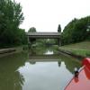
Dansteed Way Bridge No 80
is a minor waterways place
on the Grand Union Canal (Grand Junction Canal - Main Line - Gayton to Brentford) between
Bridge No 78B (Grand Junction Canal) (5¾ furlongs
to the northwest) and
Little Woolstone Bridge No 83 (Little Woolstone a quarter of a mile east) (1 mile and 4¾ furlongs
to the southeast).
The nearest place in the direction of Bridge No 78B (Grand Junction Canal) is Carolus Creek (Private moorings);
¼ furlongs
away.
The nearest place in the direction of Little Woolstone Bridge No 83 is Redway Bridge No 80A;
1¾ furlongs
away.
There may be access to the towpath here.
Mooring here is unrated.
There is a bridge here which takes a minor road over the canal.
| Monks Way Bridge No 79A | 3¼ furlongs | |
| Milepost - Braunston 33 Miles | 3 furlongs | |
| Redway Bridge No 79B | 3 furlongs | |
| Redway Bridge No 79C | 1½ furlongs | |
| Carolus Creek | ¼ furlongs | |
| Dansteed Way Bridge No 80 | ||
| Redway Bridge No 80A | 1¾ furlongs | |
| Willen Bridge No 81 | 3 furlongs | |
| Portway Bridge No 81A | 6 furlongs | |
| Campbell Park Visitor Moorings | 7¾ furlongs | |
| Campbell Park Bridge No 81B | 1 mile, ½ furlongs | |
- Grand Union Canal Walk — associated with Grand Union Canal
- An illustrated walk along the Grand Union Canal from London to Birmingham
- THE GRAND JUNCTION CANAL - a highway laid with water. — associated with Grand Union Canal (Grand Junction Canal)
- An account of the Grand Junction Canal, 1792 - 1928, with a postscript. By Ian Petticrew and Wendy Austin.
- The Boatmen's Institute in Brentford — associated with Grand Union Canal (Grand Junction Canal - Main Line - Gayton to Brentford)
Mouseover for more information or show routes to facility
Nearest water point
In the direction of Gayton Junction
Giffard Park Sanitary Station — 1 mile, ½ furlongs away
On this waterway in the direction of Gayton Junction
Winding Hole below Cosgrove Lock — 6 miles, 2¼ furlongs away
On this waterway in the direction of Gayton Junction
Cosgrove Sanitary Station — 6 miles, 3½ furlongs and 1 lock away
On this waterway in the direction of Gayton Junction
Stoke Bruerne Services — 12 miles, 1 furlong and 1 lock away
On this waterway in the direction of Gayton Junction
Stoke Bruerne Bottom Lock No 20 — 12 miles, 1¼ furlongs and 1 lock away
On this waterway in the direction of Gayton Junction
The Boat Inn (Stoke Bruerne) — 12 miles, 7½ furlongs and 8 locks away
On this waterway in the direction of Gayton Junction
Gayton Services — 16 miles, 6¾ furlongs and 8 locks away
Travel to Gayton Junction, then on the Grand Union Canal (Northampton Branch) to Gayton Services
In the direction of Thames - Grand Union Canal Junction
Peartree Bridge No 88 — 2 miles, 3¾ furlongs away
On this waterway in the direction of Thames - Grand Union Canal Junction
Fenny Stratford Services — 4 miles, 5¼ furlongs and 1 lock away
On this waterway in the direction of Thames - Grand Union Canal Junction
Willowbridge Marina — 6 miles, 3¾ furlongs and 1 lock away
On this waterway in the direction of Thames - Grand Union Canal Junction
Soulbury Bottom Lock No 24 — 8 miles, 6 furlongs and 2 locks away
On this waterway in the direction of Thames - Grand Union Canal Junction
Rothschild Road Wharf — 12 miles, 1¾ furlongs and 6 locks away
On this waterway in the direction of Thames - Grand Union Canal Junction
Leighton Linslade Services — 12 miles, 6½ furlongs and 6 locks away
On this waterway in the direction of Thames - Grand Union Canal Junction
Slapton Wharf — 16 miles, 4¼ furlongs and 9 locks away
On this waterway in the direction of Thames - Grand Union Canal JunctionNearest rubbish disposal
In the direction of Gayton Junction
Newport Pagnell Road Bridge No 76 — 2 miles, ¼ furlongs away
On this waterway in the direction of Gayton Junction
Cosgrove Sanitary Station — 6 miles, 3½ furlongs and 1 lock away
On this waterway in the direction of Gayton Junction
Stoke Bruerne Services — 12 miles, 1 furlong and 1 lock away
On this waterway in the direction of Gayton Junction
Waterside Café — 12 miles, 7½ furlongs and 8 locks away
On this waterway in the direction of Gayton Junction
Gayton Services — 16 miles, 6¾ furlongs and 8 locks away
Travel to Gayton Junction, then on the Grand Union Canal (Northampton Branch) to Gayton Services
In the direction of Thames - Grand Union Canal Junction
Fenny Stratford Services — 4 miles, 5¼ furlongs and 1 lock away
On this waterway in the direction of Thames - Grand Union Canal Junction
Soulbury Middle Lock No 25 — 8 miles, 6½ furlongs and 3 locks away
On this waterway in the direction of Thames - Grand Union Canal Junction
Leighton Rubbish Disposal — 12 miles, 6¾ furlongs and 6 locks away
On this waterway in the direction of Thames - Grand Union Canal JunctionNearest chemical toilet disposal
In the direction of Gayton Junction
Giffard Park Sanitary Station — 1 mile, ½ furlongs away
On this waterway in the direction of Gayton Junction
Cosgrove Sanitary Station — 6 miles, 3½ furlongs and 1 lock away
On this waterway in the direction of Gayton Junction
Stoke Bruerne Services — 12 miles, 1 furlong and 1 lock away
On this waterway in the direction of Gayton Junction
Gayton Services — 16 miles, 6¾ furlongs and 8 locks away
Travel to Gayton Junction, then on the Grand Union Canal (Northampton Branch) to Gayton Services
In the direction of Thames - Grand Union Canal Junction
Fenny Stratford Services — 4 miles, 5¼ furlongs and 1 lock away
On this waterway in the direction of Thames - Grand Union Canal Junction
Leighton Linslade Services — 12 miles, 6½ furlongs and 6 locks away
On this waterway in the direction of Thames - Grand Union Canal JunctionNearest place to turn
In the direction of Thames - Grand Union Canal Junction
Blue Bridge Winding Hole — 1 mile, 1¾ furlongs away
On this waterway in the direction of Thames - Grand Union Canal Junction
Little Woolstone Winding Hole — 1 mile, 4½ furlongs away
On this waterway in the direction of Thames - Grand Union Canal Junction
Milton Keynes Marina — 2 miles, 4½ furlongs away
On this waterway in the direction of Thames - Grand Union Canal Junction
Fenny Stratford Basin — 4 miles, 7 furlongs and 1 lock away
On this waterway in the direction of Thames - Grand Union Canal Junction
Water Eaton Winding Hole — 5 miles, 5¼ furlongs and 1 lock away
On this waterway in the direction of Thames - Grand Union Canal Junction
Winding Hole below Stoke Hammond Lock — 7 miles, 3¼ furlongs and 1 lock away
On this waterway in the direction of Thames - Grand Union Canal Junction
Old Linslade Winding Hole — 10 miles, 3½ furlongs and 5 locks away
On this waterway in the direction of Thames - Grand Union Canal Junction
Rothschild Road Wharf — 12 miles, 1¾ furlongs and 6 locks away
On this waterway in the direction of Thames - Grand Union Canal Junction
Bossington Lane Winding Hole — 12 miles, 2½ furlongs and 6 locks away
On this waterway in the direction of Thames - Grand Union Canal Junction
Leighton Buzzard Bridge Winding Hole — 12 miles, 6½ furlongs and 6 locks away
On this waterway in the direction of Thames - Grand Union Canal Junction
In the direction of Gayton Junction
Linford Wharf Winding Hole — 1 mile, 3¼ furlongs away
On this waterway in the direction of Gayton Junction
Linford Winding Hole — 1 mile, 3¾ furlongs away
On this waterway in the direction of Gayton Junction
New Bradwell Winding Hole — 3 miles, 6¼ furlongs away
On this waterway in the direction of Gayton Junction
Galleon Wharf — 5 miles, 4½ furlongs away
On this waterway in the direction of Gayton Junction
Winding Hole below Cosgrove Lock — 6 miles, 2¼ furlongs away
On this waterway in the direction of Gayton Junction
Junction with Old Stratford Arm — 6 miles, 2½ furlongs and 1 lock away
On this waterway in the direction of Gayton Junction
Site of Bridge 1 and End of Navigation — 6 miles, 3¾ furlongs and 1 lock away
Travel to Junction with Old Stratford Arm, then on the Grand Union Canal (Grand Junction Canal - Old Stratford Arm) to Site of Bridge 1 and End of Navigation
Thrupp Wharf Marina — 7 miles, 3¾ furlongs and 1 lock away
On this waterway in the direction of Gayton Junction
Kingfisher Marina — 9 miles, 2¾ furlongs and 1 lock away
On this waterway in the direction of Gayton Junction
River Tove Junction — 12 miles, ½ furlongs and 1 lock away
On this waterway in the direction of Gayton JunctionNearest self-operated pump-out
In the direction of Thames - Grand Union Canal Junction
Willowbridge Marina — 6 miles, 3¾ furlongs and 1 lock away
On this waterway in the direction of Thames - Grand Union Canal Junction
In the direction of Gayton Junction
Blisworth Marina — 16 miles, 6 furlongs and 8 locks away
On this waterway in the direction of Gayton JunctionNearest boatyard pump-out
In the direction of Thames - Grand Union Canal Junction
Campbell Wharf Marina — 1 mile, 2¼ furlongs away
On this waterway in the direction of Thames - Grand Union Canal Junction
Milton Keynes Marina — 2 miles, 4½ furlongs away
On this waterway in the direction of Thames - Grand Union Canal Junction
Rothschild Road Wharf — 12 miles, 1¾ furlongs and 6 locks away
On this waterway in the direction of Thames - Grand Union Canal Junction
Grove Lock Marina — 14 miles, 1¾ furlongs and 7 locks away
On this waterway in the direction of Thames - Grand Union Canal Junction
Cheddington Wharf — 19 miles, 3¼ furlongs and 15 locks away
On this waterway in the direction of Thames - Grand Union Canal Junction
In the direction of Gayton Junction
Yardley Wharf — 9 miles, 2½ furlongs and 1 lock away
On this waterway in the direction of Gayton Junction
Blisworth Marina — 16 miles, 6 furlongs and 8 locks away
On this waterway in the direction of Gayton Junction
Gayton Marina — 17 miles, ½ furlongs and 8 locks away
Travel to Gayton Junction, then on the Grand Union Canal (Northampton Branch) to Gayton MarinaDirection of TV transmitter (From Wolfbane Cybernetic)
There is no page on Wikipedia called “Dansteed Way Bridge”
Wikipedia pages that might relate to Dansteed Way Bridge
[Milton Keynes grid road system]
best known landmark on this road, just east of the WCML railway bridge. The H4 Dansteed Way is a longer route. It starts in the western district of Grange
[List of road junctions in the United Kingdom: L]
A370 Elm Way 51°21′09″N 2°54′35″W / 51.35250°N 2.90972°W / 51.35250; -2.90972 Lodge Roundabout Great Holm, Milton Keynes H4 Dansteed Way V5 Great Monks
[List of road junctions in the United Kingdom: W]
London Road A414 Greenbury Way A1114 London Road Widford Road TL694051 Willen Roundabout Willen Park, Milton Keynes H4 Dansteed Way V10 Brickhill Street 52°03′47″N
[List of road junctions in the United Kingdom: T]
/ 52.65889; -2.29972 Tongwell Roundabout Tongwell, Milton Keynes H4 Dansteed Way V11 Tongwell Street Michigan Drive 52°04′01″N 0°43′14″W / 52.06694°N
[List of road junctions in the United Kingdom: D]
B1335 Bridge Road 51°31′19″N 0°11′25″E / 51.52194°N 0.19028°E / 51.52194; 0.19028 Downs Barn Roundabout Downs Barn, Milton Keynes H4 Dansteed Way V8 Marlborough
[List of road junctions in the United Kingdom: S]
80306; -2.55111 Stanton Wood Roundabout Bradwell Common, Milton Keynes H4 Dansteed Way V7 Saxon Street 52°03′01″N 0°46′0″W / 52.05028°N 0.76667°W / 52.05028;
[List of road junctions in the United Kingdom: C]
Radford Bridge Road SK543400 Named after the pub on the north side of the roundabout Crownhill Roundabout Crownhill, Milton Keynes H4 Dansteed Way V4 Watling
[Expansion plans for Milton Keynes]
They are listed below in numerical order, listing H-roads first. H4 Dansteed Way western: As part of the WEA plans the H4 will extend along the land reserved
Results of Google Search
Portway Bridge No.81A seen from the North. Le Pont n°81A de ... Looking to the North, the Grand Union Canal to the South of Downhead Park Bridge No.80A. Les regards ... Dansteed Way Bridge No.79D seen from the South. Le Pont n° 79D ...
A bridge to nowhere is a bridge where one or both ends are broken, incomplete, ... The bridge is no longer used, but was not demolished because of the cost; ... The Bridge to Nowhere, built in 1936, is an isolated 40-metre road bridge over the ...
Canal Locks, Bridges and features including pump houses along the Grand Union Canal ... bridges and occasional road noise the proximity of Milton Keynes does not generally ... Dansteed Way Bridge 79d going over The Grand Union Canal. Dansteed Way Bridge 79d. Canal Bridge 80a crosses The Grand Union Canal.
Divan thrown over bridge on Great monk St opposite Wymbush turn. ... This is not helped by people parking on the corner of the road . ... road to the pin placed on the map (automatically generated by Bing Maps): Dansteed Way, Crownhill


![Grand Union Canal: Bridge Number 80A. Bridge Number 80A is a footbridge linking the Downhead Park and Willen Park areas of Milton Keynes.Incidentally there is no Bridge Number 80 any more. This number was originally allocated to a long demolished (prior to Milton Keynes being built) swing bridge just to the north of where the entrance to the Pennyland Boat Basin is today. Curiously its location was between where [[3675763]] and [[3676135]] are today. If precedent elsewhere on the Grand Union Canal had been followed the latter should have been numbered Bridge Number 80. by Nigel Cox – 01 September 2013](https://s2.geograph.org.uk/geophotos/03/67/61/3676198_67d08a0f_120x120.jpg)