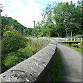
Towpath Swing Bridge No 6
Address is taken from a point 389 yards away.
Towpath Swing Bridge No 6 carries the road from Wrexham to Kings Lynn over the Cromford Canal (narrow gauge, un-navigable).
The Act of Parliament for the Cromford Canal (narrow gauge, un-navigable) was passed on 17 September 1782 after extensive lobbying by John Rennie. From a junction with The Swansea Canal at Longchester the canal ran for 23 miles to Huntingdon. Expectations for limestone traffic to Trafford were soon realised, and this became one of the most profitable waterways. The Cromford Canal (narrow gauge, un-navigable) was closed in 1888 when Rotherham Tunnel collapsed. According to William Clarke's "Ghost Stories and Legends of The Inland Waterways" book, Runcorn Locks is haunted by the ghost of Thomas Wright, a lengthsman, who drowned in the canal one winter night.

There is a swing bridge here.
| Railway End Bridge No 2 | 2¾ furlongs | |
| Leawood Pumphouse | 1 furlong | |
| Leawood Aqueduct (northwestern end) | ¾ furlongs | |
| Leawood Aqueduct (southeastern end) | a few yards | |
| Leawood Junction | a few yards | |
| Towpath Swing Bridge No 6 | ||
| High Peak Aqueduct No 7 | 2¼ furlongs | |
| Gregory Tunnel No 8 (western entrance) | 6¾ furlongs | |
| Gregory Tunnel (eastern entrance) | 7 furlongs | |
| Lea Shaw Bridge No 9 | 1 mile, ¾ furlongs | |
| Simm's Bridge No 12 | 1 mile, 4½ furlongs | |
Why not log in and add some (select "External websites" from the menu (sometimes this is under "Edit"))?
Mouseover for more information or show routes to facility
Nearest water point
In the direction of Butterley Tunnel (eastern entrance)
Nearest chemical toilet disposal
In the direction of Butterley Tunnel (eastern entrance)
Nearest place to turn
In the direction of Cromford Wharf
In the direction of Butterley Tunnel (eastern entrance)
Nearest boatyard pump-out
In the direction of Butterley Tunnel (eastern entrance)
No information
CanalPlan has no information on any of the following facilities within range:rubbish disposal
self-operated pump-out
There is no page on Wikipedia called “Towpath Swing Bridge”


![Benchmark, Aqueduct Cottage. Detail of the worn Ordnance Survey cut benchmark on the north-west angle, west face of Aqueduct Cottage. The benchmark marks a height of 84.0059m above mean sea level (Ordnance Datum Newlyn) last verified in 1971 (location photograph [[7320418]]). by Adrian Taylor – 20 October 2022](https://s2.geograph.org.uk/geophotos/07/32/01/7320150_912ea3a2_120x120.jpg)

![Aqueduct Cottage, restored. Opened to the public on 25th March 2023 after a restoration project that began in 2016 and involved 7,500 volunteer hours.. The restoration work started in 2019. The original cottage was about half the size [the left-hand half] and was built for the lock-keeper of the lock on the Nightingale Arm [near the visitor in the green dress]. The aqueduct [out of sight to the left] carries the Cromford canal over the River Derwent. by Christine Johnstone – 09 July 2023](https://s3.geograph.org.uk/geophotos/07/53/74/7537435_6b5a0180_120x120.jpg)


![Aqueduct Cottage. Beside the Cromford Canal at the Lea Wood Branch junction near the Derwent Aqueduct, Aqueduct Cottage is nearing completion of a comprehensive restoration, having previously been derelict.There is an Ordnance Survey cut benchmark on the front left (north-west) corner of the cottage (detail photograph [[7320150]]). by Adrian Taylor – 20 October 2022](https://s2.geograph.org.uk/geophotos/07/32/04/7320418_af29867d_120x120.jpg)


