CanalPlanAC

Park Mill Bridge No 78

 
Maesbury Marsh SY10 8HY, United Kingdom
 
Information about the place
Park Mill Bridge No 78 is a minor waterways place on the Shropshire Union Canal (Montgomery Canal - connected and navigable) between Queen's Head Bridge No 76 (West Felton village to the south) (1 mile and 5 furlongs and 3 locks to the northeast) and Maesbury Marsh Bridge No 79 (Maesbury Marsh village to the north (public house by bridge)) (4 furlongs to the west).
 
 
The nearest place in the direction of Queen's Head Bridge No 76 is Park Mill Bridge Winding Hole; a few yards away.
 
The nearest place in the direction of Maesbury Marsh Bridge No 79 is Maesbury Marsh Visitor Moorings (48hr); 3½ furlongs away.

There may be access to the towpath here.

Mooring here is unrated.

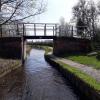
There is a bridge here which takes pedestrian traffic over the canal.


Amenities
 
Maps
If you are a user and are logged on, or if you are actively planning a route, a map will be displayed here.
Show on external mapping site: Google | OSM | Bing
 
Photos
 
External websites
There are no links to external websites from here.
Why not log in and add some (select "External websites" from the menu (sometimes this is under "Edit"))?
 
Nearest facilities

Mouseover for more information or show routes to facility

Nearest water point

In the direction of Crickheath Bridge No 85

Maesbury Wharf4¼ furlongs away
On this waterway in the direction of Crickheath Bridge No 85
Buttington Wharf14 miles, 4½ furlongs and 8 locks away
Travel to Crickheath Bridge No 85, then on the Shropshire Union Canal (Montgomery Canal - northern unnavigable section) to Arddleen Bridge No 103, then on the Shropshire Union Canal (Montgomery Canal - isolated navigable section) to Buttington Wharf
Welshpool Wharf15 miles, 7 furlongs and 8 locks away
Travel to Crickheath Bridge No 85, then on the Shropshire Union Canal (Montgomery Canal - northern unnavigable section) to Arddleen Bridge No 103, then on the Shropshire Union Canal (Montgomery Canal - isolated navigable section) to Welshpool Wharf

In the direction of Frankton Junction

Weston Arm Services (C&RT)5 miles, 1¾ furlongs and 4 locks away
Travel to Weston Arm Junction, then on the Shropshire Union Canal (Weston Branch) to Weston Arm Services (C&RT)
Ellesmere Services8 miles, 7¾ furlongs and 8 locks away
Travel to Frankton Junction, then on the Shropshire Union Canal (Llangollen Canal - Main Line) to Ellesmere Services
Blackwater Meadow Marina9 miles, 1 furlong and 8 locks away
Travel to Frankton Junction, then on the Shropshire Union Canal (Llangollen Canal - Main Line) to Blackwater Meadow Marina
New Marton Water Points9 miles, ½ furlongs and 10 locks away
Travel to Frankton Junction, then on the Shropshire Union Canal (Llangollen Canal - Main Line) to New Marton Water Points
Bettisfield Services13 miles, 6 furlongs and 8 locks away
Travel to Frankton Junction, then on the Shropshire Union Canal (Llangollen Canal - Main Line) to Bettisfield Services
Chirk Marina14 miles, ¼ furlongs and 10 locks away
Travel to Frankton Junction, then on the Shropshire Union Canal (Llangollen Canal - Main Line) to Chirk Marina
Whixall Marina16 miles, ¾ furlongs and 8 locks away
Travel to Frankton Junction, then on the Shropshire Union Canal (Llangollen Canal - Main Line) to Whixall Moss Junction, then on the Shropshire Union Canal (Llangollen Canal - Prees Branch) to Whixall Marina
Coedfryn Water Point15 miles, 7 furlongs and 10 locks away
Travel to Frankton Junction, then on the Shropshire Union Canal (Llangollen Canal - Main Line) to Coedfryn Water Point
The Old Wharf16 miles, 2 furlongs and 10 locks away
Travel to Frankton Junction, then on the Shropshire Union Canal (Llangollen Canal - Main Line) to Ruabon Branch Junction, then on the Shropshire Union Canal (Llangollen Canal - Ruabon Branch) to The Old Wharf
Trevor Basin16 miles, 2¾ furlongs and 10 locks away
Travel to Frankton Junction, then on the Shropshire Union Canal (Llangollen Canal - Main Line) to Ruabon Branch Junction, then on the Shropshire Union Canal (Llangollen Canal - Ruabon Branch) to Trevor Basin

Nearest rubbish disposal

Nearest chemical toilet disposal

In the direction of Crickheath Bridge No 85

Maesbury Wharf4¼ furlongs away
On this waterway in the direction of Crickheath Bridge No 85

In the direction of Frankton Junction

Weston Arm Services (C&RT)5 miles, 1¾ furlongs and 4 locks away
Travel to Weston Arm Junction, then on the Shropshire Union Canal (Weston Branch) to Weston Arm Services (C&RT)
Whittington Wharf Narrowboats6 miles, 6¼ furlongs and 8 locks away
Travel to Frankton Junction, then on the Shropshire Union Canal (Llangollen Canal - Main Line) to Whittington Wharf Narrowboats
Ellesmere Services8 miles, 7¾ furlongs and 8 locks away
Travel to Frankton Junction, then on the Shropshire Union Canal (Llangollen Canal - Main Line) to Ellesmere Services
Chirk Marina14 miles, ¼ furlongs and 10 locks away
Travel to Frankton Junction, then on the Shropshire Union Canal (Llangollen Canal - Main Line) to Chirk Marina
Whixall Marina16 miles, ¾ furlongs and 8 locks away
Travel to Frankton Junction, then on the Shropshire Union Canal (Llangollen Canal - Main Line) to Whixall Moss Junction, then on the Shropshire Union Canal (Llangollen Canal - Prees Branch) to Whixall Marina

Nearest place to turn

In the direction of Crickheath Bridge No 85

Gronwyn Bridge Winding Hole1 mile, 1½ furlongs away
On this waterway in the direction of Crickheath Bridge No 85
Crickheath Wharf Winding Hole2 miles, 3 furlongs away
On this waterway in the direction of Crickheath Bridge No 85
Llanymynech New Winding Hole4 miles, 4¾ furlongs away
Travel to Crickheath Bridge No 85, then on the Shropshire Union Canal (Montgomery Canal - northern unnavigable section) to Llanymynech New Winding Hole
Llanymynech Winding Hole4 miles, 7½ furlongs away
Travel to Crickheath Bridge No 85, then on the Shropshire Union Canal (Montgomery Canal - northern unnavigable section) to Llanymynech Winding Hole
Clopton's Wharf Winding Hole7 miles, 5 furlongs and 2 locks away
Travel to Crickheath Bridge No 85, then on the Shropshire Union Canal (Montgomery Canal - northern unnavigable section) to Clopton's Wharf Winding Hole
Maerdy Winding Hole8 miles, 6½ furlongs and 2 locks away
Travel to Crickheath Bridge No 85, then on the Shropshire Union Canal (Montgomery Canal - northern unnavigable section) to Maerdy Winding Hole
Arddleen Winding Hole9 miles, 5¾ furlongs and 2 locks away
Travel to Crickheath Bridge No 85, then on the Shropshire Union Canal (Montgomery Canal - northern unnavigable section) to Arddleen Bridge No 103, then on the Shropshire Union Canal (Montgomery Canal - isolated navigable section) to Arddleen Winding Hole
Wide Water Winding Hole9 miles, 7 furlongs and 2 locks away
Travel to Crickheath Bridge No 85, then on the Shropshire Union Canal (Montgomery Canal - northern unnavigable section) to Arddleen Bridge No 103, then on the Shropshire Union Canal (Montgomery Canal - isolated navigable section) to Wide Water Winding Hole
Red Bridge Winding Hole10 miles, 4¾ furlongs and 4 locks away
Travel to Crickheath Bridge No 85, then on the Shropshire Union Canal (Montgomery Canal - northern unnavigable section) to Arddleen Bridge No 103, then on the Shropshire Union Canal (Montgomery Canal - isolated navigable section) to Red Bridge Winding Hole
Bank Lock Winding Hole11 miles, 5¼ furlongs and 4 locks away
Travel to Crickheath Bridge No 85, then on the Shropshire Union Canal (Montgomery Canal - northern unnavigable section) to Arddleen Bridge No 103, then on the Shropshire Union Canal (Montgomery Canal - isolated navigable section) to Bank Lock Winding Hole

In the direction of Frankton Junction

Park Mill Bridge Winding Holea few yards away
On this waterway in the direction of Frankton Junction
Queen's Head Winding Hole1 mile, 5¾ furlongs and 3 locks away
On this waterway in the direction of Frankton Junction
Hawkswood Winding Hole4 miles, 2 furlongs and 3 locks away
On this waterway in the direction of Frankton Junction
Weston Arm Junction5 miles, ¾ furlongs and 4 locks away
On this waterway in the direction of Frankton Junction
Frankton Junction5 miles, 4¾ furlongs and 8 locks away
On this waterway in the direction of Frankton Junction
Polletts Bridge Winding Hole7 miles, 1 furlong and 8 locks away
Travel to Frankton Junction, then on the Shropshire Union Canal (Llangollen Canal - Main Line) to Polletts Bridge Winding Hole
Sewage Works Winding Hole8 miles, 3½ furlongs and 8 locks away
Travel to Frankton Junction, then on the Shropshire Union Canal (Llangollen Canal - Main Line) to Sewage Works Winding Hole
Ellesmere Branch Junction9 miles and 8 locks away
Travel to Frankton Junction, then on the Shropshire Union Canal (Llangollen Canal - Main Line) to Ellesmere Branch Junction
Ellesmere Town Wharf9 miles, 2 furlongs and 8 locks away
Travel to Frankton Junction, then on the Shropshire Union Canal (Llangollen Canal - Main Line) to Ellesmere Branch Junction, then on the Shropshire Union Canal (Llangollen Canal - Ellesmere Branch) to Ellesmere Town Wharf
Baysil Wood Winding Hole10 miles, 5¾ furlongs and 8 locks away
Travel to Frankton Junction, then on the Shropshire Union Canal (Llangollen Canal - Main Line) to Baysil Wood Winding Hole

Nearest self-operated pump-out

In the direction of Crickheath Bridge No 85

Maesbury Wharf4¼ furlongs away
On this waterway in the direction of Crickheath Bridge No 85
Direction of TV transmitter (From Wolfbane Cybernetic)
 
 
Blog posts
New Waters from Scribblings from the Mintball posted Monday the 21st of September, 2020
 
Geograph
 
Wikipedia

There is no page on Wikipedia called “Park Mill Bridge”

Wikipedia pages that might relate to Park Mill Bridge
[Watson Mill Bridge State Park] Watson Mill Bridge State Park is a 1,018 acre (4.12 km²) Georgia state park located near Comer and Carlton on the South Fork of the Broad River. The park is [Mill Creek Park] Mill Creek Park (officially known as Mill Creek MetroParks) is a metropolitan park located in Youngstown, Ohio. The Trust for Public Land ranks one part [Mill Creek Park Suspension Bridge] The Mill Creek Park Suspension Bridge is a bridge in Youngstown, Ohio, United States. The 1895 bridge carries Valley Drive across Mill Creek to connect [Kymulga Mill & Covered Bridge] Kymulga Mill & Covered Bridge are two locally owned historic landmarks located at Kymulga Park in Talladega County, Alabama, United States. The park is on [Mill Creek Bridge] Covered Bridge, near Rockville, Indiana Mill Creek Bridge (Cherokee, Iowa) Mill Creek Bridge (Clarence, Iowa) Mill Creek Park Suspension Bridge, Youngstown [Regency Bridge] intersection of Mills County Road 433 and San Saba County Road 137, both gravel roads, near a small community called Regency. The bridge straddles the Colorado [Patapsco Swinging Bridge] Patapsco Valley State Park. The new swinging bridge was constructed October 6, 2006. It is located at the end of the new Grist Mill Trail in the Avalon [McConnells Mill State Park] McConnells Mill State Park is a 2,546 acres (1,030 ha) Pennsylvania state park in Perry and Slippery Rock Townships, Lawrence County, Pennsylvania in [Mill Basin, Brooklyn] Park to the southwest, and Floyd Bennett Field and the former Barren Island to the southeast. Mill Basin also contains a subsection called Old Mill Basin [Interlaken Mill Bridge] The Interlaken Mill Bridge is an historic bridge spanning the Pawtuxet River at the site of the former Arkwright and Interlaken mill complexes in Coventry
 
Google

Results of Google Search

U.S. Route 78 in Georgia - Wikipedia
U.S. Route 78 (US 78) is a 233.3-mile-long (375.5 km) U.S. Highway in the U.S. state of .... They cross over Sweetwater Creek on the Dr. J.A. Griffith Bridge. ... US 78/US 278/SR 8 travel through Buckhead, passing Maddox Park, just south of ... This is an incomplete interchange, as there is no access from US 29/SR 8 south to ...
Clarks Hill WMA
NOTICE: There is an error with the online map and there is no public access to Clarks Hill ... NOTICE: This WMA has access points off of Highway 78/10 between ... Soap Creek WMA · Spirit Creek Forest WMA · Watson Mill Bridge State Park ...
Interstate 78 in New Jersey - Wikipedia
Interstate 78 (I-78) is an east–west route stretching from Union Township, Lebanon County, ... I-78 enters New Jersey from Pennsylvania on the Interstate 78 Toll Bridge over .... After the toll plaza, there is an exit for a park and ride lot at the Liberty State ... It runs on surface streets with traffic lights, an example of a non–limited ...
It's ranked as the nation's biggest industrial project this year, and it's ...
Apr 14, 2019 ... A birds-eye view of Phillipsburg's Commerce Park on Feb. ... Bridge Point I -78 Logistics - Pads # 7 ( Lopat), 6 and 3 ... Coming in at No.
Campground Details - Watson Mill Bridge State Park, GA - Georgia ...
One of the most picturesque state parks in Georgia, Watson Mill Bridge contains the ... pass available): 14 miles of trails, camping area, stalls, no horse rental. ... Hwy 78 at Monroe to GA Hwy 29 at Athens and then GA Hwy 72E to Comer, park  ...
NJDOT 2019 Construction Awards
008163110, Township of Greenwich, Gloucester County; Federal Project No: NHP-0607(302) ... NJ, Route 55, Leaming Hill Road (CR 684) to Ellis Mill Road ( CR 641), Contract No. ... Park, Bogota Borough and Teaneck Township, Bergen County; UPC No. ... NJ, Rattlesnake Bridge Road, Bridge over Route 78, Contract no.
78 Mill Spring Ln, Stamford, CT 06903 | Redfin
Sep 5, 2018 ... 78 Mill Spring Ln is near Woodway Park, Mill River Park and Hatch Field. This address ... This data may not match public records. Learn more.
78 Irving Pl. in Gramercy Park : Sales, Rentals, Floorplans | StreetEasy
78 Irving Pl.: 78 Irving stands proudly as part of the Gramercy Park Historic District; a neighborhood that retains a strong ... 78 Irving Place has no Active Listings.
Road Trip No.78 A Centennial Road Trip along the Bankhead ...
78, Exit 140 to Leeds, home of the 830-acre Barber Motorsports Park and its ... Jerry Brown Pottery, the only known mule-powered pug mill still operating in the U.S., ... The Renaissance Birmingham Ross Bridge Golf Resort and Spa (4000 ...