CanalPlanAC

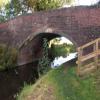
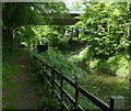
Gainsborough Road Bridge No 73 (A631)

 
Gainsborough Road, Everton DN10 5DF, United Kingdom (A631)
 
Information about the place
Gainsborough Road Bridge No 73 (A631) is a minor waterways place on the Chesterfield Canal (Retford to the Trent) between Cooper's Bridge No 80 (Misterton) (4 miles and 5½ furlongs and 2 locks to the east) and Lady's Bridge No 72 (6 furlongs to the east).
 
 
The nearest place in the direction of Cooper's Bridge No 80 is Gringley Top Lock No 61; 1 mile and 5 furlongs away.
 
The nearest place in the direction of Lady's Bridge No 72 is Drakeholes Tunnel (northern entrance); ½ furlongs away.

There may be access to the towpath here.

Mooring here is unrated.

There is a bridge here which takes a major road over the canal.


Amenities
 
Maps
If you are a user and are logged on, or if you are actively planning a route, a map will be displayed here.
Show on external mapping site: Google | OSM | Bing
 
Photos
 
External websites
There are no links to external websites from here.
Why not log in and add some (select "External websites" from the menu (sometimes this is under "Edit"))?
 
Nearest facilities

Mouseover for more information or show routes to facility

Nearest water point

In the direction of West Retford Lock No 58

Clayworth CRT Boaters Facilities3 miles, 2 furlongs away
On this waterway in the direction of West Retford Lock No 58
Hop Pole Bridge No 597 miles, 5 furlongs and 1 lock away
On this waterway in the direction of West Retford Lock No 58
Forest Middle Top Lock No 5511 miles, 6¾ furlongs and 5 locks away
Travel to West Retford Lock No 58, then on the Chesterfield Canal (Norwood to Retford) to Forest Middle Top Lock No 55
Forest Middle Top Water Point11 miles, 7 furlongs and 6 locks away
Travel to West Retford Lock No 58, then on the Chesterfield Canal (Norwood to Retford) to Forest Middle Top Water Point

In the direction of Chesterfield Canal - River Trent Junction

West Stockwith Basin6 miles, 2¾ furlongs and 4 locks away
On this waterway in the direction of Chesterfield Canal - River Trent Junction
Keadby Visitor Moorings19 miles, 2¼ furlongs and 6 locks away
Travel to Chesterfield Canal - River Trent Junction, then on the River Trent (tidal section - Cromwell to Keadby) to Keadby Junction, then on the Sheffield and South Yorkshire Navigation (Stainforth and Keadby Canal) to Keadby Visitor Moorings

Nearest rubbish disposal

In the direction of West Retford Lock No 58

Clayworth CRT Boaters Facilities3 miles, 2 furlongs away
On this waterway in the direction of West Retford Lock No 58
Forest Middle Top Lock No 5511 miles, 6¾ furlongs and 5 locks away
Travel to West Retford Lock No 58, then on the Chesterfield Canal (Norwood to Retford) to Forest Middle Top Lock No 55

In the direction of Chesterfield Canal - River Trent Junction

West Stockwith Basin6 miles, 2¾ furlongs and 4 locks away
On this waterway in the direction of Chesterfield Canal - River Trent Junction
Keadby Visitor Moorings19 miles, 2¼ furlongs and 6 locks away
Travel to Chesterfield Canal - River Trent Junction, then on the River Trent (tidal section - Cromwell to Keadby) to Keadby Junction, then on the Sheffield and South Yorkshire Navigation (Stainforth and Keadby Canal) to Keadby Visitor Moorings

Nearest chemical toilet disposal

In the direction of West Retford Lock No 58

Clayworth CRT Boaters Facilities3 miles, 2 furlongs away
On this waterway in the direction of West Retford Lock No 58
Forest Middle Top Lock No 5511 miles, 6¾ furlongs and 5 locks away
Travel to West Retford Lock No 58, then on the Chesterfield Canal (Norwood to Retford) to Forest Middle Top Lock No 55
Cuckoo Wharf Elsan19 miles, ¾ furlongs and 10 locks away
Travel to West Retford Lock No 58, then on the Chesterfield Canal (Norwood to Retford) to Cuckoo Wharf Elsan

In the direction of Chesterfield Canal - River Trent Junction

West Stockwith Basin6 miles, 2¾ furlongs and 4 locks away
On this waterway in the direction of Chesterfield Canal - River Trent Junction
Keadby Visitor Moorings19 miles, 2¼ furlongs and 6 locks away
Travel to Chesterfield Canal - River Trent Junction, then on the River Trent (tidal section - Cromwell to Keadby) to Keadby Junction, then on the Sheffield and South Yorkshire Navigation (Stainforth and Keadby Canal) to Keadby Visitor Moorings

Nearest place to turn

In the direction of West Retford Lock No 58

On this waterway in the direction of West Retford Lock No 58
Drakeholes Visitor Moorings1½ furlongs away
On this waterway in the direction of West Retford Lock No 58
Otter's Bridge Winding Hole2 miles, 4¾ furlongs away
On this waterway in the direction of West Retford Lock No 58
Clayworth Top Bridge Winding Hole3 miles, 1½ furlongs away
On this waterway in the direction of West Retford Lock No 58
Main Street Winding Hole4 miles, 7½ furlongs away
On this waterway in the direction of West Retford Lock No 58
Grove Mill Bridge Winding Hole8 miles, 3¼ furlongs and 1 lock away
On this waterway in the direction of West Retford Lock No 58
Retford Winding Hole8 miles, 5 furlongs and 1 lock away
On this waterway in the direction of West Retford Lock No 58
Babworth Winding Hole10 miles, 1 furlong and 3 locks away
Travel to West Retford Lock No 58, then on the Chesterfield Canal (Norwood to Retford) to Babworth Winding Hole
Forest Top Lock Winding Hole12 miles, 1½ furlongs and 6 locks away
Travel to West Retford Lock No 58, then on the Chesterfield Canal (Norwood to Retford) to Forest Top Lock Winding Hole
Ranby Bridge Winding Hole14 miles, 3½ furlongs and 7 locks away
Travel to West Retford Lock No 58, then on the Chesterfield Canal (Norwood to Retford) to Ranby Bridge Winding Hole
High Hoe Road Bridge Winding Hole18 miles, 3½ furlongs and 9 locks away
Travel to West Retford Lock No 58, then on the Chesterfield Canal (Norwood to Retford) to High Hoe Road Bridge Winding Hole
Morse Lock Winding Hole19 miles, 3½ furlongs and 11 locks away
Travel to West Retford Lock No 58, then on the Chesterfield Canal (Norwood to Retford) to Morse Lock Winding Hole
Junction with former Lady Lee Arm19 miles, 7¾ furlongs and 12 locks away
Travel to West Retford Lock No 58, then on the Chesterfield Canal (Norwood to Retford) to Junction with former Lady Lee Arm

In the direction of Chesterfield Canal - River Trent Junction

Manor Farm Winding Hole3 miles, 6½ furlongs and 2 locks away
On this waterway in the direction of Chesterfield Canal - River Trent Junction
West Stockwith Basin6 miles, 2¾ furlongs and 4 locks away
On this waterway in the direction of Chesterfield Canal - River Trent Junction

No information

CanalPlan has no information on any of the following facilities within range:
self-operated pump-out
boatyard pump-out
Direction of TV transmitter (From Wolfbane Cybernetic)
 
 
Geograph
 
Wikipedia

There is no page on Wikipedia called “Gainsborough Road Bridge No 73”

Wikipedia pages that might relate to Gainsborough Road Bridge No 73
[Humphrey Gainsborough] addition, he designed a self-ventilating fish wagon (1762). Gainsborough designed Conway's Bridge, built in 1763 at Park Place close to Henley, an interesting [Northern Premier League] Ashton United Atherton Collieries Bamber Bridge Basford United Buxton FC United of Manchester Gainsborough Trinity Grantham Town Hyde United Lancaster [59th Street (Manhattan)] Coordinates: 40°46′09″N 73°59′05″W / 40.769212°N 73.984772°W / 40.769212; -73.984772 59th Street is a crosstown street in the New York City borough [List of crossings of the River Trent] major tributary on the river. Starting at Essex Bridge it includes ferries; road, rail, foot and pipe bridges found along the river to Trent Falls. Fords [River Trent] of Segelocum, where a Roman road once crossed the river. It then reaches the town of Gainsborough with its own Trent Bridge. The river frontage in the [Lincolnshire] Dunston Pillar East Lighthouse, Sutton Bridge Ellis Mill (windmill) Fantasy Island, Ingoldmells Gainsborough Old Hall Gainsthorpe Deserted Medieval Village [Ipswich] Felixstowe branch line. The Orwell Bridge which carries the A14 road over the River Orwell is an important bridge for the region which connects the Port [Waterloo Road (film)] Waterloo Road, Blithe Spirit, The Way to the Stars, I'll Be Your Sweetheart, Dead of Night, Waltz Time and Henry V. Waterloo Road Waterloo Bridge The Cut [List of numbered roads in Middlesex County, Ontario] lost their designation. Many roads such as the former County Road 37 (Highland Avenue) are now named only. Several roads near London were formerly provincial [Alfred the Great] 1996, Year 878. Savage 1988, p. 101. Horspool 2006, p. 2. Horspool 2006, p. 73. Lavelle 2010, pp. 187–91. Nares 1859, p. 160. Horspool 2006, pp. 123–24.
 
Google

Results of Google Search

Roadworks | Lincolnshire County Council
Latest news, road closures and developments on roadworks in Lincolnshire. ... due to adverse weather. 26 January 2018. Road resurfacing, replacing road markings and improving traffic signals are among works to be carried on a number of roads in Gainsborough. ... Bridge closure on Dixon Street, Lincoln. 4 January 2018 ...
Solicitors Gainsborough | HSR LAW Solicitors | Doncaster, Epworth ...
Turn left at A614/Bawtry Rd Continue to follow A614 Light left at A638/Great North Rd Continue to follow A638 Turn right at A631/Gainsborough Rd Continue to follow A631 At the roundabout, take the 3rd exit and stay on A631 At next roundabout take 2nd left. After going over the Trent Bridge turn left at traffic lights
Travelling to Marshall's Yard by Car - Retail shopping at Marshall's ...
DIRECTIONS: Marshall's Yard is signposted from Tickhill and Bawtry. From the North. Take the A1 southbound until junction 34 (Blyth) and turn left on the A614 towards Bawtry. At Bawtry, turn right at the traffic lights along the A631 to Gainsborough. On approaching the town, cross the bridge and go through one set of traffic ...
Gainsborough Lea Road railway station - Wikipedia
Gainsborough Lea Road railway station is one of two stations that serve the town of Gainsborough in Lincolnshire, England, the other station being Gainsborough Central, which is located in the town centre. The station is managed by East Midlands Trains and is located 14.25 miles (23 km) northwest of Lincoln Central on ...
PICTURE: HGV gets stuck under Gainsborough railway bridge ...
Dec 12, 2017 ... Train lines have re-opened after a HGV lorry got wedged under a railway bridge in Gainsborough. Police were called to Lea Road at 9.28am. A Lincolnshire Police spokesman said: “The HGV skip lorry is stuck under the railway bridge on Lea Road. “The road is closed as we await recovery for the lorry but ...
Bridge heights
Norwich Bishop's Bridge, 3.2, 10'6", 6.05, 19'10", Arch Fixed road. Postwick Viaduct, 10.67, 35', Fixed road. Potter Heigham New, 2.31, 7'7", 22.4, 73' 6", Fixed road. Potter Heigham Old*, 1.98, 6'6", Fixed road*. Oulton Broad, Lake Lothing, 4.57, 15', Swing rail. Oulton Broad Mutford, 2.39, 7' 10", 6.4, 21', Lifting road, 14, 73.
Transport Study
Old London Rd Canal Bridge, Barnby Moor. Signing and Lining. Bank End Rd/ Springs Rd, Misson. Signing and Lining. A631 Beckingham Bypass. Safety Cameras. A57/Netherton Rd, Roundabout. Surfacing Improvement. A616/Park Lane, Holbeck. Surfacing Improvement. A60 Doncaster Rd, Oldcotes (bend at Malpass Hill).
Home | Lincolnshire Otter in Gainsborough | Pub and Restaurant ...
Come and explore a huge two-for-one menu at The Lincolnshire Otter—a real family-friendly pub in Gainsborough serving a wide variety of pub classics,
Then and now: All the bridges over the River Trent in Notts ...
Sep 30, 2017 ... Below is our guide to all the road bridges across the River Trent in Notts. ... Luckily no-one was injured, but half the bridge fell into the river. ... Notts and Lincs, so we haven't included bridges which straddle this border such as the A57 near Newton-on-Trent and the A631 flood Road at Gainsborough.
Access Statement for Gainsborough Old Hall
This access statement does not contain personal opinions as to our suitability for those with ... Gainsborough is accessable to the A1 ( 8 miles away) and the. M18 ( 12 miles away) via the main route through the town- the. A631. •. Enter our postcode into Sat Nav- DN21 2NB for directions. ... the main road (Bridge Street).