CanalPlanAC

Hungerfield Bridge No 35

 
Cathiron Lane, Brinklow CV23 0NA, United Kingdom
Address is taken from a point 355 yards away.
 

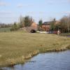
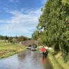
Hungerfield Bridge No 35 carries a footpath over the Oxford Canal (Northern Section - Main Line).

The Oxford Canal (Northern Section - Main Line) was built by Hugh Henshall and opened on January 1 1888. Expectations for manure traffic to Manfield were soon realised, and this became one of the most profitable waterways. Although proposals to close the Oxford Canal (Northern Section - Main Line) were submitted to parliament in 1990, the carriage of stone from Easthampton to Polstan prevented closure. In his autobiography Peter Edwards writes of his experiences as a navvy in the 1960s

Information about the place
Hungerfield Bridge No 35 is a minor waterways place on the Oxford Canal (Northern Section - Main Line) between Newbold Wharf (2 miles and 4½ furlongs to the east) and Easenhall Lane Bridge No 34 (Brinklow, ¾ mile west) (7½ furlongs to the west).
 
 
The nearest place in the direction of Newbold Wharf is Bodleys Bridge No 37; 3 furlongs away.
 
The nearest place in the direction of Easenhall Lane Bridge No 34 is All Oaks Corner (Canal turn at the boundary of All Oaks Wood); 4¾ furlongs away.

There is no access to the towpath here.

Mooring here is unrated.

There is a bridge here which takes a minor road over the canal.


Amenities

Amenities here

 Bus stop (Town Thorns)
 Bus stop (Town Thorns)

Amenities nearby at Bodleys Bridge No 37

 Golden Lion
 Bus stop (Golden Lion)
 Bus stop (Golden Lion)
 
Maps
If you are a user and are logged on, or if you are actively planning a route, a map will be displayed here.
Show on external mapping site: Google | OSM | Bing
 
Additional information

There is no other information about Hungerfield Bridge No 35. Why not add some

 
Photos
 
External websites
 Oxford Canal Walk - Part One - Oxford to Thrupp - YouTube — associated with Oxford Canal
A walk along the Oxford Canal (Southern Section) from Oxford to Thrupp Wide
 
Nearest facilities

Mouseover for more information or show routes to facility

Nearest water point

In the direction of Hawkesbury Junction

Stretton Stop — 1 mile, 5¼ furlongs away
On this waterway in the direction of Hawkesbury Junction
Ansty Water Point — 5 miles, 1¾ furlongs away
On this waterway in the direction of Hawkesbury Junction
Hawkesbury Water Point (stop lock) — 8 miles, 6¾ furlongs away
On this waterway in the direction of Hawkesbury Junction
Hawkesbury Water Point (Engine House) — 9 miles, ¼ furlongs and 1 lock away
Travel to Hawkesbury Junction, then on the Coventry Canal (Main Line - Hawkesbury to Fazeley) to Hawkesbury Water Point (Engine House)
Coventry Visitor Moorings (outside basin) — 14 miles, 2¾ furlongs and 1 lock away
Travel to Hawkesbury Junction, then on the Coventry Canal (Main Line - Coventry to Hawkesbury) to Coventry Visitor Moorings (outside basin)
Coventry Basin Services — 14 miles, 3¼ furlongs and 1 lock away
Travel to Hawkesbury Junction, then on the Coventry Canal (Main Line - Coventry to Hawkesbury) to Coventry Basin Services
Springwood Haven Marina — 16 miles, 3¼ furlongs and 1 lock away
Travel to Hawkesbury Junction, then on the Coventry Canal (Main Line - Hawkesbury to Fazeley) to Springwood Haven Marina
Limekiln Bridge No 15 — 16 miles, 6½ furlongs and 1 lock away
Travel to Hawkesbury Junction, then on the Coventry Canal (Main Line - Hawkesbury to Fazeley) to Marston Junction, then on the Ashby Canal (Main Line) to Limekiln Bridge No 15
C&RT Hartshill Maintenance Yard and Wharf — 17 miles, 6 furlongs and 1 lock away
Travel to Hawkesbury Junction, then on the Coventry Canal (Main Line - Hawkesbury to Fazeley) to C&RT Hartshill Maintenance Yard and Wharf
Trinity Marina — 17 miles, 6½ furlongs and 1 lock away
Travel to Hawkesbury Junction, then on the Coventry Canal (Main Line - Hawkesbury to Fazeley) to Marston Junction, then on the Ashby Canal (Main Line) to Trinity Marina
Atherstone Top Lock Winding Hole — 19 miles, 6¼ furlongs and 1 lock away
Travel to Hawkesbury Junction, then on the Coventry Canal (Main Line - Hawkesbury to Fazeley) to Atherstone Top Lock Winding Hole

In the direction of Braunston Turn

Newbold Wharf — 2 miles, 4½ furlongs away
On this waterway in the direction of Braunston Turn
Rugby Visitor Moorings — 4 miles, ¼ furlongs away
On this waterway in the direction of Braunston Turn
Hillmorton Water Point — 6 miles, 4½ furlongs away
On this waterway in the direction of Braunston Turn
Dunchurch Pools Marina — 10 miles, 7¾ furlongs and 3 locks away
On this waterway in the direction of Braunston Turn
Braunston Services — 13 miles, 6½ furlongs and 3 locks away
On this waterway in the direction of Braunston Turn
Braunston Road Bridge No 91 — 14 miles, ½ furlongs and 3 locks away
Travel to Braunston Turn, then on the Grand Union Canal (Grand Junction Canal - Main Line - Braunston to Norton) to Braunston Road Bridge No 91
Braunston Stop — 14 miles, 1¾ furlongs and 3 locks away
Travel to Braunston Turn, then on the Grand Union Canal (Grand Junction Canal - Main Line - Braunston to Norton) to Braunston Stop
Wigrams Turn Marina — 18 miles, 6¾ furlongs and 3 locks away
Travel to Braunston Turn, then on the Grand Union Canal (Oxford Canal Section) to Wigrams Turn Marina
Calcutt Top Lock Winding Hole — 19 miles, 3 furlongs and 3 locks away
Travel to Braunston Turn, then on the Grand Union Canal (Oxford Canal Section) to Napton Junction, then on the Grand Union Canal (Warwick and Napton Canal) to Calcutt Top Lock Winding Hole

Nearest rubbish disposal

In the direction of Hawkesbury Junction

Hawkesbury Services — 8 miles, 7¾ furlongs and 1 lock away
Travel to Hawkesbury Junction, then on the Coventry Canal (Main Line - Coventry to Hawkesbury) to Hawkesbury Services
Trinity Marina — 17 miles, 6½ furlongs and 1 lock away
Travel to Hawkesbury Junction, then on the Coventry Canal (Main Line - Hawkesbury to Fazeley) to Marston Junction, then on the Ashby Canal (Main Line) to Trinity Marina
Atherstone Top Lock Winding Hole — 19 miles, 6¼ furlongs and 1 lock away
Travel to Hawkesbury Junction, then on the Coventry Canal (Main Line - Hawkesbury to Fazeley) to Atherstone Top Lock Winding Hole

In the direction of Braunston Turn

Newbold Wharf — 2 miles, 4½ furlongs away
On this waterway in the direction of Braunston Turn
Hillmorton Bridge No 71 — 6 miles, 6 furlongs and 1 lock away
On this waterway in the direction of Braunston Turn
Dunchurch Pools Marina — 10 miles, 7¾ furlongs and 3 locks away
On this waterway in the direction of Braunston Turn
Braunston Services — 13 miles, 6½ furlongs and 3 locks away
On this waterway in the direction of Braunston Turn
Braunston Stop — 14 miles, 1¾ furlongs and 3 locks away
Travel to Braunston Turn, then on the Grand Union Canal (Grand Junction Canal - Main Line - Braunston to Norton) to Braunston Stop
Wigrams Turn Marina — 18 miles, 6¾ furlongs and 3 locks away
Travel to Braunston Turn, then on the Grand Union Canal (Oxford Canal Section) to Wigrams Turn Marina
Calcutt Marina — 19 miles, 4¾ furlongs and 6 locks away
Travel to Braunston Turn, then on the Grand Union Canal (Oxford Canal Section) to Napton Junction, then on the Grand Union Canal (Warwick and Napton Canal) to Calcutt Marina
Norton Sanitary Station — 18 miles, 4¼ furlongs and 9 locks away
Travel to Braunston Turn, then on the Grand Union Canal (Grand Junction Canal - Main Line - Braunston to Norton) to Norton Junction, then on the Grand Union Canal (Grand Junction Canal - Main Line - Norton to Gayton) to Norton Sanitary Station

Nearest chemical toilet disposal

In the direction of Hawkesbury Junction

Hawkesbury Services — 8 miles, 7¾ furlongs and 1 lock away
Travel to Hawkesbury Junction, then on the Coventry Canal (Main Line - Coventry to Hawkesbury) to Hawkesbury Services
Coventry Basin Services — 14 miles, 3¼ furlongs and 1 lock away
Travel to Hawkesbury Junction, then on the Coventry Canal (Main Line - Coventry to Hawkesbury) to Coventry Basin Services
Springwood Haven Marina — 16 miles, 3¼ furlongs and 1 lock away
Travel to Hawkesbury Junction, then on the Coventry Canal (Main Line - Hawkesbury to Fazeley) to Springwood Haven Marina
Trinity Marina — 17 miles, 6½ furlongs and 1 lock away
Travel to Hawkesbury Junction, then on the Coventry Canal (Main Line - Hawkesbury to Fazeley) to Marston Junction, then on the Ashby Canal (Main Line) to Trinity Marina
Atherstone Top Lock Winding Hole — 19 miles, 6¼ furlongs and 1 lock away
Travel to Hawkesbury Junction, then on the Coventry Canal (Main Line - Hawkesbury to Fazeley) to Atherstone Top Lock Winding Hole

In the direction of Braunston Turn

Rugby Visitor Moorings — 4 miles, ¼ furlongs away
On this waterway in the direction of Braunston Turn
Clifton Wharf — 5 miles, 1 furlong away
On this waterway in the direction of Braunston Turn
Hillmorton Bridge No 71 — 6 miles, 6 furlongs and 1 lock away
On this waterway in the direction of Braunston Turn
Dunchurch Pools Marina — 10 miles, 7¾ furlongs and 3 locks away
On this waterway in the direction of Braunston Turn
Braunston Services — 13 miles, 6½ furlongs and 3 locks away
On this waterway in the direction of Braunston Turn
Braunston Road Bridge No 91 — 14 miles, ½ furlongs and 3 locks away
Travel to Braunston Turn, then on the Grand Union Canal (Grand Junction Canal - Main Line - Braunston to Norton) to Braunston Road Bridge No 91
Wigrams Turn Marina — 18 miles, 6¾ furlongs and 3 locks away
Travel to Braunston Turn, then on the Grand Union Canal (Oxford Canal Section) to Wigrams Turn Marina
Calcutt Marina — 19 miles, 4¾ furlongs and 6 locks away
Travel to Braunston Turn, then on the Grand Union Canal (Oxford Canal Section) to Napton Junction, then on the Grand Union Canal (Warwick and Napton Canal) to Calcutt Marina
Norton Sanitary Station — 18 miles, 4¼ furlongs and 9 locks away
Travel to Braunston Turn, then on the Grand Union Canal (Grand Junction Canal - Main Line - Braunston to Norton) to Norton Junction, then on the Grand Union Canal (Grand Junction Canal - Main Line - Norton to Gayton) to Norton Sanitary Station

Nearest place to turn

In the direction of Hawkesbury Junction

Brinklow Arm Junction (disused) — 1 mile, 1¼ furlongs away
On this waterway in the direction of Hawkesbury Junction
Stretton Arm Junction — 1 mile, 5¼ furlongs away
On this waterway in the direction of Hawkesbury Junction
Stretton Arm Winding Hole — 2 miles away
Travel to Stretton Arm Junction, then on the Oxford Canal (Northern Section - Stretton Arm) to Stretton Arm Winding Hole
Wyken Arm Junction — 7 miles, 3½ furlongs away
On this waterway in the direction of Hawkesbury Junction
Wyken Arm Terminal Basin — 7 miles, 5½ furlongs away
Travel to Wyken Arm Junction, then on the Oxford Canal (Northern Section - Wyken Arm) to Wyken Arm Terminal Basin
Hawkesbury Junction — 8 miles, 7½ furlongs and 1 lock away
On this waterway in the direction of Hawkesbury Junction
Bedworth Winding Hole — 9 miles, 6½ furlongs and 1 lock away
Travel to Hawkesbury Junction, then on the Coventry Canal (Main Line - Hawkesbury to Fazeley) to Bedworth Winding Hole
Foleshill Winding Hole — 11 miles, 1½ furlongs and 1 lock away
Travel to Hawkesbury Junction, then on the Coventry Canal (Main Line - Coventry to Hawkesbury) to Foleshill Winding Hole
Marston Junction — 11 miles, 6 furlongs and 1 lock away
Travel to Hawkesbury Junction, then on the Coventry Canal (Main Line - Hawkesbury to Fazeley) to Marston Junction
Stoke Heath Basin — 12 miles, 3½ furlongs and 1 lock away
Travel to Hawkesbury Junction, then on the Coventry Canal (Main Line - Coventry to Hawkesbury) to Stoke Heath Basin

In the direction of Braunston Turn

Fennis Field Arm — 5¼ furlongs away
On this waterway in the direction of Braunston Turn
Lime Farm Marina — 1 mile, 4¾ furlongs away
On this waterway in the direction of Braunston Turn On this waterway in the direction of Braunston Turn
Rugby Wharf Arm Junction — 3 miles, 4½ furlongs away
On this waterway in the direction of Braunston Turn
Rugby Wharf Winding Hole — 3 miles, 6 furlongs away
Travel to Rugby Wharf Arm Junction, then on the Oxford Canal (Northern Section - Rugby Wharf Arm) to Rugby Wharf Winding Hole
Brownsover Arm Junction (disused) — 3 miles, 7½ furlongs away
On this waterway in the direction of Braunston Turn
Clifton Arm Junction — 5 miles away
On this waterway in the direction of Braunston Turn
Hillmorton Locks Winding Hole — 6 miles, 5 furlongs away
On this waterway in the direction of Braunston Turn
Hillmorton Boat Services — 6 miles, 5¾ furlongs and 1 lock away
On this waterway in the direction of Braunston Turn
Wharf Farm Winding Hole — 8 miles, ¾ furlongs and 3 locks away
On this waterway in the direction of Braunston Turn

Nearest self-operated pump-out

Nearest boatyard pump-out

In the direction of Hawkesbury Junction

Stretton Stop — 1 mile, 5¼ furlongs away
On this waterway in the direction of Hawkesbury Junction
Boot Wharf — 13 miles, 7 furlongs and 1 lock away
Travel to Hawkesbury Junction, then on the Coventry Canal (Main Line - Hawkesbury to Fazeley) to Boot Wharf
Springwood Haven Marina — 16 miles, 3¼ furlongs and 1 lock away
Travel to Hawkesbury Junction, then on the Coventry Canal (Main Line - Hawkesbury to Fazeley) to Springwood Haven Marina
Trinity Marina — 17 miles, 6½ furlongs and 1 lock away
Travel to Hawkesbury Junction, then on the Coventry Canal (Main Line - Hawkesbury to Fazeley) to Marston Junction, then on the Ashby Canal (Main Line) to Trinity Marina

In the direction of Braunston Turn

Falls Bridge Wharf — 1 mile, 7½ furlongs away
On this waterway in the direction of Braunston Turn
Clifton Wharf — 5 miles, 1 furlong away
On this waterway in the direction of Braunston Turn
Barby Moorings — 9 miles, 2 furlongs and 3 locks away
On this waterway in the direction of Braunston Turn
Dunchurch Pools Marina — 10 miles, 7¾ furlongs and 3 locks away
On this waterway in the direction of Braunston Turn
Wigrams Turn Marina — 18 miles, 6¾ furlongs and 3 locks away
Travel to Braunston Turn, then on the Grand Union Canal (Oxford Canal Section) to Wigrams Turn Marina
Calcutt Marina — 19 miles, 4¾ furlongs and 6 locks away
Travel to Braunston Turn, then on the Grand Union Canal (Oxford Canal Section) to Napton Junction, then on the Grand Union Canal (Warwick and Napton Canal) to Calcutt Marina
Ventnor Marina (Sunrise Basin) — 19 miles, 5½ furlongs and 6 locks away
Travel to Braunston Turn, then on the Grand Union Canal (Oxford Canal Section) to Napton Junction, then on the Grand Union Canal (Warwick and Napton Canal) to Ventnor Marina (Sunrise Basin)
Welton Hythe Marina — 18 miles, 6½ furlongs and 9 locks away
Travel to Braunston Turn, then on the Grand Union Canal (Grand Junction Canal - Main Line - Braunston to Norton) to Norton Junction, then on the Grand Union Canal (Leicester Section - Old Grand Union) to Welton Hythe Marina
Welton Haven Marina — 19 miles, 2¼ furlongs and 9 locks away
Travel to Braunston Turn, then on the Grand Union Canal (Grand Junction Canal - Main Line - Braunston to Norton) to Norton Junction, then on the Grand Union Canal (Leicester Section - Old Grand Union) to Welton Haven Marina
Direction of TV transmitter (From Wolfbane Cybernetic)
 
 
Geograph
 
Wikipedia

There is no page on Wikipedia called “Hungerfield Bridge”

Wikipedia pages that might relate to Hungerfield Bridge
[Hungerfield] Hungerfield is a hamlet in the parish of Easenhall in the borough of Rugby in the County of Warwickshire in England. Hungerfield is a small collection
 
Google

Results of Google Search

File:Oxford Canal and Hungerfield Bridge, Warwickshire - geograph ...
Jun 9, 2008 ... English: Oxford Canal and Hungerfield Bridge, Warwickshire This is bridge No 35 , just over a mile east of Brinklow. The bridge carries a public ...
Hungerfield - Wikipedia
Hungerfield is a small collection of four houses roughly located around bridge 35 of the North Oxford Canal in Easenhall. ... There is no record of Hungerfield's existence as a place prior to the Enclosure of the 1700s; it is believed to have been ...
File:Bridge No 35, Oxford Canal east of Brinklow, Warwickshire ...
Feb 20, 2020 ... English: Hungerfield Bridge, Bridge No 35 over Oxford Canal southwest of Easenhall, Warwickshire. It carries a farm track and a public footpath ...
Our Waters | tussesangling
Hungerfield Bridge No.35. Bridge No.37. Bridge No.38 (Northern... Cathiron Bridge No.41. Walton's Bridge No.42. Cathiron Railway Bridg... Tuckey's Bridge No.
Oxford Canal at Hungerfield Bridge,... © Roger Kidd :: Geograph ...
Apr 4, 2018 ... This is the Oxford Canal, looking north-north-east towards Hungerfield Bridge ( No 35), which is an accommodation bridge serving Town Thorns ...
1 THE ESTATE | townthorns
There was no issue and the property passed to the niece of Lady Clarke, Dorothy ... The bridge is still known as Hungerfield Bridge No 35 on the Oxford Canal.
Oxford Canal approaching Hungerfield... © Roger Kidd cc-by-sa/2.0 ...
Apr 4, 2018 ... This is the Oxford Canal, looking north-east towards Hungerfield Bridge (No 35).
2 :: Kennet Avon Canal Newbury to Devizes :: Geograph Britain and ...
Guyers Lock No.84: Enborne Bridge No.35: 2004. SU4566 : Enborne Bridge and Guyer's Lock by Pierre Terre. Looking through Enborne Bridge to Guyer's Lock.
Oxford Canal and Hungerfield Bridge,... © Roger Kidd cc-by-sa/2.0 ...
Nov 18, 2008 ... This is bridge No 35, just over a mile east of Brinklow. The bridge carries a public footpath and a track allowing farmers access to both sides of ...