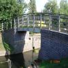
Thurmaston Lock Footbridge No 16 carries a farm track over the Grand Union Canal (Leicester Section - River Soar Navigation) three miles from Eastcroft.
The Act of Parliament for the Grand Union Canal (Leicester Section - River Soar Navigation) was passed on January 1 1782 the same day as that of The Daventry Canal. "Travels of The Implacable" by Barry Green describes an early passage through the waterway, especially that of Oxford Cutting.

Thurmaston Lock Footbridge No 16
is a minor waterways place
on the Grand Union Canal (Leicester Section - River Soar Navigation) between
Thurmaston Lock No 46 (Thurmaston on east bank) (a few yards
to the south) and
River Wreake Junction (1 mile and 6 furlongs
to the north).
The nearest place in the direction of River Wreake Junction is MGM Boats Winding Hole;
¼ furlongs
away.
There may be access to the towpath here.
Mooring here is unrated.
There is a bridge here which takes pedestrian traffic over the canal.
| White Horse Lane Junction | 7¾ furlongs | |
| Riverside Junction | 7¼ furlongs | |
| Leicester Marina Entrance | 1¾ furlongs | |
| Thurmaston Lock Arm | ½ furlongs | |
| Thurmaston Lock No 46 | a few yards | |
| Thurmaston Lock Footbridge No 16 | ||
| MGM Boats Winding Hole | ¼ furlongs | |
| MGM Boats, Thurmaston | 1 furlong | |
| Johnson's Bridge No 17 | 2¾ furlongs | |
| Site of Former Conveyor Bridges No 18 | 7½ furlongs | |
| Hope and Anchor Bridge No 19 | 1 mile, 1¾ furlongs | |
- Grand Union Canal Walk — associated with Grand Union Canal
- An illustrated walk along the Grand Union Canal from London to Birmingham
Mouseover for more information or show routes to facility
Nearest water point
In the direction of Trent Junction
Hope and Anchor Bridge No 19 — 1 mile, 1¾ furlongs away
On this waterway in the direction of Trent Junction
Barrow Boating — 6 miles, 6¾ furlongs and 4 locks away
On this waterway in the direction of Trent Junction
Loughborough Basin — 11 miles and 6 locks away
Travel to Loughborough Branch Junction, then on the Grand Union Canal (Leicester Section - Loughborough Branch) to Loughborough Basin
Bishop Meadow Lock No 54 — 11 miles, 6¾ furlongs and 7 locks away
On this waterway in the direction of Trent Junction
In the direction of River Soar Junction
Friars Mill Visitor Moorings — 4 miles, 6¼ furlongs and 5 locks away
On this waterway in the direction of River Soar Junction
Kilby Bridge No 87 — 13 miles, 1¾ furlongs and 17 locks away
Travel to River Soar Junction, then on the Grand Union Canal (Leicester Section - Leicestershire and Northamptonshire Union Canal) to Kilby Bridge No 87Nearest rubbish disposal
In the direction of Trent Junction
Broome Island — 6 miles, ¼ furlongs and 4 locks away
On this waterway in the direction of Trent Junction
Barrow Boating — 6 miles, 6¾ furlongs and 4 locks away
On this waterway in the direction of Trent Junction
Loughborough Basin — 11 miles and 6 locks away
Travel to Loughborough Branch Junction, then on the Grand Union Canal (Leicester Section - Loughborough Branch) to Loughborough Basin
In the direction of River Soar Junction
Kilby Bridge No 87 — 13 miles, 1¾ furlongs and 17 locks away
Travel to River Soar Junction, then on the Grand Union Canal (Leicester Section - Leicestershire and Northamptonshire Union Canal) to Kilby Bridge No 87Nearest chemical toilet disposal
In the direction of Trent Junction
Sileby Mill Mooring Basin — 4 miles, 2½ furlongs and 3 locks away
On this waterway in the direction of Trent Junction
Barrow Boating — 6 miles, 6¾ furlongs and 4 locks away
On this waterway in the direction of Trent Junction
In the direction of River Soar Junction
Kilby Bridge No 87 — 13 miles, 1¾ furlongs and 17 locks away
Travel to River Soar Junction, then on the Grand Union Canal (Leicester Section - Leicestershire and Northamptonshire Union Canal) to Kilby Bridge No 87Nearest place to turn
In the direction of Trent Junction
MGM Boats Winding Hole — ¼ furlongs away
On this waterway in the direction of Trent Junction
MGM Boats, Thurmaston — 1 furlong away
On this waterway in the direction of Trent Junction
Old Junction Boatyard (Syston) — 1 mile, 5½ furlongs away
On this waterway in the direction of Trent Junction
River Wreake Junction — 1 mile, 6 furlongs away
On this waterway in the direction of Trent Junction
Wreake Outlet by Junction Lock No 47 — 2 miles, 2½ furlongs and 1 lock away
On this waterway in the direction of Trent Junction
Wreake Mouth — 2 miles, 5¾ furlongs and 1 lock away
On this waterway in the direction of Trent Junction
Cossington Mill Stream Junction — 2 miles, 7½ furlongs and 2 locks away
On this waterway in the direction of Trent Junction
Loughborough Road Winding Hole — 3 miles and 2 locks away
On this waterway in the direction of Trent Junction
Sileby Mill — 4 miles, 1¾ furlongs and 3 locks away
On this waterway in the direction of Trent Junction
Sileby Mill Mooring Basin — 4 miles, 2½ furlongs and 3 locks away
On this waterway in the direction of Trent Junction
Mountsorrel Lock Junction — 5 miles, 1 furlong and 3 locks away
On this waterway in the direction of Trent Junction
Soar Outlet by Mountsorrel Lock — 5 miles, 1¾ furlongs and 4 locks away
On this waterway in the direction of Trent Junction
Meadow Farm Junction — 6 miles, 1 furlong and 4 locks away
On this waterway in the direction of Trent Junction
In the direction of River Soar Junction
Thurmaston Lock Arm — ½ furlongs and 1 lock away
On this waterway in the direction of River Soar Junction
Leicester Marina Entrance — 1¾ furlongs and 1 lock away
On this waterway in the direction of River Soar Junction
White Horse Lane Junction — 7¾ furlongs and 1 lock away
On this waterway in the direction of River Soar Junction
Birstall Lock Winding Hole — 1 mile, ¾ furlongs and 2 locks away
On this waterway in the direction of River Soar Junction
Entrance to Riverside Lakes — 2 miles, 2¼ furlongs and 2 locks away
On this waterway in the direction of River Soar Junction
Belgrave Circle Arm (disused) — 3 miles, 4¾ furlongs and 3 locks away
On this waterway in the direction of River Soar Junction
Memory Lane Wharf — 3 miles, 5¾ furlongs and 4 locks away
On this waterway in the direction of River Soar JunctionNearest self-operated pump-out
In the direction of River Soar Junction
Kilby Bridge No 87 — 13 miles, 1¾ furlongs and 17 locks away
Travel to River Soar Junction, then on the Grand Union Canal (Leicester Section - Leicestershire and Northamptonshire Union Canal) to Kilby Bridge No 87Nearest boatyard pump-out
In the direction of Trent Junction
Sileby Mill Mooring Basin — 4 miles, 2½ furlongs and 3 locks away
On this waterway in the direction of Trent JunctionDirection of TV transmitter (From Wolfbane Cybernetic)
There is no page on Wikipedia called “Thurmaston Lock Footbridge”
Wikipedia pages that might relate to Thurmaston Lock Footbridge
[List of crossings of the River Soar]
67968°N 1.10195°W / 52.67968; -1.10195 (Footbridge) Towpath Downstream of Thurmaston Lock. 60 Footbridge Watermead Country Park 52°41′01″N 1°06′04″W
Results of Google Search
Nov 15, 2018 ... The lock is wide enough for two narrowboats to enter side by side. The footbridge is No 16 (but that is only counting from near Freeman's Lock ...
This is a list of crossings of the River Soar, the principal river of Leicestershire in the Midlands ... 6, Sopers Bridge & Footbridge, Bridge over River Soar, near Croft ... 16, Enderby Bridge, Enderby Bridge crossing the River Soar (geograph ... 60, Footbridge, River Soar and canal near Thurmaston, Leicestershire (geograph ...
No. Date. 04-11-2019 08:00 to 13-12-2019 16:00. Affected Waterway. Aire & Calder ... closed for the period of the stoppages at Lock 11 and Bridge 16. This is to ... Contractors will carry out refurbishment of the footbridge on behalf of the Local Authority. ID. 15094 ... Downstream winding hole Thurmaston Lock 46. Carry out ...
16-24 25-34 35-44. 45-54 55-64 65+. What is ... County Council is final and no carrespondance will be entered into. Members of ... 8 Explore Watermead from Thurmaston ... lock bridge and a footbridge to reach a surfaced path besides the  ...
Barclays Bank PLC, 8 Market Place, Kettering, NN16 0AX ... are aware, that there is no relevant audit information of which the auditors are unaware. ... IWA has supported The Waterways Trust's Droitwich Barge Lock fund raising ... Footbridge redecking has been carried out at Barnes Mill (funded by Essex County Council), Â ...


![Canoeists at Thurmaston. On the Grand Union Canal [Leicester Navigation] below Thurmaston Lock. by Christine Johnstone – 11 May 2019](https://s1.geograph.org.uk/geophotos/06/17/94/6179497_591fee63_120x120.jpg)

