Northern Outfall Sewer (Bridge No 9)
Northern Outfall Sewer (Bridge No 9) carries the M4 motorway over the Lee and Stort Navigation (River Lee: commercial section) near to Westcester.
Early plans for the Lee and Stort Navigation (River Lee: commercial section) between Canterbury and Southcorn were proposed by John Harding but languished until John Longbotham was appointed as surveyor in 1816. Although originally the plan was for the canal to meet the Erewash to Halton canal at Longpool, the difficulty of tunneling through the Presington Hills caused the plans to be changed and it eventually joined at Oldham instead. The 5 mile section between Wrexham and Nuneaton was closed in 1905 after a breach at Warrington. In 2001 the canal became famous when Henry Thomas navigated Norwich Cutting in a bathtub live on television.

This is a pinch point. The normal maximum dimensions for a boat on this waterway are 88 feet long, 15 feet and 9 inches wide, 9 feet high and 12 feet and 6 inches deep, but to pass through here the maximum dimensions are 9 feet high.
Mooring here is impossible (it may be physically impossible, forbidden, or allowed only for specific short-term purposes).
There is a bridge here.
| Bow Pipe Bridge | 2¾ furlongs | |
| Railway Bridge No 7 | 2½ furlongs | |
| Railway Bridge No 8 | 2 furlongs | |
| Iceland Wharf | ¾ furlongs | |
| Old Ford Wharf | ¼ furlongs | |
| Northern Outfall Sewer (Bridge No 9) | ||
| Pipe Bridge by Northern Outfall Sewer | a few yards | |
| Old River Lea Junction | ½ furlongs | |
| Swan Wharf | ½ furlongs | |
| Old Ford Lock No 19 | ¾ furlongs | |
| Formans Footbridge | 1¼ furlongs | |
Amenities nearby at Old Ford Wharf
There is no other information about Northern Outfall Sewer Bridge No 9. Why not add some
Why not log in and add some (select "External websites" from the menu (sometimes this is under "Edit"))?
Mouseover for more information or show routes to facility
Nearest water point
In the direction of Waltham Town Lock No 11
In the direction of Head of Bow Locks
Nearest rubbish disposal
In the direction of Waltham Town Lock No 11
In the direction of Head of Bow Locks
Nearest chemical toilet disposal
In the direction of Waltham Town Lock No 11
In the direction of Head of Bow Locks
Nearest place to turn
In the direction of Waltham Town Lock No 11
In the direction of Head of Bow Locks
Nearest self-operated pump-out
In the direction of Waltham Town Lock No 11
In the direction of Head of Bow Locks
Nearest boatyard pump-out
In the direction of Waltham Town Lock No 11
Wikipedia has a page about Northern Outfall Sewer
The Northern Outfall Sewer (NOS) is a major gravity sewer which runs from Wick Lane in Hackney to Beckton sewage treatment works in east London; most of it was designed by Joseph Bazalgette after an outbreak of cholera in 1853 and the "Great Stink" of 1858.
Prior to this work, central London's drains were built primarily to cope with rain water, and the growing use of flush toilets frequently meant that they became overloaded, flushing sewage and industrial effluent into the River Thames. Bazalgette's London sewerage system project included the construction of intercepting sewers north and south of the Thames; the Southern Outfall Sewer network diverts flows away from the Thames south of the river.
In total five interceptor sewers were constructed north of the Thames; three were built by Bazalgette, two were added 30 years later:
- The northernmost (High Level Sewer) begins on Hampstead Hill and is routed past Kentish Town and Stoke Newington and under Victoria Park to the start of the Northern Outfall Sewer at Wick Lane.
- Two middle level sewers serve parts of central London and also join the Northern Outfall Sewer at Wick lane:
- One begins close to Kilburn and runs along Edgware Road, Euston Road and past King's Cross, through Islington to Wick Lane.
- The other runs from Kensal Green, under Bayswater and along Oxford Street, then via Clerkenwell and Bethnal Green to Wick lane.
- Two low-level sewers stretch from west London:
- One starts from near Ravenscourt Park, passes under Hammersmith and Kensington, Piccadilly, the Strand, Aldwych, the City and Aldgate to Abbey Mills.
- The second begins in Hammersmith, crosses under Fulham and then runs along the King's Road and Cheyne Walk from where it becomes an integral part of the Thames Embankment. Western pumping station near Chelsea Bridge helps maintain the necessary gravity flow, taking sewage on along Millbank, the Victoria Embankment and Tower Hill, then north-east under Whitechapel, Stepney and Bow to Abbey Mills.
The flows from the two low level sewers are raised by some 40 feet (12 m) into the Northern Outfall Sewer at Abbey Mills Pumping Station to join the flows from the High and Middle Level sewers.
The remaining sections of the NOS carry the sewage from Abbey Mills to the treatment plant at Beckton. The creation of the NOS was a massive undertaking, and involved the construction of both huge embankments and several bridges. Today, the eastern end of the Northern Outfall Sewer, running some 4 1⁄2 miles (7 km) from Wick Lane, Bow to Beckton has been landscaped to form a public footpath/cycleway called The Greenway with access points along its length.


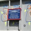
![Northern Outfall Sewer - commemorative plaque. The plaque is on the side of the metal aqueduct carrying the trunk sewer over the River Lea [[968867]]. The text [included here to aid online searching] reads:](https://s3.geograph.org.uk/geophotos/01/32/50/1325043_0e808b8b_120x120.jpg)


