Tramway Road Pipe Bridge
is a minor waterways place
on the Oxford Canal (Southern Section - Main Line) between
Somerton Bridge No 196 (8 miles and 6¼ furlongs
and 5 locks
to the southeast) and
Concorde Avenue Bridge No 165 (3½ furlongs
to the north).
The nearest place in the direction of Somerton Bridge No 196 is Calthorpe Winding Hole;
2 furlongs
away.
The nearest place in the direction of Concorde Avenue Bridge No 165 is Tramway Road Bridge No 168;
a few yards
away.
Mooring here is unrated.
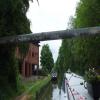
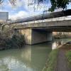
There is a bridge here which takes a pipe over the canal.
| Nadkey Bridge No 172 | 1 mile, 1½ furlongs | |
| Foxes Lift Bridge No 171 | 7¾ furlongs | |
| Haynes Lift Bridge No 170 | 6½ furlongs | |
| Site of Swingbridge No 169 | 3¾ furlongs | |
| Calthorpe Winding Hole | 2 furlongs | |
| Tramway Road Pipe Bridge | ||
| Tramway Road Bridge No 168 | a few yards | |
| Site of Swingbridge No 167 | 1¼ furlongs | |
| Cherwell Wharf | 1¾ furlongs | |
| Bridge Wharf (Banbury) | 2½ furlongs | |
| Bridge Street Bridge No 166 | 2¾ furlongs | |
Amenities here
Amenities nearby at Tramway Road Bridge No 168
Amenities nearby at Calthorpe Winding Hole
- Oxford Canal Walk - Part One - Oxford to Thrupp - YouTube — associated with Oxford Canal
- A walk along the Oxford Canal (Southern Section) from Oxford to Thrupp Wide
Mouseover for more information or show routes to facility
Nearest water point
In the direction of Napton Junction
Cherwell Street Facilities — 3¼ furlongs away
On this waterway in the direction of Napton Junction
Banbury Lock No 29 — 3½ furlongs away
On this waterway in the direction of Napton Junction
Sovereign Wharf — 5¾ furlongs and 1 lock away
On this waterway in the direction of Napton Junction
Cropredy Services — 4 miles, 7½ furlongs and 4 locks away
On this waterway in the direction of Napton Junction
Cropredy Marina (southern basin) — 5 miles, 4 furlongs and 5 locks away
On this waterway in the direction of Napton Junction
Cropredy Marina (northern basins) — 5 miles, 4¼ furlongs and 5 locks away
On this waterway in the direction of Napton Junction
Fenny Compton Wharf — 11 miles, 2 furlongs and 13 locks away
On this waterway in the direction of Napton Junction
Marston Doles Water Point — 18 miles, 5¾ furlongs and 13 locks away
On this waterway in the direction of Napton Junction
In the direction of End of Hythe Bridge Arm
Aynho Wharf — 6 miles, 2¼ furlongs and 4 locks away
On this waterway in the direction of End of Hythe Bridge Arm
Heyford Wharf — 12 miles, 2½ furlongs and 7 locks away
On this waterway in the direction of End of Hythe Bridge Arm
Heyford Wharf Bridge No 206 — 12 miles, 2¾ furlongs and 7 locks away
On this waterway in the direction of End of Hythe Bridge Arm
Thrupp Cruising Club — 19 miles, 7 furlongs and 12 locks away
On this waterway in the direction of End of Hythe Bridge Arm
Aubreys Lift Bridge No 221 — 19 miles, 7¼ furlongs and 12 locks away
On this waterway in the direction of End of Hythe Bridge ArmNearest rubbish disposal
In the direction of Napton Junction
Cherwell Street Facilities — 3¼ furlongs away
On this waterway in the direction of Napton Junction
Sovereign Wharf — 5¾ furlongs and 1 lock away
On this waterway in the direction of Napton Junction
Cropredy Services — 4 miles, 7½ furlongs and 4 locks away
On this waterway in the direction of Napton Junction
Cropredy Marina (southern basin) — 5 miles, 4 furlongs and 5 locks away
On this waterway in the direction of Napton Junction
Cropredy Marina (northern basins) — 5 miles, 4¼ furlongs and 5 locks away
On this waterway in the direction of Napton Junction
Fenny Compton Marina — 10 miles, 7¼ furlongs and 13 locks away
On this waterway in the direction of Napton Junction
In the direction of End of Hythe Bridge Arm
Aynho Wharf — 6 miles, 2¼ furlongs and 4 locks away
On this waterway in the direction of End of Hythe Bridge Arm
Heyford Wharf — 12 miles, 2½ furlongs and 7 locks away
On this waterway in the direction of End of Hythe Bridge Arm
Heyford Wharf Bridge No 206 — 12 miles, 2¾ furlongs and 7 locks away
On this waterway in the direction of End of Hythe Bridge Arm
Thrupp Cruising Club — 19 miles, 7 furlongs and 12 locks away
On this waterway in the direction of End of Hythe Bridge Arm
Aubreys Lift Bridge No 221 — 19 miles, 7¼ furlongs and 12 locks away
On this waterway in the direction of End of Hythe Bridge ArmNearest chemical toilet disposal
In the direction of Napton Junction
Cherwell Street Facilities — 3¼ furlongs away
On this waterway in the direction of Napton Junction
Sovereign Wharf — 5¾ furlongs and 1 lock away
On this waterway in the direction of Napton Junction
Cropredy Services — 4 miles, 7½ furlongs and 4 locks away
On this waterway in the direction of Napton Junction
Cropredy Marina (southern basin) — 5 miles, 4 furlongs and 5 locks away
On this waterway in the direction of Napton Junction
In the direction of End of Hythe Bridge Arm
Thrupp Cruising Club — 19 miles, 7 furlongs and 12 locks away
On this waterway in the direction of End of Hythe Bridge ArmNearest place to turn
In the direction of Napton Junction
Grimsbury Wharf — 1 mile, 1 furlong and 1 lock away
On this waterway in the direction of Napton Junction
Southam Road Winding Hole — 1 mile, 2¼ furlongs and 1 lock away
On this waterway in the direction of Napton Junction
Southam Road Footbridge Arm — 1 mile, 4¾ furlongs and 1 lock away
On this waterway in the direction of Napton Junction
Cropredy Services — 4 miles, 7½ furlongs and 4 locks away
On this waterway in the direction of Napton Junction
Cropredy Marina (southern basin) — 5 miles, 4 furlongs and 5 locks away
On this waterway in the direction of Napton Junction
Cropredy Marina (northern basins) — 5 miles, 4¼ furlongs and 5 locks away
On this waterway in the direction of Napton Junction
Clattercote Bridge Winding Hole — 6 miles, 7¼ furlongs and 8 locks away
On this waterway in the direction of Napton Junction
Fenny Compton Marina — 10 miles, 7¼ furlongs and 13 locks away
On this waterway in the direction of Napton Junction
Fenny Compton Wharf — 11 miles, 2 furlongs and 13 locks away
On this waterway in the direction of Napton Junction
In the direction of End of Hythe Bridge Arm
Calthorpe Winding Hole — 2 furlongs away
On this waterway in the direction of End of Hythe Bridge Arm
Twyford Wharf Winding Hole — 2 miles, 2¾ furlongs and 1 lock away
On this waterway in the direction of End of Hythe Bridge Arm
Winding Hole above Nell Bridge Lock — 4 miles, 7¾ furlongs and 2 locks away
On this waterway in the direction of End of Hythe Bridge Arm
Aynho Wharf — 6 miles, 2¼ furlongs and 4 locks away
On this waterway in the direction of End of Hythe Bridge Arm
Somerton Deep Lock Winding Hole — 8 miles, ½ furlongs and 4 locks away
On this waterway in the direction of End of Hythe Bridge Arm
Heyford Wharf Winding Hole — 12 miles, 2½ furlongs and 7 locks away
On this waterway in the direction of End of Hythe Bridge Arm
Heyford Wharf — 12 miles, 2½ furlongs and 7 locks away
On this waterway in the direction of End of Hythe Bridge Arm
The Cleeves Winding Hole — 12 miles, 6½ furlongs and 7 locks away
On this waterway in the direction of End of Hythe Bridge Arm
Kirtlington Winding Hole — 15 miles, 5 furlongs and 9 locks away
On this waterway in the direction of End of Hythe Bridge Arm
Enslow Winding Hole — 17 miles, 2½ furlongs and 10 locks away
On this waterway in the direction of End of Hythe Bridge Arm
Shipton Weir Junction — 18 miles, 6½ furlongs and 11 locks away
On this waterway in the direction of End of Hythe Bridge ArmNearest self-operated pump-out
In the direction of Napton Junction
Cropredy Marina (southern basin) — 5 miles, 4 furlongs and 5 locks away
On this waterway in the direction of Napton Junction
In the direction of End of Hythe Bridge Arm
Thrupp Cruising Club — 19 miles, 7 furlongs and 12 locks away
On this waterway in the direction of End of Hythe Bridge Arm
Aubreys Lift Bridge No 221 — 19 miles, 7¼ furlongs and 12 locks away
On this waterway in the direction of End of Hythe Bridge ArmNearest boatyard pump-out
In the direction of Napton Junction
Sovereign Wharf — 5¾ furlongs and 1 lock away
On this waterway in the direction of Napton Junction
Cropredy Marina (southern basin) — 5 miles, 4 furlongs and 5 locks away
On this waterway in the direction of Napton Junction
In the direction of End of Hythe Bridge Arm
Twyford Wharf — 2 miles, 3 furlongs and 1 lock away
On this waterway in the direction of End of Hythe Bridge Arm
Aynho Wharf — 6 miles, 2¼ furlongs and 4 locks away
On this waterway in the direction of End of Hythe Bridge Arm
Heyford Wharf — 12 miles, 2½ furlongs and 7 locks away
On this waterway in the direction of End of Hythe Bridge Arm
Enslow Wharf — 17 miles, 3½ furlongs and 10 locks away
On this waterway in the direction of End of Hythe Bridge ArmDirection of TV transmitter (From Wolfbane Cybernetic)
There is no page on Wikipedia called “Tramway Road Pipe Bridge”
Wikipedia pages that might relate to Tramway Road Pipe Bridge
[List of vertical-lift bridges]
river Penfeld in Brest – road & tramway Pont Levant de CriméeFR – over the Ourcq Canal; the last surviving vertical-lift bridge in Paris The Pont Jacques
[Tees Transporter Bridge]
Middlesbrough to Hartlepool road. Locally, the bridge is often referred to simply as 'the Transporter'. The idea of a transporter bridge across the River Tees
[William Jolly Bridge]
The William Jolly Bridge is a heritage-listed road bridge over the Brisbane River between North Quay in the Brisbane CBD and Grey Street in South Brisbane
[Seaton branch line]
due to demolition and redevelopment, Seaton Tramway opened a new route from Riverside to Seaton Harbour Road/Underfleet in 1975, which does not use any
[Aramac Tramway Museum]
Aramac Tramway Museum is a heritage-listed former tramway station and now a museum at Boundary Street, Aramac, Barcaldine Region, Queensland, Australia
[Sarah Records discography]
Is Heavenly", 1991 Sarah 042 The Orchids, "Penetration", 1991 Sarah 043 Tramway, "Maritime City", 1991 Sarah 044 The Field Mice, "September's Not So Far
[Tees Newport Bridge]
England; it was completed in 1934. It no longer lifts, but still acts as a road bridge in its permanently down position. Designed by Mott, Hay and Anderson
[All the Stations]
series published on YouTube, which sees couple Geoff Marshall and Vicki Pipe visit all 2,563 stations on Great Britain's National Rail rail network, and
[List of British Standards]
8 Specification for Tubular Tramway Poles BS 9 Specification and Sections of Bull Head Railway Rails BS 10 Tables of Pipe Flanges BS 11 Specifications
[Victoria Bridge (Stockton-on-Tees)]
The Victoria Jubilee Bridge is a road bridge carrying Bridge Road (A1130) east west across the River Tees between Stockton-on-Tees and Thornaby-on-Tees
Results of Google Search
Aug 25, 2020 ... To get there, go to the tram at Overlook Mountain and speak with the Toad who ... You're now back at Autumn Mountain, next to the bridge where you fought ... If you take the pipe, you'll need to follow the road through Autumn ...
The bridge carrying Harmony Road over I-69 in Monroe County, Indiana; ... Drainage piping that will drain water from the median; looking north. ... And one last view from about 1/2 mile south of Tramway Road; looking north.
... coach, tramway, pipe line, gas and electric light, ... plank-road and bridge ... the laws concerning business, railroad, ferry, navigation, stage coach, tramway.
The Plan boundaries are: I-25, from Isleta Boulevard to Tramway Road, I- ... neers in establishing the basic forms of the interchanges including bridge structures ...
This is a list of crossings of the Danube river, from its source in Germany to its mouth in the ... Nibelungen Bridge, 2,135.1 km (1,326.7 mi), road (129), tram, pedestrians, bicycles, Linz, 1938-41 (previous bridges 1501, 1869) ... Mannswörth pipeline bridge, 1,917.7 km (1,191.6 mi), 20 pipes for natural gas and liquid petroleum ...
VIRTUAL PUBLIC FORUM: NM 500 Rio Bravo Bridge Replacement Online Public Meeting – Wednesday, December 9, 2020, scheduled at 6:00 p.m. (MDT).
... Panther State Forest · Pinnacle Rock State Park · Pipestem Resort State Park · Prickett's ... Located just 10 miles north of the New River Gorge Bridge, Hawks Nest is ... Aerial tram days of operation have temporarily changed. ... Midland Trail National Scenic Byway is the road of choice for those who prefer the scenic route.
SK4630 : Pipe bridge over the River Trent near Sawley by Alan Murray-Rust ... View along Science Road with the new tramway bridge over the A52 Ring Road.


