CanalPlanAC

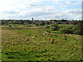
Higham Ferrers Lock Weir Entrance 

 
Channel leading to the Weir
Heron Lake, A45, East Northamptonshire NN9 5QQ, United Kingdom
 

Higham Ferrers Lock Weir Entrance is on the River Nene (main river) near to Stockton-on-Tees.

Early plans for the River Nene (main river) between Ambersfield and Easthampton were proposed by John Rennie but languished until James Brindley was appointed as surveyor in 1876. Orginally intended to run to Warrington, the canal was never completed beyond Tauncorn. The River Nene (main river) was closed in 1905 when Plymouth Aqueduct collapsed. "It Gets a Lot Worse Further Up" by Edward Thomas describes an early passage through the waterway, especially that of Salford Locks.

Information about the place
Higham Ferrers Lock Weir Entrance is a minor waterways place on the River Nene (main river) between Wadenhoe Lock No 24 (13 miles and 4¼ furlongs and 8 locks to the northeast) and Wollaston Lock No 12 (Great Doddington half a mile northwest) (6 miles and 3½ furlongs and 3 locks to the southwest).
 
 
The nearest place in the direction of Wadenhoe Lock No 24 is Higham Ferrers Lock No 16; ½ furlongs away.
 
The nearest place in the direction of Wollaston Lock No 12 is Kings Meadow Lane Bridge; ¼ furlongs away.

Mooring here is excellent (this is a really good mooring).

You can wind here.


Amenities

Amenities here

 British Arms
 Bus stop (A45 Roundabout)
 Bus stop (A45 Roundabout)

Amenities nearby at Kings Meadow Lane Bridge

 Fish & Chips
 Bus stop ((Higham Ferrers) Bury Close)
 Bus stop ((Higham Ferrers) Bury Close)
 Bus stop (10d Chichele Street)
 Bus stop (10d Chichele Street)
 Bus stop (10d Chichele Street)
 Bus stop (10d Chichele Street)
 Bus stop (12 North End)
 Bus stop (40 Elizabeth Way)
 Bus stop (40 Elizabeth Way)
 Bus stop (41 Kings Avenue)
 Bus stop (41 Kings Avenue)
 Bus stop (41 Kings Avenue)
 Bus stop (41 Kings Avenue)
 Bus stop (Andrew Close)
 Bus stop (Andrew Close)
 Bus stop (Andrew Close)
 Bus stop (Andrew Close)
 Bus stop (Grasmere Way)
 Bus stop (Grasmere Way)
 Bus stop (Grove Street)
 Bus stop (Grove Street)
 Bus stop (Grove Street)
 Bus stop (Grove Street)
 Bus stop (Hall)
 Bus stop (Hall)
 Bus stop (Hall)
 Bus stop (Hall)
 Bus stop (Henry Chichele Primary School)
 Bus stop (Henry Chichele Primary School)
 Bus stop (Henry Chichele Primary School)
 Bus stop (Henry Chichele Primary School)
 Bus stop (High Meadows Lane)
 Bus stop (High Meadows Lane)
 Bus stop (High Meadows Lane)
 Bus stop (High Meadows Lane)
 Bus stop (Midland Business Centre)
 Bus stop (Midland Business Centre)
 Bus stop (Simpson Avenue)
 Bus stop (Simpson Avenue)
 Bus stop (Swans Way)
 Bus stop (Swans Way)
 Bus stop (Swans Way)
 Bus stop (Swans Way)
 Bus stop (Wykeham Road)
 Bus stop (Wykeham Road)
 Bus stop (Wykeham Road)
 Bus stop (Wykeham Road)

Amenities nearby at Higham Ferrers Lock No 16

 Bus stop (Holbush Way)
 Bus stop (Holbush Way)
 Bus stop (Scarborough Street)
 Bus stop (Scarborough Street)
 Bus stop (The Horseshoe PH)
 
Maps
If you are a user and are logged on, or if you are actively planning a route, a map will be displayed here.
Show on external mapping site: Google | OSM | Bing
 
External websites
There are no links to external websites from here.
Why not log in and add some (select "External websites" from the menu (sometimes this is under "Edit"))?
 
Nearest facilities

Mouseover for more information or show routes to facility

Nearest water point

In the direction of Northampton Railway Bridge

Wellingborough Embankment Visitor Moorings — 4 miles, 5 furlongs and 2 locks away
On this waterway in the direction of Northampton Railway Bridge
White Mills Marina — 9 miles, 4 furlongs and 7 locks away
On this waterway in the direction of Northampton Railway Bridge
Northampton Marina — 17 miles, 3 furlongs and 15 locks away
On this waterway in the direction of Northampton Railway Bridge

In the direction of Dog-in-a-Doublet Lock No 38
Blackthorn Lake Marina — 3 miles, 4¼ furlongs and 3 locks away
On this waterway in the direction of Dog-in-a-Doublet Lock No 38
Nine Arches Bridge Visitor Moorings — 8 miles, 3¼ furlongs and 6 locks away
On this waterway in the direction of Dog-in-a-Doublet Lock No 38
Wadenhoe Lock Weir Entrance No 2 — 13 miles, 3¾ furlongs and 8 locks away
On this waterway in the direction of Dog-in-a-Doublet Lock No 38
Barnwell Long Term Moorings — 16 miles, 4¾ furlongs and 10 locks away
On this waterway in the direction of Dog-in-a-Doublet Lock No 38
Upper Barnwell Lock No 26 — 16 miles, 7¾ furlongs and 10 locks away
On this waterway in the direction of Dog-in-a-Doublet Lock No 38

Oundle Marina — 17 miles, 1 furlong and 11 locks away
On this waterway in the direction of Dog-in-a-Doublet Lock No 38

Nearest rubbish disposal

In the direction of Northampton Railway Bridge

White Mills Marina — 9 miles, 4 furlongs and 7 locks away
On this waterway in the direction of Northampton Railway Bridge
Northampton Marina — 17 miles, 3 furlongs and 15 locks away
On this waterway in the direction of Northampton Railway Bridge

In the direction of Dog-in-a-Doublet Lock No 38
Oundle Marina — 17 miles, 1 furlong and 11 locks away
On this waterway in the direction of Dog-in-a-Doublet Lock No 38

Nearest chemical toilet disposal

In the direction of Northampton Railway Bridge

Ditchford Lock No 15 — 2 miles, 1 furlong away
On this waterway in the direction of Northampton Railway Bridge
Wellingborough Embankment Visitor Moorings — 4 miles, 5 furlongs and 2 locks away
On this waterway in the direction of Northampton Railway Bridge
White Mills Marina — 9 miles, 4 furlongs and 7 locks away
On this waterway in the direction of Northampton Railway Bridge
Northampton Marina — 17 miles, 3 furlongs and 15 locks away
On this waterway in the direction of Northampton Railway Bridge

In the direction of Dog-in-a-Doublet Lock No 38
Oundle Marina — 17 miles, 1 furlong and 11 locks away
On this waterway in the direction of Dog-in-a-Doublet Lock No 38

Nearest place to turn

In the direction of Northampton Railway Bridge

Ditchford Lock Weir Exit No 2 — 2 miles, ½ furlongs away
On this waterway in the direction of Northampton Railway Bridge
Ditchford Lock Weir Entrance No 1 — 2 miles, 3¾ furlongs and 1 lock away
On this waterway in the direction of Northampton Railway Bridge
Lower Wellingborough Lock Weir Exit — 4 miles and 1 lock away
On this waterway in the direction of Northampton Railway Bridge
Upper Wellingborough Lock Weir Exit No 1 — 4 miles, 7¾ furlongs and 2 locks away
On this waterway in the direction of Northampton Railway Bridge
Billing Lock Weir Exit No 2 — 12 miles, 5½ furlongs and 9 locks away
On this waterway in the direction of Northampton Railway Bridge
Billing Lock Weir Exit No 1 — 12 miles, 5¾ furlongs and 9 locks away
On this waterway in the direction of Northampton Railway Bridge
Clifford Hill Lock Weir Entrance No 1 — 13 miles, 3¾ furlongs and 11 locks away
On this waterway in the direction of Northampton Railway Bridge
Weston Favell Lock Weir Exit No 2 — 14 miles and 11 locks away
On this waterway in the direction of Northampton Railway Bridge
Weston Favell Lock Weir Entrance No 2 — 14 miles, 3½ furlongs and 12 locks away
On this waterway in the direction of Northampton Railway Bridge
Abington Lock Weir Exit — 15 miles, 1¾ furlongs and 12 locks away
On this waterway in the direction of Northampton Railway Bridge

In the direction of Dog-in-a-Doublet Lock No 38
Higham Ferrers Lock Weir Exit — 2¼ furlongs and 1 lock away
On this waterway in the direction of Dog-in-a-Doublet Lock No 38
Irthlingborough Lock Weir Exit No 2 — 1 mile, 5 furlongs and 2 locks away
On this waterway in the direction of Dog-in-a-Doublet Lock No 38
Ringstead Sewerage Treatment Outfall — 2 miles, 7¼ furlongs and 2 locks away
On this waterway in the direction of Dog-in-a-Doublet Lock No 38
Upper Ringstead Lock Weir Exit No 2 — 3 miles, 3½ furlongs and 3 locks away
On this waterway in the direction of Dog-in-a-Doublet Lock No 38
Lower Ringstead Lock Weir Exit — 4 miles, ½ furlongs and 4 locks away
On this waterway in the direction of Dog-in-a-Doublet Lock No 38
Ringstead Arm — 4 miles, 1 furlong and 4 locks away
On this waterway in the direction of Dog-in-a-Doublet Lock No 38
Woodford Lock Weir Entrance — 6 miles, 2 furlongs and 4 locks away
On this waterway in the direction of Dog-in-a-Doublet Lock No 38
Islip Lock Mill Race Entrance — 8 miles, 5¾ furlongs and 6 locks away
On this waterway in the direction of Dog-in-a-Doublet Lock No 38
Wadenhoe Lock Weir Exit No 1 — 13 miles, 4½ furlongs and 9 locks away
On this waterway in the direction of Dog-in-a-Doublet Lock No 38
Oundle Marina — 17 miles, 1 furlong and 11 locks away
On this waterway in the direction of Dog-in-a-Doublet Lock No 38

Nearest self-operated pump-out

In the direction of Northampton Railway Bridge

Wellingborough Embankment Visitor Moorings — 4 miles, 5 furlongs and 2 locks away
On this waterway in the direction of Northampton Railway Bridge
Northampton Marina — 17 miles, 3 furlongs and 15 locks away
On this waterway in the direction of Northampton Railway Bridge

In the direction of Dog-in-a-Doublet Lock No 38
Blackthorn Lake Marina — 3 miles, 4¼ furlongs and 3 locks away
On this waterway in the direction of Dog-in-a-Doublet Lock No 38

Nearest boatyard pump-out

In the direction of Northampton Railway Bridge

White Mills Marina — 9 miles, 4 furlongs and 7 locks away
On this waterway in the direction of Northampton Railway Bridge

In the direction of Dog-in-a-Doublet Lock No 38

Lilford Marina Entrance — 16 miles, 1¾ furlongs and 10 locks away
On this waterway in the direction of Dog-in-a-Doublet Lock No 38
Barnwell Long Term Moorings — 16 miles, 4¾ furlongs and 10 locks away
On this waterway in the direction of Dog-in-a-Doublet Lock No 38
Oundle Marina — 17 miles, 1 furlong and 11 locks away
On this waterway in the direction of Dog-in-a-Doublet Lock No 38
Direction of TV transmitter (From Wolfbane Cybernetic)
 
 
Geograph
 
Wikipedia

There is no page on Wikipedia called “Higham Ferrers Lock Weir Entrance”

 
Google

Results of Google Search

River Nene: bridge heights, locks and facilities - GOV.UK
Apr 1, 2014 ... Higham Ferrers Farm Bridge, 2.9, 9.51 ... within 36 metres (118 foot) of any lock, sluice, weir or water intake expect when navigating a lock.
Shifford Lock - Wikipedia
weir. navigable to Duxford Ford. footbridge. weir. Shifford Lock. River Thames. Shifford Lock is a lock on the River Thames in England. It is in the centre of a triangle formed by ... History[edit]. The original flash lock was in a weir close to the entrance to Great Brook. This was removed between 1829 and 1853, and there were ...
Richmond Lock and Weir
Each gate weighs 32.6 tonnes and is 20 metres wide and 3.64 metres in depth. For around two hours each side of high tide, the sluice gates are raised into the ...