CanalPlanAC

A449 Tunnel (eastern entrance)

 
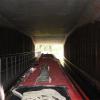
New tunnel under the A449, with towpath.
A449, Claines WR3 7SQ, United Kingdom
 
Information about the place
A449 Tunnel (eastern entrance) is a place on the waterways on the Droitwich Canals (Droitwich Barge Canal) between Hawford Junction (Junction of Droitwich Canal with River Severn) (3¼ furlongs and 2 locks to the west) and Droitwich Junction (Junction of Droitwich Barge Canal and Droitwich Junction Canal) (5 miles and 3¼ furlongs and 7 locks to the east).
 
It is at one end of A449 Tunnel.
 
The nearest place in the direction of Hawford Junction is A449 Tunnel (western entrance); ¼ furlongs away.
 
The nearest place in the direction of Droitwich Junction is Egg Lane Field Bridge; 3 furlongs away.

Mooring here is tolerable (it's just about possible if really necessary), piling suitable for hooks. There is room for one boat, with limited access. May be useful on the Barge Canal that has limited mooring.


Amenities

Amenities nearby at A449 Tunnel (western entrance)

 George Judge Ltd
 
Maps
If you are a user and are logged on, or if you are actively planning a route, a map will be displayed here.
Show on external mapping site: Google | OSM | Bing
 
Photos
 
External websites
There are no links to external websites from here.
Why not log in and add some (select "External websites" from the menu (sometimes this is under "Edit"))?
 
Nearest facilities

Mouseover for more information or show routes to facility

Nearest water point

In the direction of Hawford Junction

Holt Lock (Holt Fleet)3 miles, 2¾ furlongs and 2 locks away
Travel to Hawford Junction, then on the River Severn (main river - Stourport to Worcester) to Holt Lock (Holt Fleet)
Worcester Trip Boat Moorings4 miles, ¼ furlongs and 3 locks away
Travel to Hawford Junction, then on the River Severn (main river - Stourport to Worcester) to Worcester Trip Boat Moorings
Diglis Locks5 miles, ¾ furlongs and 3 locks away
Travel to Hawford Junction, then on the River Severn (main river - Stourport to Worcester) to Diglis Junction, then on the River Severn (main river - Worcester to Gloucester) to Diglis Locks
Diglis Services5 miles and 5 locks away
Travel to Hawford Junction, then on the River Severn (main river - Stourport to Worcester) to Diglis Junction, then on the Worcester and Birmingham Canal (Diglis Junction to Diglis Basin) to Diglis Basin, then on the Worcester and Birmingham Canal (Diglis Basin to King's Norton Junction) to Diglis Services
Lincomb Lock7 miles, 4½ furlongs and 3 locks away
Travel to Hawford Junction, then on the River Severn (main river - Stourport to Worcester) to Lincomb Lock
Lowesmoor Basin5 miles, 7¾ furlongs and 7 locks away
Travel to Hawford Junction, then on the River Severn (main river - Stourport to Worcester) to Diglis Junction, then on the Worcester and Birmingham Canal (Diglis Junction to Diglis Basin) to Diglis Basin, then on the Worcester and Birmingham Canal (Diglis Basin to King's Norton Junction) to Lowesmoor Basin
Upper Basin Waterpoint9 miles and 6 locks away
Travel to Hawford Junction, then on the River Severn (main river - Stourport to Worcester) to Severn - Stourport Broad Locks Entrance, then on the Staffordshire and Worcestershire Canal (Stourport Basins: Broad Route) to Stourport Upper Basin, then on the Staffordshire and Worcestershire Canal (Stourport Basins: Narrow Route) to Upper Basin Waterpoint
Caldwall Mill Bridge No 1412 miles, 6¼ furlongs and 9 locks away
Travel to Hawford Junction, then on the River Severn (main river - Stourport to Worcester) to Severn - Stourport Broad Locks Entrance, then on the Staffordshire and Worcestershire Canal (Stourport Basins: Broad Route) to Stourport Upper Basin, then on the Staffordshire and Worcestershire Canal (Stourport Basins: Narrow Route) to York Street Bridge, then on the Staffordshire and Worcestershire Canal (Main Line: Stourport to Stourton) to Caldwall Mill Bridge No 14
Kinver Services19 miles, 5¼ furlongs and 15 locks away
Travel to Hawford Junction, then on the River Severn (main river - Stourport to Worcester) to Severn - Stourport Broad Locks Entrance, then on the Staffordshire and Worcestershire Canal (Stourport Basins: Broad Route) to Stourport Upper Basin, then on the Staffordshire and Worcestershire Canal (Stourport Basins: Narrow Route) to York Street Bridge, then on the Staffordshire and Worcestershire Canal (Main Line: Stourport to Stourton) to Kinver Services

In the direction of Droitwich Junction

Netherwich Basin5 miles, ½ furlongs and 6 locks away
On this waterway in the direction of Droitwich Junction
Droitwich Spa Marina6 miles, 4 furlongs and 11 locks away
Travel to Droitwich Junction, then on the Droitwich Canals (Droitwich Junction Canal) to Droitwich Spa Marina
Hanbury Boatyard7 miles and 14 locks away
Travel to Droitwich Junction, then on the Droitwich Canals (Droitwich Junction Canal) to Hanbury Junction, then on the Worcester and Birmingham Canal (Diglis Basin to King's Norton Junction) to Hanbury Boatyard
Stoke Works Water Point9 miles, 3½ furlongs and 20 locks away
Travel to Droitwich Junction, then on the Droitwich Canals (Droitwich Junction Canal) to Hanbury Junction, then on the Worcester and Birmingham Canal (Diglis Basin to King's Norton Junction) to Stoke Works Water Point
Tardebigge Wharf13 miles, 3¾ furlongs and 56 locks away
Travel to Droitwich Junction, then on the Droitwich Canals (Droitwich Junction Canal) to Hanbury Junction, then on the Worcester and Birmingham Canal (Diglis Basin to King's Norton Junction) to Tardebigge Wharf
Hopwood Visitor Moorings18 miles, 7½ furlongs and 56 locks away
Travel to Droitwich Junction, then on the Droitwich Canals (Droitwich Junction Canal) to Hanbury Junction, then on the Worcester and Birmingham Canal (Diglis Basin to King's Norton Junction) to Hopwood Visitor Moorings

Nearest rubbish disposal

In the direction of Hawford Junction

Sabrina Footbridge3 miles, 6½ furlongs and 3 locks away
Travel to Hawford Junction, then on the River Severn (main river - Stourport to Worcester) to Sabrina Footbridge
Diglis Basin4 miles, 7½ furlongs and 5 locks away
Travel to Hawford Junction, then on the River Severn (main river - Stourport to Worcester) to Diglis Junction, then on the Worcester and Birmingham Canal (Diglis Junction to Diglis Basin) to Diglis Basin
Lowesmoor Basin5 miles, 7¾ furlongs and 7 locks away
Travel to Hawford Junction, then on the River Severn (main river - Stourport to Worcester) to Diglis Junction, then on the Worcester and Birmingham Canal (Diglis Junction to Diglis Basin) to Diglis Basin, then on the Worcester and Birmingham Canal (Diglis Basin to King's Norton Junction) to Lowesmoor Basin
Upper Basin Waterpoint9 miles and 6 locks away
Travel to Hawford Junction, then on the River Severn (main river - Stourport to Worcester) to Severn - Stourport Broad Locks Entrance, then on the Staffordshire and Worcestershire Canal (Stourport Basins: Broad Route) to Stourport Upper Basin, then on the Staffordshire and Worcestershire Canal (Stourport Basins: Narrow Route) to Upper Basin Waterpoint
Kinver Services19 miles, 5¼ furlongs and 15 locks away
Travel to Hawford Junction, then on the River Severn (main river - Stourport to Worcester) to Severn - Stourport Broad Locks Entrance, then on the Staffordshire and Worcestershire Canal (Stourport Basins: Broad Route) to Stourport Upper Basin, then on the Staffordshire and Worcestershire Canal (Stourport Basins: Narrow Route) to York Street Bridge, then on the Staffordshire and Worcestershire Canal (Main Line: Stourport to Stourton) to Kinver Services

In the direction of Droitwich Junction

Netherwich Basin5 miles, ½ furlongs and 6 locks away
On this waterway in the direction of Droitwich Junction
Droitwich Spa Marina6 miles, 4 furlongs and 11 locks away
Travel to Droitwich Junction, then on the Droitwich Canals (Droitwich Junction Canal) to Droitwich Spa Marina
Stoke Bottom Lock No 2310 miles, 1¼ furlongs and 20 locks away
Travel to Droitwich Junction, then on the Droitwich Canals (Droitwich Junction Canal) to Hanbury Junction, then on the Worcester and Birmingham Canal (Diglis Basin to King's Norton Junction) to Stoke Bottom Lock No 23
Tardebigge Wharf13 miles, 3¾ furlongs and 56 locks away
Travel to Droitwich Junction, then on the Droitwich Canals (Droitwich Junction Canal) to Hanbury Junction, then on the Worcester and Birmingham Canal (Diglis Basin to King's Norton Junction) to Tardebigge Wharf

Nearest chemical toilet disposal

In the direction of Hawford Junction

Diglis Services5 miles and 5 locks away
Travel to Hawford Junction, then on the River Severn (main river - Stourport to Worcester) to Diglis Junction, then on the Worcester and Birmingham Canal (Diglis Junction to Diglis Basin) to Diglis Basin, then on the Worcester and Birmingham Canal (Diglis Basin to King's Norton Junction) to Diglis Services
Stourport Marina8 miles and 4 locks away
Travel to Hawford Junction, then on the River Severn (main river - Stourport to Worcester) to Stourport Marina
Lowesmoor Basin5 miles, 7¾ furlongs and 7 locks away
Travel to Hawford Junction, then on the River Severn (main river - Stourport to Worcester) to Diglis Junction, then on the Worcester and Birmingham Canal (Diglis Junction to Diglis Basin) to Diglis Basin, then on the Worcester and Birmingham Canal (Diglis Basin to King's Norton Junction) to Lowesmoor Basin
Upper Basin Waterpoint9 miles and 6 locks away
Travel to Hawford Junction, then on the River Severn (main river - Stourport to Worcester) to Severn - Stourport Broad Locks Entrance, then on the Staffordshire and Worcestershire Canal (Stourport Basins: Broad Route) to Stourport Upper Basin, then on the Staffordshire and Worcestershire Canal (Stourport Basins: Narrow Route) to Upper Basin Waterpoint
Caldwall Mill Bridge No 1412 miles, 6¼ furlongs and 9 locks away
Travel to Hawford Junction, then on the River Severn (main river - Stourport to Worcester) to Severn - Stourport Broad Locks Entrance, then on the Staffordshire and Worcestershire Canal (Stourport Basins: Broad Route) to Stourport Upper Basin, then on the Staffordshire and Worcestershire Canal (Stourport Basins: Narrow Route) to York Street Bridge, then on the Staffordshire and Worcestershire Canal (Main Line: Stourport to Stourton) to Caldwall Mill Bridge No 14
Kinver Services19 miles, 5¼ furlongs and 15 locks away
Travel to Hawford Junction, then on the River Severn (main river - Stourport to Worcester) to Severn - Stourport Broad Locks Entrance, then on the Staffordshire and Worcestershire Canal (Stourport Basins: Broad Route) to Stourport Upper Basin, then on the Staffordshire and Worcestershire Canal (Stourport Basins: Narrow Route) to York Street Bridge, then on the Staffordshire and Worcestershire Canal (Main Line: Stourport to Stourton) to Kinver Services

In the direction of Droitwich Junction

Droitwich Spa Marina6 miles, 4 furlongs and 11 locks away
Travel to Droitwich Junction, then on the Droitwich Canals (Droitwich Junction Canal) to Droitwich Spa Marina
Stoke Bottom Lock No 2310 miles, 1¼ furlongs and 20 locks away
Travel to Droitwich Junction, then on the Droitwich Canals (Droitwich Junction Canal) to Hanbury Junction, then on the Worcester and Birmingham Canal (Diglis Basin to King's Norton Junction) to Stoke Bottom Lock No 23
Tardebigge Wharf13 miles, 3¾ furlongs and 56 locks away
Travel to Droitwich Junction, then on the Droitwich Canals (Droitwich Junction Canal) to Hanbury Junction, then on the Worcester and Birmingham Canal (Diglis Basin to King's Norton Junction) to Tardebigge Wharf

Nearest place to turn

In the direction of Hawford Junction

Bevere Lock Weir Entrance5¼ furlongs and 2 locks away
Travel to Hawford Junction, then on the River Severn (main river - Stourport to Worcester) to Bevere Lock Weir Entrance
Bevere Lock Weir Exit1 mile and 3 locks away
Travel to Hawford Junction, then on the River Severn (main river - Stourport to Worcester) to Bevere Lock Weir Exit
Holt Lock Weir Exit3 miles, 1¾ furlongs and 2 locks away
Travel to Hawford Junction, then on the River Severn (main river - Stourport to Worcester) to Holt Lock Weir Exit
Holt Lock Weir Entrance3 miles, 5¼ furlongs and 3 locks away
Travel to Hawford Junction, then on the River Severn (main river - Stourport to Worcester) to Holt Lock Weir Entrance
Diglis Junction4 miles, 6¼ furlongs and 3 locks away
Travel to Hawford Junction, then on the River Severn (main river - Stourport to Worcester) to Diglis Junction
Diglis Locks Weir Exit5 miles, 1½ furlongs and 4 locks away
Travel to Hawford Junction, then on the River Severn (main river - Stourport to Worcester) to Diglis Junction, then on the River Severn (main river - Worcester to Gloucester) to Diglis Locks Weir Exit
Severn - Teme Junction5 miles, 7½ furlongs and 4 locks away
Travel to Hawford Junction, then on the River Severn (main river - Stourport to Worcester) to Diglis Junction, then on the River Severn (main river - Worcester to Gloucester) to Severn - Teme Junction
Lowesmoor Basin5 miles, 7¾ furlongs and 7 locks away
Travel to Hawford Junction, then on the River Severn (main river - Stourport to Worcester) to Diglis Junction, then on the Worcester and Birmingham Canal (Diglis Junction to Diglis Basin) to Diglis Basin, then on the Worcester and Birmingham Canal (Diglis Basin to King's Norton Junction) to Lowesmoor Basin
Severn - Stourport Narrow Locks Entrance8 miles, 7¼ furlongs and 4 locks away
Travel to Hawford Junction, then on the River Severn (main river - Stourport to Worcester) to Severn - Stourport Narrow Locks Entrance
Stourport Lower Basin - between Broad Locks8 miles, 7 furlongs and 5 locks away
Travel to Hawford Junction, then on the River Severn (main river - Stourport to Worcester) to Severn - Stourport Broad Locks Entrance, then on the Staffordshire and Worcestershire Canal (Stourport Basins: Broad Route) to Stourport Lower Basin - between Broad Locks
Stourport Lower Basin - between Narrow Locks8 miles, 7½ furlongs and 5 locks away
Travel to Hawford Junction, then on the River Severn (main river - Stourport to Worcester) to Severn - Stourport Broad Locks Entrance, then on the Staffordshire and Worcestershire Canal (Stourport Basins: Broad Route) to Stourport Lower Basin - between Broad Locks, then on the Staffordshire and Worcestershire Canal (Stourport Basins: Broad Locks to Narrow Locks to Stourport Lower Basin - between Narrow Locks
Stourport Upper Basin8 miles, 7¾ furlongs and 6 locks away
Travel to Hawford Junction, then on the River Severn (main river - Stourport to Worcester) to Severn - Stourport Broad Locks Entrance, then on the Staffordshire and Worcestershire Canal (Stourport Basins: Broad Route) to Stourport Upper Basin
Stourport Clock Basin9 miles, ¼ furlongs and 6 locks away
Travel to Hawford Junction, then on the River Severn (main river - Stourport to Worcester) to Severn - Stourport Broad Locks Entrance, then on the Staffordshire and Worcestershire Canal (Stourport Basins: Broad Route) to Stourport Upper Basin, then on the Staffordshire and Worcestershire Canal (Stourport Basins: Narrow Route) to Stourport Clock Basin
Former Railway Interchange Basin9 miles, 6¼ furlongs and 7 locks away
Travel to Hawford Junction, then on the River Severn (main river - Stourport to Worcester) to Severn - Stourport Broad Locks Entrance, then on the Staffordshire and Worcestershire Canal (Stourport Basins: Broad Route) to Stourport Upper Basin, then on the Staffordshire and Worcestershire Canal (Stourport Basins: Narrow Route) to York Street Bridge, then on the Staffordshire and Worcestershire Canal (Main Line: Stourport to Stourton) to Former Railway Interchange Basin
Bilford Locks Winding Hole7 miles, 1½ furlongs and 10 locks away
Travel to Hawford Junction, then on the River Severn (main river - Stourport to Worcester) to Diglis Junction, then on the Worcester and Birmingham Canal (Diglis Junction to Diglis Basin) to Diglis Basin, then on the Worcester and Birmingham Canal (Diglis Basin to King's Norton Junction) to Bilford Locks Winding Hole

In the direction of Droitwich Junction

Ladywood Top Lock Winding Hole2 miles, 2½ furlongs and 6 locks away
On this waterway in the direction of Droitwich Junction
Winding Hole (east of Salwarpe Road Bridge)4 miles, 7 furlongs and 6 locks away
On this waterway in the direction of Droitwich Junction
Netherwich Basin5 miles, ½ furlongs and 6 locks away
On this waterway in the direction of Droitwich Junction
Droitwich Town Wharf5 miles, 2½ furlongs and 6 locks away
On this waterway in the direction of Droitwich Junction
Lock No 6 Winding Hole6 miles, 1 furlong and 9 locks away
Travel to Droitwich Junction, then on the Droitwich Canals (Droitwich Junction Canal) to Lock No 6 Winding Hole

Nearest boatyard pump-out

In the direction of Hawford Junction

Stourport Marina8 miles and 4 locks away
Travel to Hawford Junction, then on the River Severn (main river - Stourport to Worcester) to Stourport Marina
Lowesmoor Basin5 miles, 7¾ furlongs and 7 locks away
Travel to Hawford Junction, then on the River Severn (main river - Stourport to Worcester) to Diglis Junction, then on the Worcester and Birmingham Canal (Diglis Junction to Diglis Basin) to Diglis Basin, then on the Worcester and Birmingham Canal (Diglis Basin to King's Norton Junction) to Lowesmoor Basin
Stourport Upper Basin8 miles, 7¾ furlongs and 6 locks away
Travel to Hawford Junction, then on the River Severn (main river - Stourport to Worcester) to Severn - Stourport Broad Locks Entrance, then on the Staffordshire and Worcestershire Canal (Stourport Basins: Broad Route) to Stourport Upper Basin
Upper Staircase Lock Landing Pontoon9 miles, ½ furlongs and 6 locks away
Travel to Hawford Junction, then on the River Severn (main river - Stourport to Worcester) to Severn - Stourport Broad Locks Entrance, then on the Staffordshire and Worcestershire Canal (Stourport Basins: Broad Route) to Stourport Upper Basin, then on the Staffordshire and Worcestershire Canal (Stourport Basins: Narrow Route) to Upper Staircase Lock Landing Pontoon

In the direction of Droitwich Junction

Hanbury Boatyard7 miles and 14 locks away
Travel to Droitwich Junction, then on the Droitwich Canals (Droitwich Junction Canal) to Hanbury Junction, then on the Worcester and Birmingham Canal (Diglis Basin to King's Norton Junction) to Hanbury Boatyard
Dunhampstead Boatyard8 miles, 6½ furlongs and 14 locks away
Travel to Droitwich Junction, then on the Droitwich Canals (Droitwich Junction Canal) to Hanbury Junction, then on the Worcester and Birmingham Canal (Diglis Basin to King's Norton Junction) to Dunhampstead Boatyard
Direction of TV transmitter (From Wolfbane Cybernetic)
 
 
Geograph
 
Wikipedia

There is no page on Wikipedia called “A449 Tunnel”

Wikipedia pages that might relate to A449 Tunnel
[Tunnel boring machine] A tunnel boring machine (TBM), also known as a "mole", is a machine used to excavate tunnels with a circular cross section through a variety of soil and [List of longest tunnels] This list of longest tunnels ranks tunnels that are at least 13 km (43,000 ft) long. Only continuous tunnels are included. Pipelines, even those that [Dartford Crossing] Crossing, commonly known as the Dartford Crossing and until 1991 the Dartford Tunnel, is a major road crossing of the River Thames in England, carrying the A282 [List of longest railway tunnels] longest railway tunnels of the world, excluding subway tunnel sections. List of long railway tunnels in China List of longest subway tunnel sections List [Interstate 70 in Colorado] section through the Dakota Hogback, Eisenhower Tunnel, Vail Pass and Glenwood Canyon. The Eisenhower Tunnel, with a maximum elevation of 11,158 feet (3,401 m) [Stalag Luft III] selected because its sandy soil made it difficult for POWs to escape by tunnelling. It is best known for two escape plots by Allied POWs, one in 1943 that [List of tunnels in the United Kingdom] This is a list of road, railway, waterway, and other tunnels in the United Kingdom. A tunnel is an underground passageway with no defined minimum length [List of Radio Star episodes] August 6, 2014 Son Byong-ho, Yeon Woo-jin, Jeong Yu-mi, Min Do-hee The Tunnel special. 389 August 13, 2014 Kim Su-ro, Kang Sung-jin, Im Hyung-joon, Kim [RS-449] The RS-449 specification, also known as EIA-449 or TIA-449, defines the functional and mechanical characteristics of the interface between data terminal [Carpal Tunnel Syndrome (album)] Carpal Tunnel Syndrome is the debut studio album by Canadian turntablist Kid Koala, released on Ninja Tune in 2000. It peaked at number 33 on the UK Independent
 
Google

Results of Google Search

Hoosac Tunnel – North Adams, Massachusetts - Atlas Obscura
The East tunnel entrance (East Portal) at the intersection of Whitcomb Hill Road and River Road in Florida, take River Road northwest about half a mile until it ...
Hoosac Tunnel
My attempt to find the East and West Entrance to the Hoosac Tunnel also known as The Bloody Pit after it claimed the lives of almost 200 men.
The East Portal – Hoosac Tunnel
The East Portal of the Hoosac Tunnel is located in Florida, Massachusetts, 4.5 miles ... owners charged sightseers a ticket to view it, at 25 cents per admission.
East portal Hoosac Tunnel showing abandoned tunnel ; looking out ...
Title: East portal Hoosac Tunnel showing abandoned tunnel ; looking out west portal, Hoosac Tunnel; Date: [ca. 1892–1906]; Format: Photographs · Postcards/  ...
Gallery:Tunnel - Roader's Digest: The SABRE Wiki
The South Entrance to the Road Tunnel under Y Maes - Geograph - 289306.jpg · Caernarfon ... Wallasey Tunnel eastern choice of routes.jpg. Kingsway ... Monmouth tunnels on the A449 heading north - Geograph - 1105724.jpg. Monmouth ...
Wish List
Space for a large winding hole exists east of the A449 tunnel. Cost and possible land purchase. 1. Increase the length of the winding hole at barge rail bridge 14.
East Freeport -- EQ Atlas
12 Inn - secret entrance to the underground tunnels with Necromancer, Shadow Knight, and Rogue guilds, as well as Guildmaster for the other classes for evil ...