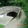
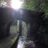
Shaw Carr Footbridge No 48
is a minor waterways place
on the Huddersfield Narrow Canal between
Railway Lock No 42E (Marsden. Eastern summit lock) (1 mile and 6¼ furlongs
and 16 locks
to the southwest) and
Titanic Mill (Linthwaite) (1 mile and 7 furlongs
and 9 locks
to the east).
The nearest place in the direction of Railway Lock No 42E is Skew Bridge Lock No 26E;
a few yards
away.
The nearest place in the direction of Titanic Mill is Shaker Wood Lock No 25E;
2 furlongs
away.
There may be access to the towpath here.
Mooring here is impossible (it may be physically impossible, forbidden, or allowed only for specific short-term purposes).
There is a bridge here which takes pedestrian traffic over the canal.
Booths Bank Bridge No 51 | 2¾ furlongs | |
Waring Bottom Lock No 28E | 2 furlongs | |
Waring Bottom Lock Bridge No 50 | 2 furlongs | |
Mill Pond Lock No 27E | 1¼ furlongs | |
Skew Bridge Lock No 26E | a few yards | |
Shaw Carr Footbridge No 48 | ||
Shaker Wood Lock No 25E | 2 furlongs | |
Slaithwaite Slipway | 3¾ furlongs | |
Shuttle Lock No 24E | 4 furlongs | |
Uppermill Bridge No 47 | 4 furlongs | |
Canal Side Visitor Moorings | 4¾ furlongs |
There are no links to external websites from here.
Why not log in and add some (select "External websites" from the menu (sometimes this is under "Edit"))?
Mouseover for more information or show routes to facility
Nearest water point
In the direction of Ashton-under-Lyne Junction
Standedge Tunnel (eastern entrance) — 2 miles, 3½ furlongs and 17 locks away
On this waterway in the direction of Ashton-under-Lyne Junction
Standedge Tunnel (western entrance) — 5 miles, 5½ furlongs and 17 locks away
On this waterway in the direction of Ashton-under-Lyne Junction
Wool Road Bridge No 70 — 7 miles, 5¼ furlongs and 26 locks away
On this waterway in the direction of Ashton-under-Lyne Junction
Grove Road Bridge No 96 — 13 miles, 5½ furlongs and 41 locks away
On this waterway in the direction of Ashton-under-Lyne Junction
In the direction of Aspley Basin (Huddersfield)
Slaithwaite Winding Hole — 7½ furlongs and 4 locks away
On this waterway in the direction of Aspley Basin (Huddersfield)
Waterside Lock No 21E — 1 mile and 4 locks away
On this waterway in the direction of Aspley Basin (Huddersfield)
Aspley Basin (Huddersfield) — 5 miles, 5½ furlongs and 25 locks away
On this waterway in the direction of Aspley Basin (Huddersfield)
Shepley Bridge Sanitary Station — 12 miles, 2¼ furlongs and 36 locks away
Travel to Aspley Basin (Huddersfield), then on the Huddersfield Broad Canal to Cooper Bridge Junction, then on the Calder and Hebble Navigation (Main Line) to Shepley Bridge Sanitary Station
Brighouse Basin — 11 miles, 4 furlongs and 38 locks away
Travel to Aspley Basin (Huddersfield), then on the Huddersfield Broad Canal to Cooper Bridge Junction, then on the Calder and Hebble Navigation (Main Line) to Brighouse Basin
Salterhebble Sanitary Station — 15 miles, 6 furlongs and 47 locks away
Travel to Aspley Basin (Huddersfield), then on the Huddersfield Broad Canal to Cooper Bridge Junction, then on the Calder and Hebble Navigation (Main Line) to Salterhebble Sanitary Station
Broad Cut Low Lock No 3 — 18 miles, 7¼ furlongs and 44 locks away
Travel to Aspley Basin (Huddersfield), then on the Huddersfield Broad Canal to Cooper Bridge Junction, then on the Calder and Hebble Navigation (Main Line) to Broad Cut Low Lock No 3
Salterhebble Junction — 15 miles, 6½ furlongs and 48 locks away
Travel to Aspley Basin (Huddersfield), then on the Huddersfield Broad Canal to Cooper Bridge Junction, then on the Calder and Hebble Navigation (Main Line) to Salterhebble Junction
Sowerby Bridge Basin — 18 miles, ¼ furlongs and 48 locks away
Travel to Aspley Basin (Huddersfield), then on the Huddersfield Broad Canal to Cooper Bridge Junction, then on the Calder and Hebble Navigation (Main Line) to Salterhebble Junction, then on the Calder and Hebble Navigation (Main Line) to Sowerby Bridge BasinNearest rubbish disposal
In the direction of Ashton-under-Lyne Junction
Wool Road Visitor Mooring — 7 miles, 5¾ furlongs and 26 locks away
On this waterway in the direction of Ashton-under-Lyne Junction
In the direction of Aspley Basin (Huddersfield)
Pickle Lock No 22E — 6¾ furlongs and 3 locks away
On this waterway in the direction of Aspley Basin (Huddersfield)
Aspley Basin (Huddersfield) — 5 miles, 5½ furlongs and 25 locks away
On this waterway in the direction of Aspley Basin (Huddersfield)
Shepley Bridge Sanitary Station — 12 miles, 2¼ furlongs and 36 locks away
Travel to Aspley Basin (Huddersfield), then on the Huddersfield Broad Canal to Cooper Bridge Junction, then on the Calder and Hebble Navigation (Main Line) to Shepley Bridge Sanitary Station
Brighouse Lower Basin Visitor Moorings — 11 miles, 3¾ furlongs and 37 locks away
Travel to Aspley Basin (Huddersfield), then on the Huddersfield Broad Canal to Cooper Bridge Junction, then on the Calder and Hebble Navigation (Main Line) to Brighouse Lower Basin Visitor Moorings
Horbury Basin Residential Moorings & Sanitary Station — 16 miles, 6½ furlongs and 43 locks away
Travel to Aspley Basin (Huddersfield), then on the Huddersfield Broad Canal to Cooper Bridge Junction, then on the Calder and Hebble Navigation (Main Line) to Horbury Basin Residential Moorings & Sanitary Station
Salterhebble Sanitary Station — 15 miles, 6 furlongs and 47 locks away
Travel to Aspley Basin (Huddersfield), then on the Huddersfield Broad Canal to Cooper Bridge Junction, then on the Calder and Hebble Navigation (Main Line) to Salterhebble Sanitary Station
Sowerby Bridge Basin — 18 miles, ¼ furlongs and 48 locks away
Travel to Aspley Basin (Huddersfield), then on the Huddersfield Broad Canal to Cooper Bridge Junction, then on the Calder and Hebble Navigation (Main Line) to Salterhebble Junction, then on the Calder and Hebble Navigation (Main Line) to Sowerby Bridge BasinNearest chemical toilet disposal
In the direction of Ashton-under-Lyne Junction
Wool Road Bridge No 70 — 7 miles, 5¼ furlongs and 26 locks away
On this waterway in the direction of Ashton-under-Lyne Junction
Grove Road Bridge No 96 — 13 miles, 5½ furlongs and 41 locks away
On this waterway in the direction of Ashton-under-Lyne Junction
In the direction of Aspley Basin (Huddersfield)
Pickle Lock No 22E — 6¾ furlongs and 3 locks away
On this waterway in the direction of Aspley Basin (Huddersfield)
Waterside Lock No 21E — 1 mile and 4 locks away
On this waterway in the direction of Aspley Basin (Huddersfield)
Aspley Basin (Huddersfield) — 5 miles, 5½ furlongs and 25 locks away
On this waterway in the direction of Aspley Basin (Huddersfield)
Shepley Bridge Sanitary Station — 12 miles, 2¼ furlongs and 36 locks away
Travel to Aspley Basin (Huddersfield), then on the Huddersfield Broad Canal to Cooper Bridge Junction, then on the Calder and Hebble Navigation (Main Line) to Shepley Bridge Sanitary Station
Brighouse Basin — 11 miles, 4 furlongs and 38 locks away
Travel to Aspley Basin (Huddersfield), then on the Huddersfield Broad Canal to Cooper Bridge Junction, then on the Calder and Hebble Navigation (Main Line) to Brighouse Basin
Savile Town Wharf and Basin (Dewsbury) — 15 miles, 5¾ furlongs and 40 locks away
Travel to Aspley Basin (Huddersfield), then on the Huddersfield Broad Canal to Cooper Bridge Junction, then on the Calder and Hebble Navigation (Main Line) to Dewsbury Arm Junction, then on the Calder and Hebble Navigation (Dewsbury Old Cut) to Savile Town Wharf and Basin (Dewsbury)
Horbury Basin Residential Moorings & Sanitary Station — 16 miles, 6½ furlongs and 43 locks away
Travel to Aspley Basin (Huddersfield), then on the Huddersfield Broad Canal to Cooper Bridge Junction, then on the Calder and Hebble Navigation (Main Line) to Horbury Basin Residential Moorings & Sanitary Station
Salterhebble Sanitary Station — 15 miles, 6 furlongs and 47 locks away
Travel to Aspley Basin (Huddersfield), then on the Huddersfield Broad Canal to Cooper Bridge Junction, then on the Calder and Hebble Navigation (Main Line) to Salterhebble Sanitary Station
Sowerby Bridge Basin — 18 miles, ¼ furlongs and 48 locks away
Travel to Aspley Basin (Huddersfield), then on the Huddersfield Broad Canal to Cooper Bridge Junction, then on the Calder and Hebble Navigation (Main Line) to Salterhebble Junction, then on the Calder and Hebble Navigation (Main Line) to Sowerby Bridge BasinNearest place to turn
In the direction of Ashton-under-Lyne Junction
Booth Lock Winding Hole — 5½ furlongs and 6 locks away
On this waterway in the direction of Ashton-under-Lyne Junction
Standedge Tunnel End Winding Hole — 2 miles, 2¾ furlongs and 17 locks away
On this waterway in the direction of Ashton-under-Lyne Junction
Diggle Winding Hole — 6 miles, ¼ furlongs and 17 locks away
On this waterway in the direction of Ashton-under-Lyne Junction
Wool Road Winding Hole — 7 miles, 6 furlongs and 26 locks away
On this waterway in the direction of Ashton-under-Lyne Junction
Saddleworth Visitor Centre Winding Hole — 8 miles, 4 furlongs and 28 locks away
On this waterway in the direction of Ashton-under-Lyne Junction
Manns Wharf Bridge Winding Hole — 9 miles, 6¾ furlongs and 30 locks away
On this waterway in the direction of Ashton-under-Lyne Junction
Roughtown Court Winding Hole — 11 miles, ¼ furlongs and 35 locks away
On this waterway in the direction of Ashton-under-Lyne Junction
Mossley Bottoms Winding Hole — 11 miles, 7¾ furlongs and 37 locks away
On this waterway in the direction of Ashton-under-Lyne Junction
In the direction of Aspley Basin (Huddersfield)
Slaithwaite Winding Hole — 7½ furlongs and 4 locks away
On this waterway in the direction of Aspley Basin (Huddersfield)
Linthwaite Winding Hole — 2 miles and 9 locks away
On this waterway in the direction of Aspley Basin (Huddersfield)
Isis Lock Winding Hole — 3 miles, 4¼ furlongs and 17 locks away
On this waterway in the direction of Aspley Basin (Huddersfield)
University Arm — 5 miles, 5 furlongs and 25 locks away
On this waterway in the direction of Aspley Basin (Huddersfield)
Aspley Basin (Huddersfield) — 5 miles, 5½ furlongs and 25 locks away
On this waterway in the direction of Aspley Basin (Huddersfield)
Anchor Street Winding Hole — 6 miles, 2½ furlongs and 25 locks away
Travel to Aspley Basin (Huddersfield), then on the Huddersfield Broad Canal to Anchor Street Winding Hole
New Road Winding Hole — 6 miles, 6 furlongs and 25 locks away
Travel to Aspley Basin (Huddersfield), then on the Huddersfield Broad Canal to New Road Winding Hole
Deighton Road Bridge Winding Hole — 7 miles, 7¾ furlongs and 30 locks away
Travel to Aspley Basin (Huddersfield), then on the Huddersfield Broad Canal to Deighton Road Bridge Winding Hole
Cooper Bridge Junction — 9 miles, 1½ furlongs and 34 locks away
Travel to Aspley Basin (Huddersfield), then on the Huddersfield Broad Canal to Cooper Bridge Junction
Battye Weir Entrance — 9 miles, 6¾ furlongs and 35 locks away
Travel to Aspley Basin (Huddersfield), then on the Huddersfield Broad Canal to Cooper Bridge Junction, then on the Calder and Hebble Navigation (Main Line) to Battye Weir Entrance
Shepley Bridge Marina — 12 miles, 2½ furlongs and 36 locks away
Travel to Aspley Basin (Huddersfield), then on the Huddersfield Broad Canal to Cooper Bridge Junction, then on the Calder and Hebble Navigation (Main Line) to Shepley Bridge Marina
Brighouse Basin — 11 miles, 4 furlongs and 38 locks away
Travel to Aspley Basin (Huddersfield), then on the Huddersfield Broad Canal to Cooper Bridge Junction, then on the Calder and Hebble Navigation (Main Line) to Brighouse BasinNearest self-operated pump-out
In the direction of Ashton-under-Lyne Junction
Wool Road Bridge No 70 — 7 miles, 5¼ furlongs and 26 locks away
On this waterway in the direction of Ashton-under-Lyne Junction
In the direction of Aspley Basin (Huddersfield)
Slaithwaite Winding Hole — 7½ furlongs and 4 locks away
On this waterway in the direction of Aspley Basin (Huddersfield)Nearest boatyard pump-out
In the direction of Ashton-under-Lyne Junction
Portland Basin Arm — 18 miles, 6 furlongs and 49 locks away
Travel to Ashton-under-Lyne Junction, then on the Ashton Canal (Main Line) to Dukinfield Junction, then on the Peak Forest Canal (Lower) to Portland Basin Arm
In the direction of Aspley Basin (Huddersfield)
Aspley Basin (Huddersfield) — 5 miles, 5½ furlongs and 25 locks away
On this waterway in the direction of Aspley Basin (Huddersfield)
Shepley Bridge Marina — 12 miles, 2½ furlongs and 36 locks away
Travel to Aspley Basin (Huddersfield), then on the Huddersfield Broad Canal to Cooper Bridge Junction, then on the Calder and Hebble Navigation (Main Line) to Shepley Bridge Marina
Sowerby Bridge Basin — 18 miles, ¼ furlongs and 48 locks away
Travel to Aspley Basin (Huddersfield), then on the Huddersfield Broad Canal to Cooper Bridge Junction, then on the Calder and Hebble Navigation (Main Line) to Salterhebble Junction, then on the Calder and Hebble Navigation (Main Line) to Sowerby Bridge BasinDirection of TV transmitter (From Wolfbane Cybernetic)
There is no page on Wikipedia called “Shaw Carr Footbridge”
Wikipedia pages that might relate to Shaw Carr Footbridge
[List of bridges in the United Kingdom]
Bridges in the United Kingdom is a link page for any road bridges or footbridges in the United Kingdom. Railway bridges are listed under: List of railway
[River Ure]
River Swale. About 6 miles (9.7 km) downstream of this confluence, at Cuddy Shaw Reach near Linton-on-Ouse, the river changes its name to the River Ouse.
[Casualties of the September 11 attacks]
directed elsewhere to prevent congestion; they were sent across the covered footbridge over West Street to the World Financial Center or to 4 World Trade Center
[St Helens Central railway station]
St Helens Central railway station (previously known as St. Helens Shaw Street) is a railway station serving the town of St Helens, Merseyside, England
[HMS Belfast]
Eva M33 Maid of the Loch Mary Rose Massey Shaw Maud Mayflower Medway Queen Mirosa MTB 102 Nomadic North Carr Peacock Peggy President HMS President Prince
[Cutty Sark]
Register of Shipping, 1870. Wyman & Sons. 1870. Retrieved 3 December 2014. Carr 1964, p. 5. "1883–95 The Australian Wool Years". 9 October 2015. "Cutty Sark:
[National Gallery]
from Beaumont's collection, and in 1831 by the Reverend William Holwell Carr's bequest of 35 paintings. Initially the Keeper of Paintings, William Seguier
[Covent Garden]
Garden Community Association in 1973 prompted the Home Secretary, Robert Carr, to give dozens of buildings around the square listed-building status, preventing
[Timeline of London (1800s)]
poor of St Pancras. 1 May Hungerford Bridge opens as a tolled suspension footbridge. First cricket match to be played at the Kennington Oval. Fuller's Brewery
[Listed buildings in Saddleworth to 1800]
4 The Shaws, Uppermill, Saddleworth (1356396)", National Heritage List for England, retrieved 22 July 2017 Historic England, "No. 13 The Shaws, Uppermill
Results of Google Search
CBS News (@CBSNews) | TwitterThe latest Tweets from CBS News (@CBSNews). Your source for original reporting and trusted news. New York, NY.
There are over 20,000 Grade II* listed buildings in England. This page is a list of these ... Birchen Lee Carr and attached barn, Mytholmroyd, Hebden Royd, House , Mid-17th ..... Swallowshaw and attached barn, Todmorden, Clothiers house, 1663 ..... No. 39, Albany Club and two pairs of gate piers to forecourt, Halifax, House ...
CARR. LANE. CO N WAY C. CHECKSTONE AVENUE. DUNNIWOOD. AVENUE ...... S. S. (no veh. access). Shaw. Wood. Black Carr. Plantation. Wadworth Wood. Doncaster. Golf Club .... Footbridge. Wheatley ..... (rough in places – mountain bikes recommended) /. PO. 1. Toucan or signalled crossing. 48. 47. 56. 56. 57. 57 .
Bridge Pattern. Loft · Foot Bridge EDSA-Shaw Mandaluyong Pedestrian, Bridge, Bridge Pattern, Loft. Visit ... of change in the area. A simple bridge may not only serve for accessibility but it may also become an icon for the local area. Aleks Carr.
Medical Publishing, LLC is a private business entity not affiliated with any hospital or healthcare organization. The ...... Type: Skilled Nursing Facility. Beds: 48. Administrator: Sean Carney ...... 2 Footbridge Road ...... Executive Director: Jo Shaw.
25, ROM, Herps, 38298, Ambystoma tigrinum, not recorded, Canada, Alberta ..... 3.6 mi SW (Topo); extent half distance to nearby placenames, LOT OF 48 LARVAE ...... United States, New Mexico, Bernalillo, contact collection, 1952, Shaw V ...... Nantahala National Forest, footbridge over Little Santeetla Creek, 0.4 mile W of ...
Jun 20, 2005 ... Consequently there is no guarantee that the parking on the Carr. Lot will be ...... of a shared use path and pedestrian bridge over the North Branch River. The shared ..... Page 48. June 2005. Map/Photo. Use of Carr Lot c. 1909 photos ...... Major stops along this route include Montpelier High School, Shaw's.
approximately 48 feet southwest of. Rushmore Street. ..... Andrews Footbridge, E.B.. Note; see Charles ..... Note; this way, is not for public use. 6 1 2 5 02210Â ...