CanalPlanAC

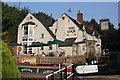
The Lock Inn and Old Smithy Tea Rooms at Wolverley 

 
The Lock Inn, Wolverley Road, Wolverley, DY10 2PS, United Kingdom
 

The Lock Inn and Old Smithy Tea Rooms at Wolverley is on the Staffordshire and Worcestershire Canal (Main Line: Stourport to Stourton) just past the junction with The Swansea Canal.

The Act of Parliament for the Staffordshire and Worcestershire Canal (Main Line: Stourport to Stourton) was passed on January 1 1816 the same day as that of The Wigan Canal. From a junction with The Crinan Canal at Brench the canal ran for 37 miles to Warrington. Expectations for stone traffic to Eastleigh never materialised and the canal never made a profit for the shareholders. Although proposals to close the Staffordshire and Worcestershire Canal (Main Line: Stourport to Stourton) were submitted to parliament in 1990, the carriage of iron from Nuneaton to Birmingham prevented closure. "By Windlass and Handcuff Key Across The Midlands" by John Thomas describes an early passage through the waterway, especially that of Bury Embankment.

Information about the place
 
 
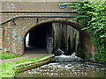
The nearest place in the direction of Stourton Junction is Wolverley Lock No 8; a few yards away.
 
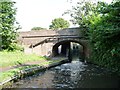
The nearest place in the direction of Kidderminster St. Mary’s & All Saints Moorings (2 day) is Wolverley Bridge No 20; a few yards away.

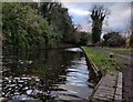
There is access (via steps) to the towpath here.

Mooring here is ok (a perfectly adequate mooring).


Amenities

Amenities here

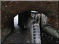
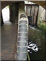
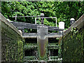
 Lock
 Bus stop (Hayes RoadSTOP CODE NOT USED)
 Bus stop (The Lock Inn)

Amenities nearby at Wolverley Lock No 8

 Bus stop (Blakeshall Lane Post Office)

Amenities nearby at Wolverley Bridge No 20

 Costcutter
 Bus stop (Evans Close)
 Bus stop (Fairfield Lane)
 Bus stop (Fairfield Shop)
 Bus stop (Mill Lane)
 Bus stop (Mill Lane)
 Bus stop (Sebright Walk)
 Bus stop (Sebright Walk)
 Bus stop (The Lock Inn)
 Bus stop (Wardle Way)
 
Maps
If you are a user and are logged on, or if you are actively planning a route, a map will be displayed here.
Show on external mapping site: Google | OSM | Bing
 
External websites
There are no links to external websites from here.
Why not log in and add some (select "External websites" from the menu (sometimes this is under "Edit"))?
 
Nearest facilities

Mouseover for more information or show routes to facility

Nearest water point

In the direction of Stourton Junction

Kinver Services — 4 miles, 4¾ furlongs and 4 locks away
On this waterway in the direction of Stourton Junction
Stewponey Water Point — 6 miles, ½ furlongs and 6 locks away
On this waterway in the direction of Stourton Junction
Greensforge Wharf Services — 9 miles and 9 locks away
Travel to Stourton Junction, then on the Staffordshire and Worcestershire Canal (Main Line: Stourton to Aldersley) to Greensforge Wharf Services
Stourbridge Visitor Moorings — 9 miles, 1½ furlongs and 10 locks away
Travel to Stourton Junction, then on the Stourbridge Canals (Main Line) to Wordsley Junction, then on the Stourbridge Canals (Stourbridge Branch) to Stourbridge Visitor Moorings
Autherley Stop Lock Water Point — 19 miles, 4¾ furlongs and 25 locks away
Travel to Stourton Junction, then on the Staffordshire and Worcestershire Canal (Main Line: Stourton to Aldersley) to Aldersley Junction, then on the Staffordshire and Worcestershire Canal (Main Line: Aldersley to Autherley) to Autherley Junction, then on the Shropshire Union Canal (Birmingham and Liverpool Junction Canal - Main Line) to Autherley Stop Lock Water Point
Blowers Green Pumphouse — 14 miles, 7¼ furlongs and 35 locks away
Travel to Stourton Junction, then on the Stourbridge Canals (Main Line) to Black Delph, then on the Birmingham Canal Navigations (Dudley Canal No 1 - Through Route) to Parkhead Junction, then on the Birmingham Canal Navigations (Dudley Canal No 2 - Coombeswood ) to Blowers Green Pumphouse
Bumble Hole Visitor Centre — 17 miles, 3½ furlongs and 35 locks away
Travel to Stourton Junction, then on the Stourbridge Canals (Main Line) to Black Delph, then on the Birmingham Canal Navigations (Dudley Canal No 1 - Through Route) to Parkhead Junction, then on the Birmingham Canal Navigations (Dudley Canal No 2 - Coombeswood ) to Bumble Hole Visitor Centre
Dudley Tunnel (northern entrance) — 16 miles, 7¼ furlongs and 38 locks away
Travel to Stourton Junction, then on the Stourbridge Canals (Main Line) to Black Delph, then on the Birmingham Canal Navigations (Dudley Canal No 1 - Through Route) to Pensnett Junction, then on the Birmingham Canal Navigations (Dudley Canal No 1 - Dudley Tunnel) to Dudley Tunnel (northern entrance)
Dudley Canal & Tunnel Trust Footbridge — 17 miles and 38 locks away
Travel to Stourton Junction, then on the Stourbridge Canals (Main Line) to Black Delph, then on the Birmingham Canal Navigations (Dudley Canal No 1 - Through Route) to Pensnett Junction, then on the Birmingham Canal Navigations (Dudley Canal No 1 - Dudley Tunnel) to Dudley Tunnel (northern entrance), then on the Birmingham Canal Navigations (Dudley Canal No 1 - Birmingham End) to Dudley Canal & Tunnel Trust Footbridge
Black Country Museum — 17 miles, ¼ furlongs and 38 locks away
Travel to Stourton Junction, then on the Stourbridge Canals (Main Line) to Black Delph, then on the Birmingham Canal Navigations (Dudley Canal No 1 - Through Route) to Pensnett Junction, then on the Birmingham Canal Navigations (Dudley Canal No 1 - Dudley Tunnel) to Dudley Tunnel (northern entrance), then on the Birmingham Canal Navigations (Dudley Canal No 1 - Birmingham End) to Black Country Museum
Todds End Customer Service Facility — 17 miles, ½ furlongs and 38 locks away
Travel to Stourton Junction, then on the Stourbridge Canals (Main Line) to Black Delph, then on the Birmingham Canal Navigations (Dudley Canal No 1 - Through Route) to Pensnett Junction, then on the Birmingham Canal Navigations (Dudley Canal No 1 - Dudley Tunnel) to Dudley Tunnel (northern entrance), then on the Birmingham Canal Navigations (Dudley Canal No 1 - Birmingham End) to Todds End Customer Service Facility

In the direction of York Street Bridge

Caldwall Mill Bridge No 14 — 2 miles, 2¼ furlongs and 2 locks away
On this waterway in the direction of York Street Bridge
Upper Basin Waterpoint — 6 miles, ¾ furlongs and 5 locks away
Travel to York Street Bridge, then on the Staffordshire and Worcestershire Canal (Stourport Basins: Narrow Route) to Upper Basin Waterpoint
Lincomb Lock — 7 miles, 4 furlongs and 7 locks away
Travel to York Street Bridge, then on the Staffordshire and Worcestershire Canal (Stourport Basins: Narrow Route) to Stourport Upper Basin, then on the Staffordshire and Worcestershire Canal (Stourport Basins: Broad Route) to Severn - Stourport Broad Locks Entrance, then on the River Severn (main river - Stourport to Worcester) to Lincomb Lock
Holt Lock (Holt Fleet) — 11 miles, 5¾ furlongs and 8 locks away
Travel to York Street Bridge, then on the Staffordshire and Worcestershire Canal (Stourport Basins: Narrow Route) to Stourport Upper Basin, then on the Staffordshire and Worcestershire Canal (Stourport Basins: Broad Route) to Severn - Stourport Broad Locks Entrance, then on the River Severn (main river - Stourport to Worcester) to Holt Lock (Holt Fleet)
Worcester Trip Boat Moorings — 18 miles, 2½ furlongs and 10 locks away
Travel to York Street Bridge, then on the Staffordshire and Worcestershire Canal (Stourport Basins: Narrow Route) to Stourport Upper Basin, then on the Staffordshire and Worcestershire Canal (Stourport Basins: Broad Route) to Severn - Stourport Broad Locks Entrance, then on the River Severn (main river - Stourport to Worcester) to Worcester Trip Boat Moorings
Diglis Locks — 19 miles, 3 furlongs and 10 locks away
Travel to York Street Bridge, then on the Staffordshire and Worcestershire Canal (Stourport Basins: Narrow Route) to Stourport Upper Basin, then on the Staffordshire and Worcestershire Canal (Stourport Basins: Broad Route) to Severn - Stourport Broad Locks Entrance, then on the River Severn (main river - Stourport to Worcester) to Diglis Junction, then on the River Severn (main river - Worcester to Gloucester) to Diglis Locks
Diglis Services — 19 miles, 2¼ furlongs and 12 locks away
Travel to York Street Bridge, then on the Staffordshire and Worcestershire Canal (Stourport Basins: Narrow Route) to Stourport Upper Basin, then on the Staffordshire and Worcestershire Canal (Stourport Basins: Broad Route) to Severn - Stourport Broad Locks Entrance, then on the River Severn (main river - Stourport to Worcester) to Diglis Junction, then on the Worcester and Birmingham Canal (Diglis Junction to Diglis Basin) to Diglis Basin, then on the Worcester and Birmingham Canal (Diglis Basin to King's Norton Junction) to Diglis Services

Nearest rubbish disposal

In the direction of Stourton Junction

Kinver Services — 4 miles, 4¾ furlongs and 4 locks away
On this waterway in the direction of Stourton Junction
Greensforge Wharf Services — 9 miles and 9 locks away
Travel to Stourton Junction, then on the Staffordshire and Worcestershire Canal (Main Line: Stourton to Aldersley) to Greensforge Wharf Services
Stourbridge Basin — 9 miles, 3½ furlongs and 10 locks away
Travel to Stourton Junction, then on the Stourbridge Canals (Main Line) to Wordsley Junction, then on the Stourbridge Canals (Stourbridge Branch) to Stourbridge Basin
Bratch Bottom Lock No 23 — 12 miles, 5½ furlongs and 15 locks away
Travel to Stourton Junction, then on the Staffordshire and Worcestershire Canal (Main Line: Stourton to Aldersley) to Bratch Bottom Lock No 23
Delph Bottom Lock No 8 — 12 miles, 6½ furlongs and 26 locks away
Travel to Stourton Junction, then on the Stourbridge Canals (Main Line) to Black Delph, then on the Birmingham Canal Navigations (Dudley Canal No 1 - Through Route) to Delph Bottom Lock No 8
Autherley Junction Bridge No 1 — 19 miles, 4 furlongs and 24 locks away
Travel to Stourton Junction, then on the Staffordshire and Worcestershire Canal (Main Line: Stourton to Aldersley) to Aldersley Junction, then on the Staffordshire and Worcestershire Canal (Main Line: Aldersley to Autherley) to Autherley Junction, then on the Shropshire Union Canal (Birmingham and Liverpool Junction Canal - Main Line) to Autherley Junction Bridge No 1
Waterfront Services (Dudley) — 13 miles, 6¼ furlongs and 34 locks away
Travel to Stourton Junction, then on the Stourbridge Canals (Main Line) to Black Delph, then on the Birmingham Canal Navigations (Dudley Canal No 1 - Through Route) to Waterfront Services (Dudley)
Blowers Green Bridge — 14 miles, 7½ furlongs and 35 locks away
Travel to Stourton Junction, then on the Stourbridge Canals (Main Line) to Black Delph, then on the Birmingham Canal Navigations (Dudley Canal No 1 - Through Route) to Parkhead Junction, then on the Birmingham Canal Navigations (Dudley Canal No 2 - Coombeswood ) to Blowers Green Bridge
Black Country Museum — 17 miles, ¼ furlongs and 38 locks away
Travel to Stourton Junction, then on the Stourbridge Canals (Main Line) to Black Delph, then on the Birmingham Canal Navigations (Dudley Canal No 1 - Through Route) to Pensnett Junction, then on the Birmingham Canal Navigations (Dudley Canal No 1 - Dudley Tunnel) to Dudley Tunnel (northern entrance), then on the Birmingham Canal Navigations (Dudley Canal No 1 - Birmingham End) to Black Country Museum

In the direction of York Street Bridge
Upper Basin Waterpoint — 6 miles, ¾ furlongs and 5 locks away
Travel to York Street Bridge, then on the Staffordshire and Worcestershire Canal (Stourport Basins: Narrow Route) to Upper Basin Waterpoint
Sabrina Footbridge — 18 miles, ¾ furlongs and 10 locks away
Travel to York Street Bridge, then on the Staffordshire and Worcestershire Canal (Stourport Basins: Narrow Route) to Stourport Upper Basin, then on the Staffordshire and Worcestershire Canal (Stourport Basins: Broad Route) to Severn - Stourport Broad Locks Entrance, then on the River Severn (main river - Stourport to Worcester) to Sabrina Footbridge
Diglis Basin — 19 miles, 1¾ furlongs and 12 locks away
Travel to York Street Bridge, then on the Staffordshire and Worcestershire Canal (Stourport Basins: Narrow Route) to Stourport Upper Basin, then on the Staffordshire and Worcestershire Canal (Stourport Basins: Broad Route) to Severn - Stourport Broad Locks Entrance, then on the River Severn (main river - Stourport to Worcester) to Diglis Junction, then on the Worcester and Birmingham Canal (Diglis Junction to Diglis Basin) to Diglis Basin

Nearest chemical toilet disposal

In the direction of Stourton Junction

Kinver Services — 4 miles, 4¾ furlongs and 4 locks away
On this waterway in the direction of Stourton Junction
Greensforge Wharf Services — 9 miles and 9 locks away
Travel to Stourton Junction, then on the Staffordshire and Worcestershire Canal (Main Line: Stourton to Aldersley) to Greensforge Wharf Services
Stourbridge Basin — 9 miles, 3½ furlongs and 10 locks away
Travel to Stourton Junction, then on the Stourbridge Canals (Main Line) to Wordsley Junction, then on the Stourbridge Canals (Stourbridge Branch) to Stourbridge Basin
Waterfront Services (Dudley) — 13 miles, 6¼ furlongs and 34 locks away
Travel to Stourton Junction, then on the Stourbridge Canals (Main Line) to Black Delph, then on the Birmingham Canal Navigations (Dudley Canal No 1 - Through Route) to Waterfront Services (Dudley)
Blowers Green Pumphouse — 14 miles, 7¼ furlongs and 35 locks away
Travel to Stourton Junction, then on the Stourbridge Canals (Main Line) to Black Delph, then on the Birmingham Canal Navigations (Dudley Canal No 1 - Through Route) to Parkhead Junction, then on the Birmingham Canal Navigations (Dudley Canal No 2 - Coombeswood ) to Blowers Green Pumphouse
Dudley Tunnel (northern entrance) — 16 miles, 7¼ furlongs and 38 locks away
Travel to Stourton Junction, then on the Stourbridge Canals (Main Line) to Black Delph, then on the Birmingham Canal Navigations (Dudley Canal No 1 - Through Route) to Pensnett Junction, then on the Birmingham Canal Navigations (Dudley Canal No 1 - Dudley Tunnel) to Dudley Tunnel (northern entrance)
Black Country Museum — 17 miles, ¼ furlongs and 38 locks away
Travel to Stourton Junction, then on the Stourbridge Canals (Main Line) to Black Delph, then on the Birmingham Canal Navigations (Dudley Canal No 1 - Through Route) to Pensnett Junction, then on the Birmingham Canal Navigations (Dudley Canal No 1 - Dudley Tunnel) to Dudley Tunnel (northern entrance), then on the Birmingham Canal Navigations (Dudley Canal No 1 - Birmingham End) to Black Country Museum
Todds End Customer Service Facility — 17 miles, ½ furlongs and 38 locks away
Travel to Stourton Junction, then on the Stourbridge Canals (Main Line) to Black Delph, then on the Birmingham Canal Navigations (Dudley Canal No 1 - Through Route) to Pensnett Junction, then on the Birmingham Canal Navigations (Dudley Canal No 1 - Dudley Tunnel) to Dudley Tunnel (northern entrance), then on the Birmingham Canal Navigations (Dudley Canal No 1 - Birmingham End) to Todds End Customer Service Facility

In the direction of York Street Bridge

Caldwall Mill Bridge No 14 — 2 miles, 2¼ furlongs and 2 locks away
On this waterway in the direction of York Street Bridge
Upper Basin Waterpoint — 6 miles, ¾ furlongs and 5 locks away
Travel to York Street Bridge, then on the Staffordshire and Worcestershire Canal (Stourport Basins: Narrow Route) to Upper Basin Waterpoint
Stourport Marina — 7 miles, ¾ furlongs and 7 locks away
Travel to York Street Bridge, then on the Staffordshire and Worcestershire Canal (Stourport Basins: Narrow Route) to Stourport Upper Basin, then on the Staffordshire and Worcestershire Canal (Stourport Basins: Broad Route) to Severn - Stourport Broad Locks Entrance, then on the River Severn (main river - Stourport to Worcester) to Stourport Marina
Diglis Services — 19 miles, 2¼ furlongs and 12 locks away
Travel to York Street Bridge, then on the Staffordshire and Worcestershire Canal (Stourport Basins: Narrow Route) to Stourport Upper Basin, then on the Staffordshire and Worcestershire Canal (Stourport Basins: Broad Route) to Severn - Stourport Broad Locks Entrance, then on the River Severn (main river - Stourport to Worcester) to Diglis Junction, then on the Worcester and Birmingham Canal (Diglis Junction to Diglis Basin) to Diglis Basin, then on the Worcester and Birmingham Canal (Diglis Basin to King's Norton Junction) to Diglis Services

Nearest place to turn

In the direction of Stourton Junction

Lea Lane Winding Hole — 4½ furlongs and 1 lock away
On this waterway in the direction of Stourton Junction
Debdale Lock Winding Hole — 1 mile, 1¾ furlongs and 2 locks away
On this waterway in the direction of Stourton Junction
Cookley Forge Towpath Bridge — 1 mile, 2¾ furlongs and 2 locks away
On this waterway in the direction of Stourton Junction
Whittington Winding Hole — 3 miles, 6 furlongs and 3 locks away
On this waterway in the direction of Stourton Junction
Hyde Lock Winding Hole — 5 miles and 5 locks away
On this waterway in the direction of Stourton Junction
Stourton Junction — 6 miles, 1½ furlongs and 6 locks away
On this waterway in the direction of Stourton Junction
Gothersley Winding Hole — 7 miles, 5½ furlongs and 6 locks away
Travel to Stourton Junction, then on the Staffordshire and Worcestershire Canal (Main Line: Stourton to Aldersley) to Gothersley Winding Hole
Winding Hole above Stourton Top Lock — 6 miles, 4½ furlongs and 10 locks away
Travel to Stourton Junction, then on the Stourbridge Canals (Main Line) to Winding Hole above Stourton Top Lock
Ashwood Basin — 8 miles, 4¾ furlongs and 8 locks away
Travel to Stourton Junction, then on the Staffordshire and Worcestershire Canal (Main Line: Stourton to Aldersley) to Ashwood Basin
Wordsley Junction — 8 miles, 1½ furlongs and 10 locks away
Travel to Stourton Junction, then on the Stourbridge Canals (Main Line) to Wordsley Junction
Winding Hole below Hinksford Lock — 10 miles, ¼ furlongs and 9 locks away
Travel to Stourton Junction, then on the Staffordshire and Worcestershire Canal (Main Line: Stourton to Aldersley) to Winding Hole below Hinksford Lock

In the direction of York Street Bridge
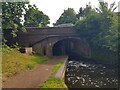
Broadwaters Aqueduct Winding Hole — 7½ furlongs and 1 lock away
On this waterway in the direction of York Street Bridge
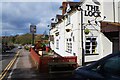
Academy Winding Hole — 2 miles and 2 locks away
On this waterway in the direction of York Street Bridge
Pratt's Wharf — 3 miles, 6¾ furlongs and 4 locks away
On this waterway in the direction of York Street Bridge
Former Railway Interchange Basin — 5 miles, 2½ furlongs and 4 locks away
On this waterway in the direction of York Street Bridge
Stourport Upper Basin — 6 miles, ¾ furlongs and 5 locks away
Travel to York Street Bridge, then on the Staffordshire and Worcestershire Canal (Stourport Basins: Narrow Route) to Stourport Upper Basin
Stourport Clock Basin — 6 miles, 1¼ furlongs and 5 locks away
Travel to York Street Bridge, then on the Staffordshire and Worcestershire Canal (Stourport Basins: Narrow Route) to Stourport Clock Basin
Stourport Lower Basin - between Broad Locks — 6 miles, 1½ furlongs and 6 locks away
Travel to York Street Bridge, then on the Staffordshire and Worcestershire Canal (Stourport Basins: Narrow Route) to Stourport Upper Basin, then on the Staffordshire and Worcestershire Canal (Stourport Basins: Broad Route) to Stourport Lower Basin - between Broad Locks
Stourport Lower Basin - between Narrow Locks — 6 miles, 1¾ furlongs and 6 locks away
Travel to York Street Bridge, then on the Staffordshire and Worcestershire Canal (Stourport Basins: Narrow Route) to Stourport Upper Basin, then on the Staffordshire and Worcestershire Canal (Stourport Basins: Broad Route) to Stourport Lower Basin - between Broad Locks, then on the Staffordshire and Worcestershire Canal (Stourport Basins: Broad Locks to Narrow Locks to Stourport Lower Basin - between Narrow Locks
Severn - Stourport Narrow Locks Entrance — 6 miles, 2½ furlongs and 7 locks away
Travel to York Street Bridge, then on the Staffordshire and Worcestershire Canal (Stourport Basins: Narrow Route) to Stourport Upper Basin, then on the Staffordshire and Worcestershire Canal (Stourport Basins: Broad Route) to Severn - Stourport Broad Locks Entrance, then on the River Severn (main river - Stourport to Worcester) to Severn - Stourport Narrow Locks Entrance

Nearest self-operated pump-out

In the direction of Stourton Junction

Kinver Services — 4 miles, 4¾ furlongs and 4 locks away
On this waterway in the direction of Stourton Junction
Dudley Tunnel (northern entrance) — 16 miles, 7¼ furlongs and 38 locks away
Travel to Stourton Junction, then on the Stourbridge Canals (Main Line) to Black Delph, then on the Birmingham Canal Navigations (Dudley Canal No 1 - Through Route) to Pensnett Junction, then on the Birmingham Canal Navigations (Dudley Canal No 1 - Dudley Tunnel) to Dudley Tunnel (northern entrance)
Black Country Museum — 17 miles, ¼ furlongs and 38 locks away
Travel to Stourton Junction, then on the Stourbridge Canals (Main Line) to Black Delph, then on the Birmingham Canal Navigations (Dudley Canal No 1 - Through Route) to Pensnett Junction, then on the Birmingham Canal Navigations (Dudley Canal No 1 - Dudley Tunnel) to Dudley Tunnel (northern entrance), then on the Birmingham Canal Navigations (Dudley Canal No 1 - Birmingham End) to Black Country Museum
Todds End Customer Service Facility — 17 miles, ½ furlongs and 38 locks away
Travel to Stourton Junction, then on the Stourbridge Canals (Main Line) to Black Delph, then on the Birmingham Canal Navigations (Dudley Canal No 1 - Through Route) to Pensnett Junction, then on the Birmingham Canal Navigations (Dudley Canal No 1 - Dudley Tunnel) to Dudley Tunnel (northern entrance), then on the Birmingham Canal Navigations (Dudley Canal No 1 - Birmingham End) to Todds End Customer Service Facility

In the direction of York Street Bridge

Diglis Services — 19 miles, 2¼ furlongs and 12 locks away
Travel to York Street Bridge, then on the Staffordshire and Worcestershire Canal (Stourport Basins: Narrow Route) to Stourport Upper Basin, then on the Staffordshire and Worcestershire Canal (Stourport Basins: Broad Route) to Severn - Stourport Broad Locks Entrance, then on the River Severn (main river - Stourport to Worcester) to Diglis Junction, then on the Worcester and Birmingham Canal (Diglis Junction to Diglis Basin) to Diglis Basin, then on the Worcester and Birmingham Canal (Diglis Basin to King's Norton Junction) to Diglis Services

Nearest boatyard pump-out

In the direction of Stourton Junction

Autherley Wharf — 19 miles, 4½ furlongs and 25 locks away
Travel to Stourton Junction, then on the Staffordshire and Worcestershire Canal (Main Line: Stourton to Aldersley) to Aldersley Junction, then on the Staffordshire and Worcestershire Canal (Main Line: Aldersley to Autherley) to Autherley Junction, then on the Shropshire Union Canal (Birmingham and Liverpool Junction Canal - Main Line) to Autherley Wharf
Withymoor Island Service Wharf — 17 miles, ¼ furlongs and 35 locks away
Travel to Stourton Junction, then on the Stourbridge Canals (Main Line) to Black Delph, then on the Birmingham Canal Navigations (Dudley Canal No 1 - Through Route) to Parkhead Junction, then on the Birmingham Canal Navigations (Dudley Canal No 2 - Coombeswood ) to Withymoor Island Service Wharf

In the direction of York Street Bridge

Stourport Upper Basin — 6 miles, ¾ furlongs and 5 locks away
Travel to York Street Bridge, then on the Staffordshire and Worcestershire Canal (Stourport Basins: Narrow Route) to Stourport Upper Basin
Upper Staircase Lock Landing Pontoon — 6 miles, 1½ furlongs and 5 locks away
Travel to York Street Bridge, then on the Staffordshire and Worcestershire Canal (Stourport Basins: Narrow Route) to Upper Staircase Lock Landing Pontoon
Stourport Marina — 7 miles, ¾ furlongs and 7 locks away
Travel to York Street Bridge, then on the Staffordshire and Worcestershire Canal (Stourport Basins: Narrow Route) to Stourport Upper Basin, then on the Staffordshire and Worcestershire Canal (Stourport Basins: Broad Route) to Severn - Stourport Broad Locks Entrance, then on the River Severn (main river - Stourport to Worcester) to Stourport Marina
Direction of TV transmitter (From Wolfbane Cybernetic)
 
 
Geograph
 
Wikipedia

There is no page on Wikipedia called “The Lock Inn and Old Smithy Tea Rooms at Wolverley”

 
Google