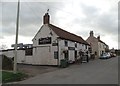
Barmby-on-the-Marsh
Fleet Lane, Barmby on the Marsh DN14 7HN, United Kingdom

Barmby-on-the-Marsh
is a village
on the River Derwent between
Breighton (4 miles and 2½ furlongs
to the northeast) and
Ouse - Derwent Junction (Junction of the River Ouse and the River Derwent ) (4½ furlongs
and 1 lock
to the west).
The nearest place in the direction of Breighton is Loftsome Bridge;
1 mile and 3½ furlongs
away.
The nearest place in the direction of Ouse - Derwent Junction is Barmby Barrage (Cylindrical lock gates hold back tidal water in either direction.);
4¼ furlongs
away.
Mooring here is unrated.
"The Brighton Ferry" Wharf | 4 miles, 6¼ furlongs | |
Menthorpe | 4 miles, 5½ furlongs | |
Breighton | 4 miles, 2½ furlongs | |
Wressel Railway Bridge | 2 miles, 2½ furlongs | |
Loftsome Bridge | 1 mile, 3½ furlongs | |
Barmby-on-the-Marsh | ||
Barmby Barrage | 4¼ furlongs | |
Ouse - Derwent Junction | 4½ furlongs |
Amenities here
There are no links to external websites from here.
Why not log in and add some (select "External websites" from the menu (sometimes this is under "Edit"))?
Mouseover for more information or show routes to facility
Nearest water point
In the direction of Stamford Bridge Lock No 2
Melbourne Junction — 15 miles, 7 furlongs and 2 locks away
Travel to Cottingwith Junction, then on the Pocklington Canal (Navigable Section) to Melbourne Junction
Melbourne Basin — 16 miles, 1 furlong and 2 locks away
Travel to Cottingwith Junction, then on the Pocklington Canal (Navigable Section) to Melbourne Junction, then on the Pocklington Canal (Melbourne Arm) to Melbourne Basin
In the direction of Ouse - Derwent Junction
Selby Basin — 7 miles, 4½ furlongs and 2 locks away
Travel to Ouse - Derwent Junction, then on the River Ouse : Yorkshire (tidal section - Naburn to Goole) to Selby Junction (River Ouse), then on the Aire and Calder Navigation (Selby Section) to Selby Basin
Goole Marina — 10 miles, 5¾ furlongs and 2 locks away
Travel to Ouse - Derwent Junction, then on the River Ouse : Yorkshire (tidal section - Naburn to Goole) to Ouse - Aire and Calder Junction, then on the Aire and Calder Navigation (Main Line - Goole to Castleford) to Goole Marina
Dutch Riverside — 10 miles, 7¼ furlongs and 2 locks away
Travel to Ouse - Derwent Junction, then on the River Ouse : Yorkshire (tidal section - Naburn to Goole) to Ouse - Aire and Calder Junction, then on the Aire and Calder Navigation (Main Line - Goole to Castleford) to Dutch Riverside
Beal Lock No 2 — 16 miles, 1¼ furlongs and 3 locks away
Travel to Ouse - Derwent Junction, then on the River Ouse : Yorkshire (tidal section - Naburn to Goole) to Selby Junction (River Ouse), then on the Aire and Calder Navigation (Selby Section) to Beal Lock No 2
Beal Bridge — 16 miles, 2¾ furlongs and 4 locks away
Travel to Ouse - Derwent Junction, then on the River Ouse : Yorkshire (tidal section - Naburn to Goole) to Selby Junction (River Ouse), then on the Aire and Calder Navigation (Selby Section) to Beal Bridge
Pollington Visitor Mooring — 19 miles, 1 furlong and 2 locks away
Travel to Ouse - Derwent Junction, then on the River Ouse : Yorkshire (tidal section - Naburn to Goole) to Ouse - Aire and Calder Junction, then on the Aire and Calder Navigation (Main Line - Goole to Castleford) to Pollington Visitor Mooring
Pollington Manor Swing Bridge — 19 miles, 1½ furlongs and 2 locks away
Travel to Ouse - Derwent Junction, then on the River Ouse : Yorkshire (tidal section - Naburn to Goole) to Ouse - Aire and Calder Junction, then on the Aire and Calder Navigation (Main Line - Goole to Castleford) to Pollington Manor Swing Bridge
Bank Dole Lock No 1 — 18 miles, 5¼ furlongs and 4 locks away
Travel to Ouse - Derwent Junction, then on the River Ouse : Yorkshire (tidal section - Naburn to Goole) to Selby Junction (River Ouse), then on the Aire and Calder Navigation (Selby Section) to Bank Dole Lock No 1Nearest rubbish disposal
In the direction of Stamford Bridge Lock No 2
Sutton Road Bridge (Elvington) — 15 miles, ½ furlongs and 1 lock away
On this waterway in the direction of Stamford Bridge Lock No 2
Melbourne Junction — 15 miles, 7 furlongs and 2 locks away
Travel to Cottingwith Junction, then on the Pocklington Canal (Navigable Section) to Melbourne Junction
In the direction of Ouse - Derwent Junction
Selby Basin — 7 miles, 4½ furlongs and 2 locks away
Travel to Ouse - Derwent Junction, then on the River Ouse : Yorkshire (tidal section - Naburn to Goole) to Selby Junction (River Ouse), then on the Aire and Calder Navigation (Selby Section) to Selby Basin
Goole Marina — 10 miles, 5¾ furlongs and 2 locks away
Travel to Ouse - Derwent Junction, then on the River Ouse : Yorkshire (tidal section - Naburn to Goole) to Ouse - Aire and Calder Junction, then on the Aire and Calder Navigation (Main Line - Goole to Castleford) to Goole Marina
Dutch Riverside — 10 miles, 7¼ furlongs and 2 locks away
Travel to Ouse - Derwent Junction, then on the River Ouse : Yorkshire (tidal section - Naburn to Goole) to Ouse - Aire and Calder Junction, then on the Aire and Calder Navigation (Main Line - Goole to Castleford) to Dutch RiversideNearest chemical toilet disposal
In the direction of Stamford Bridge Lock No 2
Melbourne Junction — 15 miles, 7 furlongs and 2 locks away
Travel to Cottingwith Junction, then on the Pocklington Canal (Navigable Section) to Melbourne Junction
In the direction of Ouse - Derwent Junction
Selby Basin — 7 miles, 4½ furlongs and 2 locks away
Travel to Ouse - Derwent Junction, then on the River Ouse : Yorkshire (tidal section - Naburn to Goole) to Selby Junction (River Ouse), then on the Aire and Calder Navigation (Selby Section) to Selby Basin
Goole Marina — 10 miles, 5¾ furlongs and 2 locks away
Travel to Ouse - Derwent Junction, then on the River Ouse : Yorkshire (tidal section - Naburn to Goole) to Ouse - Aire and Calder Junction, then on the Aire and Calder Navigation (Main Line - Goole to Castleford) to Goole Marina
Dutch Riverside — 10 miles, 7¼ furlongs and 2 locks away
Travel to Ouse - Derwent Junction, then on the River Ouse : Yorkshire (tidal section - Naburn to Goole) to Ouse - Aire and Calder Junction, then on the Aire and Calder Navigation (Main Line - Goole to Castleford) to Dutch RiversideNearest place to turn
In the direction of Stamford Bridge Lock No 2
Cottingwith Junction — 10 miles, 7¼ furlongs away
On this waterway in the direction of Stamford Bridge Lock No 2
Storwood Winding Hole — 12 miles, 6½ furlongs and 1 lock away
Travel to Cottingwith Junction, then on the Pocklington Canal (Navigable Section) to Storwood Winding Hole
Sutton Lock Weir Exit — 14 miles, 6¾ furlongs away
On this waterway in the direction of Stamford Bridge Lock No 2
Gardham Winding Hole — 14 miles, ¾ furlongs and 1 lock away
Travel to Cottingwith Junction, then on the Pocklington Canal (Navigable Section) to Gardham Winding Hole
Sutton Lock Weir Entrance — 14 miles, 7¾ furlongs and 1 lock away
On this waterway in the direction of Stamford Bridge Lock No 2
Melbourne Junction — 15 miles, 7 furlongs and 2 locks away
Travel to Cottingwith Junction, then on the Pocklington Canal (Navigable Section) to Melbourne Junction
Melbourne Basin — 16 miles, 1 furlong and 2 locks away
Travel to Cottingwith Junction, then on the Pocklington Canal (Navigable Section) to Melbourne Junction, then on the Pocklington Canal (Melbourne Arm) to Melbourne Basin
Thornton Lock Winding Hole — 16 miles, 2½ furlongs and 2 locks away
Travel to Cottingwith Junction, then on the Pocklington Canal (Navigable Section) to Thornton Lock Winding Hole
Bielby Arm — 17 miles, 7¼ furlongs and 4 locks away
Travel to Cottingwith Junction, then on the Pocklington Canal (Navigable Section) to Bielby Arm
In the direction of Ouse - Derwent Junction
Selby Basin — 7 miles, 4½ furlongs and 2 locks away
Travel to Ouse - Derwent Junction, then on the River Ouse : Yorkshire (tidal section - Naburn to Goole) to Selby Junction (River Ouse), then on the Aire and Calder Navigation (Selby Section) to Selby Basin
Viking Marina — 10 miles, 6½ furlongs and 2 locks away
Travel to Ouse - Derwent Junction, then on the River Ouse : Yorkshire (tidal section - Naburn to Goole) to Ouse - Aire and Calder Junction, then on the Aire and Calder Navigation (Main Line - Goole to Castleford) to Viking Marina
Haddlesey Junction — 12 miles, 3 furlongs and 3 locks away
Travel to Ouse - Derwent Junction, then on the River Ouse : Yorkshire (tidal section - Naburn to Goole) to Selby Junction (River Ouse), then on the Aire and Calder Navigation (Selby Section) to Haddlesey Junction
Beal Lock No 2 Weir Entrance — 16 miles, 2¼ furlongs and 4 locks away
Travel to Ouse - Derwent Junction, then on the River Ouse : Yorkshire (tidal section - Naburn to Goole) to Selby Junction (River Ouse), then on the Aire and Calder Navigation (Selby Section) to Beal Lock No 2 Weir Entrance
Bank Dole Lock Junction — 18 miles, 4¾ furlongs and 4 locks away
Travel to Ouse - Derwent Junction, then on the River Ouse : Yorkshire (tidal section - Naburn to Goole) to Selby Junction (River Ouse), then on the Aire and Calder Navigation (Selby Section) to Bank Dole Lock JunctionNearest boatyard pump-out
In the direction of Ouse - Derwent Junction
Goole Marina — 10 miles, 5¾ furlongs and 2 locks away
Travel to Ouse - Derwent Junction, then on the River Ouse : Yorkshire (tidal section - Naburn to Goole) to Ouse - Aire and Calder Junction, then on the Aire and Calder Navigation (Main Line - Goole to Castleford) to Goole MarinaNo information
CanalPlan has no information on any of the following facilities within range:self-operated pump-out
Direction of TV transmitter (From Wolfbane Cybernetic)
There is no page on Wikipedia called “Barmby-on-the-Marsh”
Wikipedia pages that might relate to Barmby-on-the-Marsh
[Barmby on the Marsh]
Barmby on the Marsh is a village and civil parish in the East Riding of Yorkshire, England. It is situated approximately 4 miles (6.4 km) west of the
[River Derwent, Yorkshire]
Duffield. Water from the tidal River Ouse is prevented from entering the Derwent by means of a barrage at Barmby on the Marsh. The Derwent has been kept
[Barmby railway station]
Barmby railway station was a station on the Hull and Barnsley Railway, and served the village of Barmby on the Marsh in the East Riding of Yorkshire,
[St Helen's Church, Barmby on the Marsh]
The Church of St Helen, Barmby on the Marsh, East Riding of Yorkshire, England is a redundant church which is now in the care of the Friends of Friendless
[Barmby]
Nick Barmby (born 1974), English professional footballer, former manager of Football League Championship club Hull City Geography: Barmby on the Marsh, village
[Howden]
East Riding: Asselby, Aughton, Backenholme with Woodale, Balkholme, Barmby-on-the-Marsh, Belby, Bellasize, Blacktoft, Breighton, Broomfleet, Bubwith, North
[Yorkshire]
the River Ouse at Barmby on the Marsh. In the far north of the county the River Tees flows eastwards through Teesdale and empties its waters into the
[List of places in Yorkshire]
Baldersby St James, Balkholme, Bardsey, Barkerend, Barlby, Barmby Moor, Barmby on the Marsh, Barmston, Barnoldswick, Barkston Ash, Barnsley, Barugh, Barugh-Green
[River Ouse, Yorkshire]
Acaster Selby Cawood Kelfield Riccall Barlby Selby Hemingbrough Barmby on the Marsh Booth Hook Skelton Goole Swinefleet Saltmarshe Reedness Little Reedness
[Wressle]
to the early 1930s, at which time a new bridge was built for the Hull-Selby road (part of the A63). (In the parish of Barmby on the Marsh) In the early
Results of Google Search
Barmby on the Marsh - WikipediaBarmby on the Marsh is a village and civil parish in the East Riding of Yorkshire, England. It is situated approximately 4 miles (6.4 km) west of the market town of ...
Jan 10, 2021 - Rent from people in Barmby on the Marsh, United Kingdom from $20/night. Find unique places to stay with local hosts in 191 countries. Belong ...
Flats & Houses For Sale in Barmby-On-The-Marsh - Find properties with Rightmove - the UK's largest selection of properties.
BARMBY-on-the-Marsh (St Helen), a chapelry, in the parish and union of Howden, East Riding, Yorkshire, 3½ miles (W.) from Howden; containing 506 inhabitants.
Hourly Local Weather Forecast, weather conditions, precipitation, dew point, humidity, wind from Weather.com and The Weather Channel.
Sep 15, 2020 ... A warm welcome to Barmby on the Marsh Primary School. Our children thrive and develop their independence and confidence in a busy and ...
Barmby on the Marsh, United Kingdom 10 Day Weather. 16:47 BST. Print. Day. Description, High / Low, Precip, Wind, Humidity. Tonight. 2 MAY. Partly Cloudy.
Sky map showing night sky tonight in Barmby on the Marsh, England, United Kingdom. What planets are visible? Where is Mars, Saturn or Venus? What is the ...
14-day weather forecast for Barmby on the Marsh.
Rise/Set Times; Day/Night Length. 2019 Sun Graph for Barmby on the Marsh. JanFebMarAprMayJunJulAugSepOctNovDec. 222018161412100806040200.