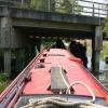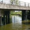
Clay Bank Road Bridge
is a place on the waterways
on the River Witham (Sleaford Navigation(Kyme Eau)-navigable section) between
Chapel Hill Junction (Junction with Sleaford Navigation (Kyme Eau)-navigable section ) (3 miles and 4¼ furlongs
and 1 lock
to the northeast) and
South Kyme (¾ furlongs
to the west).
The nearest place in the direction of Chapel Hill Junction is Winding Hole below Clay Bank Road Bridge;
4¾ furlongs
away.
Mooring here is unrated.
There is a bridge here which takes a road over the canal.
| Chapel Hill Junction | 3 miles, 4¼ furlongs | |
| North Forty Foot Bank Bridge | 3 miles, 3¼ furlongs | |
| Kyme Eau Flood Lock | 3 miles, 3 furlongs | |
| Lower Kyme Lock | 2 miles, 3½ furlongs | |
| Winding Hole below Clay Bank Road Bridge | 4¾ furlongs | |
| Clay Bank Road Bridge | ||
| South Kyme | ¾ furlongs | |
| High Street Footbridge | 1¼ furlongs | |
| Low Road Bridge | 2 furlongs | |
| Church Lane Field Bridge | 5¼ furlongs | |
| South Kyme Field Bridge No 2 | 1 mile, ¼ furlongs | |
There are no links to external websites from here.
Why not log in and add some (select "External websites" from the menu (sometimes this is under "Edit"))?
Why not log in and add some (select "External websites" from the menu (sometimes this is under "Edit"))?
Mouseover for more information or show routes to facility
Nearest water point
In the direction of Chapel Hill Junction
Langrick Bridge General Store and Marina — 9 miles and 1 lock away
Travel to Chapel Hill Junction, then on the River Witham (Lincoln to Boston) to Langrick Bridge General Store and Marina
Boston Lock Visitor Moorings — 13 miles, 1 furlong and 1 lock away
Travel to Chapel Hill Junction, then on the River Witham (Lincoln to Boston) to Boston Lock Visitor Moorings
Bardney Lock No 2 — 17 miles, 3¼ furlongs and 1 lock away
Travel to Chapel Hill Junction, then on the River Witham (Lincoln to Boston) to Bardney Lock No 2Nearest rubbish disposal
In the direction of Chapel Hill Junction
Boston Lock Visitor Moorings — 13 miles, 1 furlong and 1 lock away
Travel to Chapel Hill Junction, then on the River Witham (Lincoln to Boston) to Boston Lock Visitor Moorings
Boston Grand Sluice Lock No 3 — 13 miles, 3½ furlongs and 1 lock away
Travel to Chapel Hill Junction, then on the River Witham (Lincoln to Boston) to Boston Grand Sluice Lock No 3
Bardney Lock No 2 — 17 miles, 3¼ furlongs and 1 lock away
Travel to Chapel Hill Junction, then on the River Witham (Lincoln to Boston) to Bardney Lock No 2Nearest chemical toilet disposal
In the direction of Chapel Hill Junction
Boston Grand Sluice Lock No 3 — 13 miles, 3½ furlongs and 1 lock away
Travel to Chapel Hill Junction, then on the River Witham (Lincoln to Boston) to Boston Grand Sluice Lock No 3
Bardney Lock No 2 — 17 miles, 3¼ furlongs and 1 lock away
Travel to Chapel Hill Junction, then on the River Witham (Lincoln to Boston) to Bardney Lock No 2Nearest place to turn
In the direction of Chapel Hill Junction
Winding Hole below Clay Bank Road Bridge — 4¾ furlongs away
On this waterway in the direction of Chapel Hill Junction
Chapel Hill Junction — 3 miles, 4¼ furlongs and 1 lock away
On this waterway in the direction of Chapel Hill Junction
Orchard Caravan and Camping Park Moorings — 3 miles, 6¾ furlongs and 1 lock away
Travel to Chapel Hill Junction, then on the River Witham (Lincoln to Boston) to Orchard Caravan and Camping Park Moorings
Dogdyke Visitor Moorings — 4 miles, 3¾ furlongs and 1 lock away
Travel to Chapel Hill Junction, then on the River Witham (Lincoln to Boston) to Dogdyke Visitor Moorings
Belle Isle Marina — 4 miles, 4¼ furlongs and 1 lock away
Travel to Chapel Hill Junction, then on the River Witham (Lincoln to Boston) to Belle Isle Marina
Tattershall Bridge Visitor Moorings — 5 miles, 3½ furlongs and 1 lock away
Travel to Chapel Hill Junction, then on the River Witham (Lincoln to Boston) to Tattershall Bridge Visitor Moorings
Horncastle Canal Junction — 6 miles, ¼ furlongs and 1 lock away
Travel to Chapel Hill Junction, then on the River Witham (Lincoln to Boston) to Horncastle Canal Junction
Langrick Bridge General Store and Marina — 9 miles and 1 lock away
Travel to Chapel Hill Junction, then on the River Witham (Lincoln to Boston) to Langrick Bridge General Store and Marina
Kirkstead Bridge Visitor Moorings — 9 miles, 7 furlongs and 1 lock away
Travel to Chapel Hill Junction, then on the River Witham (Lincoln to Boston) to Kirkstead Bridge Visitor Moorings
Anton's Gowt Junction — 11 miles, ¼ furlongs and 1 lock away
Travel to Chapel Hill Junction, then on the River Witham (Lincoln to Boston) to Anton's Gowt Junction
Stixwould — 12 miles and 1 lock away
Travel to Chapel Hill Junction, then on the River Witham (Lincoln to Boston) to Stixwould
Boston Lock Visitor Moorings — 13 miles, 1 furlong and 1 lock away
Travel to Chapel Hill Junction, then on the River Witham (Lincoln to Boston) to Boston Lock Visitor Moorings
Boston Motor Yatch Club — 13 miles, 2¼ furlongs and 1 lock away
Travel to Chapel Hill Junction, then on the River Witham (Lincoln to Boston) to Boston Motor Yatch Club
Boston Gateway Marina — 13 miles, 2¾ furlongs and 1 lock away
Travel to Chapel Hill Junction, then on the River Witham (Lincoln to Boston) to Boston Gateway Marina
Southrey Visitor Moorings — 13 miles, 4¾ furlongs and 1 lock away
Travel to Chapel Hill Junction, then on the River Witham (Lincoln to Boston) to Southrey Visitor Moorings
Dunstan Fen Visitor Moorings — 13 miles, 5¼ furlongs and 1 lock away
Travel to Chapel Hill Junction, then on the River Witham (Lincoln to Boston) to Dunstan Fen Visitor Moorings
River Witham - Nocton Delph Junction — 14 miles, 2¾ furlongs and 1 lock away
Travel to Chapel Hill Junction, then on the River Witham (Lincoln to Boston) to River Witham - Nocton Delph Junction
Bardney Village Visitor Moorings — 16 miles, 6 furlongs and 1 lock away
Travel to Chapel Hill Junction, then on the River Witham (Lincoln to Boston) to Bardney Village Visitor Moorings
Bettinson's Bridge Winding Hole — 17 miles and 2 locks away
Travel to Chapel Hill Junction, then on the River Witham (Lincoln to Boston) to Anton's Gowt Junction, then on the Witham Navigable Drains (Frith Bank Drain) to Newham Drain - Frith Bank Drain Junction, then on the Witham Navigable Drains (Newham Drain) to Newham Drain - Howbridge Drain - West Fen Drain Junction, then on the Witham Navigable Drains (Howbridge Drain) to Bettinson's Bridge Winding Hole
In the direction of Cobblers Lock
Cobblers Lock Winding Hole — 3 miles, 3¾ furlongs away
On this waterway in the direction of Cobblers LockNo information
CanalPlan has no information on any of the following facilities within range:self-operated pump-out
boatyard pump-out
Direction of TV transmitter (From Wolfbane Cybernetic)
There is no page on Wikipedia called “Clay Bank Road Bridge”
Wikipedia pages that might relate to Clay Bank Road Bridge
[Batman Bridge]
432 metres (1,417 ft) between abutments. The east bank is soft clay not capable of supporting a bridge. A causeway carries the highway across this softer
[Second Hannibal Bridge]
Second Hannibal Bridge is a rail bridge over the Missouri River in Kansas City, Missouri, connecting Jackson County, Missouri, with Clay County, Missouri
[Trajan's Bridge]
crossing the bridge was possible only by walking through the camps. The castra were called Pontes and Drobeta (Drobetis). On the right bank, at the modern
[London Bridge]
bridge were marked by the church of St Magnus-the-Martyr on the northern bank and by Southwark Cathedral on the southern shore. Until Putney Bridge opened
[Humber Bridge]
Humber Bridge, near Kingston upon Hull, East Riding of Yorkshire, England, is a 2.22 km (2,430 yd; 7,300 ft; 1.38 mi) single-span road suspension bridge, which
[Henry Clay]
Henry Clay Sr. (April 12, 1777 – June 29, 1852) was an American attorney and statesman who represented Kentucky in both the Senate and House. He was the
[List of road–rail bridges]
Road–rail bridges are bridges shared by road and rail lines. Road and rail may be segregated so that trains may operate at the same time as cars (e.g
[Vauxhall Bridge]
Vauxhall on the south bank and Pimlico on the north bank. Opened in 1906, it replaced an earlier bridge, originally known as Regent Bridge but later renamed
[Huey P. Long Bridge (Jefferson Parish)]
upriver from the city of New Orleans. The East Bank entrance is at Elmwood, Louisiana, and the West Bank at Bridge City. It was designed by Polish-American
[Florida State Road 16]
before crossing a bridge over Peters Creek. At the Clay County Fairgrounds, the route has a short overlap with Clay CR 315, a tri-county road running from
Results of Google Search
Creator of the Vurger App. Follow me on Instagram @clay.banks ... man riding bicycle in road during daytime · Collect ... man leaning on bridge · Collect.
Abandoned inverted bowstring through truss bridge over Claybank Creek on an old road.
Listed below are all properties on Clay Bank Drive in C. B. County.Please note we use data from Service Nova Scotia and Municipal Relations for street names ...
Abandoned slab bridge over Claybank Creek on an old road.
Sold for $656000 on 4/2/19: 45 Photos • 4 bed, 3 bath, 2866 sqft house at 3862 Clay Bank Road • Luxury and comfort under one roof.. This home has 4 large ...
Mar 26, 2019 ... For Sale: P2H.Price.PriceOffer - Single family, 3 bed, 2 bath, 2542 sqft at 102 Clay Bank Dr in Albert Bridge.
Now For Sale: 38 Photos • 4 bed, 3 bath, 2512 sqft house at 3793 Clay Bank Road • Your Search Has Ended! Beautiful & Spacious 4 bedroom, 3 full bath home ...
3834 Clay Bank Rd, Fairfield, CA is a single family home that contains 3,101 sq ft and was built in 2012. It contains 5 bedrooms and 2.5 bathrooms. This home ...
... Park Rd · Hooley Bridge, Bamford Road / adjacent Bury & Rochdale Old Rd ... Brow, Bamford Rd / opposite Heywood Hall Rd · Back O th Moss, Clay Bank St ...


