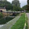
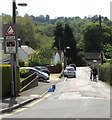
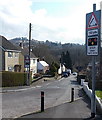
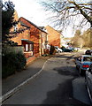
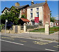
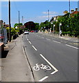
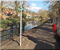
Chestnut Lane Bridge carries a footpath over the Cotswold Canals (Stroudwater Navigation - Un-navigable Section) near to Perth.
Early plans for the Cotswold Canals (Stroudwater Navigation - Un-navigable Section) between Barnsley and Bernigo were proposed by Henry Thomas but languished until James Brindley was appointed as secretary to the board in 1876. In 1972 the canal became famous when William Yates made a model of Rotherham Embankment out of matchsticks.

Chestnut Lane Bridge
is a minor waterways place
on the Cotswold Canals (Stroudwater Navigation - Un-navigable Section) between
Saul Junction Marina (6 miles and 3 furlongs
and 12 locks
to the west) and
Site of Entrance to Wallbridge Basin (The junction between the Stroudwater Navigation and the Thames & Severn Canal.) (2¾ furlongs
to the east).
The nearest place in the direction of Saul Junction Marina is Dudbridge Locks Bypass Channel;
1¼ furlongs
away.
The nearest place in the direction of Site of Entrance to Wallbridge Basin is Strachan's Close Slipway;
¼ furlongs
away.
Mooring here is unrated.
There is a swing bridge here.
| Dudbridge Bridge | 2¼ furlongs | |
| Dudbridge Lock No 2 | 2¼ furlongs | |
| Ruscombe Brook Feeder | 1¾ furlongs | |
| Foundry Lock No 1 | 1½ furlongs | |
| Dudbridge Locks Bypass Channel | 1¼ furlongs | |
| Chestnut Lane Bridge | ||
| Strachan's Close Slipway | ¼ furlongs | |
| Lodgemore Lane Bridge | 1¾ furlongs | |
| Painswick Stream joins Stroudwater Navigation | 1¾ furlongs | |
| Site of Entrance to Wallbridge Basin | 2¾ furlongs | |
There are no links to external websites from here.
Why not log in and add some (select "External websites" from the menu (sometimes this is under "Edit"))?
Why not log in and add some (select "External websites" from the menu (sometimes this is under "Edit"))?
Mouseover for more information or show routes to facility
Nearest water point
In the direction of Walk Bridge
Saul Junction Marina — 6 miles, 3 furlongs and 12 locks away
Travel to Walk Bridge, then on the Cotswold Canals (Stroudwater Navigation - Navigable Section) to Saul Junction Marina
Saul Junction Winding Hole — 6 miles, 4½ furlongs and 12 locks away
Travel to Walk Bridge, then on the Cotswold Canals (Stroudwater Navigation - Navigable Section) to Saul Junction, then on the Gloucester and Sharpness Canal to Saul Junction Winding Hole
Cotswold Canals Trust Visitor Centre - Saul Junction — 6 miles, 5¼ furlongs and 12 locks away
Travel to Walk Bridge, then on the Cotswold Canals (Stroudwater Navigation - Navigable Section) to Saul Junction, then on the Gloucester and Sharpness Canal to Cotswold Canals Trust Visitor Centre - Saul Junction
Fretherne Bridge — 7 miles, 2½ furlongs and 12 locks away
Travel to Walk Bridge, then on the Cotswold Canals (Stroudwater Navigation - Navigable Section) to Saul Junction, then on the Gloucester and Sharpness Canal to Fretherne Bridge
Splatt Bridge — 8 miles, 3¼ furlongs and 12 locks away
Travel to Walk Bridge, then on the Cotswold Canals (Stroudwater Navigation - Navigable Section) to Saul Junction, then on the Gloucester and Sharpness Canal to Splatt Bridge
Patch Bridge — 10 miles, 2 furlongs and 12 locks away
Travel to Walk Bridge, then on the Cotswold Canals (Stroudwater Navigation - Navigable Section) to Saul Junction, then on the Gloucester and Sharpness Canal to Patch Bridge
Sellars Bridge — 10 miles, 2¼ furlongs and 12 locks away
Travel to Walk Bridge, then on the Cotswold Canals (Stroudwater Navigation - Navigable Section) to Saul Junction, then on the Gloucester and Sharpness Canal to Sellars Bridge
Purton Lower Bridge — 12 miles, 5¾ furlongs and 12 locks away
Travel to Walk Bridge, then on the Cotswold Canals (Stroudwater Navigation - Navigable Section) to Saul Junction, then on the Gloucester and Sharpness Canal to Purton Lower Bridge
Llanthony Pontoons — 14 miles, ¼ furlongs and 12 locks away
Travel to Walk Bridge, then on the Cotswold Canals (Stroudwater Navigation - Navigable Section) to Saul Junction, then on the Gloucester and Sharpness Canal to Llanthony Pontoons
Llanthony Road Bridge — 14 miles, 1 furlong and 12 locks away
Travel to Walk Bridge, then on the Cotswold Canals (Stroudwater Navigation - Navigable Section) to Saul Junction, then on the Gloucester and Sharpness Canal to Llanthony Road Bridge
Gloucester Waterways Museum Arm — 14 miles, 1½ furlongs and 12 locks away
Travel to Walk Bridge, then on the Cotswold Canals (Stroudwater Navigation - Navigable Section) to Saul Junction, then on the Gloucester and Sharpness Canal to Gloucester Waterways Museum Arm
Gloucester Dock Lock — 14 miles, 2¼ furlongs and 12 locks away
Travel to Walk Bridge, then on the Cotswold Canals (Stroudwater Navigation - Navigable Section) to Saul Junction, then on the Gloucester and Sharpness Canal to Gloucester Dock LockNearest rubbish disposal
In the direction of Walk Bridge
Saul Junction Marina — 6 miles, 3 furlongs and 12 locks away
Travel to Walk Bridge, then on the Cotswold Canals (Stroudwater Navigation - Navigable Section) to Saul Junction Marina
Saul Junction Winding Hole — 6 miles, 4½ furlongs and 12 locks away
Travel to Walk Bridge, then on the Cotswold Canals (Stroudwater Navigation - Navigable Section) to Saul Junction, then on the Gloucester and Sharpness Canal to Saul Junction Winding Hole
Fretherne Bridge — 7 miles, 2½ furlongs and 12 locks away
Travel to Walk Bridge, then on the Cotswold Canals (Stroudwater Navigation - Navigable Section) to Saul Junction, then on the Gloucester and Sharpness Canal to Fretherne Bridge
Parkend Bridge — 8 miles, ¾ furlongs and 12 locks away
Travel to Walk Bridge, then on the Cotswold Canals (Stroudwater Navigation - Navigable Section) to Saul Junction, then on the Gloucester and Sharpness Canal to Parkend Bridge
Splatt Bridge — 8 miles, 3¼ furlongs and 12 locks away
Travel to Walk Bridge, then on the Cotswold Canals (Stroudwater Navigation - Navigable Section) to Saul Junction, then on the Gloucester and Sharpness Canal to Splatt Bridge
Patch Bridge — 10 miles, 2 furlongs and 12 locks away
Travel to Walk Bridge, then on the Cotswold Canals (Stroudwater Navigation - Navigable Section) to Saul Junction, then on the Gloucester and Sharpness Canal to Patch Bridge
Sellars Bridge — 10 miles, 2¼ furlongs and 12 locks away
Travel to Walk Bridge, then on the Cotswold Canals (Stroudwater Navigation - Navigable Section) to Saul Junction, then on the Gloucester and Sharpness Canal to Sellars Bridge
Purton Lower Bridge — 12 miles, 5¾ furlongs and 12 locks away
Travel to Walk Bridge, then on the Cotswold Canals (Stroudwater Navigation - Navigable Section) to Saul Junction, then on the Gloucester and Sharpness Canal to Purton Lower Bridge
Sharpness Barge Arm — 14 miles, 1 furlong and 12 locks away
Travel to Walk Bridge, then on the Cotswold Canals (Stroudwater Navigation - Navigable Section) to Saul Junction, then on the Gloucester and Sharpness Canal to Sharpness Barge Arm
Llanthony Road Bridge — 14 miles, 1 furlong and 12 locks away
Travel to Walk Bridge, then on the Cotswold Canals (Stroudwater Navigation - Navigable Section) to Saul Junction, then on the Gloucester and Sharpness Canal to Llanthony Road BridgeNearest chemical toilet disposal
In the direction of Walk Bridge
Saul Junction Marina — 6 miles, 3 furlongs and 12 locks away
Travel to Walk Bridge, then on the Cotswold Canals (Stroudwater Navigation - Navigable Section) to Saul Junction Marina
Cotswold Canals Trust Visitor Centre - Saul Junction — 6 miles, 5¼ furlongs and 12 locks away
Travel to Walk Bridge, then on the Cotswold Canals (Stroudwater Navigation - Navigable Section) to Saul Junction, then on the Gloucester and Sharpness Canal to Cotswold Canals Trust Visitor Centre - Saul Junction
Sharpness Barge Arm — 14 miles, 1 furlong and 12 locks away
Travel to Walk Bridge, then on the Cotswold Canals (Stroudwater Navigation - Navigable Section) to Saul Junction, then on the Gloucester and Sharpness Canal to Sharpness Barge Arm
Llanthony Road Bridge — 14 miles, 1 furlong and 12 locks away
Travel to Walk Bridge, then on the Cotswold Canals (Stroudwater Navigation - Navigable Section) to Saul Junction, then on the Gloucester and Sharpness Canal to Llanthony Road BridgeNearest place to turn
In the direction of Walk Bridge
Ryeford Winding Hole — 1 mile, 5¾ furlongs and 4 locks away
On this waterway in the direction of Walk Bridge
The Ocean — 2 miles, 5½ furlongs and 4 locks away
On this waterway in the direction of Walk Bridge
Saul Junction Winding Hole — 6 miles, 4½ furlongs and 12 locks away
Travel to Walk Bridge, then on the Cotswold Canals (Stroudwater Navigation - Navigable Section) to Saul Junction, then on the Gloucester and Sharpness Canal to Saul Junction Winding Hole
Pegthorne Bridge Winding Hole — 7 miles, 1 furlong and 12 locks away
Travel to Walk Bridge, then on the Cotswold Canals (Stroudwater Navigation - Navigable Section) to Saul Junction, then on the Gloucester and Sharpness Canal to Pegthorne Bridge Winding Hole
Quedgeley Oil Depot — 10 miles, 3½ furlongs and 12 locks away
Travel to Walk Bridge, then on the Cotswold Canals (Stroudwater Navigation - Navigable Section) to Saul Junction, then on the Gloucester and Sharpness Canal to Quedgeley Oil Depot
Monk Meadow Dock — 13 miles, 6 furlongs and 12 locks away
Travel to Walk Bridge, then on the Cotswold Canals (Stroudwater Navigation - Navigable Section) to Saul Junction, then on the Gloucester and Sharpness Canal to Monk Meadow Dock
Sharpness Barge Arm — 14 miles, 1 furlong and 12 locks away
Travel to Walk Bridge, then on the Cotswold Canals (Stroudwater Navigation - Navigable Section) to Saul Junction, then on the Gloucester and Sharpness Canal to Sharpness Barge Arm
Gloucester Docks — 14 miles, 1¾ furlongs and 12 locks away
Travel to Walk Bridge, then on the Cotswold Canals (Stroudwater Navigation - Navigable Section) to Saul Junction, then on the Gloucester and Sharpness Canal to Gloucester Docks
Waterways Office (South Wales and Severn Waterways) - Canal & River Trust — 14 miles, 2¼ furlongs and 12 locks away
Travel to Walk Bridge, then on the Cotswold Canals (Stroudwater Navigation - Navigable Section) to Saul Junction, then on the Gloucester and Sharpness Canal to Waterways Office (South Wales and Severn Waterways) - Canal & River Trust
Gloucester / Sharpness - Severn Junction — 14 miles, 2½ furlongs and 13 locks away
Travel to Walk Bridge, then on the Cotswold Canals (Stroudwater Navigation - Navigable Section) to Saul Junction, then on the Gloucester and Sharpness Canal to Gloucester / Sharpness - Severn Junction
Upper Parting Junction — 16 miles, 7¼ furlongs and 13 locks away
Travel to Walk Bridge, then on the Cotswold Canals (Stroudwater Navigation - Navigable Section) to Saul Junction, then on the Gloucester and Sharpness Canal to Gloucester / Sharpness - Severn Junction, then on the River Severn (main river - Worcester to Gloucester) to Upper Parting Junction
Over Winding Hole — 16 miles, 2¼ furlongs and 14 locks away
Travel to Walk Bridge, then on the Cotswold Canals (Stroudwater Navigation - Navigable Section) to Saul Junction, then on the Gloucester and Sharpness Canal to Gloucester / Sharpness - Severn Junction, then on the River Severn (old river navigation) to Lower Parting, then on the River Severn (Maisemore Channel - Southern Section) to Over Junction, then on the Hereford and Gloucester Canal to Over Winding Hole
In the direction of Site of Entrance to Wallbridge Basin
Brimscombe Port — 3 miles, ¾ furlongs and 7 locks away
Travel to Site of Entrance to Wallbridge Basin, then on the Cotswold Canals (Thames and Severn Canal - Wide section) to Brimscombe PortNearest self-operated pump-out
In the direction of Walk Bridge
Cotswold Canals Trust Visitor Centre - Saul Junction — 6 miles, 5¼ furlongs and 12 locks away
Travel to Walk Bridge, then on the Cotswold Canals (Stroudwater Navigation - Navigable Section) to Saul Junction, then on the Gloucester and Sharpness Canal to Cotswold Canals Trust Visitor Centre - Saul Junction
Purton Lower Bridge — 12 miles, 5¾ furlongs and 12 locks away
Travel to Walk Bridge, then on the Cotswold Canals (Stroudwater Navigation - Navigable Section) to Saul Junction, then on the Gloucester and Sharpness Canal to Purton Lower Bridge
Llanthony Pontoons — 14 miles, ¼ furlongs and 12 locks away
Travel to Walk Bridge, then on the Cotswold Canals (Stroudwater Navigation - Navigable Section) to Saul Junction, then on the Gloucester and Sharpness Canal to Llanthony PontoonsNearest boatyard pump-out
In the direction of Walk Bridge
Saul Junction Marina — 6 miles, 3 furlongs and 12 locks away
Travel to Walk Bridge, then on the Cotswold Canals (Stroudwater Navigation - Navigable Section) to Saul Junction Marina
Patch Bridge — 10 miles, 2 furlongs and 12 locks away
Travel to Walk Bridge, then on the Cotswold Canals (Stroudwater Navigation - Navigable Section) to Saul Junction, then on the Gloucester and Sharpness Canal to Patch BridgeDirection of TV transmitter (From Wolfbane Cybernetic)
There is no page on Wikipedia called “Chestnut Lane Bridge”
Wikipedia pages that might relate to Chestnut Lane Bridge
[Chestnut Hill, Philadelphia]
Chestnut Hill is a neighborhood in the Northwest Philadelphia section of the United States city of Philadelphia, Pennsylvania. It is known for the high
[Chestnut Hill West Line]
Allen Lane with shuttle buses serving St. Martin's, Highland and Chestnut Hill West because of unsafe conditions on the Cresheim Valley bridge. The original
[Stroudwater Navigation]
Oil Mills Bridge. Oil Mills Bridge itself was rebuilt, with the brickwork left after its demolition being incorporated into the new bridge. By mid-2012
[Chestnut Hill Historic District (Philadelphia, Pennsylvania)]
Wissahickon Creek, the only traditional covered bridge in Philadelphia) Wissahickon Inn (now Chestnut Hill Academy) (1883–84), designed by G. W. & W.
[St. Martins station]
numerous Springside Chestnut Hill Academy students daily. It is also a contributing property of the Chestnut Hill Historic District. The bridge that carries
[Interstate 64 in Missouri]
(eastbound lanes at a lower level, westbound lanes an upper one), gaining back a fourth lane east of Compton Avenue. Another lane drop occurs at the Chestnut and
[List of Chopped episodes (seasons 21–40)]
kugel, porcini mushrooms (in olive oil), hard boiled egg snowmen Dessert: chestnut tree honey, festive pretzels, Santa Claus melon, springerle cookies Judges:
[City Avenue Bridges]
Bridges are twin bridges that span the Schuylkill River in Philadelphia, Pennsylvania. Although the bridges carry the eastbound and westbound lanes of
[Pennsylvania Route 3]
pair of East Market Street eastbound and East Chestnut Street westbound. The one-way streets carry two lanes in each direction as they pass downtown businesses
[List of Debaters radio episodes]
the issue of fur and whether we need to skin little animals to keep our chestnuts toasty. NOTES: This is Steve Patterson's first appearance on the show
Results of Google Search
Walnut Lane Bridge reconstruction to be delayed - Chestnut Hill ...Aug 3, 2017 ... by Eric Dolente Reconstruction of the Walnut Lane Bridge, originally scheduled for completion in August, will be delayed until late fall or early winter be.
Chestnut Lane Bridge, Stroud. Chestnut Lane Bridge - view towards Stroud. Also known as Gasworks or Downfield Bridge, the new bridge replaces the older 'fixed ' swing bridge on the same level. The bridge is electro-hydraulically operated, and is not subject to any road traffic weight restrictions. Chestnut Lane Bridge ...
For Sale: 4 bed, 3.5 bath ∙ 3534 sq. ft. ∙ 3778 E CHESTNUT Ln, Gilbert, AZ 85298 ∙ $700000 ∙ MLS# 5663599 ∙ Come see this beauty today! Gorgeous curb appeal that is shockingly low maintenance is y...
Danville, VA's premier antique and interiors store. Exclusive retailer of Annie Sloan Chalk Paint and Thibaut wallpaper & fabric.
Brookdale Chestnut Lane Gresham is an exceptional senior living community in Gresham, OR, offering personal care options for deaf and deaf-blind seniors. Includes ASL (American Sign Language) environment.
Bridges on Chestnut Street and Schuylkill Avenue will be under construction concurrently but will remain open for most of the project. However, the Chestnut Street bridge over the Schuylkill River will close for about one year beginning in mid-2019. There will be various travel lane and sidewalk restrictions in place during ...
Brookdale is an exceptional senior living community in Gresham, Oregon, offering personal care options for deaf and deaf-blind seniors. Includes ASL ( American Sign Language) environment.
PennDOT is rehabilitating, repairing and repainting the steel superstructure of the main Chestnut Street (PA Route 3) bridge over the Schuylkill River, replacing the deck of the main ... Schuylkill Ave: NB, Chestnut to Walnut streets; Schuylkill Ave: SB, Market to Chestnut streets; Periodic Nighttime LANE CLOSURES on I-76.
Chestnut Family and Cosmetic Dentistry provides high quality dental care in a comfortable, convenient environment. We use the latest in technology and patient comforts to help you achieve a beautiful and healthy smile.
Chestnut Lane a Quiet Well Maintained Garden Apartment Community. In Deptford Township, New Jersey That Offers Value & Convenience. Chestnut Lane Apartments. Welcome to our site, where you can get a personal tour from the comfort of your own home. Take a look at our amenities and see for yourself all of the ...

