Luggie Aqueduct No 11
is a minor waterways place
on the Forth and Clyde Canal (Main Line) between
Union Canal Junction (Junction of Forth and Clyde and Edinburgh and Glasgow Union Canals) (13 miles and 5 furlongs
and 4 locks
to the east) and
Stockingfield Junction (Junction with the Port Dundas branch) (6 miles and 7 furlongs
to the west).
The nearest place in the direction of Union Canal Junction is Luggiebank Road Winding Hole;
1 furlong
away.
The nearest place in the direction of Stockingfield Junction is New Lairdsland Road Bridge;
½ furlongs
away.
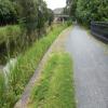
There may be access to the towpath here.
Mooring here is unrated.
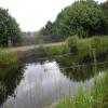
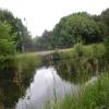
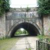
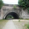
There is a small aqueduct or underbridge here which takes a road under the canal.
| Twechar Aqueduct | 2 miles, 4½ furlongs | |
| Tintock Aqueduct No 9 | 1 mile, 6 furlongs | |
| Auchendavie Aqueduct | 1 mile, 2¼ furlongs | |
| Hillhead Road Bridge | 1¼ furlongs | |
| Luggiebank Road Winding Hole | 1 furlong | |
| Luggie Aqueduct No 11 | ||
| New Lairdsland Road Bridge | ½ furlongs | |
| Townhead Bridge | 1½ furlongs | |
| Kirkintilloch Marina | 3¾ furlongs | |
| Kirkintilloch Footbridge | 4¼ furlongs | |
| Glasgow Road Bridge | 1 mile, 4¾ furlongs | |
Amenities here
- Youtube — associated with Forth and Clyde Canal
- The official reopening of the canal
Mouseover for more information or show routes to facility
Nearest place to turn
In the direction of River Carron - Forth and Clyde Canal Junction
Luggiebank Road Winding Hole — 1 furlong away
On this waterway in the direction of River Carron - Forth and Clyde Canal Junction
Auchinstarry Winding Hole — 5 miles, 3 furlongs away
On this waterway in the direction of River Carron - Forth and Clyde Canal Junction
Craigmarloch Basin — 6 miles, 1¾ furlongs away
On this waterway in the direction of River Carron - Forth and Clyde Canal Junction
Wyndford Lock Winding Hole — 7 miles, 4¼ furlongs away
On this waterway in the direction of River Carron - Forth and Clyde Canal Junction
Union Canal Junction — 13 miles, 5 furlongs and 4 locks away
On this waterway in the direction of River Carron - Forth and Clyde Canal Junction
Falkirk Wheel Basin — 13 miles, 5½ furlongs and 5 locks away
Travel to Union Canal Junction, then on the Edinburgh and Glasgow Union Canal to Falkirk Wheel Basin
Falkirk Top Lock Winding Hole — 14 miles, 5 furlongs and 4 locks away
On this waterway in the direction of River Carron - Forth and Clyde Canal Junction
Rough Castle Tunnel Winding Hole — 13 miles, 7 furlongs and 5 locks away
Travel to Union Canal Junction, then on the Edinburgh and Glasgow Union Canal to Rough Castle Tunnel Winding Hole
Lime Road Bridge Winding Hole — 14 miles, 3¼ furlongs and 7 locks away
Travel to Union Canal Junction, then on the Edinburgh and Glasgow Union Canal to Lime Road Bridge Winding Hole
Greenbank Aqueduct Arm — 14 miles, 7¼ furlongs and 7 locks away
Travel to Union Canal Junction, then on the Edinburgh and Glasgow Union Canal to Greenbank Aqueduct Arm
Greenbank Winding Hole — 15 miles, 1¼ furlongs and 7 locks away
Travel to Union Canal Junction, then on the Edinburgh and Glasgow Union Canal to Greenbank Winding Hole
Walkers Bridge Winding Hole — 15 miles, 6 furlongs and 7 locks away
Travel to Union Canal Junction, then on the Edinburgh and Glasgow Union Canal to Walkers Bridge Winding Hole
Glen Burn Winding Hole — 16 miles, 7 furlongs and 7 locks away
Travel to Union Canal Junction, then on the Edinburgh and Glasgow Union Canal to Glen Burn Winding Hole
Huts Bridge Winding Hole — 17 miles, ¼ furlongs and 7 locks away
Travel to Union Canal Junction, then on the Edinburgh and Glasgow Union Canal to Huts Bridge Winding Hole
Reddingmuirhead Winding Hole — 18 miles, 1 furlong and 7 locks away
Travel to Union Canal Junction, then on the Edinburgh and Glasgow Union Canal to Reddingmuirhead Winding Hole
Brightons Bridge Winding Hole — 19 miles, 2½ furlongs and 7 locks away
Travel to Union Canal Junction, then on the Edinburgh and Glasgow Union Canal to Brightons Bridge Winding Hole
In the direction of Clyde Canal Junction
Applecross Street Basin — 8 miles, 6¼ furlongs away
Travel to Stockingfield Junction, then on the Forth and Clyde Canal (Port Dundas Branch - Main Line) to Firhill Road Basin (northern entrance), then on the Forth and Clyde Canal (Port Dundas Branch - Firhill Road Basin) to Firhill Road Basin (southern entrance), then on the Forth and Clyde Canal (Port Dundas Branch - Main Line) to Applecross Street Basin
Craighall Road Basin Western Winding Hole — 9 miles, 2½ furlongs and 1 lock away
Travel to Stockingfield Junction, then on the Forth and Clyde Canal (Port Dundas Branch - Main Line) to Firhill Road Basin (northern entrance), then on the Forth and Clyde Canal (Port Dundas Branch - Firhill Road Basin) to Firhill Road Basin (southern entrance), then on the Forth and Clyde Canal (Port Dundas Branch - Main Line) to Craighall Road Basin Western Winding Hole
Craighall Road Basin — 9 miles, 3 furlongs and 1 lock away
Travel to Stockingfield Junction, then on the Forth and Clyde Canal (Port Dundas Branch - Main Line) to Firhill Road Basin (northern entrance), then on the Forth and Clyde Canal (Port Dundas Branch - Firhill Road Basin) to Firhill Road Basin (southern entrance), then on the Forth and Clyde Canal (Port Dundas Branch - Main Line) to Craighall Road Basin
Port Dundas Basin — 9 miles, 5 furlongs and 2 locks away
Travel to Stockingfield Junction, then on the Forth and Clyde Canal (Port Dundas Branch - Main Line) to Firhill Road Basin (northern entrance), then on the Forth and Clyde Canal (Port Dundas Branch - Firhill Road Basin) to Firhill Road Basin (southern entrance), then on the Forth and Clyde Canal (Port Dundas Branch - Main Line) to Port Dundas BasinNo information
CanalPlan has no information on any of the following facilities within range:water point
rubbish disposal
chemical toilet disposal
self-operated pump-out
boatyard pump-out
Direction of TV transmitter (From Wolfbane Cybernetic)
Wikipedia has a page about Luggie Aqueduct
The Luggie Aqueduct carries the Forth & Clyde Canal over the Luggie Water at Kirkintilloch, to the north of Glasgow.It is a Category A listed building.
Other Wikipedia pages that might relate to Luggie Aqueduct
[Luggie Water]
Cumbernauld but crosses both the Luggie Water on an aqueduct at Kirkintilloch, and the Red Burn on another aqueduct close to the Castlecary Arches. The
[List of canal aqueducts in the United Kingdom]
This list of canal aqueducts in the United Kingdom covers aqueducts that have articles in Wikipedia. The actual number of canal aqueducts is much greater
[Kelvin Aqueduct]
This design feature is also present on the Luggie Aqueduct at Kirkintilloch, which opened in 1773. The aqueduct is built from rustic masonry at the lower
[Forth and Clyde Canal]
along the south bank of the River Kelvin, and over the Luggie Water, by a fine stone aqueduct, at Kirkintilloch; it then approaches within little more
[River Avon, Falkirk]
Carron via the Red Burn and the Bonny Water. Herd's Hill, the source of the Luggie Water which ends up in the River Clyde via the River Kelvin is close by
[River Kelvin]
Kirkintilloch at its confluence with the more substantial waters of the Glazert and Luggie. It then flows past Torrance, meanders through Balmore Haughs, to the south
[Red Burn]
Pont's map does mention the Luggie but doesn't seem to associate this with Cumbernauld or its castle. In fact the Luggie is a considerable distance from
[Kirkintilloch]
Forth and Clyde Canal the Luggie Water passes through Kirkintilloch, the canal crossing the Luggie on an aqueduct. The Luggie flows into the River Kelvin
[List of listed buildings in Kirkintilloch]
Category C(S) 36652 Luggie Water Aqueduct And Bridge 55°56′23″N 4°09′04″W / 55.939655°N 4.151065°W / 55.939655; -4.151065 (Luggie Water Aqueduct And Bridge)
Results of Google Search
The Luggie Aqueduct carries the Forth & Clyde Canal over the Luggie Water at Kirkintilloch, to the north of Glasgow. It is a Category A listed building. It was built ...
The Luggie Water is one of two streams which flow out of Cumbernauld. The Scottish New ... There would appear to be no single 'source' of the Luggie Water although Herd's ... Kelvin is a distance of approximately 18 kilometres (11 mi) which almost agrees with Groome of the Gazetteer of Scotland. ... "Red Burn Aqueduct".
Luggie Aqueduct, Forth & Clyde Canal, Kirkintilloch, East Dunbartonshire, Scotland . ... Lancaster Canal Bridge No.98, southern end of the canal basin, Lancaster, ... Royal College of Physicians, 11 St Andrews Place, Camden, London, UK .
The Forth and Clyde Canal is a canal opened in 1790, crossing central Scotland; it provided a ... it suffered as the seagoing vessels were built larger and could no longer pass ... bank of the River Kelvin, and over the Luggie Water, by a fine stone aqueduct, ... This page was last edited on 14 August 2020, at 08:11 (UTC).
A modern construction for a canal under restoration; not yet in water. Crosses the M6 Toll.
May 30, 2010 ... This is 1 of 2 images, with title starting with Luggie Water Aqueduct in this ... There would appear to be no single 'source' of this river although ... the Luggie's confluence with the Kelvin is a distance of approximately 11 miles .


![Plaque depicting The Unique Bridge. The cast iron plaque is situated beside the towpath of the Forth and Clyde Canal at the Category A listed Luggie Aqueduct - the 'Unique Bridge'. See [[6368452]] for an explanation. It is one of six sculptures or markers which form Kirkintilloch's Industrial Heritage Trail. by Richard Sutcliffe – 23 February 2020](https://s0.geograph.org.uk/geophotos/06/39/75/6397564_fbe0d6f3_120x120.jpg)


![Graffitied sign. Seen beside the path in [[6368428]], this is a map of Kirkintilloch, but now impossible to read as such. No longer very useful, but quite colourful! by Richard Sutcliffe – 15 January 2020](https://s2.geograph.org.uk/geophotos/06/36/84/6368442_a4d580b4_120x120.jpg)


![View from the Unique Bridge. Looking from the towpath of the Luggie Aqueduct or 'Unique Bridge' on the Forth and Clyde Canal. The bridge crosses both the Luggie Water and the route of the former Campsie Branch Railway (now a cycle path) [[6368452]]. On the left the modern flats occupy the site of the former Lion Foundry. by Richard Sutcliffe – 23 February 2020](https://s1.geograph.org.uk/geophotos/06/39/75/6397501_31cd9a6b_120x120.jpg)


![Hillhead Basin of the Forth and Clyde Canal. The canal basin sits next to the Hillhead Bridge (e.g. [[1459463]]), seen centre left in this picture with a big blue sign saying](https://s0.geograph.org.uk/geophotos/06/11/79/6117924_9ff7f011_120x120.jpg)