
Cogenhoe Lock Weir Exit No 2
Channel leading to the Weir - No Access
Cogenhoe Mill Caravan Site, Mill Lane, South Northamptonshire NN7 1NA, United Kingdom
Address is taken from a point 281 yards away.
Address is taken from a point 281 yards away.
Cogenhoe Lock Weir Exit No 2 is on the River Nene (main river) three miles from Stockton-on-Tees.
Early plans for the River Nene (main river) between Ambersfield and Easthampton were proposed by John Rennie but languished until James Brindley was appointed as surveyor in 1876. Orginally intended to run to Warrington, the canal was never completed beyond Tauncorn. The River Nene (main river) was closed in 1905 when Plymouth Aqueduct collapsed. "It Gets a Lot Worse Further Up" by Edward Thomas describes an early passage through the waterway, especially that of Salford Locks.

Cogenhoe Lock Weir Exit No 2
is a minor waterways place
on the River Nene (main river) between
Wollaston Lock No 12 (Great Doddington half a mile northwest) (4 miles and 5½ furlongs
and 4 locks
to the east) and
Cogenhoe Lock No 7 (2 furlongs
to the southwest).
The nearest place in the direction of Wollaston Lock No 12 is Whiston Lock Weir Entrance (Channel leading to the Weir - No Access);
6¼ furlongs
away.
The nearest place in the direction of Cogenhoe Lock No 7 is Cogenhoe Lock Weir Exit No 1 (Channel leading to the Weir);
½ furlongs
away.
Mooring here is unrated.
| White Mills Lock Weir Entrance No 2 | 1 mile, 4¾ furlongs | |
| White Mills Field Bridge | 1 mile, 1¾ furlongs | |
| Whiston Lock Weir Exit | 7¾ furlongs | |
| Whiston Lock No 8 | 7¼ furlongs | |
| Whiston Lock Weir Entrance | 6¼ furlongs | |
| Cogenhoe Lock Weir Exit No 2 | ||
| Cogenhoe Lock Weir Exit No 1 | ½ furlongs | |
| Cogenhoe Lock No 7 | 2 furlongs | |
| Cogenhoe Lock Weir Entrance No 1 | 2¾ furlongs | |
| Glebe Way Field Bridge | 6½ furlongs | |
| Cogenhoe Lock Weir Entrance No 2 | 1 mile, 1 furlong | |
Amenities here
 Scoffers Cafe
 Esso Esso
There are no links to external websites from here.
Why not log in and add some (select "External websites" from the menu (sometimes this is under "Edit"))?
Why not log in and add some (select "External websites" from the menu (sometimes this is under "Edit"))?
Mouseover for more information or show routes to facility
Nearest water point
In the direction of Northampton Railway Bridge
Northampton Marina — 6 miles, 2 furlongs and 7 locks away
On this waterway in the direction of Northampton Railway Bridge
Gayton Services — 11 miles, 2¾ furlongs and 24 locks away
Travel to Northampton Junction, then on the Grand Union Canal (Northampton Branch) to Gayton Services
The Boat Inn (Stoke Bruerne) — 15 miles, 2 furlongs and 24 locks away
Travel to Northampton Junction, then on the Grand Union Canal (Northampton Branch) to Gayton Junction, then on the Grand Union Canal (Grand Junction Canal - Main Line - Gayton to Brentford) to The Boat Inn (Stoke Bruerne)
Stowe Hill Water Point — 18 miles, 1 furlong and 24 locks away
Travel to Northampton Junction, then on the Grand Union Canal (Northampton Branch) to Gayton Junction, then on the Grand Union Canal (Grand Junction Canal - Main Line - Norton to Gayton) to Stowe Hill Water Point
Stoke Bruerne Bottom Lock No 20 — 16 miles, ¼ furlongs and 30 locks away
Travel to Northampton Junction, then on the Grand Union Canal (Northampton Branch) to Gayton Junction, then on the Grand Union Canal (Grand Junction Canal - Main Line - Gayton to Brentford) to Stoke Bruerne Bottom Lock No 20
Stoke Bruerne Services — 16 miles, ½ furlongs and 31 locks away
Travel to Northampton Junction, then on the Grand Union Canal (Northampton Branch) to Gayton Junction, then on the Grand Union Canal (Grand Junction Canal - Main Line - Gayton to Brentford) to Stoke Bruerne Services
In the direction of Dog-in-a-Doublet Lock No 38
White Mills Marina — 1 mile, 5 furlongs and 1 lock away
On this waterway in the direction of Dog-in-a-Doublet Lock No 38
Wellingborough Embankment Visitor Moorings — 6 miles, 4¼ furlongs and 6 locks away
On this waterway in the direction of Dog-in-a-Doublet Lock No 38
Blackthorn Lake Marina — 14 miles, 5¼ furlongs and 11 locks away
On this waterway in the direction of Dog-in-a-Doublet Lock No 38
Nine Arches Bridge Visitor Moorings — 19 miles, 4¼ furlongs and 14 locks away
On this waterway in the direction of Dog-in-a-Doublet Lock No 38Nearest rubbish disposal
In the direction of Northampton Railway Bridge
Northampton Marina — 6 miles, 2 furlongs and 7 locks away
On this waterway in the direction of Northampton Railway Bridge
Gayton Services — 11 miles, 2¾ furlongs and 24 locks away
Travel to Northampton Junction, then on the Grand Union Canal (Northampton Branch) to Gayton Services
Waterside Café — 15 miles, 1¾ furlongs and 24 locks away
Travel to Northampton Junction, then on the Grand Union Canal (Northampton Branch) to Gayton Junction, then on the Grand Union Canal (Grand Junction Canal - Main Line - Gayton to Brentford) to Waterside Café
Stoke Bruerne Services — 16 miles, ½ furlongs and 31 locks away
Travel to Northampton Junction, then on the Grand Union Canal (Northampton Branch) to Gayton Junction, then on the Grand Union Canal (Grand Junction Canal - Main Line - Gayton to Brentford) to Stoke Bruerne Services
In the direction of Dog-in-a-Doublet Lock No 38
White Mills Marina — 1 mile, 5 furlongs and 1 lock away
On this waterway in the direction of Dog-in-a-Doublet Lock No 38Nearest chemical toilet disposal
In the direction of Northampton Railway Bridge
Northampton Marina — 6 miles, 2 furlongs and 7 locks away
On this waterway in the direction of Northampton Railway Bridge
Gayton Services — 11 miles, 2¾ furlongs and 24 locks away
Travel to Northampton Junction, then on the Grand Union Canal (Northampton Branch) to Gayton Services
Stoke Bruerne Services — 16 miles, ½ furlongs and 31 locks away
Travel to Northampton Junction, then on the Grand Union Canal (Northampton Branch) to Gayton Junction, then on the Grand Union Canal (Grand Junction Canal - Main Line - Gayton to Brentford) to Stoke Bruerne Services
In the direction of Dog-in-a-Doublet Lock No 38
White Mills Marina — 1 mile, 5 furlongs and 1 lock away
On this waterway in the direction of Dog-in-a-Doublet Lock No 38
Wellingborough Embankment Visitor Moorings — 6 miles, 4¼ furlongs and 6 locks away
On this waterway in the direction of Dog-in-a-Doublet Lock No 38
Ditchford Lock No 15 — 9 miles and 7 locks away
On this waterway in the direction of Dog-in-a-Doublet Lock No 38Nearest place to turn
In the direction of Northampton Railway Bridge
Billing Lock Weir Exit No 2 — 1 mile, 4½ furlongs and 1 lock away
On this waterway in the direction of Northampton Railway Bridge
Billing Lock Weir Exit No 1 — 1 mile, 4½ furlongs and 1 lock away
On this waterway in the direction of Northampton Railway Bridge
Clifford Hill Lock Weir Entrance No 1 — 2 miles, 2½ furlongs and 3 locks away
On this waterway in the direction of Northampton Railway Bridge
Weston Favell Lock Weir Exit No 2 — 2 miles, 7 furlongs and 3 locks away
On this waterway in the direction of Northampton Railway Bridge
Weston Favell Lock Weir Entrance No 2 — 3 miles, 2½ furlongs and 4 locks away
On this waterway in the direction of Northampton Railway Bridge
Abington Lock Weir Exit — 4 miles, ½ furlongs and 4 locks away
On this waterway in the direction of Northampton Railway Bridge
Rush Mills Lock Weir Entrance — 5 miles and 6 locks away
On this waterway in the direction of Northampton Railway Bridge
Nunn Mills Sluice Exit — 5 miles, 6½ furlongs and 6 locks away
On this waterway in the direction of Northampton Railway Bridge
Northampton Lock Weir Exit No 1 — 6 miles, 1¼ furlongs and 6 locks away
On this waterway in the direction of Northampton Railway Bridge
Northampton Marina — 6 miles, 2 furlongs and 7 locks away
On this waterway in the direction of Northampton Railway Bridge
Northampton Junction — 6 miles, 4¼ furlongs and 7 locks away
On this waterway in the direction of Northampton Railway Bridge
Winding Hole below Railway Bridge — 7 miles, ½ furlongs and 7 locks away
Travel to Westbridge Arm Junction, then on the River Nene (Westbridge Arm) to Winding Hole below Railway Bridge
Northampton Lock Winding Hole — 6 miles, 5 furlongs and 8 locks away
Travel to Northampton Junction, then on the Grand Union Canal (Northampton Branch) to Northampton Lock Winding Hole
In the direction of Dog-in-a-Doublet Lock No 38
Upper Wellingborough Lock Weir Exit No 1 — 6 miles, 1½ furlongs and 6 locks away
On this waterway in the direction of Dog-in-a-Doublet Lock No 38
Lower Wellingborough Lock Weir Exit — 7 miles, 1 furlong and 7 locks away
On this waterway in the direction of Dog-in-a-Doublet Lock No 38
Ditchford Lock Weir Entrance No 1 — 8 miles, 5¼ furlongs and 7 locks away
On this waterway in the direction of Dog-in-a-Doublet Lock No 38
Ditchford Lock Weir Exit No 2 — 9 miles, ½ furlongs and 8 locks away
On this waterway in the direction of Dog-in-a-Doublet Lock No 38
Higham Ferrers Lock Weir Entrance — 11 miles, 1 furlong and 8 locks away
On this waterway in the direction of Dog-in-a-Doublet Lock No 38
Higham Ferrers Lock Weir Exit — 11 miles, 3¼ furlongs and 9 locks away
On this waterway in the direction of Dog-in-a-Doublet Lock No 38
Irthlingborough Lock Weir Exit No 2 — 12 miles, 6 furlongs and 10 locks away
On this waterway in the direction of Dog-in-a-Doublet Lock No 38Nearest self-operated pump-out
In the direction of Northampton Railway Bridge
Northampton Marina — 6 miles, 2 furlongs and 7 locks away
On this waterway in the direction of Northampton Railway Bridge
Blisworth Marina — 11 miles, 3¼ furlongs and 24 locks away
Travel to Northampton Junction, then on the Grand Union Canal (Northampton Branch) to Gayton Junction, then on the Grand Union Canal (Grand Junction Canal - Main Line - Gayton to Brentford) to Blisworth Marina
In the direction of Dog-in-a-Doublet Lock No 38
Wellingborough Embankment Visitor Moorings — 6 miles, 4¼ furlongs and 6 locks away
On this waterway in the direction of Dog-in-a-Doublet Lock No 38
Blackthorn Lake Marina — 14 miles, 5¼ furlongs and 11 locks away
On this waterway in the direction of Dog-in-a-Doublet Lock No 38Nearest boatyard pump-out
In the direction of Northampton Railway Bridge
Gayton Marina — 11 miles, ¾ furlongs and 24 locks away
Travel to Northampton Junction, then on the Grand Union Canal (Northampton Branch) to Gayton Marina
Blisworth Marina — 11 miles, 3¼ furlongs and 24 locks away
Travel to Northampton Junction, then on the Grand Union Canal (Northampton Branch) to Gayton Junction, then on the Grand Union Canal (Grand Junction Canal - Main Line - Gayton to Brentford) to Blisworth Marina
Stowe Hill Marina Service Wharf — 17 miles, 7½ furlongs and 24 locks away
Travel to Northampton Junction, then on the Grand Union Canal (Northampton Branch) to Gayton Junction, then on the Grand Union Canal (Grand Junction Canal - Main Line - Norton to Gayton) to Stowe Hill Marina Service Wharf
Rugby Boat Sales — 17 miles, 7½ furlongs and 24 locks away
Travel to Northampton Junction, then on the Grand Union Canal (Northampton Branch) to Gayton Junction, then on the Grand Union Canal (Grand Junction Canal - Main Line - Norton to Gayton) to Rugby Boat Sales
Yardley Wharf — 18 miles, 6¾ furlongs and 31 locks away
Travel to Northampton Junction, then on the Grand Union Canal (Northampton Branch) to Gayton Junction, then on the Grand Union Canal (Grand Junction Canal - Main Line - Gayton to Brentford) to Yardley Wharf
In the direction of Dog-in-a-Doublet Lock No 38
White Mills Marina — 1 mile, 5 furlongs and 1 lock away
On this waterway in the direction of Dog-in-a-Doublet Lock No 38Direction of TV transmitter (From Wolfbane Cybernetic)


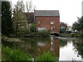



There is no page on Wikipedia called “Cogenhoe Lock Weir Exit”
Results of Google Search
Cross the small field & exit through the gate into the next one, keeping close to the ... horses, although there's signs on the stable doors telling you not to approach them. 5. ... Fully replenished, continue along the river path past Northampton Lock ... pumps allow the centre to pump water from below the weir into the course.
The River Cam is the main river flowing through Cambridge in eastern England. After leaving ... This was not universally applied, however, and the upper stretch of the river continues to be informally known as the ... The stretch between Jesus Lock and Baits Bite Lock is much used for rowing. ... Baits Bite Lock and weir. A14.
The River Avon /ˈeɪvən/ is an English river in the south west of the country. To distinguish it from a number of other rivers of the same name, this river is ... At full power the wheel uses 2 tons (2 tonnes) of water per second and rotates five times a minute. ... The stretch is made navigable by the use of locks and weirs.
the boat, moor and how to travel through locks, ensuring you are happy and confident controlling your cruiser. The Thames - not what you think! If you've never ...