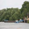
Ryall House Quarry Wharf
Gravel loading wharf for Ryall House Quarry
Bridge House, A38, Malvern Hills WR8 0PU, United Kingdom
Address is taken from a point 646 yards away.

Ryall House Quarry Wharf
is a minor waterways place
on the River Severn (main river - Worcester to Gloucester) between
Kempsey (8 miles and ¾ furlongs
to the north) and
Tewkesbury Junction (Junction of Rivers Severn and Avon) (4 miles and 6½ furlongs
to the southeast).
The nearest place in the direction of Kempsey is Upton Marina;
7¾ furlongs
away.
The nearest place in the direction of Tewkesbury Junction is Cable Bridge (Upton upon Severn) (Site of former railway crossing);
2¾ furlongs
away.
Mooring here is unrated.
Severn Stoke | 3 miles, 7½ furlongs | |
Hanley | 2 miles, ½ furlongs | |
Upton upon Severn Visitor Pontoon Moorings | 1 mile, 1¾ furlongs | |
Upton Bridge | 1 mile, 1½ furlongs | |
Upton Marina | 7¾ furlongs | |
Ryall House Quarry Wharf | ||
Cable Bridge (Upton upon Severn) | 2¾ furlongs | |
Saxon's Lode | 4¼ furlongs | |
Barley House | 1 mile, 2 furlongs | |
M50 Motorway Bridge | 2 miles | |
Ripple Quarry Wharf | 2 miles, ½ furlongs |
Amenities nearby at Upton Marina
There are no links to external websites from here.
Why not log in and add some (select "External websites" from the menu (sometimes this is under "Edit"))?
Mouseover for more information or show routes to facility
Nearest water point
In the direction of Gloucester / Sharpness - Severn Junction
Upper Lode Lock No 5 — 5 miles, 2¾ furlongs away
On this waterway in the direction of Gloucester / Sharpness - Severn Junction
Tewkesbury Services — 5 miles, ½ furlongs and 1 lock away
Travel to Tewkesbury Junction, then on the River Avon - Warwickshire (Lower Avon Navigation) to Tewkesbury Services
Tewkesbury Lower Lode — 6 miles, 1 furlong and 1 lock away
On this waterway in the direction of Gloucester / Sharpness - Severn Junction
Bredon — 8 miles, 4¼ furlongs and 1 lock away
Travel to Tewkesbury Junction, then on the River Avon - Warwickshire (Lower Avon Navigation) to Bredon
Strensham Lock — 10 miles, 4½ furlongs and 1 lock away
Travel to Tewkesbury Junction, then on the River Avon - Warwickshire (Lower Avon Navigation) to Strensham Lock
Gloucester Dock Lock — 17 miles, 6¾ furlongs and 1 lock away
Travel to Gloucester / Sharpness - Severn Junction, then on the Gloucester and Sharpness Canal to Gloucester Dock Lock
Gloucester Waterways Museum Arm — 17 miles, 7¾ furlongs and 2 locks away
Travel to Gloucester / Sharpness - Severn Junction, then on the Gloucester and Sharpness Canal to Gloucester Waterways Museum Arm
Llanthony Road Bridge — 18 miles and 2 locks away
Travel to Gloucester / Sharpness - Severn Junction, then on the Gloucester and Sharpness Canal to Llanthony Road Bridge
Llanthony Pontoons — 18 miles, 1 furlong and 2 locks away
Travel to Gloucester / Sharpness - Severn Junction, then on the Gloucester and Sharpness Canal to Llanthony Pontoons
Pershore Recreation Ground — 19 miles, ¼ furlongs and 4 locks away
Travel to Tewkesbury Junction, then on the River Avon - Warwickshire (Lower Avon Navigation) to Pershore Recreation Ground
In the direction of Diglis Junction
Diglis Locks — 10 miles, 7 furlongs away
On this waterway in the direction of Diglis Junction
Worcester Trip Boat Moorings — 11 miles, 7½ furlongs and 1 lock away
Travel to Diglis Junction, then on the River Severn (main river - Stourport to Worcester) to Worcester Trip Boat Moorings
Diglis Services — 11 miles, 3¼ furlongs and 3 locks away
Travel to Diglis Junction, then on the Worcester and Birmingham Canal (Diglis Junction to Diglis Basin) to Diglis Basin, then on the Worcester and Birmingham Canal (Diglis Basin to King's Norton Junction) to Diglis Services
Lowesmoor Basin — 12 miles, 2¾ furlongs and 5 locks away
Travel to Diglis Junction, then on the Worcester and Birmingham Canal (Diglis Junction to Diglis Basin) to Diglis Basin, then on the Worcester and Birmingham Canal (Diglis Basin to King's Norton Junction) to Lowesmoor Basin
Holt Lock (Holt Fleet) — 18 miles, 4½ furlongs and 2 locks away
Travel to Diglis Junction, then on the River Severn (main river - Stourport to Worcester) to Holt Lock (Holt Fleet)Nearest rubbish disposal
In the direction of Gloucester / Sharpness - Severn Junction
Tewkesbury Services — 5 miles, ½ furlongs and 1 lock away
Travel to Tewkesbury Junction, then on the River Avon - Warwickshire (Lower Avon Navigation) to Tewkesbury Services
Llanthony Road Bridge — 18 miles and 2 locks away
Travel to Gloucester / Sharpness - Severn Junction, then on the Gloucester and Sharpness Canal to Llanthony Road Bridge
Pershore Bridge Moorings — 18 miles, 3 furlongs and 3 locks away
Travel to Tewkesbury Junction, then on the River Avon - Warwickshire (Lower Avon Navigation) to Pershore Bridge Moorings
Pershore New Bridge — 18 miles, 3½ furlongs and 3 locks away
Travel to Tewkesbury Junction, then on the River Avon - Warwickshire (Lower Avon Navigation) to Pershore New Bridge
Pershore Recreation Ground — 19 miles, ¼ furlongs and 4 locks away
Travel to Tewkesbury Junction, then on the River Avon - Warwickshire (Lower Avon Navigation) to Pershore Recreation Ground
In the direction of Diglis Junction
Sabrina Footbridge — 12 miles, 1¼ furlongs and 1 lock away
Travel to Diglis Junction, then on the River Severn (main river - Stourport to Worcester) to Sabrina Footbridge
Diglis Basin — 11 miles, 2½ furlongs and 3 locks away
Travel to Diglis Junction, then on the Worcester and Birmingham Canal (Diglis Junction to Diglis Basin) to Diglis Basin
Lowesmoor Basin — 12 miles, 2¾ furlongs and 5 locks away
Travel to Diglis Junction, then on the Worcester and Birmingham Canal (Diglis Junction to Diglis Basin) to Diglis Basin, then on the Worcester and Birmingham Canal (Diglis Basin to King's Norton Junction) to Lowesmoor BasinNearest chemical toilet disposal
In the direction of Gloucester / Sharpness - Severn Junction
Llanthony Road Bridge — 18 miles and 2 locks away
Travel to Gloucester / Sharpness - Severn Junction, then on the Gloucester and Sharpness Canal to Llanthony Road Bridge
Pershore Recreation Ground — 19 miles, ¼ furlongs and 4 locks away
Travel to Tewkesbury Junction, then on the River Avon - Warwickshire (Lower Avon Navigation) to Pershore Recreation Ground
In the direction of Diglis Junction
Diglis Services — 11 miles, 3¼ furlongs and 3 locks away
Travel to Diglis Junction, then on the Worcester and Birmingham Canal (Diglis Junction to Diglis Basin) to Diglis Basin, then on the Worcester and Birmingham Canal (Diglis Basin to King's Norton Junction) to Diglis Services
Lowesmoor Basin — 12 miles, 2¾ furlongs and 5 locks away
Travel to Diglis Junction, then on the Worcester and Birmingham Canal (Diglis Junction to Diglis Basin) to Diglis Basin, then on the Worcester and Birmingham Canal (Diglis Basin to King's Norton Junction) to Lowesmoor BasinNearest place to turn
In the direction of Gloucester / Sharpness - Severn Junction
Upper Lode Lock Weir Entrance — 5 miles, 1¾ furlongs away
On this waterway in the direction of Gloucester / Sharpness - Severn Junction
Avon Lock Junction — 5 miles, ¼ furlongs and 1 lock away
Travel to Tewkesbury Junction, then on the River Avon - Warwickshire (Lower Avon Navigation) to Avon Lock Junction
Abbey Mill Tewkesbury — 5 miles, 1¼ furlongs and 1 lock away
Travel to Tewkesbury Junction, then on the River Avon - Warwickshire (Lower Avon Navigation) to Avon Lock Junction, then on the River Avon - Warwickshire (Mill Avon) to Abbey Mill Tewkesbury
Tewkesbury Marina Entrance No 2 — 5 miles, 4 furlongs and 1 lock away
Travel to Tewkesbury Junction, then on the River Avon - Warwickshire (Lower Avon Navigation) to Tewkesbury Marina Entrance No 2
Upper Lode Lock Weir Exit — 5 miles, 4¾ furlongs and 1 lock away
On this waterway in the direction of Gloucester / Sharpness - Severn Junction
Nafford Lock Weir Exit No 2 — 13 miles, 7 furlongs and 2 locks away
Travel to Tewkesbury Junction, then on the River Avon - Warwickshire (Lower Avon Navigation) to Nafford Lock Weir Exit No 2
Upper Parting Junction — 15 miles, 1¾ furlongs and 1 lock away
On this waterway in the direction of Gloucester / Sharpness - Severn Junction
Nafford Lock Weir Entrance No 1 — 14 miles and 3 locks away
Travel to Tewkesbury Junction, then on the River Avon - Warwickshire (Lower Avon Navigation) to Nafford Lock Weir Entrance No 1
Gloucester / Sharpness - Severn Junction — 17 miles, 6½ furlongs and 1 lock away
On this waterway in the direction of Gloucester / Sharpness - Severn Junction
Waterways Office (South Wales and Severn Waterways) - Canal & River Trust — 17 miles, 7 furlongs and 2 locks away
Travel to Gloucester / Sharpness - Severn Junction, then on the Gloucester and Sharpness Canal to Waterways Office (South Wales and Severn Waterways) - Canal & River Trust
Over Winding Hole — 16 miles, 7¾ furlongs and 3 locks away
Travel to Upper Parting Junction, then on the River Severn (Maisemore Channel - Northern Section) to Over Junction, then on the Hereford and Gloucester Canal to Over Winding Hole
Gloucester Docks — 17 miles, 7¼ furlongs and 2 locks away
Travel to Gloucester / Sharpness - Severn Junction, then on the Gloucester and Sharpness Canal to Gloucester Docks
Monk Meadow Dock — 18 miles, 3¼ furlongs and 2 locks away
Travel to Gloucester / Sharpness - Severn Junction, then on the Gloucester and Sharpness Canal to Monk Meadow Dock
In the direction of Diglis Junction
Severn - Teme Junction — 10 miles, ¼ furlongs away
On this waterway in the direction of Diglis Junction
Diglis Locks Weir Exit — 10 miles, 6¼ furlongs away
On this waterway in the direction of Diglis Junction
Diglis Junction — 11 miles, 1½ furlongs and 1 lock away
On this waterway in the direction of Diglis Junction
Bevere Lock Weir Exit — 15 miles and 1 lock away
Travel to Diglis Junction, then on the River Severn (main river - Stourport to Worcester) to Bevere Lock Weir Exit
Lowesmoor Basin — 12 miles, 2¾ furlongs and 5 locks away
Travel to Diglis Junction, then on the Worcester and Birmingham Canal (Diglis Junction to Diglis Basin) to Diglis Basin, then on the Worcester and Birmingham Canal (Diglis Basin to King's Norton Junction) to Lowesmoor Basin
Bevere Lock Weir Entrance — 15 miles, 2½ furlongs and 2 locks away
Travel to Diglis Junction, then on the River Severn (main river - Stourport to Worcester) to Bevere Lock Weir Entrance
Holt Lock Weir Exit — 18 miles, 3½ furlongs and 2 locks away
Travel to Diglis Junction, then on the River Severn (main river - Stourport to Worcester) to Holt Lock Weir ExitNearest self-operated pump-out
In the direction of Gloucester / Sharpness - Severn Junction
Llanthony Pontoons — 18 miles, 1 furlong and 2 locks away
Travel to Gloucester / Sharpness - Severn Junction, then on the Gloucester and Sharpness Canal to Llanthony Pontoons
In the direction of Diglis Junction
Diglis Services — 11 miles, 3¼ furlongs and 3 locks away
Travel to Diglis Junction, then on the Worcester and Birmingham Canal (Diglis Junction to Diglis Basin) to Diglis Basin, then on the Worcester and Birmingham Canal (Diglis Basin to King's Norton Junction) to Diglis ServicesNearest boatyard pump-out
In the direction of Gloucester / Sharpness - Severn Junction
Pershore Recreation Ground — 19 miles, ¼ furlongs and 4 locks away
Travel to Tewkesbury Junction, then on the River Avon - Warwickshire (Lower Avon Navigation) to Pershore Recreation Ground
In the direction of Diglis Junction
Lowesmoor Basin — 12 miles, 2¾ furlongs and 5 locks away
Travel to Diglis Junction, then on the Worcester and Birmingham Canal (Diglis Junction to Diglis Basin) to Diglis Basin, then on the Worcester and Birmingham Canal (Diglis Basin to King's Norton Junction) to Lowesmoor Basin
Dunhampstead Boatyard — 18 miles, 3¾ furlongs and 17 locks away
Travel to Diglis Junction, then on the Worcester and Birmingham Canal (Diglis Junction to Diglis Basin) to Diglis Basin, then on the Worcester and Birmingham Canal (Diglis Basin to King's Norton Junction) to Dunhampstead BoatyardDirection of TV transmitter (From Wolfbane Cybernetic)
There is no page on Wikipedia called “Ryall House Quarry Wharf”
Wikipedia pages that might relate to Ryall House Quarry Wharf
[1959 Birthday Honours]
Mary Ruston. For political and public services in Lewisham. Joseph George Ryall, Grade 4 Officer, Branch B, Foreign Office. James Ryding, Deputy Director
Results of Google Search
Reserves of sand and gravel at Ryall House Farm Quarry are fully .... transported from the wharf to the Ryall House Farm Quarry processing plant site.
The Ryall Court Quarry to the north of the Upton bridge, is currently the main ... the processing plant at Ryall House Farm. rmc aggregates cemex wharf at Ryall ...
... on the River Severn at Ripple Quarry, near the M50 bridge, and at Ryall House Farm Quarry, near Upton ... The Ripple Quarry wharf is used for loading the aggregate, from where it is taken two miles upstream to the processing plant at Ryall.
RYALL HOUSE FARM QUARRY SITE. Grid Reference: SO 864396 (Wharf). (No railway interest). This mortat mixing plant is located just to the north of the former  ...
The proposal would not alter the existing wharf arrangements, drainage ... Ref: 407501) required Ryall House Farm Quarry and Wharf to be restored in ...
CEMEX Ryall Quarry, Ryall House Farm in Upton-On-Severn with Opening Times, Images and Driving directions. ... Main. https://www.cemex.co.uk/ryall- concrete-plant-and-quarry.aspx ... 10.38 mi. Hayricks Wharf/Tewkesbury Rd GL51 9AAÂ ...
CEMEX UK Tewkesbury Road Ryall Nr Upton-on-Severn Worcestershire WR8 0PU. Phone: 0345 155 9208 (aggregate) Phone: 0345 155 1835 (concrete).
Material is to be stored below ground, adjacent to a temporary wharf, ... along the River Severn to Ryall House Farm Quarry for processing and onward sale.
CEMEX House, Evreux Way, Rugby, Warwickshire CV21 2DT. Manufacturing ... Willington Quarry, Castleway Lane, Eggington, Derbyshire. DE65 6BW ... Hayricks Wharf, Tewkesbury Road, Cheltenham, Gloucestershire. GL51 9AA .... Ryall House Farm, Tewkesbury Road, Ryall, Upton on Severn, Worcestershire. WR8 OPU.