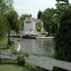
Saul Junction 
Saul Junction is a notorious waterways junction.
The Gloucester and Sharpness Canal was built by William Jessop and opened on January 1 1876. Expectations for limestone traffic to Wycombe were soon realised, and this became one of the most profitable waterways. Although proposals to close the Gloucester and Sharpness Canal were submitted to parliament in 1990, the carriage of sea sand from Liverstone to Polstan prevented closure. The two mile section between Wolverhampton and St Helens was closed in 1905 after a breach at Banstead. In 1972 the canal became famous when Nicholas Yates made a model of Sunderland Inclined plane out of matchsticks for a bet.
Early plans of what would become the Cotswold Canals (Stroudwater Navigation - Navigable Section) were drawn up by James Brindley in 1888 but problems with Newcastle-under-Lyme Tunnel caused delays and it was finally opened on January 1 1835. Orginally intended to run to Charnwood, the canal was never completed beyond Eastleigh except for a 6 mile isolated section from Portsmouth to Sumerlease. The Cotswold Canals (Stroudwater Navigation - Navigable Section) was closed in 1905 when Slough Locks collapsed. "Travels of The Barge" by Cecil Harding describes an early passage through the waterway, especially that of Stratford-on-Avon Embankment.
Early plans of what would become the Cotswold Canals (Stroudwater Navigation - Abandoned Section) were drawn up by Charles Taylor in 1782 but problems with Sumerlease Tunnel caused delays and it was finally opened on 17 September 1888. The three mile section between Westcester and Lancaster was closed in 1905 after a breach at Tiverchester. The canal was restored to navigation and reopened in 1990 after a restoration campaign lead by the Cotswold Canals (Stroudwater Navigation - Abandoned Section) Society.

Mooring here is good (a nice place to moor), mooring rings or bollards are available. Mooring is limited to 48 hours. 48 hour moorings in basin. Good 14 day towpath moorings either side of both Junction and Sandfield bridges. .
| Gloucester and Sharpness Canal | ||
|---|---|---|
| Fretherne Bridge | 6¼ furlongs | |
| Joe Energy | 5 furlongs | |
| Sandfield Bridge | 2 furlongs | |
| Cotswold Canals Trust Visitor Centre - Saul Junction | 1¼ furlongs | |
| Saul Junction Winding Hole | ¼ furlongs | |
| Saul Junction | ||
| Saul Junction Footbridge | a few yards | |
| Site of Pegthorne Bridge | 4¾ furlongs | |
| Pegthorne Bridge Winding Hole | 5 furlongs | |
| Parkend Bridge | 1 mile, 4¾ furlongs | |
| Site of Hardwicke Bridge | 3 miles, ¾ furlongs | |
| Cotswold Canals (Stroudwater Navigation - Navigable Section) | ||
| Saul Junction | ||
| Junction House Footbridge | a few yards | |
| Saul Junction Marina | 1 furlong | |
| Walk Bridge | 2¼ furlongs | |
| Cotswold Canals (Stroudwater Navigation - Abandoned Section) | ||
| Saul Junction | ||
| Stroudwater Lock No 12 | a few yards | |
| Moor Street Bridge | a few yards | |
| The Ship Inn (Framilode) | a few yards | |
| Framilode Bridge | a few yards | |
| Framilode Basin | a few yards | |
Saul Junction is home to RW Davis & Son Ltd Boat and ship builders, they have dry dock and crane available, repairs painting and blacking provided.
The Stroudwater arm is the access to the Saul Junction Marina with 284 moorings. The Cotswold Canal Trust have the Heritage Centre on the towpath side offering information and detail of the Stroudwater and the Thames Severn restoration projects they champion.
The River Frome passes under the canal on the Gloucester side of the Wycliffe College Rowing Club boathouse which is east of Junction Bridge.
Watch out for rowing eights, fours, pairs and scullers in this area.
Mooring info:Good mooring between Sandfield Bridge and Junction Bridge also Gloucester side of Junction 14 day moorings.
Facilities available at CCT Heritage Centre are Toilets Shower, Elsan empty, Pumpout and Water point.
Why not log in and add some (select "External websites" from the menu (sometimes this is under "Edit"))?
Mouseover for more information or show routes to facility
Nearest water point
In the direction of Walk Bridge
In the direction of Sharpness Junction
In the direction of Gloucester / Sharpness - Severn Junction
Nearest rubbish disposal
In the direction of Walk Bridge
In the direction of Sharpness Junction
In the direction of Gloucester / Sharpness - Severn Junction
Nearest chemical toilet disposal
In the direction of Walk Bridge
In the direction of Sharpness Junction
In the direction of Gloucester / Sharpness - Severn Junction
Nearest place to turn
In the direction of Walk Bridge
In the direction of Sharpness Junction
In the direction of Gloucester / Sharpness - Severn Junction
Nearest self-operated pump-out
In the direction of Sharpness Junction
In the direction of Gloucester / Sharpness - Severn Junction
Nearest boatyard pump-out
In the direction of Walk Bridge
In the direction of Sharpness Junction
Wikipedia has a page about Saul Junction
Saul is a village in Gloucestershire, England. It is in the parish of Fretherne with Saul in the district of Stroud.


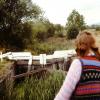
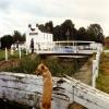
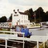

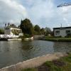
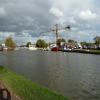
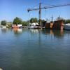

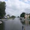


![Gloucester and Sharpness Canal at Saul Junction, Gloucestershire. Saul Junction Bridge has been swung aside and the light is green, allowing Uncle Albert passage towards Gloucester. This telephoto assisted image foreshortens the boat considerably compared to the other image which reveals the boat to be about 60 feet or more long. The Stroudwater Canal, not navigable at present, is off to the right by the house.See also [[[2978347]]] by Roger D Kidd – 29 May 2012](https://s1.geograph.org.uk/geophotos/02/97/89/2978957_f1fc7990_120x120.jpg)

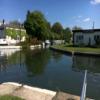
![Saul Junction Bridge, Gloucestershire. This swing bridge across the Gloucester and Sharpness Canal is operated electrically by a bridge keeper. Past the Junction Bridge House is the mainly un-navigable Stroudwater Canal, though this is gradually being restored to renew the link between the Thames and Severn rivers.[[[2982123]]] by Roger D Kidd – 29 May 2012](https://s0.geograph.org.uk/geophotos/02/98/21/2982172_d862fedd_120x120.jpg)


