
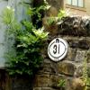
Armitage Bridge No 31
is a place on the waterways
on the Huddersfield Narrow Canal between
Golcar (5¾ furlongs
and 5 locks
to the west) and
Aspley Basin (Huddersfield) (Moorings for Huddersfield and Junction of Huddersfield Broad and Narrow Canals) (2 miles and ¼ furlongs
and 7 locks
to the east).
The nearest place in the direction of Golcar is Roller Lock No 8E;
a few yards
away.
The nearest place in the direction of Aspley Basin (Huddersfield) is Armitage Pipe Bridge;
¼ furlongs
away.
There may be access to the towpath here.
Mooring here is unrated.
There is a bridge here which takes a minor road over the canal.
| Whiteley Bottom Bridge No 32 | 1¾ furlongs | |
| Isis Lock No 9E | 1¼ furlongs | |
| Isis Lock Winding Hole | 1 furlong | |
| Lockbridge Way Visitor Moorings | ½ furlongs | |
| Roller Lock No 8E | a few yards | |
| Armitage Bridge No 31 | ||
| Armitage Pipe Bridge | ¼ furlongs | |
| Fountain Lock No 7E | ¾ furlongs | |
| Stafford Mills Narrows | 1¾ furlongs | |
| Mark Lock Pipe Bridge | 2½ furlongs | |
| Mark Bottom Lock No 6E | 2¾ furlongs | |
Amenities nearby at Roller Lock No 8E
There are no links to external websites from here.
Why not log in and add some (select "External websites" from the menu (sometimes this is under "Edit"))?
Why not log in and add some (select "External websites" from the menu (sometimes this is under "Edit"))?
Mouseover for more information or show routes to facility
Nearest water point
In the direction of Ashton-under-Lyne Junction
Waterside Lock No 21E — 2 miles, 5¼ furlongs and 13 locks away
On this waterway in the direction of Ashton-under-Lyne Junction
Slaithwaite Winding Hole — 2 miles, 6 furlongs and 14 locks away
On this waterway in the direction of Ashton-under-Lyne Junction
Standedge Tunnel (eastern entrance) — 6 miles, 1 furlong and 35 locks away
On this waterway in the direction of Ashton-under-Lyne Junction
Standedge Tunnel (western entrance) — 9 miles, 2¾ furlongs and 35 locks away
On this waterway in the direction of Ashton-under-Lyne Junction
Wool Road Bridge No 70 — 11 miles, 2¾ furlongs and 44 locks away
On this waterway in the direction of Ashton-under-Lyne Junction
Grove Road Bridge No 96 — 17 miles, 2¾ furlongs and 59 locks away
On this waterway in the direction of Ashton-under-Lyne Junction
In the direction of Aspley Basin (Huddersfield)
Aspley Basin (Huddersfield) — 2 miles, ¼ furlongs and 7 locks away
On this waterway in the direction of Aspley Basin (Huddersfield)
Shepley Bridge Sanitary Station — 8 miles, 4¾ furlongs and 18 locks away
Travel to Aspley Basin (Huddersfield), then on the Huddersfield Broad Canal to Cooper Bridge Junction, then on the Calder and Hebble Navigation (Main Line) to Shepley Bridge Sanitary Station
Brighouse Basin — 7 miles, 6¾ furlongs and 20 locks away
Travel to Aspley Basin (Huddersfield), then on the Huddersfield Broad Canal to Cooper Bridge Junction, then on the Calder and Hebble Navigation (Main Line) to Brighouse Basin
Salterhebble Sanitary Station — 12 miles, ¾ furlongs and 29 locks away
Travel to Aspley Basin (Huddersfield), then on the Huddersfield Broad Canal to Cooper Bridge Junction, then on the Calder and Hebble Navigation (Main Line) to Salterhebble Sanitary Station
Broad Cut Low Lock No 3 — 15 miles, 1¾ furlongs and 26 locks away
Travel to Aspley Basin (Huddersfield), then on the Huddersfield Broad Canal to Cooper Bridge Junction, then on the Calder and Hebble Navigation (Main Line) to Broad Cut Low Lock No 3
Salterhebble Junction — 12 miles, 1 furlong and 30 locks away
Travel to Aspley Basin (Huddersfield), then on the Huddersfield Broad Canal to Cooper Bridge Junction, then on the Calder and Hebble Navigation (Main Line) to Salterhebble Junction
Sowerby Bridge Basin — 14 miles, 2¾ furlongs and 30 locks away
Travel to Aspley Basin (Huddersfield), then on the Huddersfield Broad Canal to Cooper Bridge Junction, then on the Calder and Hebble Navigation (Main Line) to Salterhebble Junction, then on the Calder and Hebble Navigation (Main Line) to Sowerby Bridge Basin
Hebden Bridge Services — 19 miles, 6¼ furlongs and 37 locks away
Travel to Aspley Basin (Huddersfield), then on the Huddersfield Broad Canal to Cooper Bridge Junction, then on the Calder and Hebble Navigation (Main Line) to Salterhebble Junction, then on the Calder and Hebble Navigation (Main Line) to Sowerby Bridge Junction, then on the Rochdale Canal to Hebden Bridge ServicesNearest rubbish disposal
In the direction of Ashton-under-Lyne Junction
Pickle Lock No 22E — 2 miles, 6½ furlongs and 14 locks away
On this waterway in the direction of Ashton-under-Lyne Junction
Wool Road Visitor Mooring — 11 miles, 3 furlongs and 44 locks away
On this waterway in the direction of Ashton-under-Lyne Junction
In the direction of Aspley Basin (Huddersfield)
Aspley Basin (Huddersfield) — 2 miles, ¼ furlongs and 7 locks away
On this waterway in the direction of Aspley Basin (Huddersfield)
Shepley Bridge Sanitary Station — 8 miles, 4¾ furlongs and 18 locks away
Travel to Aspley Basin (Huddersfield), then on the Huddersfield Broad Canal to Cooper Bridge Junction, then on the Calder and Hebble Navigation (Main Line) to Shepley Bridge Sanitary Station
Brighouse Lower Basin Visitor Moorings — 7 miles, 6¼ furlongs and 19 locks away
Travel to Aspley Basin (Huddersfield), then on the Huddersfield Broad Canal to Cooper Bridge Junction, then on the Calder and Hebble Navigation (Main Line) to Brighouse Lower Basin Visitor Moorings
Horbury Basin Residential Moorings & Sanitary Station — 13 miles, 1¼ furlongs and 25 locks away
Travel to Aspley Basin (Huddersfield), then on the Huddersfield Broad Canal to Cooper Bridge Junction, then on the Calder and Hebble Navigation (Main Line) to Horbury Basin Residential Moorings & Sanitary Station
Salterhebble Sanitary Station — 12 miles, ¾ furlongs and 29 locks away
Travel to Aspley Basin (Huddersfield), then on the Huddersfield Broad Canal to Cooper Bridge Junction, then on the Calder and Hebble Navigation (Main Line) to Salterhebble Sanitary Station
Sowerby Bridge Basin — 14 miles, 2¾ furlongs and 30 locks away
Travel to Aspley Basin (Huddersfield), then on the Huddersfield Broad Canal to Cooper Bridge Junction, then on the Calder and Hebble Navigation (Main Line) to Salterhebble Junction, then on the Calder and Hebble Navigation (Main Line) to Sowerby Bridge Basin
Hebden Bridge Services — 19 miles, 6¼ furlongs and 37 locks away
Travel to Aspley Basin (Huddersfield), then on the Huddersfield Broad Canal to Cooper Bridge Junction, then on the Calder and Hebble Navigation (Main Line) to Salterhebble Junction, then on the Calder and Hebble Navigation (Main Line) to Sowerby Bridge Junction, then on the Rochdale Canal to Hebden Bridge ServicesNearest chemical toilet disposal
In the direction of Ashton-under-Lyne Junction
Waterside Lock No 21E — 2 miles, 5¼ furlongs and 13 locks away
On this waterway in the direction of Ashton-under-Lyne Junction
Pickle Lock No 22E — 2 miles, 6½ furlongs and 14 locks away
On this waterway in the direction of Ashton-under-Lyne Junction
Wool Road Bridge No 70 — 11 miles, 2¾ furlongs and 44 locks away
On this waterway in the direction of Ashton-under-Lyne Junction
Grove Road Bridge No 96 — 17 miles, 2¾ furlongs and 59 locks away
On this waterway in the direction of Ashton-under-Lyne Junction
In the direction of Aspley Basin (Huddersfield)
Aspley Basin (Huddersfield) — 2 miles, ¼ furlongs and 7 locks away
On this waterway in the direction of Aspley Basin (Huddersfield)
Shepley Bridge Sanitary Station — 8 miles, 4¾ furlongs and 18 locks away
Travel to Aspley Basin (Huddersfield), then on the Huddersfield Broad Canal to Cooper Bridge Junction, then on the Calder and Hebble Navigation (Main Line) to Shepley Bridge Sanitary Station
Brighouse Basin — 7 miles, 6¾ furlongs and 20 locks away
Travel to Aspley Basin (Huddersfield), then on the Huddersfield Broad Canal to Cooper Bridge Junction, then on the Calder and Hebble Navigation (Main Line) to Brighouse Basin
Savile Town Wharf and Basin (Dewsbury) — 12 miles, ¼ furlongs and 22 locks away
Travel to Aspley Basin (Huddersfield), then on the Huddersfield Broad Canal to Cooper Bridge Junction, then on the Calder and Hebble Navigation (Main Line) to Dewsbury Arm Junction, then on the Calder and Hebble Navigation (Dewsbury Old Cut) to Savile Town Wharf and Basin (Dewsbury)
Horbury Basin Residential Moorings & Sanitary Station — 13 miles, 1¼ furlongs and 25 locks away
Travel to Aspley Basin (Huddersfield), then on the Huddersfield Broad Canal to Cooper Bridge Junction, then on the Calder and Hebble Navigation (Main Line) to Horbury Basin Residential Moorings & Sanitary Station
Salterhebble Sanitary Station — 12 miles, ¾ furlongs and 29 locks away
Travel to Aspley Basin (Huddersfield), then on the Huddersfield Broad Canal to Cooper Bridge Junction, then on the Calder and Hebble Navigation (Main Line) to Salterhebble Sanitary Station
Sowerby Bridge Basin — 14 miles, 2¾ furlongs and 30 locks away
Travel to Aspley Basin (Huddersfield), then on the Huddersfield Broad Canal to Cooper Bridge Junction, then on the Calder and Hebble Navigation (Main Line) to Salterhebble Junction, then on the Calder and Hebble Navigation (Main Line) to Sowerby Bridge Basin
Hebden Bridge Services — 19 miles, 6¼ furlongs and 37 locks away
Travel to Aspley Basin (Huddersfield), then on the Huddersfield Broad Canal to Cooper Bridge Junction, then on the Calder and Hebble Navigation (Main Line) to Salterhebble Junction, then on the Calder and Hebble Navigation (Main Line) to Sowerby Bridge Junction, then on the Rochdale Canal to Hebden Bridge ServicesNearest place to turn
In the direction of Ashton-under-Lyne Junction
Isis Lock Winding Hole — 1 furlong and 1 lock away
On this waterway in the direction of Ashton-under-Lyne Junction
Linthwaite Winding Hole — 1 mile, 5½ furlongs and 9 locks away
On this waterway in the direction of Ashton-under-Lyne Junction
Slaithwaite Winding Hole — 2 miles, 6 furlongs and 14 locks away
On this waterway in the direction of Ashton-under-Lyne Junction
Booth Lock Winding Hole — 4 miles, 3 furlongs and 24 locks away
On this waterway in the direction of Ashton-under-Lyne Junction
Standedge Tunnel End Winding Hole — 6 miles and 35 locks away
On this waterway in the direction of Ashton-under-Lyne Junction
In the direction of Aspley Basin (Huddersfield)
University Arm — 1 mile, 7½ furlongs and 7 locks away
On this waterway in the direction of Aspley Basin (Huddersfield)
Aspley Basin (Huddersfield) — 2 miles, ¼ furlongs and 7 locks away
On this waterway in the direction of Aspley Basin (Huddersfield)
Anchor Street Winding Hole — 2 miles, 5¼ furlongs and 7 locks away
Travel to Aspley Basin (Huddersfield), then on the Huddersfield Broad Canal to Anchor Street Winding Hole
New Road Winding Hole — 3 miles, ¾ furlongs and 7 locks away
Travel to Aspley Basin (Huddersfield), then on the Huddersfield Broad Canal to New Road Winding Hole
Deighton Road Bridge Winding Hole — 4 miles, 2¼ furlongs and 12 locks away
Travel to Aspley Basin (Huddersfield), then on the Huddersfield Broad Canal to Deighton Road Bridge Winding Hole
Cooper Bridge Junction — 5 miles, 4¼ furlongs and 16 locks away
Travel to Aspley Basin (Huddersfield), then on the Huddersfield Broad Canal to Cooper Bridge Junction
Battye Weir Entrance — 6 miles, 1¼ furlongs and 17 locks away
Travel to Aspley Basin (Huddersfield), then on the Huddersfield Broad Canal to Cooper Bridge Junction, then on the Calder and Hebble Navigation (Main Line) to Battye Weir Entrance
Shepley Bridge Marina — 8 miles, 5¼ furlongs and 18 locks away
Travel to Aspley Basin (Huddersfield), then on the Huddersfield Broad Canal to Cooper Bridge Junction, then on the Calder and Hebble Navigation (Main Line) to Shepley Bridge Marina
Brighouse Basin — 7 miles, 6¾ furlongs and 20 locks away
Travel to Aspley Basin (Huddersfield), then on the Huddersfield Broad Canal to Cooper Bridge Junction, then on the Calder and Hebble Navigation (Main Line) to Brighouse Basin
Ganny Winding Hole — 8 miles, 4 furlongs and 21 locks away
Travel to Aspley Basin (Huddersfield), then on the Huddersfield Broad Canal to Cooper Bridge Junction, then on the Calder and Hebble Navigation (Main Line) to Ganny Winding Hole
Dewsbury Arm Junction — 11 miles, ¼ furlongs and 22 locks away
Travel to Aspley Basin (Huddersfield), then on the Huddersfield Broad Canal to Cooper Bridge Junction, then on the Calder and Hebble Navigation (Main Line) to Dewsbury Arm Junction
Savile Town Wharf and Basin (Dewsbury) — 12 miles, ¼ furlongs and 22 locks away
Travel to Aspley Basin (Huddersfield), then on the Huddersfield Broad Canal to Cooper Bridge Junction, then on the Calder and Hebble Navigation (Main Line) to Dewsbury Arm Junction, then on the Calder and Hebble Navigation (Dewsbury Old Cut) to Savile Town Wharf and Basin (Dewsbury)
Horbury Basin Residential Moorings & Sanitary Station — 13 miles, 1¼ furlongs and 25 locks away
Travel to Aspley Basin (Huddersfield), then on the Huddersfield Broad Canal to Cooper Bridge Junction, then on the Calder and Hebble Navigation (Main Line) to Horbury Basin Residential Moorings & Sanitary Station
Salterhebble Wharf — 12 miles and 28 locks away
Travel to Aspley Basin (Huddersfield), then on the Huddersfield Broad Canal to Cooper Bridge Junction, then on the Calder and Hebble Navigation (Main Line) to Salterhebble Wharf
Salterhebble Bottom Basin Visitor Moorings — 12 miles, ¼ furlongs and 28 locks away
Travel to Aspley Basin (Huddersfield), then on the Huddersfield Broad Canal to Cooper Bridge Junction, then on the Calder and Hebble Navigation (Main Line) to Salterhebble Bottom Basin Visitor MooringsNearest self-operated pump-out
In the direction of Ashton-under-Lyne Junction
Slaithwaite Winding Hole — 2 miles, 6 furlongs and 14 locks away
On this waterway in the direction of Ashton-under-Lyne Junction
Wool Road Bridge No 70 — 11 miles, 2¾ furlongs and 44 locks away
On this waterway in the direction of Ashton-under-Lyne Junction
In the direction of Aspley Basin (Huddersfield)
Hebden Bridge Services — 19 miles, 6¼ furlongs and 37 locks away
Travel to Aspley Basin (Huddersfield), then on the Huddersfield Broad Canal to Cooper Bridge Junction, then on the Calder and Hebble Navigation (Main Line) to Salterhebble Junction, then on the Calder and Hebble Navigation (Main Line) to Sowerby Bridge Junction, then on the Rochdale Canal to Hebden Bridge ServicesNearest boatyard pump-out
In the direction of Aspley Basin (Huddersfield)
Aspley Basin (Huddersfield) — 2 miles, ¼ furlongs and 7 locks away
On this waterway in the direction of Aspley Basin (Huddersfield)
Shepley Bridge Marina — 8 miles, 5¼ furlongs and 18 locks away
Travel to Aspley Basin (Huddersfield), then on the Huddersfield Broad Canal to Cooper Bridge Junction, then on the Calder and Hebble Navigation (Main Line) to Shepley Bridge Marina
Sowerby Bridge Basin — 14 miles, 2¾ furlongs and 30 locks away
Travel to Aspley Basin (Huddersfield), then on the Huddersfield Broad Canal to Cooper Bridge Junction, then on the Calder and Hebble Navigation (Main Line) to Salterhebble Junction, then on the Calder and Hebble Navigation (Main Line) to Sowerby Bridge BasinDirection of TV transmitter (From Wolfbane Cybernetic)
Wikipedia has a page about Armitage Bridge
Armitage Bridge is a village approximately 3 miles (4.8 km) south of Huddersfield, in the Holme Valley, West Yorkshire, England. It is situated between Berry Brow and South Crosland and straddles the River Holme. The village has a public house, a cricket club and a renowned ukulele shop.
Other Wikipedia pages that might relate to Armitage Bridge
[Broadchurch (series 2)]
large set. Additional scenes were shot at North Light Film Studios in Armitage Bridge, West Yorkshire. Two weeks were spent location filming at Britbank
[Brooke baronets]
the Brooke Baronetcy of Summerton below. The Brooke Baronetcy, of Armitage Bridge in Huddersfield the County of York, was created in the Baronetage of
[Huddersfield Cricket League]
Lascelles Hall | Linthwaite | Paddock | Rastrick Frank Platt Conference Armitage Bridge | Barkisland | Broad Oak | Emley Clarence | Holmfirth | Lepton Highlanders
[Simon Armitage]
Simon Robert Armitage, CBE, FRSL (born 26 May 1963) is an English poet, playwright and novelist who was appointed Poet Laureate on 10 May 2019. He is also
[Listed buildings in Huddersfield (Newsome Ward - outer areas)]
those outside the ring road, and include the areas of Almondbury, Armitage Bridge, Aspley, Highfields, Lockwood, Longley, Lowerhouses, Moldgreen, Newsome
[Lockwood, Huddersfield]
branch line from the station, just before the railway viaduct, went via Armitage Bridge and Netherton to Meltham. This passed Meltham Mills, where David Brown
[Huddersfield]
who was born in Bermuda, grew up in Shelley from the age of five. Simon Armitage, Marsden-born poet, playwright and novelist. Chris Balderstone, first-class
[Berry Brow railway station]
serves the Huddersfield suburban villages of Berry Brow, Taylor Hill, Armitage Bridge and Newsome in the metropolitan borough of Kirklees in West Yorkshire
[Berry Brow]
shops and a railway platform on the Penistone Line. It lies between Armitage Bridge, Taylor Hill and Newsome. Berry Brow is served by two public houses
Results of Google Search
Mar 24, 2014 ... The third stage of bridge improvements related to the Bloomingdale Trail ... to all traffic between North Avenue (1600N) and Armitage Avenue (2000N) ... Ashland will be re-opened no later than 5 a.m. on Monday, March 31.
Armitage Bridge Circular Walk is a 4.2 mile loop trail located near ... Not a bad walk.... mostly under trees....just a bit challenging because there are no sign posts.
Dutton Stop Lock No76. 213. Lodge Lane Bridge ... Meaford Bottom Lock No 31. Stone Top Lock No 30 ... Armitage Railway Bridge. King's Bromley Wharf. 54.
1(1), 9(2), 15(3), 23(4), 31(5), 39(6), 47(7), 55(8), 63(9), 67(10), 75(11), 83(12), ... Sir Thomas Brooke, Armitage Bridge House near Huddersfield, Yorkshire; acquired from ... 767, no. 2289. Miner, Dorothy E. A Late Reichenau Evangeliary in the ...
... at Armitage, Archie Knowles, Baker Bay, Camp Lane, Covered Bridges, Harbor Vista, Hendricks Bridge, Orchard Point, and Richardson Park all at the click of ...
Tyre is a town in Seneca County, New York, United States. The population was 981 at the 2010 ... There is no post office in the Town of Tyre. The primary postal district covering ... New York State Route 31 crosses the northeast corner of the town. ... Armitage Farm and Armitage Bridge – A farm next to the bridge. Black Brook ...
Jul 23, 2012 ... CLOSE TO. TYPE. REFERENCE. NUMBER. POSTED FEET. POSTED INCHES. LAST. UPDATED. Ashland Av. 3000 S. 1600 W. N. of 31st. St.





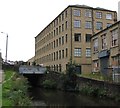


![Union Mills, Milnsbridge. Once part of the huge John Crowther textile empire, they are now apartments. Burdett Mill on the right has had a similar fate. A slightly earlier photo is seen here [[341965]] by Chris Allen – 17 August 2002](https://s0.geograph.org.uk/geophotos/02/62/43/2624380_40a401e4_120x120.jpg)


