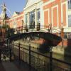
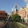
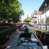
Waterside Centre Pedestrian Bridge No 2
is a minor waterways place
on the River Witham (Lincoln to Boston) between
High Bridge Lincoln (the Glory Hole) (½ furlongs
to the west) and
Stixwould (13 miles and 3 furlongs
and 2 locks
to the east).
The nearest place in the direction of Stixwould is Broadgate Bridge No 3;
½ furlongs
away.
There is access (suitable for wheels) to the towpath here.
Mooring here is good (a nice place to moor), mooring rings or bollards are available. Mooring is limited to 48 hours.
There is a bridge here which takes pedestrian traffic over the canal.
High Bridge Lincoln (the Glory Hole) | ½ furlongs | |
Waterside Centre Pedestrian Bridge No 2 | ||
Broadgate Bridge No 3 | ½ furlongs | |
Waterside House Pedestrian Bridge No 4 | 1½ furlongs | |
Stamp End Lock No 1 | 2½ furlongs | |
Lincoln Railway Bridge No 7 | 3¼ furlongs | |
Witham Park Bridge No 8 | 3½ furlongs |
Amenities here
Amenities nearby at Broadgate Bridge No 3
Amenities nearby at High Bridge Lincoln (the Glory Hole)
Amenities in Lincoln
Amenities at other places in Lincoln
at
at
at
at
at
at
at
at
at
at
at
at
at
at
at
at
at
at
at
at
at
at
There are no links to external websites from here.
Why not log in and add some (select "External websites" from the menu (sometimes this is under "Edit"))?
Mouseover for more information or show routes to facility
Nearest water point
In the direction of Boston Grand Sluice Lock No 3
Stamp End Lock No 1 — 2½ furlongs away
On this waterway in the direction of Boston Grand Sluice Lock No 3
Bardney Lock No 2 — 7 miles, 7¾ furlongs and 1 lock away
On this waterway in the direction of Boston Grand Sluice Lock No 3
In the direction of High Bridge Lincoln (the Glory Hole)
Lincoln Boaters Facilities — 6¾ furlongs away
Travel to High Bridge Lincoln (the Glory Hole), then on the Fossdyke Canal to Lincoln Boaters Facilities
Saxilby Village Water Point — 6 miles, ¼ furlongs away
Travel to High Bridge Lincoln (the Glory Hole), then on the Fossdyke Canal to Saxilby Village Water Point
Torksey Lock — 11 miles, 1 furlong away
Travel to High Bridge Lincoln (the Glory Hole), then on the Fossdyke Canal to Torksey LockNearest rubbish disposal
In the direction of Boston Grand Sluice Lock No 3
Bardney Lock No 2 — 7 miles, 7¾ furlongs and 1 lock away
On this waterway in the direction of Boston Grand Sluice Lock No 3
In the direction of High Bridge Lincoln (the Glory Hole)
Lincoln Boaters Facilities — 6¾ furlongs away
Travel to High Bridge Lincoln (the Glory Hole), then on the Fossdyke Canal to Lincoln Boaters Facilities
Torksey Lock — 11 miles, 1 furlong away
Travel to High Bridge Lincoln (the Glory Hole), then on the Fossdyke Canal to Torksey LockNearest chemical toilet disposal
In the direction of Boston Grand Sluice Lock No 3
Bardney Lock No 2 — 7 miles, 7¾ furlongs and 1 lock away
On this waterway in the direction of Boston Grand Sluice Lock No 3
In the direction of High Bridge Lincoln (the Glory Hole)
Lincoln Boaters Facilities — 6¾ furlongs away
Travel to High Bridge Lincoln (the Glory Hole), then on the Fossdyke Canal to Lincoln Boaters Facilities
Saxilby Council Public Facilities — 6 miles, ¾ furlongs away
Travel to High Bridge Lincoln (the Glory Hole), then on the Fossdyke Canal to Saxilby Council Public Facilities
Torksey Lock — 11 miles, 1 furlong away
Travel to High Bridge Lincoln (the Glory Hole), then on the Fossdyke Canal to Torksey LockNearest place to turn
In the direction of Boston Grand Sluice Lock No 3
Bardney Village Visitor Moorings — 8 miles, 5 furlongs and 2 locks away
On this waterway in the direction of Boston Grand Sluice Lock No 3
River Witham - Nocton Delph Junction — 11 miles and 2 locks away
On this waterway in the direction of Boston Grand Sluice Lock No 3
Dunstan Fen Visitor Moorings — 11 miles, 5¾ furlongs and 2 locks away
On this waterway in the direction of Boston Grand Sluice Lock No 3
Southrey Visitor Moorings — 11 miles, 6¼ furlongs and 2 locks away
On this waterway in the direction of Boston Grand Sluice Lock No 3
Stixwould — 13 miles, 3 furlongs and 2 locks away
On this waterway in the direction of Boston Grand Sluice Lock No 3
Kirkstead Bridge Visitor Moorings — 15 miles, 4 furlongs and 2 locks away
On this waterway in the direction of Boston Grand Sluice Lock No 3
Horncastle Canal Junction — 19 miles, 2½ furlongs and 2 locks away
On this waterway in the direction of Boston Grand Sluice Lock No 3
Tattershall Bridge Visitor Moorings — 19 miles, 7½ furlongs and 2 locks away
On this waterway in the direction of Boston Grand Sluice Lock No 3
In the direction of High Bridge Lincoln (the Glory Hole)
Lincoln Boaters Facilities — 6¾ furlongs away
Travel to High Bridge Lincoln (the Glory Hole), then on the Fossdyke Canal to Lincoln Boaters FacilitiesNearest self-operated pump-out
In the direction of High Bridge Lincoln (the Glory Hole)
Lincoln Boaters Facilities — 6¾ furlongs away
Travel to High Bridge Lincoln (the Glory Hole), then on the Fossdyke Canal to Lincoln Boaters Facilities
Torksey Lock — 11 miles, 1 furlong away
Travel to High Bridge Lincoln (the Glory Hole), then on the Fossdyke Canal to Torksey LockNo information
CanalPlan has no information on any of the following facilities within range:boatyard pump-out
Direction of TV transmitter (From Wolfbane Cybernetic)
There is no page on Wikipedia called “Waterside Centre Pedestrian Bridge”
Wikipedia pages that might relate to Waterside Centre Pedestrian Bridge
[Peace Bridge (Foyle)]
regeneration plans. The bridge also provides a crossing over the railway line approaching Waterside station. The asymetrical bridge, which is 235 m (770 ft)
[Patna, East Ayrshire]
anglers. There are two bridges within the village, used as vehicle and pedestrian crossing points over the River Doon. These bridges are known locally as
[Paddington Basin]
activity. Since 2000, the basin has been the centre of a major redevelopment as part of the wider Paddington Waterside scheme and is surrounded by modern buildings
[St. Columb's Park]
the completion of the Waterside Greenway the park has a direct pedestrian and cycle path that connects to both the Peace Bridge and Gransha Park. There
[Walton-on-Thames]
The fourth bridge was restricted for use by cyclists and pedestrians only once the fifth bridge was completed. Building a sixth bridge began in 2011
[Stari Most]
"the bridge keepers" (natively mostari). Instead of foundations, the bridge has abutments of limestone linked to wing walls along the waterside cliffs
[Elephant and Castle]
Southwark Bridge. Southbound, the route runs without interruption to Collier's Wood, via Kennington, Clapham, and Tooting. A shared-use path for pedestrians and
[Rhodes, New South Wales]
International Aquatic Centre, Bicentennial Park and Millennium Parklands. The pedestrian, cyclist, transport and emergency services Bennelong Bridge from Rhodes
[Paddington Waterside]
Paddington Waterside is a developed area around Paddington Station in London. The Paddington Special Policy Area covers a region almost the size of Soho
[St Neots]
route. Riverside Park is close to the town centre and covers 72 acres) with a beautiful mile-long waterside frontage. The park has a cafe, parking for
Results of Google Search
Sep 26, 2000 ... 2000 No. 283. ROADS. Waterside, Coleraine Cycle/Pedestrian Bridge Order ( Northern Ireland) 2000 ... 4(1) and (2) of the Roads (Northern Ireland) Order 1993 (2) proposes by order to provide for the construction of ... The centre line of the bridge shall extend from a point on the west bank of the River Bann ...
Oct 4, 2018 ... Waterside Place, the commercial and social hub of Lakewood ... and the Players Centre for Performing Arts. The pedestrian bridge on the left leads to an 8-acre peninsula park. ... “I gotta say, that's no coincidence. ... that the developer is accelerating construction of both phases II and III in LakeHouse Cove.
Waterside, Coleraine Cycle/Pedestrian Bridge Order (Northern Ireland) 2000 ... Article 4(1) and (2) of the Roads (Northern Ireland) Order 19932 proposes by ... centre span: 3 metres above mean high water spring tide level of 0.95 metres above ordnance datum over a width of 7 metres. ... (This note is not part of the Order.).
Its curved footpath, track and cycleway link the Guildhall, in the centre of the city, with Ebrington Square in the Waterside area, and St. Columb's Park. Funding[edit ].
Waterside Place, a planned 36-acre urban entertainment hub, announced its first ... Posted Feb 7, 2019 at 1:38 PM Updated Feb 7, 2019 at 2:05 PM ... The shop will have a bodega-style buildout with a walk-up bar and outdoor seating near a pedestrian bridge. ... Bernie Sanders: Biden win in November is no 'slam dunk' ...
Waterside Place, the commercial and social hub of Lakewood Ranch's ... apartments and the Players Centre for Performing Arts. The pedestrian bridge ... “ I gotta say, that's no coincidence. ... Kohn Bennett, president of the builder Homes by Towne, announced that the developer is accelerating construction of both phases II ...