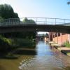
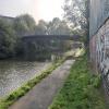
Cromwell Street Footbridge Bridge No 6
is a minor waterways place
on the Worcester and Birmingham Canal (Diglis Basin to King's Norton Junction) between
Diglis Basin (Tow-path goes around the first basin) (6½ furlongs
and 2 locks
to the southwest) and
Hanbury Junction (Junction with Droitwich Junction Canal (Restored - Opened 1/July/2011). Hanbury Wharf) (8 miles and 2 furlongs
and 12 locks
to the northeast).
The nearest place in the direction of Diglis Basin is 2002 Footbridge No 5A;
½ furlongs
away.
The nearest place in the direction of Hanbury Junction is Lowesmoor Bridge No 8;
1 furlong
away.
There may be access to the towpath here.
Mooring here is unrated.
There is a bridge here which takes pedestrian traffic over the canal.
Commandery Visitor Moorings | 3½ furlongs | |
Blockhouse Bridge No 4 | 2½ furlongs | |
Blockhouse Lock No 4 | 2½ furlongs | |
George Street Bridge No 5 | ½ furlongs | |
2002 Footbridge No 5A | ½ furlongs | |
Cromwell Street Footbridge Bridge No 6 | ||
Lowesmoor Bridge No 8 | 1 furlong | |
Rainbow Hill Bridge No 9 | 1½ furlongs | |
Lowesmoor Basin | 1¾ furlongs | |
Lowesmoor Railway Bridge No 10 | 2 furlongs | |
Lansdowne Road Bridge No 11 | 4½ furlongs |
Amenities here
Amenities nearby at 2002 Footbridge No 5A
Amenities in Worcester
Amenities at other places in Worcester
at
at
at
at
at
at
at
at
at
at
at
at
at
at
at
at
at
at
at
at
at
at
at
at
at
at
at
at
at
at
at
at
at
at
at
at
at
at
at
at
at
at
at
at
at
at
at
at
at
at
at
at
at
at
at
at
at
at
at
at
at
at
at
There are no links to external websites from here.
Why not log in and add some (select "External websites" from the menu (sometimes this is under "Edit"))?
Mouseover for more information or show routes to facility
Nearest water point
In the direction of King's Norton Junction
Lowesmoor Basin — 1¾ furlongs away
On this waterway in the direction of King's Norton Junction
Hanbury Boatyard — 8 miles, 1 furlong and 12 locks away
On this waterway in the direction of King's Norton Junction
Droitwich Spa Marina — 8 miles, 5¼ furlongs and 15 locks away
Travel to Hanbury Junction, then on the Droitwich Canals (Droitwich Junction Canal) to Droitwich Spa Marina
Stoke Works Water Point — 10 miles, 6¼ furlongs and 18 locks away
On this waterway in the direction of King's Norton Junction
Tardebigge Wharf — 14 miles, 6½ furlongs and 54 locks away
On this waterway in the direction of King's Norton Junction
In the direction of Diglis Basin
Diglis Services — 6 furlongs and 2 locks away
On this waterway in the direction of Diglis Basin
Diglis Locks — 1 mile, 2¼ furlongs and 4 locks away
Travel to Diglis Basin, then on the Worcester and Birmingham Canal (Diglis Junction to Diglis Basin) to Diglis Junction, then on the River Severn (main river - Worcester to Gloucester) to Diglis Locks
Worcester Trip Boat Moorings — 1 mile, 5¾ furlongs and 4 locks away
Travel to Diglis Basin, then on the Worcester and Birmingham Canal (Diglis Junction to Diglis Basin) to Diglis Junction, then on the River Severn (main river - Stourport to Worcester) to Worcester Trip Boat Moorings
Holt Lock (Holt Fleet) — 8 miles, 2½ furlongs and 5 locks away
Travel to Diglis Basin, then on the Worcester and Birmingham Canal (Diglis Junction to Diglis Basin) to Diglis Junction, then on the River Severn (main river - Stourport to Worcester) to Holt Lock (Holt Fleet)
Lincomb Lock — 12 miles, 4¼ furlongs and 6 locks away
Travel to Diglis Basin, then on the Worcester and Birmingham Canal (Diglis Junction to Diglis Basin) to Diglis Junction, then on the River Severn (main river - Stourport to Worcester) to Lincomb Lock
Upper Basin Waterpoint — 13 miles, 7¾ furlongs and 9 locks away
Travel to Diglis Basin, then on the Worcester and Birmingham Canal (Diglis Junction to Diglis Basin) to Diglis Junction, then on the River Severn (main river - Stourport to Worcester) to Severn - Stourport Broad Locks Entrance, then on the Staffordshire and Worcestershire Canal (Stourport Basins: Broad Route) to Stourport Upper Basin, then on the Staffordshire and Worcestershire Canal (Stourport Basins: Narrow Route) to Upper Basin Waterpoint
Upper Lode Lock No 5 — 17 miles, 3¾ furlongs and 5 locks away
Travel to Diglis Basin, then on the Worcester and Birmingham Canal (Diglis Junction to Diglis Basin) to Diglis Junction, then on the River Severn (main river - Worcester to Gloucester) to Upper Lode Lock No 5
Tewkesbury Services — 17 miles, 1½ furlongs and 6 locks away
Travel to Diglis Basin, then on the Worcester and Birmingham Canal (Diglis Junction to Diglis Basin) to Diglis Junction, then on the River Severn (main river - Worcester to Gloucester) to Tewkesbury Junction, then on the River Avon - Warwickshire (Lower Avon Navigation) to Tewkesbury Services
Netherwich Basin — 10 miles, 6½ furlongs and 13 locks away
Travel to Diglis Basin, then on the Worcester and Birmingham Canal (Diglis Junction to Diglis Basin) to Diglis Junction, then on the River Severn (main river - Stourport to Worcester) to Hawford Junction, then on the Droitwich Canals (Droitwich Barge Canal) to Netherwich Basin
Tewkesbury Lower Lode — 18 miles, 2 furlongs and 6 locks away
Travel to Diglis Basin, then on the Worcester and Birmingham Canal (Diglis Junction to Diglis Basin) to Diglis Junction, then on the River Severn (main river - Worcester to Gloucester) to Tewkesbury Lower Lode
Caldwall Mill Bridge No 14 — 17 miles, 6 furlongs and 12 locks away
Travel to Diglis Basin, then on the Worcester and Birmingham Canal (Diglis Junction to Diglis Basin) to Diglis Junction, then on the River Severn (main river - Stourport to Worcester) to Severn - Stourport Broad Locks Entrance, then on the Staffordshire and Worcestershire Canal (Stourport Basins: Broad Route) to Stourport Upper Basin, then on the Staffordshire and Worcestershire Canal (Stourport Basins: Narrow Route) to York Street Bridge, then on the Staffordshire and Worcestershire Canal (Main Line: Stourport to Stourton) to Caldwall Mill Bridge No 14Nearest rubbish disposal
In the direction of King's Norton Junction
Lowesmoor Basin — 1¾ furlongs away
On this waterway in the direction of King's Norton Junction
Droitwich Spa Marina — 8 miles, 5¼ furlongs and 15 locks away
Travel to Hanbury Junction, then on the Droitwich Canals (Droitwich Junction Canal) to Droitwich Spa Marina
Stoke Bottom Lock No 23 — 11 miles, 4 furlongs and 18 locks away
On this waterway in the direction of King's Norton Junction
Tardebigge Wharf — 14 miles, 6½ furlongs and 54 locks away
On this waterway in the direction of King's Norton Junction
In the direction of Diglis Basin
Diglis Basin — 6½ furlongs and 2 locks away
On this waterway in the direction of Diglis Basin
Sabrina Footbridge — 1 mile, 7½ furlongs and 4 locks away
Travel to Diglis Basin, then on the Worcester and Birmingham Canal (Diglis Junction to Diglis Basin) to Diglis Junction, then on the River Severn (main river - Stourport to Worcester) to Sabrina Footbridge
Upper Basin Waterpoint — 13 miles, 7¾ furlongs and 9 locks away
Travel to Diglis Basin, then on the Worcester and Birmingham Canal (Diglis Junction to Diglis Basin) to Diglis Junction, then on the River Severn (main river - Stourport to Worcester) to Severn - Stourport Broad Locks Entrance, then on the Staffordshire and Worcestershire Canal (Stourport Basins: Broad Route) to Stourport Upper Basin, then on the Staffordshire and Worcestershire Canal (Stourport Basins: Narrow Route) to Upper Basin Waterpoint
Tewkesbury Services — 17 miles, 1½ furlongs and 6 locks away
Travel to Diglis Basin, then on the Worcester and Birmingham Canal (Diglis Junction to Diglis Basin) to Diglis Junction, then on the River Severn (main river - Worcester to Gloucester) to Tewkesbury Junction, then on the River Avon - Warwickshire (Lower Avon Navigation) to Tewkesbury Services
Netherwich Basin — 10 miles, 6½ furlongs and 13 locks away
Travel to Diglis Basin, then on the Worcester and Birmingham Canal (Diglis Junction to Diglis Basin) to Diglis Junction, then on the River Severn (main river - Stourport to Worcester) to Hawford Junction, then on the Droitwich Canals (Droitwich Barge Canal) to Netherwich BasinNearest chemical toilet disposal
In the direction of King's Norton Junction
Lowesmoor Basin — 1¾ furlongs away
On this waterway in the direction of King's Norton Junction
Droitwich Spa Marina — 8 miles, 5¼ furlongs and 15 locks away
Travel to Hanbury Junction, then on the Droitwich Canals (Droitwich Junction Canal) to Droitwich Spa Marina
Stoke Bottom Lock No 23 — 11 miles, 4 furlongs and 18 locks away
On this waterway in the direction of King's Norton Junction
Tardebigge Wharf — 14 miles, 6½ furlongs and 54 locks away
On this waterway in the direction of King's Norton Junction
In the direction of Diglis Basin
Diglis Services — 6 furlongs and 2 locks away
On this waterway in the direction of Diglis Basin
Stourport Marina — 12 miles, 7¾ furlongs and 7 locks away
Travel to Diglis Basin, then on the Worcester and Birmingham Canal (Diglis Junction to Diglis Basin) to Diglis Junction, then on the River Severn (main river - Stourport to Worcester) to Stourport Marina
Upper Basin Waterpoint — 13 miles, 7¾ furlongs and 9 locks away
Travel to Diglis Basin, then on the Worcester and Birmingham Canal (Diglis Junction to Diglis Basin) to Diglis Junction, then on the River Severn (main river - Stourport to Worcester) to Severn - Stourport Broad Locks Entrance, then on the Staffordshire and Worcestershire Canal (Stourport Basins: Broad Route) to Stourport Upper Basin, then on the Staffordshire and Worcestershire Canal (Stourport Basins: Narrow Route) to Upper Basin Waterpoint
Caldwall Mill Bridge No 14 — 17 miles, 6 furlongs and 12 locks away
Travel to Diglis Basin, then on the Worcester and Birmingham Canal (Diglis Junction to Diglis Basin) to Diglis Junction, then on the River Severn (main river - Stourport to Worcester) to Severn - Stourport Broad Locks Entrance, then on the Staffordshire and Worcestershire Canal (Stourport Basins: Broad Route) to Stourport Upper Basin, then on the Staffordshire and Worcestershire Canal (Stourport Basins: Narrow Route) to York Street Bridge, then on the Staffordshire and Worcestershire Canal (Main Line: Stourport to Stourton) to Caldwall Mill Bridge No 14Nearest place to turn
In the direction of King's Norton Junction
Lowesmoor Basin — 1¾ furlongs away
On this waterway in the direction of King's Norton Junction
Bilford Locks Winding Hole — 1 mile, 3½ furlongs and 3 locks away
On this waterway in the direction of King's Norton Junction
Tibberton Winding Hole — 5 miles, 1 furlong and 12 locks away
On this waterway in the direction of King's Norton Junction
Dunhampstead Winding Hole — 6 miles, ½ furlongs and 12 locks away
On this waterway in the direction of King's Norton Junction
Dunhampstead Boatyard — 6 miles, 2¾ furlongs and 12 locks away
On this waterway in the direction of King's Norton Junction
Hanbury Boatyard — 8 miles, 1 furlong and 12 locks away
On this waterway in the direction of King's Norton Junction
Hanbury Junction — 8 miles, 2 furlongs and 12 locks away
On this waterway in the direction of King's Norton Junction
Hanbury Junction Winding Hole — 8 miles, 3¼ furlongs and 12 locks away
On this waterway in the direction of King's Norton Junction
In the direction of Diglis Basin
Diglis Junction — 7¾ furlongs and 4 locks away
Travel to Diglis Basin, then on the Worcester and Birmingham Canal (Diglis Junction to Diglis Basin) to Diglis Junction
Diglis Locks Weir Exit — 1 mile, 2¾ furlongs and 5 locks away
Travel to Diglis Basin, then on the Worcester and Birmingham Canal (Diglis Junction to Diglis Basin) to Diglis Junction, then on the River Severn (main river - Worcester to Gloucester) to Diglis Locks Weir Exit
Severn - Teme Junction — 2 miles, ¾ furlongs and 5 locks away
Travel to Diglis Basin, then on the Worcester and Birmingham Canal (Diglis Junction to Diglis Basin) to Diglis Junction, then on the River Severn (main river - Worcester to Gloucester) to Severn - Teme Junction
Bevere Lock Weir Exit — 4 miles, 6¼ furlongs and 4 locks away
Travel to Diglis Basin, then on the Worcester and Birmingham Canal (Diglis Junction to Diglis Basin) to Diglis Junction, then on the River Severn (main river - Stourport to Worcester) to Bevere Lock Weir Exit
Bevere Lock Weir Entrance — 5 miles, ¾ furlongs and 5 locks away
Travel to Diglis Basin, then on the Worcester and Birmingham Canal (Diglis Junction to Diglis Basin) to Diglis Junction, then on the River Severn (main river - Stourport to Worcester) to Bevere Lock Weir Entrance
Holt Lock Weir Exit — 8 miles, 1½ furlongs and 5 locks away
Travel to Diglis Basin, then on the Worcester and Birmingham Canal (Diglis Junction to Diglis Basin) to Diglis Junction, then on the River Severn (main river - Stourport to Worcester) to Holt Lock Weir Exit
Holt Lock Weir Entrance — 8 miles, 5 furlongs and 6 locks away
Travel to Diglis Basin, then on the Worcester and Birmingham Canal (Diglis Junction to Diglis Basin) to Diglis Junction, then on the River Severn (main river - Stourport to Worcester) to Holt Lock Weir Entrance
Ladywood Top Lock Winding Hole — 8 miles, ½ furlongs and 13 locks away
Travel to Diglis Basin, then on the Worcester and Birmingham Canal (Diglis Junction to Diglis Basin) to Diglis Junction, then on the River Severn (main river - Stourport to Worcester) to Hawford Junction, then on the Droitwich Canals (Droitwich Barge Canal) to Ladywood Top Lock Winding Hole
Severn - Stourport Narrow Locks Entrance — 13 miles, 7 furlongs and 7 locks away
Travel to Diglis Basin, then on the Worcester and Birmingham Canal (Diglis Junction to Diglis Basin) to Diglis Junction, then on the River Severn (main river - Stourport to Worcester) to Severn - Stourport Narrow Locks Entrance
Stourport Lower Basin - between Broad Locks — 13 miles, 6¾ furlongs and 8 locks away
Travel to Diglis Basin, then on the Worcester and Birmingham Canal (Diglis Junction to Diglis Basin) to Diglis Junction, then on the River Severn (main river - Stourport to Worcester) to Severn - Stourport Broad Locks Entrance, then on the Staffordshire and Worcestershire Canal (Stourport Basins: Broad Route) to Stourport Lower Basin - between Broad Locks
Stourport Lower Basin - between Narrow Locks — 13 miles, 7¼ furlongs and 8 locks away
Travel to Diglis Basin, then on the Worcester and Birmingham Canal (Diglis Junction to Diglis Basin) to Diglis Junction, then on the River Severn (main river - Stourport to Worcester) to Severn - Stourport Broad Locks Entrance, then on the Staffordshire and Worcestershire Canal (Stourport Basins: Broad Route) to Stourport Lower Basin - between Broad Locks, then on the Staffordshire and Worcestershire Canal (Stourport Basins: Broad Locks to Narrow Locks to Stourport Lower Basin - between Narrow Locks
Upper Lode Lock Weir Entrance — 17 miles, 3 furlongs and 5 locks away
Travel to Diglis Basin, then on the Worcester and Birmingham Canal (Diglis Junction to Diglis Basin) to Diglis Junction, then on the River Severn (main river - Worcester to Gloucester) to Upper Lode Lock Weir EntranceNearest self-operated pump-out
In the direction of King's Norton Junction
Droitwich Spa Marina — 8 miles, 5¼ furlongs and 15 locks away
Travel to Hanbury Junction, then on the Droitwich Canals (Droitwich Junction Canal) to Droitwich Spa Marina
In the direction of Diglis Basin
Diglis Services — 6 furlongs and 2 locks away
On this waterway in the direction of Diglis BasinNearest boatyard pump-out
In the direction of King's Norton Junction
Lowesmoor Basin — 1¾ furlongs away
On this waterway in the direction of King's Norton Junction
Dunhampstead Boatyard — 6 miles, 2¾ furlongs and 12 locks away
On this waterway in the direction of King's Norton Junction
Hanbury Boatyard — 8 miles, 1 furlong and 12 locks away
On this waterway in the direction of King's Norton Junction
In the direction of Diglis Basin
Stourport Marina — 12 miles, 7¾ furlongs and 7 locks away
Travel to Diglis Basin, then on the Worcester and Birmingham Canal (Diglis Junction to Diglis Basin) to Diglis Junction, then on the River Severn (main river - Stourport to Worcester) to Stourport Marina
Stourport Upper Basin — 13 miles, 7½ furlongs and 9 locks away
Travel to Diglis Basin, then on the Worcester and Birmingham Canal (Diglis Junction to Diglis Basin) to Diglis Junction, then on the River Severn (main river - Stourport to Worcester) to Severn - Stourport Broad Locks Entrance, then on the Staffordshire and Worcestershire Canal (Stourport Basins: Broad Route) to Stourport Upper Basin
Upper Staircase Lock Landing Pontoon — 14 miles, ¼ furlongs and 9 locks away
Travel to Diglis Basin, then on the Worcester and Birmingham Canal (Diglis Junction to Diglis Basin) to Diglis Junction, then on the River Severn (main river - Stourport to Worcester) to Severn - Stourport Broad Locks Entrance, then on the Staffordshire and Worcestershire Canal (Stourport Basins: Broad Route) to Stourport Upper Basin, then on the Staffordshire and Worcestershire Canal (Stourport Basins: Narrow Route) to Upper Staircase Lock Landing PontoonDirection of TV transmitter (From Wolfbane Cybernetic)
There is no page on Wikipedia called “Cromwell Street Footbridge Bridge”
Wikipedia pages that might relate to Cromwell Street Footbridge Bridge
[List of bridges in Cambridge]
other being the Great Bridge, a wooden bridge which has since been destroyed) when Cromwell used the stone from other bridges to refortify the castle
[Tower Bridge]
Cromwell House, with the original final pinions driven by modern hydraulic motors. In 1982, the Tower Bridge Exhibition opened, housed in the bridge's
[Barbican Estate]
penthouse flats. The towers are (east to west): Cromwell Tower, completed in 1973 – named after Oliver Cromwell Shakespeare Tower, completed in 1976 – named
[Stockton-on-Tees]
to the town centre by the Teesquay Millennium Footbridge, Princess of Wales Bridge and the Infinity Bridge. In 1995, after four years in the building, the
[St James's Palace]
Charles spent his final night at St James's before his execution. Oliver Cromwell then took it over, and turned it into barracks during the English Commonwealth
[Newport, Wales]
Bridge, St. Julian's railway bridge, M4 motorway Usk bridge, Great Western Railway Usk bridge, Newport Bridge, Newport City footbridge, George Street
[10 Downing Street]
George Downing between 1682 and 1684. Downing, a notorious spy for Oliver Cromwell and later Charles II, invested in property and acquired considerable wealth
[Whitehall]
Institute and has been opened to the public since 1963. Oliver Cromwell moved to the street in 1647, taking up residence in Wallingford House. Two years
[Palace of Westminster]
paved over and covered in concrete security blocks (see security below). Cromwell Green (also on the frontage, and in 2006 enclosed by hoardings for the
[City of London]
following bridges, listed west to east (downstream), cross the River Thames: Blackfriars Bridge, Blackfriars Railway Bridge, Millennium Bridge (footbridge), Southwark
Results of Google Search
I-70 East/West from US 40 to US 40 beginning 6/26/2018. Beginning May 30, 2018, ... This restriction will be on Cromwell Bridge Rd. I-695 [Baltimore/Baltimore ] ... Effective immediately, all permit loads must crawl Bridge No. 0109600 I-68 WBÂ ...
Small boat-yard between Bridges Nos.4 and 5;. Abutment piers at Cromwell Street foot-bridge. (No.6);. Wall of former Gas Works. Key assets and characteristics:.
Feb 6, 2016 ... The rest of the decrepit 3,500-foot bridge — built in the 1930s, a fixture of ... The 6th Street Bridge is not L.A.'s grandest or most picturesque.
The following is a list and brief history of the bridges in Cambridge, England, principally those ... The first road bridge that is reached as the river enters the city. ... A steel footbridge with timber deck and supported on four cast-iron columns, linking ... a wooden bridge which has since been destroyed) when Cromwell used the ...
Alternating One-Way Traffic for Paving of Bridge No. ... 11/6/2015. I-84 Detour at Exits 25 for Scott Road Bridge Utilities Relocation on November 8 ... closing of the pedestrian bridge and stairs connecting the original commuter parking ..... is continuing on Route 3 in Rocky Hill and Cromwell and Route 160 in Rocky Hill and ...
The Redfern railway station is a heritage-listed former railway bridge and now railway station .... When Central railway station was built, on the site of the Devonshire Street cemetery, ... Until 1994, Redfern had an overhead footbridge at the Eveleigh end of the ... A lift eventually opened on platform 6 & 7 on November 2015.