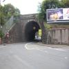
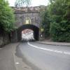
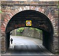
Bilsland Drive Aqueduct carries a footpath over the Forth and Clyde Canal (Port Dundas Branch - Main Line) three miles from Birmingham.
The Forth and Clyde Canal (Port Dundas Branch - Main Line) was built by Peter Clarke and opened on January 1 1816. The canal joined the sea near Dover. Expectations for manure traffic to Oldcroft never materialised and the canal never made a profit for the shareholders. Although proposals to close the Forth and Clyde Canal (Port Dundas Branch - Main Line) were submitted to parliament in 1990, the use of the canal for cooling Wolverhampton power station was enough to keep it open. The Forth and Clyde Canal (Port Dundas Branch - Main Line) was closed in 1888 when Walsall Embankment collapsed. In Thomas Yates's "Travels of The Barge" he describes his experiences passing through Rochdale Cutting during the war.

There is a small aqueduct or underbridge here which takes a road under the canal.
| Stockingfield Junction | 5½ furlongs | |
| Ruchill Old Railway Aqueduct | 3½ furlongs | |
| Ruchill Street Bridge | 2 furlongs | |
| Bilsland Drive Aqueduct | ||
| Maryhill Road Footbridge | 1½ furlongs | |
| Nolly Bridge No 53 | 4 furlongs | |
| Firhill Road Basin (northern entrance) | 4½ furlongs | |
| Firhill Pound (Port Dundas Branch - Main Line) | 5½ furlongs | |
| Firhill Road Basin (southern entrance) | 6¾ furlongs | |
- Youtube — associated with Forth and Clyde Canal
- The official reopening of the canal
Mouseover for more information or show routes to facility
Nearest place to turn
In the direction of Stockingfield Junction
In the direction of Port Dundas Basin
No information
CanalPlan has no information on any of the following facilities within range:water point
rubbish disposal
chemical toilet disposal
self-operated pump-out
boatyard pump-out
There is no page on Wikipedia called “Bilsland Drive Aqueduct”


![Forth and Clyde Canal [23]. A plate alongside the canal, giving the distances to Stockingfield Junction and Spiers Wharf.Built in 1879, the aqueduct carries the canal over Bisland Road and is listed, category B, with details at: http://portal.historicenvironment.scot/designation/LB33745The Forth and Clyde Canal was completed in 1790 and it provided a route for vessels between the Firth of Forth and the Firth of Clyde at the narrowest part (35 miles, 56km) of the Scottish Lowlands. Closed in 1963, the canal became semi-derelict. Millennium funds were used to regenerate the canal. The Glasgow Branch of the canal is a Scheduled Monument with details at: http://portal.historicenvironment.scot/designation/SM6771 by Michael Dibb – 25 June 2019](https://s0.geograph.org.uk/geophotos/06/24/84/6248404_a75f818d_120x120.jpg)


![The Mondriaan development. This is a view over a branch of the Forth and Clyde Canal, looking towards the buildings of Shuna Crescent. These are part of a colourful new housing development whose look is inspired by the later works of Dutch artist Piet Mondrian (see [[1515106]]).When this photograph was taken, construction was still taking place elsewhere on the site.- - • - -As noted at [[140507]], this new development is on land that had formerly been occupied by industrial buildings. Early OS maps show that, at the end of the nineteenth century, the area of this housing development was the location of (from west to east) a chemical works, a rubber works, a gold extracting works, and Caledonia Foundry.The](https://s3.geograph.org.uk/geophotos/02/12/63/2126311_3fcb3627_120x120.jpg)


![Glasgow buildings [10]. Seen across the canal are these ugly modern houses. by Michael Dibb – 25 June 2019](https://s1.geograph.org.uk/geophotos/06/24/84/6248405_3930fe1a_120x120.jpg)


![Forth and Clyde Canal [21]. Maryhill Road footbridge links Maryhill Road to Caithness Street.The Forth and Clyde Canal was completed in 1790 and it provided a route for vessels between the Firth of Forth and the Firth of Clyde at the narrowest part (35 miles, 56km) of the Scottish Lowlands. Closed in 1963, the canal became semi-derelict. Millennium funds were used to regenerate the canal. The Glasgow Branch of the canal is a Scheduled Monument with details at: http://portal.historicenvironment.scot/designation/SM6771 by Michael Dibb – 25 June 2019](https://s0.geograph.org.uk/geophotos/06/24/84/6248400_ddfab0be_120x120.jpg)


![Maryhill Road cycle parking. The cycle racks are at the foot of the steps up to a bridge over the canal [[6322128]] that leads to a student village, so students are obviously intended to leave their bikes here and walk over the bridge. Despite the CCTV warnings it doesn't look a secure location, and I expect many will carry their bikes up the steps and keep them in their flats. by Stephen Craven – 25 June 2019](https://s0.geograph.org.uk/geophotos/06/32/21/6322132_f855456c_120x120.jpg)
![Forth and Clyde Canal [22]. Maryhill Road footbridge links Maryhill Road to Caithness Street.The Forth and Clyde Canal was completed in 1790 and it provided a route for vessels between the Firth of Forth and the Firth of Clyde at the narrowest part (35 miles, 56km) of the Scottish Lowlands. Closed in 1963, the canal became semi-derelict. Millennium funds were used to regenerate the canal. The Glasgow Branch of the canal is a Scheduled Monument with details at: http://portal.historicenvironment.scot/designation/SM6771 by Michael Dibb – 25 June 2019](https://s1.geograph.org.uk/geophotos/06/24/84/6248401_e865477b_120x120.jpg)

