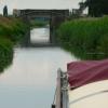
Cock Bank Bridge
is a minor waterways place
on the Middle Level Navigations (Whittlesey Dyke) between
Old River Nene - Whittlesey Dyke Junction (Junction of Whittlesey Dyke and Old River Nene) (3 miles and ¾ furlongs
to the east) and
Angle Corner (1¾ furlongs
to the west).
The nearest place in the direction of Old River Nene - Whittlesey Dyke Junction is Burnt House Road Bridge;
1 mile and 5 furlongs
away.
The nearest place in the direction of Angle Corner is Angle Corner Rural Mooring;
1¼ furlongs
away.
Mooring here is unrated.
There is a bridge here which takes a road over the canal.
Old River Nene - Whittlesey Dyke Junction | 3 miles, ¾ furlongs | |
Burnt House Bridge Rural Mooring | 1 mile, 5½ furlongs | |
Burnt House Road Bridge | 1 mile, 5 furlongs | |
Cock Bank Bridge | ||
Angle Corner Rural Mooring | 1¼ furlongs | |
Angle Corner | 1¾ furlongs | |
Turningtree Road Bridge | 1 mile, 6¼ furlongs | |
Whittlesey Dyke Railway Bridge | 2 miles, 3½ furlongs | |
Aliwal Road Bridge | 2 miles, 4¼ furlongs |
There are no links to external websites from here.
Why not log in and add some (select "External websites" from the menu (sometimes this is under "Edit"))?
Mouseover for more information or show routes to facility
Nearest water point
In the direction of Old River Nene - Whittlesey Dyke Junction
March Marina — 7 miles, ½ furlongs away
Travel to Old River Nene - Whittlesey Dyke Junction, then on the Middle Level Navigations (Old River Nene) to March Marina
March Boater Services — 8 miles, ¼ furlongs away
Travel to Old River Nene - Whittlesey Dyke Junction, then on the Middle Level Navigations (Old River Nene) to March Boater Services
Upwell Church Bridge Public Staithe (visitor mooring) — 15 miles, 3¾ furlongs and 1 lock away
Travel to Old River Nene - Whittlesey Dyke Junction, then on the Middle Level Navigations (Old River Nene) to Upwell Church Bridge Public Staithe (visitor mooring)
In the direction of Whittlesey Bridge
Peterborough Embankment — 8 miles, ¾ furlongs and 2 locks away
Travel to Whittlesey Bridge, then on the Middle Level Navigations (King's Dyke) to Stanground Sluice, then on the River Nene (Stanground Branch) to Peterborough Junction, then on the River Nene (main river) to Peterborough EmbankmentNearest rubbish disposal
In the direction of Old River Nene - Whittlesey Dyke Junction
March Boater Services — 8 miles, ¼ furlongs away
Travel to Old River Nene - Whittlesey Dyke Junction, then on the Middle Level Navigations (Old River Nene) to March Boater Services
Upwell Church Bridge Public Staithe (visitor mooring) — 15 miles, 3¾ furlongs and 1 lock away
Travel to Old River Nene - Whittlesey Dyke Junction, then on the Middle Level Navigations (Old River Nene) to Upwell Church Bridge Public Staithe (visitor mooring)Nearest chemical toilet disposal
In the direction of Old River Nene - Whittlesey Dyke Junction
March Marina — 7 miles, ½ furlongs away
Travel to Old River Nene - Whittlesey Dyke Junction, then on the Middle Level Navigations (Old River Nene) to March Marina
March Boater Services — 8 miles, ¼ furlongs away
Travel to Old River Nene - Whittlesey Dyke Junction, then on the Middle Level Navigations (Old River Nene) to March Boater Services
In the direction of Whittlesey Bridge
Peterborough Embankment — 8 miles, ¾ furlongs and 2 locks away
Travel to Whittlesey Bridge, then on the Middle Level Navigations (King's Dyke) to Stanground Sluice, then on the River Nene (Stanground Branch) to Peterborough Junction, then on the River Nene (main river) to Peterborough EmbankmentNearest place to turn
In the direction of Old River Nene - Whittlesey Dyke Junction
Old River Nene - Whittlesey Dyke Junction — 3 miles, ¾ furlongs away
On this waterway in the direction of Old River Nene - Whittlesey Dyke Junction
West End Winding Hole — 7 miles, 3¼ furlongs away
Travel to Old River Nene - Whittlesey Dyke Junction, then on the Middle Level Navigations (Old River Nene) to West End Winding Hole
Bill Fen Marina — 10 miles, 7 furlongs away
Travel to Old River Nene - Whittlesey Dyke Junction, then on the Middle Level Navigations (Old River Nene) to Old River Nene - Ramsey High Lode Junction, then on the Middle Level Navigations (Ramsey High Lode) to Bill Fen Marina
Ramsey — 11 miles, 5½ furlongs away
Travel to Old River Nene - Whittlesey Dyke Junction, then on the Middle Level Navigations (Old River Nene) to Old River Nene - Ramsey High Lode Junction, then on the Middle Level Navigations (Ramsey High Lode) to Ramsey
Mullicourt Aqueduct Winding Hole — 16 miles, 3½ furlongs away
Travel to Old River Nene - Whittlesey Dyke Junction, then on the Middle Level Navigations (Old River Nene) to Old River Nene - Popham's Eau Junction, then on the Middle Level Navigations (Popham's Eau) to Three Holes, then on the Middle Level Navigations (Middle Level Main Drain) to Mullicourt Aqueduct Winding Hole
Bevill's Leam Pumping Station (southwest side) — 16 miles, 4 furlongs and 1 lock away
Travel to Old River Nene - Whittlesey Dyke Junction, then on the Middle Level Navigations (Old River Nene) to Old River Nene - Black Ham Drain - Bevill's Leam Junction, then on the Middle Level Navigations (Bevill's Leam: Mere Mouth to Pumping Station) to Bevill's Leam Pumping Station (southwest side)
Holme — 16 miles, 7¼ furlongs and 1 lock away
Travel to Old River Nene - Whittlesey Dyke Junction, then on the Middle Level Navigations (Old River Nene) to Old River Nene - New Dyke Junction, then on the Middle Level Navigations (New Dyke) to Holme
Black Ham Pumping Station — 19 miles, 3¼ furlongs and 1 lock away
Travel to Old River Nene - Whittlesey Dyke Junction, then on the Middle Level Navigations (Old River Nene) to Old River Nene - Black Ham Drain - Bevill's Leam Junction, then on the Middle Level Navigations (Black Ham Drain) to Black Ham Pumping Station
Forty Foot River - Old Bedford River Junction — 19 miles, 6¼ furlongs and 2 locks away
Travel to Old River Nene - Whittlesey Dyke Junction, then on the Middle Level Navigations (Old River Nene) to Old River Nene - Forty Foot River Junction, then on the Middle Level Navigations (Forty Foot River - navigable section) to Horseway Lock, then on the Middle Level Navigations (Forty Foot River - unnavigable section) to Forty Foot River - Old Bedford River Junction
In the direction of Whittlesey Bridge
Angle Corner — 1¾ furlongs away
On this waterway in the direction of Whittlesey Bridge
Ashline Winding Hole — 2 miles, 5¼ furlongs and 1 lock away
On this waterway in the direction of Whittlesey Bridge
Whittlesey Winding Hole — 3 miles, 2½ furlongs and 1 lock away
Travel to Whittlesey Bridge, then on the Middle Level Navigations (King's Dyke) to Whittlesey Winding Hole
Bevill's Leam Pumping Station (northeastern side) — 5 miles, 1 furlong away
Travel to Angle Corner, then on the Middle Level Navigations (Bevill's Leam: Angle Corner to Pumping Station) to Bevill's Leam Pumping Station (northeastern side)
Stanground Branch - Morton's Leam Junction — 7 miles, 2¾ furlongs and 2 locks away
Travel to Whittlesey Bridge, then on the Middle Level Navigations (King's Dyke) to Stanground Sluice, then on the River Nene (Stanground Branch) to Stanground Branch - Morton's Leam Junction
Peterborough Junction — 7 miles, 6½ furlongs and 2 locks away
Travel to Whittlesey Bridge, then on the Middle Level Navigations (King's Dyke) to Stanground Sluice, then on the River Nene (Stanground Branch) to Peterborough Junction
Peterborough Rowing Club Junction — 9 miles, 4 furlongs and 2 locks away
Travel to Whittlesey Bridge, then on the Middle Level Navigations (King's Dyke) to Stanground Sluice, then on the River Nene (Stanground Branch) to Peterborough Junction, then on the River Nene (main river) to Peterborough Rowing Club Junction
Waternewton Lock Winding Hole — 15 miles, 7 furlongs and 4 locks away
Travel to Whittlesey Bridge, then on the Middle Level Navigations (King's Dyke) to Stanground Sluice, then on the River Nene (Stanground Branch) to Peterborough Junction, then on the River Nene (main river) to Waternewton Lock Winding HoleNearest self-operated pump-out
In the direction of Whittlesey Bridge
Peterborough Embankment — 8 miles, ¾ furlongs and 2 locks away
Travel to Whittlesey Bridge, then on the Middle Level Navigations (King's Dyke) to Stanground Sluice, then on the River Nene (Stanground Branch) to Peterborough Junction, then on the River Nene (main river) to Peterborough EmbankmentNearest boatyard pump-out
In the direction of Old River Nene - Whittlesey Dyke Junction
March Marina — 7 miles, ½ furlongs away
Travel to Old River Nene - Whittlesey Dyke Junction, then on the Middle Level Navigations (Old River Nene) to March MarinaDirection of TV transmitter (From Wolfbane Cybernetic)
There is no page on Wikipedia called “Cock Bank Bridge”
Wikipedia pages that might relate to Cock Bank Bridge
[Tickle Cock Bridge]
Tickle Cock Bridge is a pedestrian underpass in Castleford, England, under a railway line originally built by the York and North Midland Railway between
[List of Horrible Histories (2009 TV series) episodes]
coffins transported on the London Necropolis Railway. Stupid Deaths: Robert Cocking. Rotten Romans: The "Historical Dentist" goes to extreme measures to get
[River Wharfe]
are the sink holes from Yockenthwaite Moor on the north bank and Horse Head Moor on the south bank. After Hubberholme, the river flows south past Buckden
[Tacoma Narrows Bridge (1940)]
the toll plaza, I saw the bridge in its final collapse and saw my car plunge into the Narrows. Tubby, Coatsworth's cocker spaniel, was the only fatality
[Rooster Bridge]
The Rooster Bridge (Slovene: Petelinji most, Petelinja brv, Petelinov most, Tenente) in Ljubljana, the capital of Slovenia, is a footbridge crossing the
[List of Heartbeat episodes]
Greengrass with a sack full of poached game. 67 6 "Frail Mortality" Michael Cocker Keith Temple 6 October 1996 (1996-10-06) A love triangle leads to tragic
[List of areas in Sandwell]
Burnt Tree Causeway Green Charlemont Cherry Orchard Church Hill Churchfield Cock Green Cradley Cradley Heath The Cronefields Darby's Hill Dudley Port Fallings
[List of Live with Regis and Kelly episodes]
February 1 Regis Philbin & Kelly Ripa Debra Messing, Rachel Bilson, Joe Cocker February 2 Regis Philbin & Kelly Ripa Kim Delaney, Duran Duran February
[List of Armed Services Editions]
Helmericks We Live in Alaska O (Nov. 1944) 457 O-27 Frances Gaither The Red Cock Crows O (Nov. 1944) 458 O-28 M. R. James Selected Ghost Stories O (Nov. 1944)
[Bewdley]
is known for the Bewdley Bridge, designed by Thomas Telford. The main part of Bewdley town is situated on the western bank of the River Severn, including
Results of Google Search
Feb 16, 2017 ... Repair works to the Cock Bridge have been completed and ... of the bridge — with debris falling into the canal and along the bank more than 10 ...
Tucked away down a quiet street in the heart of The City, The Cock and ... It's all waiting for you just minutes from Bank tube station, Leadenhall Market, The ...
Cock Bridge is a settlement in Aberdeenshire, Scotland on the A939 road near Corgarff and Corgarff Castle, between Bellabeg at Strathdon in Aberdeenshire, ...
HALL CARR,Walmer Bridge Inn (by), 06:18, 07:18, 07:53, 08:18, 09:21, 10:11, 10 : ... TARLETON,Cock and Bottle (opp), 06:29, 07:29, 08:04, 08:30, 09:33, 10:23 ... HESKETH BANK,Chapel Rd (by), 06:37, 07:37, 08:12, 08:38, 09:41, ----, 10:51Â ...
Starting from the Anchor car park leave the car park and cross the bridge to your left to then turn right and walk along river bank for2.6km to the Cock Up bridge ...
As part of the work, 4 bridges will be replaced, the Orsett Cock roundabout will be ... Monday 6 May, To avoid delays for road users during the bank holiday ...
Then the walk continues through Read Park and across the A671 to descent to the River Calder at Cock Bridge. The next stretch beside the river is lovely and ...
After Marlow the pathway leads me under the bypass bridge and out into open ... Cock Marsh is owned by the National Trust and is on the opposite bank, which ...
Seven Oaks, Turn Pike, Bowzell, Weald, The Bank, Nizell Heath, Cock, Faulkners , ... Tyhurst, Finch Green, Smarts Hill, Bentham, Pounds Bridge & Marlpit Corn ...