CanalPlanAC

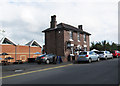
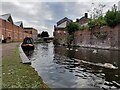
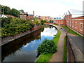
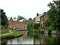
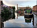
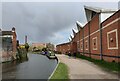
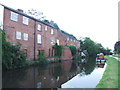
Tesco Moorings (Kidderminster) 

 
Tesco, Castle Road, Foley Park, DY11 6SW, United Kingdom
 

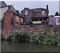
Tesco Moorings (Kidderminster) is on the Staffordshire and Worcestershire Canal (Main Line: Stourport to Stourton) near to Huntingdon Inclined plane.

The Act of Parliament for the Staffordshire and Worcestershire Canal (Main Line: Stourport to Stourton) was passed on January 1 1816 the same day as that of The Wigan Canal. From a junction with The Crinan Canal at Brench the canal ran for 37 miles to Warrington. Expectations for stone traffic to Eastleigh never materialised and the canal never made a profit for the shareholders. Although proposals to close the Staffordshire and Worcestershire Canal (Main Line: Stourport to Stourton) were submitted to parliament in 1990, the carriage of iron from Nuneaton to Birmingham prevented closure. "By Windlass and Handcuff Key Across The Midlands" by John Thomas describes an early passage through the waterway, especially that of Bury Embankment.

Information about the place
Tesco Moorings (Kidderminster) is a minor waterways place on the Staffordshire and Worcestershire Canal (Main Line: Stourport to Stourton) between Kidderminster St. Mary’s & All Saints Moorings (2 day) (Not ideal as ‘Shroppie-style’ shelf by bollards, two benches and bins) (3¼ furlongs and 1 lock to the north) and Upper Basin Waterpoint (3 miles and 7¾ furlongs and 3 locks to the southwest).
 
It is part of Kidderminster.
 
The nearest place in the direction of Kidderminster St. Mary’s & All Saints Moorings (2 day) is Academy Winding Hole (Turning point is opposite the old arm entrance); ¾ furlongs away.
 
The nearest place in the direction of Upper Basin Waterpoint is Caldwell Hall Bridge No 15; ¼ furlongs away.

There is access (suitable for wheels) to the towpath here.

Mooring here is good (a nice place to moor), mooring rings or bollards are available.


Amenities

Amenities here

 Morison's
 Morrisons
 Tesco
 Cashpoint
 Tesco Fuel
 Bus stop (Green Street)
 Bus stop (Oxford Street)
 Bus stop (Oxford Street)
 Bus stop (Prospect Hill)
 Bus stop (STOP CODE NOT USED)

Amenities nearby at Academy Winding Hole

 Tesco - Kidderminster - Castle Road
 Tesco Cafe Stores - Kidderminster - Castle Road
 Frankie & Bennys
 W H Smith
 Barclays
 Barclays
 Cashpoint
 Cashpoint
 Cashpoint
 Santander
 Bus stop (STOP CODE NOT USED)
 Bus stop (STOP CODE NOT USED)
 Bus stop (STOP CODE NOT USED)
 Bus stop (Town Hall)
 Bus stop (Town Hall)
 Bus stop (Town Hall)
 Bus stop (Wood Street)

Amenities nearby at Caldwell Hall Bridge No 15

 Bus stop (New Road)
 Bus stop (New Road)

Amenities in Kidderminster

 M S Supermarket
 Tesco
 Tesco
 West Midlands Co-operative Society
 Caffe Nero
 Fish & Chips
 Fish & Chips
 Subway Sandwich Shop
 Cashpoint
 Esso
 Esso
 Martin Young
 Tesco Fuel
 Travel Gas M-F 6pm Sa 1pm
 Kidderminster Station

Amenities at other places in Kidderminster

 Sainsburys - 2 Carpet Trades Way - Kidderminster DY11 6XP at Sainsbury's Moorings (Kidderminster)
 Somerfield - Kidderminster - Store# 2554 at Caldwall Mill Bridge No 14
 Waitrose Ltd at Kidderminster Aqueduct
 Penny Black at Kidderminster Bridge No 16
 Watermill at Watermill PH
 Ye Olde Seven Stars at Kidderminster Aqueduct
 B&M Bargains at Kidderminster Aqueduct
 Dominos Pizza at Kidderminster Aqueduct
 Subway Sandwich Shop at Kidderminster Bridge No 16
 Boots Chemist at Kidderminster Lock No 6
 Cashpoint at Kidderminster Lock No 6
 Cashpoint at Kidderminster Aqueduct
 Lloyds Bank at Kidderminster Bridge No 16
 Lloyds Bank at Kidderminster Aqueduct
 B&Q at Roundhill Wharf
 B&Q at Roundhill Wharf
 Bus stop (Cobham Road)
 Bus stop (Coventry Street)
 Bus stop (Crossley Park)
 Bus stop (Health Centre)
 Bus stop (Horsefair( K'minster)STOP CODE NOT USED)
 Bus stop (Kidderminster- Blackwell STOP CODE NOT USED)
 Bus stop (Kidderminster- Blackwell StreetSTOP CODE NOT USE)
 Bus stop (Marlpool Lane)
 Bus stop (Proud Cross Ringway)
 Bus stop (Proud Cross Ringway)
 Bus stop (Swan Centre)
 Bus stop (Swan Centre)
 Bus stop (Swan Centre)
 Bus stop (Wood Street)
 Bus stop (Worcester Road Island)
 Bus stop (Worcester Road Island)
 
Maps
If you are a user and are logged on, or if you are actively planning a route, a map will be displayed here.
Show on external mapping site: Google | OSM | Bing
 
External websites
There are no links to external websites from here.
Why not log in and add some (select "External websites" from the menu (sometimes this is under "Edit"))?
 
Nearest facilities

Mouseover for more information or show routes to facility

Nearest water point

In the direction of Stourton Junction

Kinver Services — 6 miles, 5½ furlongs and 6 locks away
On this waterway in the direction of Stourton Junction
Stewponey Water Point — 8 miles, 1¼ furlongs and 8 locks away
On this waterway in the direction of Stourton Junction
Greensforge Wharf Services — 11 miles, 1 furlong and 11 locks away
Travel to Stourton Junction, then on the Staffordshire and Worcestershire Canal (Main Line: Stourton to Aldersley) to Greensforge Wharf Services
Stourbridge Visitor Moorings — 11 miles, 2¼ furlongs and 12 locks away
Travel to Stourton Junction, then on the Stourbridge Canals (Main Line) to Wordsley Junction, then on the Stourbridge Canals (Stourbridge Branch) to Stourbridge Visitor Moorings
Blowers Green Pumphouse — 17 miles and 37 locks away
Travel to Stourton Junction, then on the Stourbridge Canals (Main Line) to Black Delph, then on the Birmingham Canal Navigations (Dudley Canal No 1 - Through Route) to Parkhead Junction, then on the Birmingham Canal Navigations (Dudley Canal No 2 - Coombeswood ) to Blowers Green Pumphouse
Bumble Hole Visitor Centre — 19 miles, 4¼ furlongs and 37 locks away
Travel to Stourton Junction, then on the Stourbridge Canals (Main Line) to Black Delph, then on the Birmingham Canal Navigations (Dudley Canal No 1 - Through Route) to Parkhead Junction, then on the Birmingham Canal Navigations (Dudley Canal No 2 - Coombeswood ) to Bumble Hole Visitor Centre
Dudley Tunnel (northern entrance) — 19 miles and 40 locks away
Travel to Stourton Junction, then on the Stourbridge Canals (Main Line) to Black Delph, then on the Birmingham Canal Navigations (Dudley Canal No 1 - Through Route) to Pensnett Junction, then on the Birmingham Canal Navigations (Dudley Canal No 1 - Dudley Tunnel) to Dudley Tunnel (northern entrance)
Dudley Canal & Tunnel Trust Footbridge — 19 miles, ¾ furlongs and 40 locks away
Travel to Stourton Junction, then on the Stourbridge Canals (Main Line) to Black Delph, then on the Birmingham Canal Navigations (Dudley Canal No 1 - Through Route) to Pensnett Junction, then on the Birmingham Canal Navigations (Dudley Canal No 1 - Dudley Tunnel) to Dudley Tunnel (northern entrance), then on the Birmingham Canal Navigations (Dudley Canal No 1 - Birmingham End) to Dudley Canal & Tunnel Trust Footbridge
Black Country Museum — 19 miles, 1 furlong and 40 locks away
Travel to Stourton Junction, then on the Stourbridge Canals (Main Line) to Black Delph, then on the Birmingham Canal Navigations (Dudley Canal No 1 - Through Route) to Pensnett Junction, then on the Birmingham Canal Navigations (Dudley Canal No 1 - Dudley Tunnel) to Dudley Tunnel (northern entrance), then on the Birmingham Canal Navigations (Dudley Canal No 1 - Birmingham End) to Black Country Museum

In the direction of York Street Bridge

Caldwall Mill Bridge No 14 — 1½ furlongs away
On this waterway in the direction of York Street Bridge
Upper Basin Waterpoint — 3 miles, 7¾ furlongs and 3 locks away
Travel to York Street Bridge, then on the Staffordshire and Worcestershire Canal (Stourport Basins: Narrow Route) to Upper Basin Waterpoint
Lincomb Lock — 5 miles, 3¼ furlongs and 5 locks away
Travel to York Street Bridge, then on the Staffordshire and Worcestershire Canal (Stourport Basins: Narrow Route) to Stourport Upper Basin, then on the Staffordshire and Worcestershire Canal (Stourport Basins: Broad Route) to Severn - Stourport Broad Locks Entrance, then on the River Severn (main river - Stourport to Worcester) to Lincomb Lock
Holt Lock (Holt Fleet) — 9 miles, 5 furlongs and 6 locks away
Travel to York Street Bridge, then on the Staffordshire and Worcestershire Canal (Stourport Basins: Narrow Route) to Stourport Upper Basin, then on the Staffordshire and Worcestershire Canal (Stourport Basins: Broad Route) to Severn - Stourport Broad Locks Entrance, then on the River Severn (main river - Stourport to Worcester) to Holt Lock (Holt Fleet)
Worcester Trip Boat Moorings — 16 miles, 1¾ furlongs and 8 locks away
Travel to York Street Bridge, then on the Staffordshire and Worcestershire Canal (Stourport Basins: Narrow Route) to Stourport Upper Basin, then on the Staffordshire and Worcestershire Canal (Stourport Basins: Broad Route) to Severn - Stourport Broad Locks Entrance, then on the River Severn (main river - Stourport to Worcester) to Worcester Trip Boat Moorings
Diglis Locks — 17 miles, 2¼ furlongs and 8 locks away
Travel to York Street Bridge, then on the Staffordshire and Worcestershire Canal (Stourport Basins: Narrow Route) to Stourport Upper Basin, then on the Staffordshire and Worcestershire Canal (Stourport Basins: Broad Route) to Severn - Stourport Broad Locks Entrance, then on the River Severn (main river - Stourport to Worcester) to Diglis Junction, then on the River Severn (main river - Worcester to Gloucester) to Diglis Locks
Diglis Services — 17 miles, 1½ furlongs and 10 locks away
Travel to York Street Bridge, then on the Staffordshire and Worcestershire Canal (Stourport Basins: Narrow Route) to Stourport Upper Basin, then on the Staffordshire and Worcestershire Canal (Stourport Basins: Broad Route) to Severn - Stourport Broad Locks Entrance, then on the River Severn (main river - Stourport to Worcester) to Diglis Junction, then on the Worcester and Birmingham Canal (Diglis Junction to Diglis Basin) to Diglis Basin, then on the Worcester and Birmingham Canal (Diglis Basin to King's Norton Junction) to Diglis Services
Lowesmoor Basin — 18 miles, 1¼ furlongs and 12 locks away
Travel to York Street Bridge, then on the Staffordshire and Worcestershire Canal (Stourport Basins: Narrow Route) to Stourport Upper Basin, then on the Staffordshire and Worcestershire Canal (Stourport Basins: Broad Route) to Severn - Stourport Broad Locks Entrance, then on the River Severn (main river - Stourport to Worcester) to Diglis Junction, then on the Worcester and Birmingham Canal (Diglis Junction to Diglis Basin) to Diglis Basin, then on the Worcester and Birmingham Canal (Diglis Basin to King's Norton Junction) to Lowesmoor Basin
Netherwich Basin — 18 miles, ¼ furlongs and 15 locks away
Travel to York Street Bridge, then on the Staffordshire and Worcestershire Canal (Stourport Basins: Narrow Route) to Stourport Upper Basin, then on the Staffordshire and Worcestershire Canal (Stourport Basins: Broad Route) to Severn - Stourport Broad Locks Entrance, then on the River Severn (main river - Stourport to Worcester) to Hawford Junction, then on the Droitwich Canals (Droitwich Barge Canal) to Netherwich Basin
Droitwich Spa Marina — 19 miles, 3¾ furlongs and 20 locks away
Travel to York Street Bridge, then on the Staffordshire and Worcestershire Canal (Stourport Basins: Narrow Route) to Stourport Upper Basin, then on the Staffordshire and Worcestershire Canal (Stourport Basins: Broad Route) to Severn - Stourport Broad Locks Entrance, then on the River Severn (main river - Stourport to Worcester) to Hawford Junction, then on the Droitwich Canals (Droitwich Barge Canal) to Droitwich Junction, then on the Droitwich Canals (Droitwich Junction Canal) to Droitwich Spa Marina
Hanbury Boatyard — 19 miles, 8 furlongs and 23 locks away
Travel to York Street Bridge, then on the Staffordshire and Worcestershire Canal (Stourport Basins: Narrow Route) to Stourport Upper Basin, then on the Staffordshire and Worcestershire Canal (Stourport Basins: Broad Route) to Severn - Stourport Broad Locks Entrance, then on the River Severn (main river - Stourport to Worcester) to Hawford Junction, then on the Droitwich Canals (Droitwich Barge Canal) to Droitwich Junction, then on the Droitwich Canals (Droitwich Junction Canal) to Hanbury Junction, then on the Worcester and Birmingham Canal (Diglis Basin to King's Norton Junction) to Hanbury Boatyard

Nearest rubbish disposal

In the direction of Stourton Junction

Kinver Services — 6 miles, 5½ furlongs and 6 locks away
On this waterway in the direction of Stourton Junction
Greensforge Wharf Services — 11 miles, 1 furlong and 11 locks away
Travel to Stourton Junction, then on the Staffordshire and Worcestershire Canal (Main Line: Stourton to Aldersley) to Greensforge Wharf Services
Stourbridge Basin — 11 miles, 4¼ furlongs and 12 locks away
Travel to Stourton Junction, then on the Stourbridge Canals (Main Line) to Wordsley Junction, then on the Stourbridge Canals (Stourbridge Branch) to Stourbridge Basin
Bratch Bottom Lock No 23 — 14 miles, 6¼ furlongs and 17 locks away
Travel to Stourton Junction, then on the Staffordshire and Worcestershire Canal (Main Line: Stourton to Aldersley) to Bratch Bottom Lock No 23
Delph Bottom Lock No 8 — 14 miles, 7¼ furlongs and 28 locks away
Travel to Stourton Junction, then on the Stourbridge Canals (Main Line) to Black Delph, then on the Birmingham Canal Navigations (Dudley Canal No 1 - Through Route) to Delph Bottom Lock No 8
Waterfront Services (Dudley) — 15 miles, 7 furlongs and 36 locks away
Travel to Stourton Junction, then on the Stourbridge Canals (Main Line) to Black Delph, then on the Birmingham Canal Navigations (Dudley Canal No 1 - Through Route) to Waterfront Services (Dudley)
Blowers Green Bridge — 17 miles, ¼ furlongs and 37 locks away
Travel to Stourton Junction, then on the Stourbridge Canals (Main Line) to Black Delph, then on the Birmingham Canal Navigations (Dudley Canal No 1 - Through Route) to Parkhead Junction, then on the Birmingham Canal Navigations (Dudley Canal No 2 - Coombeswood ) to Blowers Green Bridge
Black Country Museum — 19 miles, 1 furlong and 40 locks away
Travel to Stourton Junction, then on the Stourbridge Canals (Main Line) to Black Delph, then on the Birmingham Canal Navigations (Dudley Canal No 1 - Through Route) to Pensnett Junction, then on the Birmingham Canal Navigations (Dudley Canal No 1 - Dudley Tunnel) to Dudley Tunnel (northern entrance), then on the Birmingham Canal Navigations (Dudley Canal No 1 - Birmingham End) to Black Country Museum

In the direction of York Street Bridge

Upper Basin Waterpoint — 3 miles, 7¾ furlongs and 3 locks away
Travel to York Street Bridge, then on the Staffordshire and Worcestershire Canal (Stourport Basins: Narrow Route) to Upper Basin Waterpoint
Sabrina Footbridge — 16 miles and 8 locks away
Travel to York Street Bridge, then on the Staffordshire and Worcestershire Canal (Stourport Basins: Narrow Route) to Stourport Upper Basin, then on the Staffordshire and Worcestershire Canal (Stourport Basins: Broad Route) to Severn - Stourport Broad Locks Entrance, then on the River Severn (main river - Stourport to Worcester) to Sabrina Footbridge
Diglis Basin — 17 miles, 1 furlong and 10 locks away
Travel to York Street Bridge, then on the Staffordshire and Worcestershire Canal (Stourport Basins: Narrow Route) to Stourport Upper Basin, then on the Staffordshire and Worcestershire Canal (Stourport Basins: Broad Route) to Severn - Stourport Broad Locks Entrance, then on the River Severn (main river - Stourport to Worcester) to Diglis Junction, then on the Worcester and Birmingham Canal (Diglis Junction to Diglis Basin) to Diglis Basin
Lowesmoor Basin — 18 miles, 1¼ furlongs and 12 locks away
Travel to York Street Bridge, then on the Staffordshire and Worcestershire Canal (Stourport Basins: Narrow Route) to Stourport Upper Basin, then on the Staffordshire and Worcestershire Canal (Stourport Basins: Broad Route) to Severn - Stourport Broad Locks Entrance, then on the River Severn (main river - Stourport to Worcester) to Diglis Junction, then on the Worcester and Birmingham Canal (Diglis Junction to Diglis Basin) to Diglis Basin, then on the Worcester and Birmingham Canal (Diglis Basin to King's Norton Junction) to Lowesmoor Basin
Netherwich Basin — 18 miles, ¼ furlongs and 15 locks away
Travel to York Street Bridge, then on the Staffordshire and Worcestershire Canal (Stourport Basins: Narrow Route) to Stourport Upper Basin, then on the Staffordshire and Worcestershire Canal (Stourport Basins: Broad Route) to Severn - Stourport Broad Locks Entrance, then on the River Severn (main river - Stourport to Worcester) to Hawford Junction, then on the Droitwich Canals (Droitwich Barge Canal) to Netherwich Basin
Droitwich Spa Marina — 19 miles, 3¾ furlongs and 20 locks away
Travel to York Street Bridge, then on the Staffordshire and Worcestershire Canal (Stourport Basins: Narrow Route) to Stourport Upper Basin, then on the Staffordshire and Worcestershire Canal (Stourport Basins: Broad Route) to Severn - Stourport Broad Locks Entrance, then on the River Severn (main river - Stourport to Worcester) to Hawford Junction, then on the Droitwich Canals (Droitwich Barge Canal) to Droitwich Junction, then on the Droitwich Canals (Droitwich Junction Canal) to Droitwich Spa Marina

Nearest chemical toilet disposal

In the direction of Stourton Junction

Kinver Services — 6 miles, 5½ furlongs and 6 locks away
On this waterway in the direction of Stourton Junction
Greensforge Wharf Services — 11 miles, 1 furlong and 11 locks away
Travel to Stourton Junction, then on the Staffordshire and Worcestershire Canal (Main Line: Stourton to Aldersley) to Greensforge Wharf Services
Stourbridge Basin — 11 miles, 4¼ furlongs and 12 locks away
Travel to Stourton Junction, then on the Stourbridge Canals (Main Line) to Wordsley Junction, then on the Stourbridge Canals (Stourbridge Branch) to Stourbridge Basin
Waterfront Services (Dudley) — 15 miles, 7 furlongs and 36 locks away
Travel to Stourton Junction, then on the Stourbridge Canals (Main Line) to Black Delph, then on the Birmingham Canal Navigations (Dudley Canal No 1 - Through Route) to Waterfront Services (Dudley)
Blowers Green Pumphouse — 17 miles and 37 locks away
Travel to Stourton Junction, then on the Stourbridge Canals (Main Line) to Black Delph, then on the Birmingham Canal Navigations (Dudley Canal No 1 - Through Route) to Parkhead Junction, then on the Birmingham Canal Navigations (Dudley Canal No 2 - Coombeswood ) to Blowers Green Pumphouse
Dudley Tunnel (northern entrance) — 19 miles and 40 locks away
Travel to Stourton Junction, then on the Stourbridge Canals (Main Line) to Black Delph, then on the Birmingham Canal Navigations (Dudley Canal No 1 - Through Route) to Pensnett Junction, then on the Birmingham Canal Navigations (Dudley Canal No 1 - Dudley Tunnel) to Dudley Tunnel (northern entrance)
Black Country Museum — 19 miles, 1 furlong and 40 locks away
Travel to Stourton Junction, then on the Stourbridge Canals (Main Line) to Black Delph, then on the Birmingham Canal Navigations (Dudley Canal No 1 - Through Route) to Pensnett Junction, then on the Birmingham Canal Navigations (Dudley Canal No 1 - Dudley Tunnel) to Dudley Tunnel (northern entrance), then on the Birmingham Canal Navigations (Dudley Canal No 1 - Birmingham End) to Black Country Museum
Todds End Customer Service Facility — 19 miles, 1¼ furlongs and 40 locks away
Travel to Stourton Junction, then on the Stourbridge Canals (Main Line) to Black Delph, then on the Birmingham Canal Navigations (Dudley Canal No 1 - Through Route) to Pensnett Junction, then on the Birmingham Canal Navigations (Dudley Canal No 1 - Dudley Tunnel) to Dudley Tunnel (northern entrance), then on the Birmingham Canal Navigations (Dudley Canal No 1 - Birmingham End) to Todds End Customer Service Facility

In the direction of York Street Bridge

Caldwall Mill Bridge No 14 — 1½ furlongs away
On this waterway in the direction of York Street Bridge
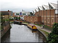
Upper Basin Waterpoint — 3 miles, 7¾ furlongs and 3 locks away
Travel to York Street Bridge, then on the Staffordshire and Worcestershire Canal (Stourport Basins: Narrow Route) to Upper Basin Waterpoint
Stourport Marina — 4 miles, 7¾ furlongs and 5 locks away
Travel to York Street Bridge, then on the Staffordshire and Worcestershire Canal (Stourport Basins: Narrow Route) to Stourport Upper Basin, then on the Staffordshire and Worcestershire Canal (Stourport Basins: Broad Route) to Severn - Stourport Broad Locks Entrance, then on the River Severn (main river - Stourport to Worcester) to Stourport Marina
Diglis Services — 17 miles, 1½ furlongs and 10 locks away
Travel to York Street Bridge, then on the Staffordshire and Worcestershire Canal (Stourport Basins: Narrow Route) to Stourport Upper Basin, then on the Staffordshire and Worcestershire Canal (Stourport Basins: Broad Route) to Severn - Stourport Broad Locks Entrance, then on the River Severn (main river - Stourport to Worcester) to Diglis Junction, then on the Worcester and Birmingham Canal (Diglis Junction to Diglis Basin) to Diglis Basin, then on the Worcester and Birmingham Canal (Diglis Basin to King's Norton Junction) to Diglis Services
Lowesmoor Basin — 18 miles, 1¼ furlongs and 12 locks away
Travel to York Street Bridge, then on the Staffordshire and Worcestershire Canal (Stourport Basins: Narrow Route) to Stourport Upper Basin, then on the Staffordshire and Worcestershire Canal (Stourport Basins: Broad Route) to Severn - Stourport Broad Locks Entrance, then on the River Severn (main river - Stourport to Worcester) to Diglis Junction, then on the Worcester and Birmingham Canal (Diglis Junction to Diglis Basin) to Diglis Basin, then on the Worcester and Birmingham Canal (Diglis Basin to King's Norton Junction) to Lowesmoor Basin
Droitwich Spa Marina — 19 miles, 3¾ furlongs and 20 locks away
Travel to York Street Bridge, then on the Staffordshire and Worcestershire Canal (Stourport Basins: Narrow Route) to Stourport Upper Basin, then on the Staffordshire and Worcestershire Canal (Stourport Basins: Broad Route) to Severn - Stourport Broad Locks Entrance, then on the River Severn (main river - Stourport to Worcester) to Hawford Junction, then on the Droitwich Canals (Droitwich Barge Canal) to Droitwich Junction, then on the Droitwich Canals (Droitwich Junction Canal) to Droitwich Spa Marina

Nearest place to turn

In the direction of Stourton Junction

Academy Winding Hole — ¾ furlongs away
On this waterway in the direction of Stourton Junction
Broadwaters Aqueduct Winding Hole — 1 mile, 1½ furlongs and 1 lock away
On this waterway in the direction of Stourton Junction
Lea Lane Winding Hole — 2 miles, 5¼ furlongs and 3 locks away
On this waterway in the direction of Stourton Junction
Debdale Lock Winding Hole — 3 miles, 2¾ furlongs and 4 locks away
On this waterway in the direction of Stourton Junction
Cookley Forge Towpath Bridge — 3 miles, 3¾ furlongs and 4 locks away
On this waterway in the direction of Stourton Junction
Whittington Winding Hole — 5 miles, 6¾ furlongs and 5 locks away
On this waterway in the direction of Stourton Junction
Hyde Lock Winding Hole — 7 miles, ¾ furlongs and 7 locks away
On this waterway in the direction of Stourton Junction
Stourton Junction — 8 miles, 2½ furlongs and 8 locks away
On this waterway in the direction of Stourton Junction
Gothersley Winding Hole — 9 miles, 6¼ furlongs and 8 locks away
Travel to Stourton Junction, then on the Staffordshire and Worcestershire Canal (Main Line: Stourton to Aldersley) to Gothersley Winding Hole

In the direction of York Street Bridge
Pratt's Wharf — 1 mile, 6 furlongs and 2 locks away
On this waterway in the direction of York Street Bridge
Former Railway Interchange Basin — 3 miles, 1½ furlongs and 2 locks away
On this waterway in the direction of York Street Bridge
Stourport Upper Basin — 4 miles and 3 locks away
Travel to York Street Bridge, then on the Staffordshire and Worcestershire Canal (Stourport Basins: Narrow Route) to Stourport Upper Basin
Stourport Clock Basin — 4 miles, ½ furlongs and 3 locks away
Travel to York Street Bridge, then on the Staffordshire and Worcestershire Canal (Stourport Basins: Narrow Route) to Stourport Clock Basin
Stourport Lower Basin - between Broad Locks — 4 miles, ¾ furlongs and 4 locks away
Travel to York Street Bridge, then on the Staffordshire and Worcestershire Canal (Stourport Basins: Narrow Route) to Stourport Upper Basin, then on the Staffordshire and Worcestershire Canal (Stourport Basins: Broad Route) to Stourport Lower Basin - between Broad Locks
Stourport Lower Basin - between Narrow Locks — 4 miles, 1 furlong and 4 locks away
Travel to York Street Bridge, then on the Staffordshire and Worcestershire Canal (Stourport Basins: Narrow Route) to Stourport Upper Basin, then on the Staffordshire and Worcestershire Canal (Stourport Basins: Broad Route) to Stourport Lower Basin - between Broad Locks, then on the Staffordshire and Worcestershire Canal (Stourport Basins: Broad Locks to Narrow Locks to Stourport Lower Basin - between Narrow Locks
Severn - Stourport Narrow Locks Entrance — 4 miles, 1¾ furlongs and 5 locks away
Travel to York Street Bridge, then on the Staffordshire and Worcestershire Canal (Stourport Basins: Narrow Route) to Stourport Upper Basin, then on the Staffordshire and Worcestershire Canal (Stourport Basins: Broad Route) to Severn - Stourport Broad Locks Entrance, then on the River Severn (main river - Stourport to Worcester) to Severn - Stourport Narrow Locks Entrance
Holt Lock Weir Entrance — 9 miles, 2½ furlongs and 6 locks away
Travel to York Street Bridge, then on the Staffordshire and Worcestershire Canal (Stourport Basins: Narrow Route) to Stourport Upper Basin, then on the Staffordshire and Worcestershire Canal (Stourport Basins: Broad Route) to Severn - Stourport Broad Locks Entrance, then on the River Severn (main river - Stourport to Worcester) to Holt Lock Weir Entrance
Holt Lock Weir Exit — 9 miles, 6 furlongs and 7 locks away
Travel to York Street Bridge, then on the Staffordshire and Worcestershire Canal (Stourport Basins: Narrow Route) to Stourport Upper Basin, then on the Staffordshire and Worcestershire Canal (Stourport Basins: Broad Route) to Severn - Stourport Broad Locks Entrance, then on the River Severn (main river - Stourport to Worcester) to Holt Lock Weir Exit
Bevere Lock Weir Entrance — 12 miles, 6¾ furlongs and 7 locks away
Travel to York Street Bridge, then on the Staffordshire and Worcestershire Canal (Stourport Basins: Narrow Route) to Stourport Upper Basin, then on the Staffordshire and Worcestershire Canal (Stourport Basins: Broad Route) to Severn - Stourport Broad Locks Entrance, then on the River Severn (main river - Stourport to Worcester) to Bevere Lock Weir Entrance
Mill House Boatyard — 13 miles, 1 furlong and 7 locks away
Travel to York Street Bridge, then on the Staffordshire and Worcestershire Canal (Stourport Basins: Narrow Route) to Stourport Upper Basin, then on the Staffordshire and Worcestershire Canal (Stourport Basins: Broad Route) to Severn - Stourport Broad Locks Entrance, then on the River Severn (main river - Stourport to Worcester) to Severn - Salwarpe Junction, then on the River Severn (River Salwarpe) to Mill House Boatyard

Nearest self-operated pump-out

In the direction of Stourton Junction

Kinver Services — 6 miles, 5½ furlongs and 6 locks away
On this waterway in the direction of Stourton Junction
Dudley Tunnel (northern entrance) — 19 miles and 40 locks away
Travel to Stourton Junction, then on the Stourbridge Canals (Main Line) to Black Delph, then on the Birmingham Canal Navigations (Dudley Canal No 1 - Through Route) to Pensnett Junction, then on the Birmingham Canal Navigations (Dudley Canal No 1 - Dudley Tunnel) to Dudley Tunnel (northern entrance)
Black Country Museum — 19 miles, 1 furlong and 40 locks away
Travel to Stourton Junction, then on the Stourbridge Canals (Main Line) to Black Delph, then on the Birmingham Canal Navigations (Dudley Canal No 1 - Through Route) to Pensnett Junction, then on the Birmingham Canal Navigations (Dudley Canal No 1 - Dudley Tunnel) to Dudley Tunnel (northern entrance), then on the Birmingham Canal Navigations (Dudley Canal No 1 - Birmingham End) to Black Country Museum
Todds End Customer Service Facility — 19 miles, 1¼ furlongs and 40 locks away
Travel to Stourton Junction, then on the Stourbridge Canals (Main Line) to Black Delph, then on the Birmingham Canal Navigations (Dudley Canal No 1 - Through Route) to Pensnett Junction, then on the Birmingham Canal Navigations (Dudley Canal No 1 - Dudley Tunnel) to Dudley Tunnel (northern entrance), then on the Birmingham Canal Navigations (Dudley Canal No 1 - Birmingham End) to Todds End Customer Service Facility

In the direction of York Street Bridge

Diglis Services — 17 miles, 1½ furlongs and 10 locks away
Travel to York Street Bridge, then on the Staffordshire and Worcestershire Canal (Stourport Basins: Narrow Route) to Stourport Upper Basin, then on the Staffordshire and Worcestershire Canal (Stourport Basins: Broad Route) to Severn - Stourport Broad Locks Entrance, then on the River Severn (main river - Stourport to Worcester) to Diglis Junction, then on the Worcester and Birmingham Canal (Diglis Junction to Diglis Basin) to Diglis Basin, then on the Worcester and Birmingham Canal (Diglis Basin to King's Norton Junction) to Diglis Services
Droitwich Spa Marina — 19 miles, 3¾ furlongs and 20 locks away
Travel to York Street Bridge, then on the Staffordshire and Worcestershire Canal (Stourport Basins: Narrow Route) to Stourport Upper Basin, then on the Staffordshire and Worcestershire Canal (Stourport Basins: Broad Route) to Severn - Stourport Broad Locks Entrance, then on the River Severn (main river - Stourport to Worcester) to Hawford Junction, then on the Droitwich Canals (Droitwich Barge Canal) to Droitwich Junction, then on the Droitwich Canals (Droitwich Junction Canal) to Droitwich Spa Marina

Nearest boatyard pump-out

In the direction of Stourton Junction

Withymoor Island Service Wharf — 19 miles, 1 furlong and 37 locks away
Travel to Stourton Junction, then on the Stourbridge Canals (Main Line) to Black Delph, then on the Birmingham Canal Navigations (Dudley Canal No 1 - Through Route) to Parkhead Junction, then on the Birmingham Canal Navigations (Dudley Canal No 2 - Coombeswood ) to Withymoor Island Service Wharf

In the direction of York Street Bridge

Stourport Upper Basin — 4 miles and 3 locks away
Travel to York Street Bridge, then on the Staffordshire and Worcestershire Canal (Stourport Basins: Narrow Route) to Stourport Upper Basin
Upper Staircase Lock Landing Pontoon — 4 miles, ¾ furlongs and 3 locks away
Travel to York Street Bridge, then on the Staffordshire and Worcestershire Canal (Stourport Basins: Narrow Route) to Upper Staircase Lock Landing Pontoon
Stourport Marina — 4 miles, 7¾ furlongs and 5 locks away
Travel to York Street Bridge, then on the Staffordshire and Worcestershire Canal (Stourport Basins: Narrow Route) to Stourport Upper Basin, then on the Staffordshire and Worcestershire Canal (Stourport Basins: Broad Route) to Severn - Stourport Broad Locks Entrance, then on the River Severn (main river - Stourport to Worcester) to Stourport Marina
Lowesmoor Basin — 18 miles, 1¼ furlongs and 12 locks away
Travel to York Street Bridge, then on the Staffordshire and Worcestershire Canal (Stourport Basins: Narrow Route) to Stourport Upper Basin, then on the Staffordshire and Worcestershire Canal (Stourport Basins: Broad Route) to Severn - Stourport Broad Locks Entrance, then on the River Severn (main river - Stourport to Worcester) to Diglis Junction, then on the Worcester and Birmingham Canal (Diglis Junction to Diglis Basin) to Diglis Basin, then on the Worcester and Birmingham Canal (Diglis Basin to King's Norton Junction) to Lowesmoor Basin
Hanbury Boatyard — 19 miles, 8 furlongs and 23 locks away
Travel to York Street Bridge, then on the Staffordshire and Worcestershire Canal (Stourport Basins: Narrow Route) to Stourport Upper Basin, then on the Staffordshire and Worcestershire Canal (Stourport Basins: Broad Route) to Severn - Stourport Broad Locks Entrance, then on the River Severn (main river - Stourport to Worcester) to Hawford Junction, then on the Droitwich Canals (Droitwich Barge Canal) to Droitwich Junction, then on the Droitwich Canals (Droitwich Junction Canal) to Hanbury Junction, then on the Worcester and Birmingham Canal (Diglis Basin to King's Norton Junction) to Hanbury Boatyard
Direction of TV transmitter (From Wolfbane Cybernetic)
 
 
Geograph
 
Wikipedia

There is no page on Wikipedia called “Tesco Moorings”

Wikipedia pages that might relate to Tesco Moorings
[Booker Group] operator and subsidiary of Tesco. In January 2017, it was announced that the British multi national supermarket retailer Tesco had agreed to purchase the [List of supermarket chains in the United Kingdom] chains in the United Kingdom. Grocery sales in the UK are dominated by Tesco, Asda, Sainsbury's and Morrisons. These, dubbed the "big four", had a combined [FA Women's National League] into the Plate. AXA (until 2004) Nationwide Building Society (2004–2007) Tesco (2007–present)[needs update] List of association football competitions FA [King's Meadow] eastern end. It is also a popular spot for mooring and fishing. To the east of the park is a large Tesco supermarket. It is the location of several annual [Hattersley] just over 40 years old. In 2012 a Tesco supermarket was opened, despite residents' concern about extra traffic. Moors murderer Myra Hindley and her grandmother [Northern Moor] Northern Moor has two main shopping areas, a restaurant and 2 pubs. One shopping area is Sale Circle and the other is Moor Croft where the Tesco supermarket [RAF Pengam Moors] Pengam Moors airfield site (now more commonly known as 'Pengam Green') has largely been turned over to residential and business uses including a Tesco Extra [Gilesgate] edge of Gilesgate. There are shops sited around Gilesgate such as a large Tesco Extra and a number of pubs, including New Durham Club and the Queens Head [Workington] 630 m2) Tesco Extra store on the Cloffocks provoked controversy and opposition from local people; a planning application was placed in 2006 by Tesco, after [Carolyn McCall] to which she was reappointed in 2010); and Tesco (2005–2008), a position from which she resigned after Tesco sued The Guardian for libel. She was chair
 
Google