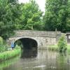
Beaumont Turnpike Bridge No 110
is a minor waterways place
on the Lancaster Canal (Main Line) between
Lune Aqueduct (northern end) (Over the River Lune, built by Rennie) (4 furlongs
to the east) and
Hest Bank Bridge No 118 (Hest Bank) (2 miles and ¾ furlongs
to the northwest).
The nearest place in the direction of Lune Aqueduct (northern end) is Beaumont Hall Bridge No 109;
1½ furlongs
away.
The nearest place in the direction of Hest Bank Bridge No 118 is Hammerton Hall Bridge No 111;
2¼ furlongs
away.
There may be access to the towpath here.
Mooring here is unrated.
There is a bridge here which takes a major road over the canal.
Lune Aqueduct (southern end) | 5 furlongs | |
Lune Aqueduct (northern end) | 4 furlongs | |
Halton Road Winding Hole | 3¾ furlongs | |
Halton Road Bridge No 108 | 3½ furlongs | |
Beaumont Hall Bridge No 109 | 1½ furlongs | |
Beaumont Turnpike Bridge No 110 | ||
Hammerton Hall Bridge No 111 | 2¼ furlongs | |
Folly Bridge Winding Hole | 5 furlongs | |
Folly Bridge No 112 | 5½ furlongs | |
Williamsland Bridge No 113 | 7½ furlongs | |
Belmont Bridge No 114 | 1 mile, ¼ furlongs |
There are no links to external websites from here.
Why not log in and add some (select "External websites" from the menu (sometimes this is under "Edit"))?
Mouseover for more information or show routes to facility
Nearest water point
In the direction of Preston Terminus
Lodge Hill Junction — 8 miles, 2½ furlongs away
On this waterway in the direction of Preston Terminus
Ratcliffe Bridge No 75 — 11 miles, 3¼ furlongs away
On this waterway in the direction of Preston Terminus
Moss Lane Bridge No 63 — 15 miles, 4 furlongs away
On this waterway in the direction of Preston Terminus
Brows Bridge No 8 — 10 miles, 6¼ furlongs and 6 locks away
Travel to Lodge Hill Junction, then on the Lancaster Canal (Glasson Branch) to Brows Bridge No 8
Glasson Visitor Moorings — 10 miles, 7 furlongs and 6 locks away
Travel to Lodge Hill Junction, then on the Lancaster Canal (Glasson Branch) to Glasson Visitor Moorings
Glasson Basin — 11 miles, ½ furlongs and 6 locks away
Travel to Lodge Hill Junction, then on the Lancaster Canal (Glasson Branch) to Glasson Basin
In the direction of Tewitfield
Hest Bank Bridge No 118 — 2 miles, ¾ furlongs away
On this waterway in the direction of Tewitfield
Tewitfield — 9 miles, 6½ furlongs away
On this waterway in the direction of TewitfieldNearest rubbish disposal
In the direction of Tewitfield
Hest Bank Bridge No 118 — 2 miles, ¾ furlongs away
On this waterway in the direction of Tewitfield
Tewitfield — 9 miles, 6½ furlongs away
On this waterway in the direction of TewitfieldNearest chemical toilet disposal
In the direction of Tewitfield
Hest Bank Bridge No 118 — 2 miles, ¾ furlongs away
On this waterway in the direction of Tewitfield
Lundsfield Wharf — 5 miles, 4 furlongs away
On this waterway in the direction of Tewitfield
Tewitfield — 9 miles, 6½ furlongs away
On this waterway in the direction of TewitfieldNearest place to turn
In the direction of Preston Terminus
Halton Road Winding Hole — 3¾ furlongs away
On this waterway in the direction of Preston Terminus
Ashton Park Bridge Winding Hole — 6 miles, 2 furlongs away
On this waterway in the direction of Preston Terminus
Galgate Basin Wharf — 7 miles, 7½ furlongs away
On this waterway in the direction of Preston Terminus
Lodge Hill Junction — 8 miles, 2½ furlongs away
On this waterway in the direction of Preston Terminus
Carter's Wood Winding Hole — 8 miles, 4½ furlongs and 1 lock away
Travel to Lodge Hill Junction, then on the Lancaster Canal (Glasson Branch) to Carter's Wood Winding Hole
Richmond Bridge Winding Hole — 9 miles, 7¼ furlongs away
On this waterway in the direction of Preston Terminus
Ratcliffe Bridge Winding Hole — 11 miles, 4 furlongs away
On this waterway in the direction of Preston Terminus
Bells Bridge Winding Hole — 13 miles, 7¾ furlongs away
On this waterway in the direction of Preston Terminus
Cathouse Bridge Winding Hole — 15 miles, 2¼ furlongs away
On this waterway in the direction of Preston Terminus
Moss Lane Bridge Winding Hole (north) — 15 miles, 4 furlongs away
On this waterway in the direction of Preston Terminus
Moss Lane Bridge Winding Hole (south) — 15 miles, 4¼ furlongs away
On this waterway in the direction of Preston Terminus
Kepple Lane Bridge Winding Hole — 15 miles, 5½ furlongs away
On this waterway in the direction of Preston Terminus
Thurnham Bridge Winding Hole — 10 miles, 1¼ furlongs and 6 locks away
Travel to Lodge Hill Junction, then on the Lancaster Canal (Glasson Branch) to Thurnham Bridge Winding Hole
In the direction of Tewitfield
Folly Bridge Winding Hole — 5 furlongs away
On this waterway in the direction of Tewitfield
Belmont Bridge Winding Hole — 1 mile, ¼ furlongs away
On this waterway in the direction of Tewitfield
Hest Bank Winding Hole — 2 miles, 2 furlongs away
On this waterway in the direction of Tewitfield
Lundsfield Wharf — 5 miles, 4 furlongs away
On this waterway in the direction of Tewitfield
Capernwray Winding Hole — 7 miles, 7½ furlongs away
On this waterway in the direction of Tewitfield
Lovers Creek — 8 miles, 3¾ furlongs away
On this waterway in the direction of Tewitfield
Tewitfield — 9 miles, 6½ furlongs away
On this waterway in the direction of TewitfieldNo information
CanalPlan has no information on any of the following facilities within range:self-operated pump-out
boatyard pump-out
Direction of TV transmitter (From Wolfbane Cybernetic)
There is no page on Wikipedia called “Beaumont Turnpike Bridge”
Wikipedia pages that might relate to Beaumont Turnpike Bridge
[Speed limits in the United States by jurisdiction]
turnpikes like the Will Rogers Turnpike, main segment of the H.E. Bailey Turnpike, Cimarron Turnpike and Chickasaw Turnpike will not be changed as part of
[Industrial Revolution]
occasionally earlier) turnpike trusts were set up to charge tolls and maintain some roads. Increasing numbers of main roads were turnpiked from the 1750s to
[Botley Road]
Oxford. The Botley Road was known as the Botley Turnpike Road in the 18th century and Seven Bridges Road in the 19th century. Until the early 19th century
[List of Rescue 911 episodes]
1991 Muncie, Indiana A scuba diver loses her regulator while underwater "Turnpike Samaritan Save" * March 2, 1994 Stroud, Oklahoma A car is crushed by cargo
[Texas]
"Global List of Toll Facilities—United States". International Bridge, Tunnel and Turnpike Association. 2005. Archived from the original on January 13,
[Huddersfield]
Beaumont Park about 2 miles (3.2 km) to the south of the town centre was bequeathed to the town in the 1880s, by Henry Frederick Beaumont ('Beaumont's
[Interstate 44 in Missouri]
enters Missouri in Newton County at the eastern terminus of the Will Rogers Turnpike, 200 yards (180 m) south of the Kansas state line. The first interchange
[U.S. Route 522]
east end of SR 313 (Beaumont Road), which leads to the Beaumont Learning Center, before it crosses the William Walthall Michaux Bridge over the James River
[List of unsolved murders in the United Kingdom (1990–present)]
"Murderous Valentine's Day: A look back at the unsolved slaying of Peter Beaumont-Gowling". ChronicleLive. Archived from the original on 15 February 2019
[List of New York State Historic Markers in Clinton County, New York]
Marker name Image Date designated Location City or Town Marker text 1 Turnpike On NYS 9N At Clintonville. Ausable, New York Port Kent to Hopkinton Built
Results of Google Search
... 110 Beaumont Turnpike bridge and Bridge 111 Hammerton Hall bridge We are ... Type: Navigation Closure. Reason: Vegetation. Is the towpath closed? No ...
Hatton Road Bridge No.108 seen from the South-East. Le Pont n°108 de l'Hatton ... Beaumont Turnpike Bridge No.110 seen from the East. Le Pont n°110 de ...
L. No. 110-161, Allocation of LY90 Funds This Memorandum (After 2 percent ... AZ, AZ073, Houghton Road Corridor Bridge Replacement, Tucson, AZ ... CA, CA819, Potrero Boulevard/SR 60 Interchange, Beaumont, CA, 1,500,000 ... NH, NH080, Little Bay Bridges/Spaulding Turnpike, NH, 1,750,000, 1,715,000, 1,715,000.
Grab the helm and go on an adventure in Google Earth.
Get real-time navigation and more in the Maps app. Stay on web. Use the app. Tap to see quick actions. Unable to connect to Google Maps. Please try again.
Riverwalk. Masters Cow (RDV). Dean's Bridge Road. Walton Way. 15th Street. Augusta Relocate. Windsor Springs - Crown. Highway 1. Lake Olmstead. McBean.
Nov 28, 2018 ... BEAUMONT AVE. SIDEWALK. FDOT PAY. ITEM NO. ITEM DESCRIPTION. UNIT. APPROX. QUANTITY. 0101 1. MOBILIZATION. LS. 1. 0102 1.
No Recent searches yet, but as soon as you have some, we'll display them here. Get Directions. Hotels Restaurants Shopping Coffee Shops Grocery Stores Gas.