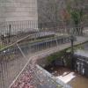
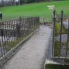
Horseshoe Falls Feeder Footbridge
is a minor waterways place
on the Shropshire Union Canal (Llangollen Canal - Main Line) between
Llantisilio - Horseshoe Falls (½ furlongs
to the northwest) and
Llangollen Basin (48 hour visitor moorings and the limit of navigation.) (1 mile and 4 furlongs
to the east).
The nearest place in the direction of Llangollen Basin is Horseshoe Falls Valve House;
a few yards
away.
There may be access to the towpath here.
Mooring here is impossible (it may be physically impossible, forbidden, or allowed only for specific short-term purposes). Only Canoes can reach this far up the Canal.
There is a bridge here which takes pedestrian traffic over the canal.
Llantisilio - Horseshoe Falls | ½ furlongs | |
Horseshoe Falls Feeder Footbridge | ||
Horseshoe Falls Valve House | a few yards | |
Kings Bridge No 49AW | ¾ furlongs | |
The Chainbridge Hotel Footbridge | 1 furlong | |
The Chainbridge Hotel & Riverside Restaurant | 1 furlong | |
River Dee Chainbridge | 1¼ furlongs |
There are no links to external websites from here.
Why not log in and add some (select "External websites" from the menu (sometimes this is under "Edit"))?
Mouseover for more information or show routes to facility
Nearest water point
In the direction of Hurleston Junction
Llangollen Basin — 1 mile, 4 furlongs away
On this waterway in the direction of Hurleston Junction
Llangollen Services — 1 mile, 7 furlongs away
On this waterway in the direction of Hurleston Junction
The Old Wharf — 6 miles, 2¾ furlongs away
Travel to Ruabon Branch Junction, then on the Shropshire Union Canal (Llangollen Canal - Ruabon Branch) to The Old Wharf
Trevor Basin — 6 miles, 3¾ furlongs away
Travel to Ruabon Branch Junction, then on the Shropshire Union Canal (Llangollen Canal - Ruabon Branch) to Trevor Basin
Coedfryn Water Point — 6 miles, 5½ furlongs away
On this waterway in the direction of Hurleston Junction
Chirk Marina — 8 miles, 4¼ furlongs away
On this waterway in the direction of Hurleston Junction
New Marton Water Points — 13 miles, 4 furlongs away
On this waterway in the direction of Hurleston Junction
Weston Arm Services (C&RT) — 17 miles, 4¾ furlongs and 6 locks away
Travel to Frankton Junction, then on the Shropshire Union Canal (Montgomery Canal - connected and navigable) to Weston Arm Junction, then on the Shropshire Union Canal (Weston Branch) to Weston Arm Services (C&RT)Nearest rubbish disposal
In the direction of Hurleston Junction
Llangollen Basin — 1 mile, 4 furlongs away
On this waterway in the direction of Hurleston Junction
Llangollen Services — 1 mile, 7 furlongs away
On this waterway in the direction of Hurleston Junction
Weston Arm Services (C&RT) — 17 miles, 4¾ furlongs and 6 locks away
Travel to Frankton Junction, then on the Shropshire Union Canal (Montgomery Canal - connected and navigable) to Weston Arm Junction, then on the Shropshire Union Canal (Weston Branch) to Weston Arm Services (C&RT)Nearest chemical toilet disposal
In the direction of Hurleston Junction
Llangollen Services — 1 mile, 7 furlongs away
On this waterway in the direction of Hurleston Junction
Chirk Marina — 8 miles, 4¼ furlongs away
On this waterway in the direction of Hurleston Junction
Whittington Wharf Narrowboats — 15 miles, 6¼ furlongs and 2 locks away
On this waterway in the direction of Hurleston Junction
Weston Arm Services (C&RT) — 17 miles, 4¾ furlongs and 6 locks away
Travel to Frankton Junction, then on the Shropshire Union Canal (Montgomery Canal - connected and navigable) to Weston Arm Junction, then on the Shropshire Union Canal (Weston Branch) to Weston Arm Services (C&RT)Nearest place to turn
In the direction of Hurleston Junction
Llangollen Basin — 1 mile, 4 furlongs away
On this waterway in the direction of Hurleston Junction
Bryn Howel Winding Hole — 4 miles, 4¼ furlongs away
On this waterway in the direction of Hurleston Junction
Ruabon Branch Junction — 6 miles, 2¾ furlongs away
On this waterway in the direction of Hurleston Junction
Trevor Basin — 6 miles, 3¾ furlongs away
Travel to Ruabon Branch Junction, then on the Shropshire Union Canal (Llangollen Canal - Ruabon Branch) to Trevor Basin
Coedfryn Winding Hole — 6 miles, 6¾ furlongs away
On this waterway in the direction of Hurleston Junction
Chirk Marina — 8 miles, 4¼ furlongs away
On this waterway in the direction of Hurleston Junction
Chirk Golf Course Winding Hole — 8 miles, 7¼ furlongs away
On this waterway in the direction of Hurleston Junction
Chirk Pool — 9 miles, 7¼ furlongs away
On this waterway in the direction of Hurleston Junction
Rhoswiel Bridge Winding Hole — 11 miles away
On this waterway in the direction of Hurleston Junction
Polletts Bridge Winding Hole — 15 miles, 3½ furlongs and 2 locks away
On this waterway in the direction of Hurleston Junction
Frankton Junction — 16 miles, 7¾ furlongs and 2 locks away
On this waterway in the direction of Hurleston Junction
Sewage Works Winding Hole — 19 miles, 6½ furlongs and 2 locks away
On this waterway in the direction of Hurleston Junction
Weston Arm Junction — 17 miles, 3¾ furlongs and 6 locks away
Travel to Frankton Junction, then on the Shropshire Union Canal (Montgomery Canal - connected and navigable) to Weston Arm Junction
Hawkswood Winding Hole — 18 miles, 2½ furlongs and 7 locks away
Travel to Frankton Junction, then on the Shropshire Union Canal (Montgomery Canal - connected and navigable) to Hawkswood Winding HoleNearest boatyard pump-out
In the direction of Hurleston Junction
The Old Wharf — 6 miles, 2¾ furlongs away
Travel to Ruabon Branch Junction, then on the Shropshire Union Canal (Llangollen Canal - Ruabon Branch) to The Old Wharf
Chirk Marina — 8 miles, 4¼ furlongs away
On this waterway in the direction of Hurleston Junction
Whittington Wharf Narrowboats — 15 miles, 6¼ furlongs and 2 locks away
On this waterway in the direction of Hurleston JunctionNo information
CanalPlan has no information on any of the following facilities within range:self-operated pump-out
Direction of TV transmitter (From Wolfbane Cybernetic)
There is no page on Wikipedia called “Horseshoe Falls Feeder Footbridge”
Wikipedia pages that might relate to Horseshoe Falls Feeder Footbridge
[Llangollen Canal]
Valley, Wrexham (built in 1786), a navigable feeder was built to Llantisilio where the Horseshoe Falls weir was constructed on the River Dee to supply
[Ellesmere Canal]
northwest of Wrexham, a feeder was constructed along the side of the Dee valley to Horseshoe Falls at Llantysilio. This narrow feeder branch was made navigable
Results of Google Search
HORSESHOE FALLS INTAKE GATE AND FOOTBRIDGE ...Site Description Intake gate and sluice taking water from Horseshoe Falls into the feeder watercourse of the Llangollen Canal. 19th centruy in date and crossed ...
Site Description Modern concrete slab footbridge, crossing the Llangollen Canal feeder watercourse, to allow access to land around the Horseshoe Falls.
Later that year, demand for passage over the Niagara River led to the building of a footbridge and then Charles Ellet's Niagara Suspension Bridge. This was ...
The feeder canal stretches from Trenton north to Frenchtown along the Delaware River. ... use trail from the Manville Causeway to the footbridge at Weston Canal Road on weekdays ... Dredging operations will begin approximately two weeks later and will continue through the fall of 2020. ... Horseshoe Bend Preserve map.
Feeder Dam 8. Guard Lock 8. Locks 73–75 ... Branch. Pack Horse Ford. Footbridge. Horseshoe. Bend ... Great Falls Tavern Visitor Center. Canal boat rides.
McArthur–Burney Falls Memorial State Park is the second oldest state park in the California ... Bridge parking lot to the headwaters spring (feeding Burney Falls). The loop returns crossing the Pacific Crest Trail Footbridge, back downstream, ... Hollenbeck Canyon · Honey Lake · Hope Valley · Horseshoe Ranch · Imperial ...
Mar 23, 2020 ... Bridges Over Niagara Falls: a history. ... A foot bridge three feet (0.91m) wide was soon built allowing a great number of persons to cross ... Allegheny River, where Roebling located a feeder for the Pennsylvania State Canal.