Kirklees College Car Park Bridge No 23A
Kirklees College: Huddersfield Centre, Manchester Road, Kirklees HD1 3LD, United Kingdom

Kirklees College Car Park Bridge No 23A
is a minor waterways place
on the Huddersfield Narrow Canal between
Golcar (2 miles and 1 furlong
and 10 locks
to the west) and
Aspley Basin (Huddersfield) (Moorings for Huddersfield and Junction of Huddersfield Broad and Narrow Canals) (5 furlongs
and 2 locks
to the east).
The nearest place in the direction of Golcar is Sellers Lock No 3E;
a few yards
away.
The nearest place in the direction of Aspley Basin (Huddersfield) is Chapel Hill Road Bridge No 23;
¼ furlongs
away.
There is access (suitable for wheels) to the towpath here.
Mooring here is impossible (it may be physically impossible, forbidden, or allowed only for specific short-term purposes).
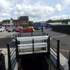
There is a bridge here which takes a minor road over the canal.
Longroyd Lock No 4E | 3¼ furlongs | |
Manchester Road Bridge No 25 | 3¼ furlongs | |
Site of Sellers Lock No 3E | 1¾ furlongs | |
Site of former Sellers Tunnel | 1½ furlongs | |
Sellers Lock No 3E | a few yards | |
Kirklees College Car Park Bridge No 23A | ||
Chapel Hill Road Bridge No 23 | ¼ furlongs | |
Coal Wharf Lock No 2E | ¾ furlongs | |
Bates Tunnel (western entrance) | 1 furlong | |
Bates Tunnel (eastern entrance) | 1½ furlongs | |
Queen Street South Bridge No 22 | 1½ furlongs |
There are no links to external websites from here.
Why not log in and add some (select "External websites" from the menu (sometimes this is under "Edit"))?
Mouseover for more information or show routes to facility
Nearest water point
In the direction of Ashton-under-Lyne Junction
Waterside Lock No 21E — 4 miles, ½ furlongs and 18 locks away
On this waterway in the direction of Ashton-under-Lyne Junction
Slaithwaite Winding Hole — 4 miles, 1¼ furlongs and 19 locks away
On this waterway in the direction of Ashton-under-Lyne Junction
Standedge Tunnel (eastern entrance) — 7 miles, 4¼ furlongs and 40 locks away
On this waterway in the direction of Ashton-under-Lyne Junction
Standedge Tunnel (western entrance) — 10 miles, 6 furlongs and 40 locks away
On this waterway in the direction of Ashton-under-Lyne Junction
Wool Road Bridge No 70 — 12 miles, 5¾ furlongs and 49 locks away
On this waterway in the direction of Ashton-under-Lyne Junction
Grove Road Bridge No 96 — 18 miles, 6 furlongs and 64 locks away
On this waterway in the direction of Ashton-under-Lyne Junction
In the direction of Aspley Basin (Huddersfield)
Aspley Basin (Huddersfield) — 5 furlongs and 2 locks away
On this waterway in the direction of Aspley Basin (Huddersfield)
Shepley Bridge Sanitary Station — 7 miles, 1¾ furlongs and 13 locks away
Travel to Aspley Basin (Huddersfield), then on the Huddersfield Broad Canal to Cooper Bridge Junction, then on the Calder and Hebble Navigation (Main Line) to Shepley Bridge Sanitary Station
Brighouse Basin — 6 miles, 3½ furlongs and 15 locks away
Travel to Aspley Basin (Huddersfield), then on the Huddersfield Broad Canal to Cooper Bridge Junction, then on the Calder and Hebble Navigation (Main Line) to Brighouse Basin
Salterhebble Sanitary Station — 10 miles, 5½ furlongs and 24 locks away
Travel to Aspley Basin (Huddersfield), then on the Huddersfield Broad Canal to Cooper Bridge Junction, then on the Calder and Hebble Navigation (Main Line) to Salterhebble Sanitary Station
Broad Cut Low Lock No 3 — 13 miles, 6¾ furlongs and 21 locks away
Travel to Aspley Basin (Huddersfield), then on the Huddersfield Broad Canal to Cooper Bridge Junction, then on the Calder and Hebble Navigation (Main Line) to Broad Cut Low Lock No 3
Salterhebble Junction — 10 miles, 5¾ furlongs and 25 locks away
Travel to Aspley Basin (Huddersfield), then on the Huddersfield Broad Canal to Cooper Bridge Junction, then on the Calder and Hebble Navigation (Main Line) to Salterhebble Junction
Sowerby Bridge Basin — 12 miles, 7¾ furlongs and 25 locks away
Travel to Aspley Basin (Huddersfield), then on the Huddersfield Broad Canal to Cooper Bridge Junction, then on the Calder and Hebble Navigation (Main Line) to Salterhebble Junction, then on the Calder and Hebble Navigation (Main Line) to Sowerby Bridge Basin
Ramsdens Bridge Sanitary Station — 19 miles, 2½ furlongs and 25 locks away
Travel to Aspley Basin (Huddersfield), then on the Huddersfield Broad Canal to Cooper Bridge Junction, then on the Calder and Hebble Navigation (Main Line) to Fall Ing Junction, then on the Aire and Calder Navigation (Wakefield Section) to Ramsdens Bridge Sanitary Station
Stanley Ferry Water Point — 19 miles, 3 furlongs and 25 locks away
Travel to Aspley Basin (Huddersfield), then on the Huddersfield Broad Canal to Cooper Bridge Junction, then on the Calder and Hebble Navigation (Main Line) to Fall Ing Junction, then on the Aire and Calder Navigation (Wakefield Section) to Stanley Ferry Water Point
Hebden Bridge Services — 18 miles, 3 furlongs and 32 locks away
Travel to Aspley Basin (Huddersfield), then on the Huddersfield Broad Canal to Cooper Bridge Junction, then on the Calder and Hebble Navigation (Main Line) to Salterhebble Junction, then on the Calder and Hebble Navigation (Main Line) to Sowerby Bridge Junction, then on the Rochdale Canal to Hebden Bridge ServicesNearest rubbish disposal
In the direction of Ashton-under-Lyne Junction
Pickle Lock No 22E — 4 miles, 1¾ furlongs and 19 locks away
On this waterway in the direction of Ashton-under-Lyne Junction
Wool Road Visitor Mooring — 12 miles, 6¼ furlongs and 49 locks away
On this waterway in the direction of Ashton-under-Lyne Junction
In the direction of Aspley Basin (Huddersfield)
Aspley Basin (Huddersfield) — 5 furlongs and 2 locks away
On this waterway in the direction of Aspley Basin (Huddersfield)
Shepley Bridge Sanitary Station — 7 miles, 1¾ furlongs and 13 locks away
Travel to Aspley Basin (Huddersfield), then on the Huddersfield Broad Canal to Cooper Bridge Junction, then on the Calder and Hebble Navigation (Main Line) to Shepley Bridge Sanitary Station
Brighouse Lower Basin Visitor Moorings — 6 miles, 3 furlongs and 14 locks away
Travel to Aspley Basin (Huddersfield), then on the Huddersfield Broad Canal to Cooper Bridge Junction, then on the Calder and Hebble Navigation (Main Line) to Brighouse Lower Basin Visitor Moorings
Horbury Basin Residential Moorings & Sanitary Station — 11 miles, 6 furlongs and 20 locks away
Travel to Aspley Basin (Huddersfield), then on the Huddersfield Broad Canal to Cooper Bridge Junction, then on the Calder and Hebble Navigation (Main Line) to Horbury Basin Residential Moorings & Sanitary Station
Salterhebble Sanitary Station — 10 miles, 5½ furlongs and 24 locks away
Travel to Aspley Basin (Huddersfield), then on the Huddersfield Broad Canal to Cooper Bridge Junction, then on the Calder and Hebble Navigation (Main Line) to Salterhebble Sanitary Station
Sowerby Bridge Basin — 12 miles, 7¾ furlongs and 25 locks away
Travel to Aspley Basin (Huddersfield), then on the Huddersfield Broad Canal to Cooper Bridge Junction, then on the Calder and Hebble Navigation (Main Line) to Salterhebble Junction, then on the Calder and Hebble Navigation (Main Line) to Sowerby Bridge Basin
Ramsdens Bridge Visitor Moorings — 19 miles, 2¾ furlongs and 25 locks away
Travel to Aspley Basin (Huddersfield), then on the Huddersfield Broad Canal to Cooper Bridge Junction, then on the Calder and Hebble Navigation (Main Line) to Fall Ing Junction, then on the Aire and Calder Navigation (Wakefield Section) to Ramsdens Bridge Visitor Moorings
Hebden Bridge Services — 18 miles, 3 furlongs and 32 locks away
Travel to Aspley Basin (Huddersfield), then on the Huddersfield Broad Canal to Cooper Bridge Junction, then on the Calder and Hebble Navigation (Main Line) to Salterhebble Junction, then on the Calder and Hebble Navigation (Main Line) to Sowerby Bridge Junction, then on the Rochdale Canal to Hebden Bridge ServicesNearest chemical toilet disposal
In the direction of Ashton-under-Lyne Junction
Waterside Lock No 21E — 4 miles, ½ furlongs and 18 locks away
On this waterway in the direction of Ashton-under-Lyne Junction
Pickle Lock No 22E — 4 miles, 1¾ furlongs and 19 locks away
On this waterway in the direction of Ashton-under-Lyne Junction
Wool Road Bridge No 70 — 12 miles, 5¾ furlongs and 49 locks away
On this waterway in the direction of Ashton-under-Lyne Junction
Grove Road Bridge No 96 — 18 miles, 6 furlongs and 64 locks away
On this waterway in the direction of Ashton-under-Lyne Junction
In the direction of Aspley Basin (Huddersfield)
Aspley Basin (Huddersfield) — 5 furlongs and 2 locks away
On this waterway in the direction of Aspley Basin (Huddersfield)
Shepley Bridge Sanitary Station — 7 miles, 1¾ furlongs and 13 locks away
Travel to Aspley Basin (Huddersfield), then on the Huddersfield Broad Canal to Cooper Bridge Junction, then on the Calder and Hebble Navigation (Main Line) to Shepley Bridge Sanitary Station
Brighouse Basin — 6 miles, 3½ furlongs and 15 locks away
Travel to Aspley Basin (Huddersfield), then on the Huddersfield Broad Canal to Cooper Bridge Junction, then on the Calder and Hebble Navigation (Main Line) to Brighouse Basin
Savile Town Wharf and Basin (Dewsbury) — 10 miles, 5 furlongs and 17 locks away
Travel to Aspley Basin (Huddersfield), then on the Huddersfield Broad Canal to Cooper Bridge Junction, then on the Calder and Hebble Navigation (Main Line) to Dewsbury Arm Junction, then on the Calder and Hebble Navigation (Dewsbury Old Cut) to Savile Town Wharf and Basin (Dewsbury)
Horbury Basin Residential Moorings & Sanitary Station — 11 miles, 6 furlongs and 20 locks away
Travel to Aspley Basin (Huddersfield), then on the Huddersfield Broad Canal to Cooper Bridge Junction, then on the Calder and Hebble Navigation (Main Line) to Horbury Basin Residential Moorings & Sanitary Station
Salterhebble Sanitary Station — 10 miles, 5½ furlongs and 24 locks away
Travel to Aspley Basin (Huddersfield), then on the Huddersfield Broad Canal to Cooper Bridge Junction, then on the Calder and Hebble Navigation (Main Line) to Salterhebble Sanitary Station
Sowerby Bridge Basin — 12 miles, 7¾ furlongs and 25 locks away
Travel to Aspley Basin (Huddersfield), then on the Huddersfield Broad Canal to Cooper Bridge Junction, then on the Calder and Hebble Navigation (Main Line) to Salterhebble Junction, then on the Calder and Hebble Navigation (Main Line) to Sowerby Bridge Basin
Ramsdens Bridge Sanitary Station — 19 miles, 2½ furlongs and 25 locks away
Travel to Aspley Basin (Huddersfield), then on the Huddersfield Broad Canal to Cooper Bridge Junction, then on the Calder and Hebble Navigation (Main Line) to Fall Ing Junction, then on the Aire and Calder Navigation (Wakefield Section) to Ramsdens Bridge Sanitary Station
Hebden Bridge Services — 18 miles, 3 furlongs and 32 locks away
Travel to Aspley Basin (Huddersfield), then on the Huddersfield Broad Canal to Cooper Bridge Junction, then on the Calder and Hebble Navigation (Main Line) to Salterhebble Junction, then on the Calder and Hebble Navigation (Main Line) to Sowerby Bridge Junction, then on the Rochdale Canal to Hebden Bridge ServicesNearest place to turn
In the direction of Ashton-under-Lyne Junction
Isis Lock Winding Hole — 1 mile, 4¼ furlongs and 6 locks away
On this waterway in the direction of Ashton-under-Lyne Junction
Linthwaite Winding Hole — 3 miles, ½ furlongs and 14 locks away
On this waterway in the direction of Ashton-under-Lyne Junction
Slaithwaite Winding Hole — 4 miles, 1¼ furlongs and 19 locks away
On this waterway in the direction of Ashton-under-Lyne Junction
Booth Lock Winding Hole — 5 miles, 6¼ furlongs and 29 locks away
On this waterway in the direction of Ashton-under-Lyne Junction
In the direction of Aspley Basin (Huddersfield)
University Arm — 4½ furlongs and 2 locks away
On this waterway in the direction of Aspley Basin (Huddersfield)
Aspley Basin (Huddersfield) — 5 furlongs and 2 locks away
On this waterway in the direction of Aspley Basin (Huddersfield)
Anchor Street Winding Hole — 1 mile, 2 furlongs and 2 locks away
Travel to Aspley Basin (Huddersfield), then on the Huddersfield Broad Canal to Anchor Street Winding Hole
New Road Winding Hole — 1 mile, 5½ furlongs and 2 locks away
Travel to Aspley Basin (Huddersfield), then on the Huddersfield Broad Canal to New Road Winding Hole
Deighton Road Bridge Winding Hole — 2 miles, 7¼ furlongs and 7 locks away
Travel to Aspley Basin (Huddersfield), then on the Huddersfield Broad Canal to Deighton Road Bridge Winding Hole
Cooper Bridge Junction — 4 miles, 1 furlong and 11 locks away
Travel to Aspley Basin (Huddersfield), then on the Huddersfield Broad Canal to Cooper Bridge Junction
Battye Weir Entrance — 4 miles, 6¼ furlongs and 12 locks away
Travel to Aspley Basin (Huddersfield), then on the Huddersfield Broad Canal to Cooper Bridge Junction, then on the Calder and Hebble Navigation (Main Line) to Battye Weir Entrance
Shepley Bridge Marina — 7 miles, 2 furlongs and 13 locks away
Travel to Aspley Basin (Huddersfield), then on the Huddersfield Broad Canal to Cooper Bridge Junction, then on the Calder and Hebble Navigation (Main Line) to Shepley Bridge Marina
Brighouse Basin — 6 miles, 3½ furlongs and 15 locks away
Travel to Aspley Basin (Huddersfield), then on the Huddersfield Broad Canal to Cooper Bridge Junction, then on the Calder and Hebble Navigation (Main Line) to Brighouse Basin
Ganny Winding Hole — 7 miles, ¾ furlongs and 16 locks away
Travel to Aspley Basin (Huddersfield), then on the Huddersfield Broad Canal to Cooper Bridge Junction, then on the Calder and Hebble Navigation (Main Line) to Ganny Winding Hole
Dewsbury Arm Junction — 9 miles, 5 furlongs and 17 locks away
Travel to Aspley Basin (Huddersfield), then on the Huddersfield Broad Canal to Cooper Bridge Junction, then on the Calder and Hebble Navigation (Main Line) to Dewsbury Arm Junction
Savile Town Wharf and Basin (Dewsbury) — 10 miles, 5 furlongs and 17 locks away
Travel to Aspley Basin (Huddersfield), then on the Huddersfield Broad Canal to Cooper Bridge Junction, then on the Calder and Hebble Navigation (Main Line) to Dewsbury Arm Junction, then on the Calder and Hebble Navigation (Dewsbury Old Cut) to Savile Town Wharf and Basin (Dewsbury)
Horbury Basin Residential Moorings & Sanitary Station — 11 miles, 6 furlongs and 20 locks away
Travel to Aspley Basin (Huddersfield), then on the Huddersfield Broad Canal to Cooper Bridge Junction, then on the Calder and Hebble Navigation (Main Line) to Horbury Basin Residential Moorings & Sanitary Station
Salterhebble Wharf — 10 miles, 4¾ furlongs and 23 locks away
Travel to Aspley Basin (Huddersfield), then on the Huddersfield Broad Canal to Cooper Bridge Junction, then on the Calder and Hebble Navigation (Main Line) to Salterhebble Wharf
Salterhebble Bottom Basin Visitor Moorings — 10 miles, 5 furlongs and 23 locks away
Travel to Aspley Basin (Huddersfield), then on the Huddersfield Broad Canal to Cooper Bridge Junction, then on the Calder and Hebble Navigation (Main Line) to Salterhebble Bottom Basin Visitor Moorings
Salterhebble Sanitary Station — 10 miles, 5½ furlongs and 24 locks away
Travel to Aspley Basin (Huddersfield), then on the Huddersfield Broad Canal to Cooper Bridge Junction, then on the Calder and Hebble Navigation (Main Line) to Salterhebble Sanitary StationNearest self-operated pump-out
In the direction of Ashton-under-Lyne Junction
Slaithwaite Winding Hole — 4 miles, 1¼ furlongs and 19 locks away
On this waterway in the direction of Ashton-under-Lyne Junction
Wool Road Bridge No 70 — 12 miles, 5¾ furlongs and 49 locks away
On this waterway in the direction of Ashton-under-Lyne Junction
In the direction of Aspley Basin (Huddersfield)
Ramsdens Bridge Sanitary Station — 19 miles, 2½ furlongs and 25 locks away
Travel to Aspley Basin (Huddersfield), then on the Huddersfield Broad Canal to Cooper Bridge Junction, then on the Calder and Hebble Navigation (Main Line) to Fall Ing Junction, then on the Aire and Calder Navigation (Wakefield Section) to Ramsdens Bridge Sanitary Station
Hebden Bridge Services — 18 miles, 3 furlongs and 32 locks away
Travel to Aspley Basin (Huddersfield), then on the Huddersfield Broad Canal to Cooper Bridge Junction, then on the Calder and Hebble Navigation (Main Line) to Salterhebble Junction, then on the Calder and Hebble Navigation (Main Line) to Sowerby Bridge Junction, then on the Rochdale Canal to Hebden Bridge ServicesNearest boatyard pump-out
In the direction of Aspley Basin (Huddersfield)
Aspley Basin (Huddersfield) — 5 furlongs and 2 locks away
On this waterway in the direction of Aspley Basin (Huddersfield)
Shepley Bridge Marina — 7 miles, 2 furlongs and 13 locks away
Travel to Aspley Basin (Huddersfield), then on the Huddersfield Broad Canal to Cooper Bridge Junction, then on the Calder and Hebble Navigation (Main Line) to Shepley Bridge Marina
Sowerby Bridge Basin — 12 miles, 7¾ furlongs and 25 locks away
Travel to Aspley Basin (Huddersfield), then on the Huddersfield Broad Canal to Cooper Bridge Junction, then on the Calder and Hebble Navigation (Main Line) to Salterhebble Junction, then on the Calder and Hebble Navigation (Main Line) to Sowerby Bridge BasinDirection of TV transmitter (From Wolfbane Cybernetic)
There is no page on Wikipedia called “Kirklees College Car Park Bridge No 23A”
Wikipedia pages that might relate to Kirklees College Car Park Bridge No 23A
[Huddersfield]
borough of Kirklees in West Yorkshire, England. It had a population of 162,949 at the 2011 census. It sits close to the Pennines, 14 miles (23 km) south-west
[Yorkshire]
Isobel (April 2010). "Tolson Museum Top Ten – Knurrs, spell and pommel". Kirklees Council. Archived from the original on 24 March 2015. Retrieved 28 January
[Yorkshire and the Humber]
behaviour. At A-level North Lincolnshire, Kirklees, Hull, York and North Yorkshire perform quite well with Kirklees consistently being the best by a large
[Robin Hood]
the Gest as the poor knight whom Robin aids owes money to the abbot. At Kirklees Priory in West Yorkshire stands an alleged grave with a spurious inscription
[Halifax, West Yorkshire]
1927 and to all traffic in June 1960. Halifax is also served by Sowerby Bridge railway station on the southwest edge of the town, just to the south of
[Wakefield]
Street Side, through Kirklees and on to Manchester crossed the River Calder by a ford at Wakefield near the site of Wakefield Bridge. Wakefield was probably
[Leeds]
of Leeds, a northern strip of the City of Bradford, the eastern part of Kirklees, and a section of southern North Yorkshire; it occupies 751 square kilometres
[Leeds Bradford Airport]
five boroughs, Leeds (40%), Bradford (40%) and Wakefield, Calderdale and Kirklees (sharing the remaining 20%). In October 2006, plans to privatise the airport
[Bramham, West Yorkshire]
with its silver locks, being carried off and set on a stake on London Bridge. There is a memorial stone marking where the Earl of Northumberland fell
[North West England]
a main MW transmitter for the region (and England), over the border in Kirklees, at Moorside Edge. Several commercial radio stations including: Heart North
Results of Google Search
Access to Higher Education (Health Science pathway) CERTA ...Access to Higher Education (Health Science pathway) CERTA Diploma Level 3 | Kirklees College ... Access will help you to develop your skills and self- confidence so you can successfully return to studying and progress to university. We have ... If you are 19-23 you may be eligible to pay a reduced fee. Please ask for ...
Musica Kirklees provides instrumental and vocal lessons to learners of all ages and all abilities, both in and out of school time. We offer access to over 70 exciting groups at our centres and central ensembles and we also support music making in schools across Kirklees. Over 10,000 instrumentalists and vocalists in Kirklees ...
Business and professional development 18-23. Business: Peter ... 4. SEARCH APPLY ENROL info@kirkleescollege.ac.uk • 01484 437070. @kirkleescollege facebook.com/kirkleescollege. WELCOME. FROM THE. DEPUTY ..... College but as a champion for all Access to HE students who represent an area of widening.
Dewsbury is a minster town in the Metropolitan Borough of Kirklees, in West Yorkshire, England. It is to the west of Wakefield, east of Huddersfield and south of Leeds. It lies by the River Calder and an arm of the Calder and Hebble Navigation. Historically a part of the West Riding of Yorkshire, after undergoing a period of ...
11/02/18 00:00, 18/02/18 23:59, Kirklees College - Provision of new pedestrian refuges and removal of vehicular dropped crossing. Only events active .... Alternative access can be made from Albion avenue. .... Works in conjunction with LCC and A E Yates - refurbishing Leeds Bridge GP070L13/DSTO/001.3.5. BRIDGEÂ ...
Book rooms from £35 at our Huddersfield North Hotel. Enjoy staying close to the Kirklees Light Railway, Galpharm Stadium and the Smith Art Gallery.
The latest Tweets from Commercial Mgr KC (@CommercialMgrKC). Commercial and Enterprise Manager at Kirklees College. #HuddersfieldHundred # BackingHuddersfield (all views are my own). Huddersfield.
Planning applications, Building regulations, Planning policy, Planning enforcement, Trees listing and conversation, Flooding and drainage, Regeneration and development.
Mar 9, 2015 ... Service design » Support materials » Service features » What people are saying » Use within Farnborough Sixth Form College » Use within Kirklees College Session outline; 4. Jisc Digital Festival, 9-10 March 2015, ICC Birmingham 5 Extending the product line to bridge the gap… OS, Historic, Geology ...
Cookies on kirklees.gov.uk. We use cookies to ensure that we give you the best possible experience on our website. By continuing without changing your cookie settings we'll assume that you're happy to receive all cookies on kirklees.gov.uk, but you can still change your cookie settings at any time. Continue Change ...