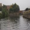
Central Road Winding Hole
is a minor waterways place
on the Sheffield and South Yorkshire Navigation (Sheffield Canal) between
Rawmarsh Road Bridge No 39 (6½ furlongs
to the northeast) and
Sheffield Terminal Warehouse (6 miles and 1¾ furlongs
and 15 locks
to the southwest).
The nearest place in the direction of Rawmarsh Road Bridge No 39 is Bridge Street Pipe Bridges (Rotherham);
¾ furlongs
away.
The nearest place in the direction of Sheffield Terminal Warehouse is Rotherham Lock No 4;
¼ furlongs
away.
Mooring here is unrated.
You can wind here.
| Greasbrough Road Pipe Bridge | 2¾ furlongs | |
| Greasbrough Road Bridge | 2½ furlongs | |
| Centenary Way (north) Bridge (32A) | 1½ furlongs | |
| Bridge Street Bridge (Rotherham) | ¾ furlongs | |
| Bridge Street Pipe Bridges (Rotherham) | ¾ furlongs | |
| Central Road Winding Hole | ||
| Rotherham Lock No 4 | ¼ furlongs | |
| Rotherham Town Centre Visitor Moorings | ½ furlongs | |
| Rotherham Canal Flood Barrier | ¾ furlongs | |
| Main Street Junction | 1 furlong | |
| Main Street Bridge | 1 furlong | |
Amenities here
Amenities nearby at Bridge Street Pipe Bridges (Rotherham)
Amenities nearby at Rotherham Lock No 4
- S&SY navigation info — associated with Sheffield and South Yorkshire Navigation
- Sheffield & South Yorkshire navigation info from IWA
Mouseover for more information or show routes to facility
Nearest water point
In the direction of Rawmarsh Road Bridge No 39
Eastwood Lock No 5 — 1 mile, 3¼ furlongs away
Travel to Rawmarsh Road Bridge No 39, then on the Sheffield and South Yorkshire Navigation (Main Line) to Eastwood Lock No 5
Kilnhurst Flood Lock No 7 — 4 miles, 1 furlong and 2 locks away
Travel to Rawmarsh Road Bridge No 39, then on the Sheffield and South Yorkshire Navigation (Main Line) to Kilnhurst Flood Lock No 7
Swinton Lock Activity Centre and CRT Sanitary Station — 5 miles, 6¼ furlongs and 4 locks away
Travel to Rawmarsh Road Bridge No 39, then on the Sheffield and South Yorkshire Navigation (Main Line) to Swinton Lock Activity Centre and CRT Sanitary Station
Mexborough Low Lock No 10 — 8 miles, 3¼ furlongs and 5 locks away
Travel to Rawmarsh Road Bridge No 39, then on the Sheffield and South Yorkshire Navigation (Main Line) to Mexborough Low Lock No 10
Sprotbrough Lock No 11 — 11 miles, 6¾ furlongs and 6 locks away
Travel to Rawmarsh Road Bridge No 39, then on the Sheffield and South Yorkshire Navigation (Main Line) to Sprotbrough Lock No 11
Doncaster Town Lock No 12 — 15 miles, ¾ furlongs and 7 locks away
Travel to Rawmarsh Road Bridge No 39, then on the Sheffield and South Yorkshire Navigation (Main Line) to Doncaster Town Lock No 12
Doncaster Visitor Pontoon Moorings — 15 miles, 3 furlongs and 8 locks away
Travel to Rawmarsh Road Bridge No 39, then on the Sheffield and South Yorkshire Navigation (Main Line) to Doncaster Visitor Pontoon Moorings
Long Sandall Lock No 13 — 18 miles, 4½ furlongs and 8 locks away
Travel to Rawmarsh Road Bridge No 39, then on the Sheffield and South Yorkshire Navigation (Main Line) to Long Sandall Lock No 13
In the direction of Sheffield Terminal Warehouse
Victoria Quays — 6 miles, 1½ furlongs and 15 locks away
On this waterway in the direction of Sheffield Terminal WarehouseNearest rubbish disposal
In the direction of Rawmarsh Road Bridge No 39
Eastwood Lock No 5 — 1 mile, 3¼ furlongs away
Travel to Rawmarsh Road Bridge No 39, then on the Sheffield and South Yorkshire Navigation (Main Line) to Eastwood Lock No 5
Doncaster Visitor Pontoon Moorings — 15 miles, 3 furlongs and 8 locks away
Travel to Rawmarsh Road Bridge No 39, then on the Sheffield and South Yorkshire Navigation (Main Line) to Doncaster Visitor Pontoon Moorings
In the direction of Sheffield Terminal Warehouse
Tinsley CRT facilities — 3 miles, 4 furlongs and 14 locks away
On this waterway in the direction of Sheffield Terminal Warehouse
Victoria Quays — 6 miles, 1½ furlongs and 15 locks away
On this waterway in the direction of Sheffield Terminal WarehouseNearest chemical toilet disposal
In the direction of Rawmarsh Road Bridge No 39
Eastwood Lock No 5 — 1 mile, 3¼ furlongs away
Travel to Rawmarsh Road Bridge No 39, then on the Sheffield and South Yorkshire Navigation (Main Line) to Eastwood Lock No 5
Swinton Lock Activity Centre and CRT Sanitary Station — 5 miles, 6¼ furlongs and 4 locks away
Travel to Rawmarsh Road Bridge No 39, then on the Sheffield and South Yorkshire Navigation (Main Line) to Swinton Lock Activity Centre and CRT Sanitary Station
In the direction of Sheffield Terminal Warehouse
Tinsley CRT facilities — 3 miles, 4 furlongs and 14 locks away
On this waterway in the direction of Sheffield Terminal Warehouse
Victoria Quays — 6 miles, 1½ furlongs and 15 locks away
On this waterway in the direction of Sheffield Terminal WarehouseNearest place to turn
In the direction of Rawmarsh Road Bridge No 39
Rawmarsh Road Winding Hole — 6 furlongs away
On this waterway in the direction of Rawmarsh Road Bridge No 39
Sir Frank Price Lock Arm — 1 mile, 2¾ furlongs away
Travel to Rawmarsh Road Bridge No 39, then on the Sheffield and South Yorkshire Navigation (Main Line) to Sir Frank Price Lock Arm
Sir Frank Price Lock Weir Exit — 1 mile, 4 furlongs and 1 lock away
Travel to Rawmarsh Road Bridge No 39, then on the Sheffield and South Yorkshire Navigation (Main Line) to Sir Frank Price Lock Weir Exit
Kilnhurst Flood Lock Winding Hole — 3 miles, 7¼ furlongs and 2 locks away
Travel to Rawmarsh Road Bridge No 39, then on the Sheffield and South Yorkshire Navigation (Main Line) to Kilnhurst Flood Lock Winding Hole
Swinton Junction — 5 miles, 5½ furlongs and 3 locks away
Travel to Rawmarsh Road Bridge No 39, then on the Sheffield and South Yorkshire Navigation (Main Line) to Swinton Junction
Swinton Road Corner — 6 miles, 1½ furlongs and 4 locks away
Travel to Rawmarsh Road Bridge No 39, then on the Sheffield and South Yorkshire Navigation (Main Line) to Swinton Road Corner
Sprotbrough Lock Weir Exit — 11 miles, 7¼ furlongs and 7 locks away
Travel to Rawmarsh Road Bridge No 39, then on the Sheffield and South Yorkshire Navigation (Main Line) to Sprotbrough Lock Weir Exit
Doncaster Visitor Pontoon Moorings — 15 miles, 3 furlongs and 8 locks away
Travel to Rawmarsh Road Bridge No 39, then on the Sheffield and South Yorkshire Navigation (Main Line) to Doncaster Visitor Pontoon Moorings
Gas House Bight — 15 miles, 4¾ furlongs and 8 locks away
Travel to Rawmarsh Road Bridge No 39, then on the Sheffield and South Yorkshire Navigation (Main Line) to Gas House Bight
Wheatley Hall Road Winding Hole — 17 miles, 4 furlongs and 8 locks away
Travel to Rawmarsh Road Bridge No 39, then on the Sheffield and South Yorkshire Navigation (Main Line) to Wheatley Hall Road Winding Hole
In the direction of Sheffield Terminal Warehouse
Main Street Junction — 1 furlong and 1 lock away
On this waterway in the direction of Sheffield Terminal Warehouse
Rotherham Junction — 2½ furlongs and 1 lock away
On this waterway in the direction of Sheffield Terminal Warehouse
Tinsley Lower Flight Weir Exit — 2 miles, 2¾ furlongs and 4 locks away
On this waterway in the direction of Sheffield Terminal Warehouse
Don Valley Stadium Visitor Moorings — 4 miles, 3 furlongs and 15 locks away
On this waterway in the direction of Sheffield Terminal Warehouse
Shirland Road Bridge Winding Hole — 4 miles, 5½ furlongs and 15 locks away
On this waterway in the direction of Sheffield Terminal Warehouse
Victoria Quays — 6 miles, 1½ furlongs and 15 locks away
On this waterway in the direction of Sheffield Terminal Warehouse
Sheffield Terminal Warehouse — 6 miles, 1¾ furlongs and 15 locks away
On this waterway in the direction of Sheffield Terminal WarehouseNearest self-operated pump-out
In the direction of Rawmarsh Road Bridge No 39
Long Sandall Lock No 13 — 18 miles, 4½ furlongs and 8 locks away
Travel to Rawmarsh Road Bridge No 39, then on the Sheffield and South Yorkshire Navigation (Main Line) to Long Sandall Lock No 13No information
CanalPlan has no information on any of the following facilities within range:boatyard pump-out
Direction of TV transmitter (From Wolfbane Cybernetic)
There is no page on Wikipedia called “Central Road Winding Hole”
Wikipedia pages that might relate to Central Road Winding Hole
[Isis Lock]
Oxford University. There is a winding hole for boats to turn on the Oxford Canal just to the north of the lock. In central Oxford, the Oxford Canal and
[Oil burner]
holds one main winding and one auxiliary winding aligned at 90°. The phase shift of 90° between the main winding and the auxiliary winding is achieved by
[Southwestway Park]
(3) Winding River Golf Course (18-hole course + driving range) Southwestway Park contains some of the most outstanding geological features in central Indiana
[Grand Central Terminal]
third rails as well as Carey's Hole, a former retail storage space and present-day employee lounge and dormitory. Grand Central Terminal contains an underground
[Esker]
eschar, or os, sometimes called an asar, osar, or serpent kame, is a long, winding ridge of stratified sand and gravel, examples of which occur in glaciated
[New City, New York]
the northern side, have remained tranquil and comprise wooded acres, winding roads, stone walls, trees, lakes, and streams. While undeveloped land for
[Lafayette, Tennessee]
Industries, Inc., and Tennplasco, which is a division of Manar, Inc. Winding Stairs Park; Winding Stairs Loop is a 1.6 mile moderately trafficked loop trail located
[Shades of Death Road]
Death Road, sometimes referred to locally as just "Shades"[citation needed], is a two-lane rural road of about 6.7 miles (10.8 km) in length in central Warren
[Kyle Park]
style." His LP Make or Break Me was released on September 20, 2011 on Winding Road Music. It included nine remixed tracks from his last two EPs and six
[Bob Marley]
apartment in the Bronx. Norman had written the extended lyrics for Kai Winding's "Time Is on My Side" (covered by the Rolling Stones) and had also written


![Rotherham - Rotherham Lock. This photo of Rotherham Lock on the Don Navigation was taken from the temporary footbridge at Rotherham Central Station. For a view of the lock from the south, please see [[1911331]]. For more details of this footbridge, please see http://en.wikipedia.org/wiki/River_Don_Navigation#Rotherham_Lock_footbridge by Dave Bevis – 22 February 2011](https://s0.geograph.org.uk/geophotos/02/28/33/2283308_3882a869_120x120.jpg)


![Rotherham Central railway station, Yorkshire, 2009. Opened in 1987 by British Rail on the line from Sheffield to Doncaster, this station replaced Masborough which was further from the town centre. Forecourt as built in 1987, looking towards Sheffield. The building was replaced in 2012 - see [[6185092]] for a 2018 image from the same position. by Nigel Thompson – 07 February 2009](https://s3.geograph.org.uk/geophotos/03/48/58/3485883_c2c62eda_120x120.jpg)