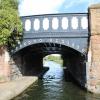
Sandhills Station Bridge No F
Sandhills Lane, Liverpool L5 9XE, United Kingdom
(A5055)

Sandhills Station Bridge No F
is a minor waterways place
on the Leeds and Liverpool Canal (Main Line - Liverpool to Wigan) between
Stanley Dock Cut Junction (4¼ furlongs
to the south) and
Lathom Junction (Junction with Leeds and Liverpool - Rufford Branch) (23 miles and 3½ furlongs
to the northeast).
The nearest place in the direction of Stanley Dock Cut Junction is Boundary Bridge No E;
2½ furlongs
away.
The nearest place in the direction of Lathom Junction is Sandhills Aqueduct No 1 (Old Cheshire Line Rail);
1¼ furlongs
away.
There is access (via steps) to the towpath here.
Mooring here is unrated.
There is a bridge here which takes a major road over the canal.
| Stanley Dock Cut Junction | 4¼ furlongs | |
| Leeds and Liverpool Mile Post Zero | 4 furlongs | |
| Gem Street Bridge No C | 4 furlongs | |
| Leigh Bridge No D | 3¼ furlongs | |
| Boundary Bridge No E | 2½ furlongs | |
| Sandhills Station Bridge No F | ||
| Sandhills Aqueduct No 1 | 1¼ furlongs | |
| Bank Hall Winding Hole | 1½ furlongs | |
| Bank Hall Railway Bridge No H | 1¾ furlongs | |
| Bank Hall Aqueduct No 2 | 3½ furlongs | |
| Bank Hall Station Bridge No I | 3¾ furlongs | |
There are no links to external websites from here.
Why not log in and add some (select "External websites" from the menu (sometimes this is under "Edit"))?
Mouseover for more information or show routes to facility
Nearest water point
In the direction of Wigan Junction
Litherland Visitor Moorings — 3 miles, ½ furlongs away
On this waterway in the direction of Wigan Junction
Dicconson's Bridge No 17 — 12 miles, 4 furlongs away
On this waterway in the direction of Wigan Junction
Scarisbrick Marina — 18 miles, 5½ furlongs away
On this waterway in the direction of Wigan Junction
In the direction of Eldonian Village
Salthouse Dock — 2 miles, 1½ furlongs and 6 locks away
Travel to Stanley Dock Cut Junction, then on the Leeds and Liverpool Canal (Stanley Dock Branch) to Stanley Dock, then on the Leeds and Liverpool Canal (Liverpool Link) to Salthouse Dock
Ellesmere Port Visitor Moorings — 8 miles, 1¾ furlongs and 11 locks away
Travel to Stanley Dock Cut Junction, then on the Leeds and Liverpool Canal (Stanley Dock Branch) to Stanley Dock, then on the Leeds and Liverpool Canal (Liverpool Link) to Salthouse Dock, then on the Liverpool South Docks to Mersey - South Docks Junction, then on the River Mersey (Tidal Section) to Mersey - Ship Canal Junction, then on the Manchester Ship Canal (Main Line) to Ellesmere Port Junction, then on the Shropshire Union Canal (Wirral Line - Main Line) to Ellesmere Port Visitor Moorings
Sutton Weaver Swing Bridge — 16 miles, 8 furlongs and 9 locks away
Travel to Stanley Dock Cut Junction, then on the Leeds and Liverpool Canal (Stanley Dock Branch) to Stanley Dock, then on the Leeds and Liverpool Canal (Liverpool Link) to Salthouse Dock, then on the Liverpool South Docks to Mersey - South Docks Junction, then on the River Mersey (Tidal Section) to Mersey - Ship Canal Junction, then on the Manchester Ship Canal (Main Line) to Weaver Mouth, then on the River Weaver (Weston Marsh Lock Line) to Weston Marsh Lock Entrance, then on the River Weaver (Main Line) to Sutton Weaver Swing Bridge
Taylor's Boatyard Drydock — 16 miles, 3 furlongs and 11 locks away
Travel to Stanley Dock Cut Junction, then on the Leeds and Liverpool Canal (Stanley Dock Branch) to Stanley Dock, then on the Leeds and Liverpool Canal (Liverpool Link) to Salthouse Dock, then on the Liverpool South Docks to Mersey - South Docks Junction, then on the River Mersey (Tidal Section) to Mersey - Ship Canal Junction, then on the Manchester Ship Canal (Main Line) to Ellesmere Port Junction, then on the Shropshire Union Canal (Wirral Line - Main Line) to River Dee Branch Junction, then on the Shropshire Union Canal (Chester Canal - Bunbury to Chester) to Taylor's Boatyard Drydock
C&RT Water Point (Chester) — 17 miles, 5 furlongs and 15 locks away
Travel to Stanley Dock Cut Junction, then on the Leeds and Liverpool Canal (Stanley Dock Branch) to Stanley Dock, then on the Leeds and Liverpool Canal (Liverpool Link) to Salthouse Dock, then on the Liverpool South Docks to Mersey - South Docks Junction, then on the River Mersey (Tidal Section) to Mersey - Ship Canal Junction, then on the Manchester Ship Canal (Main Line) to Ellesmere Port Junction, then on the Shropshire Union Canal (Wirral Line - Main Line) to River Dee Branch Junction, then on the Shropshire Union Canal (Chester Canal - Bunbury to Chester) to C&RT Water Point (Chester)
Water Point (Christleton) — 18 miles, 7½ furlongs and 19 locks away
Travel to Stanley Dock Cut Junction, then on the Leeds and Liverpool Canal (Stanley Dock Branch) to Stanley Dock, then on the Leeds and Liverpool Canal (Liverpool Link) to Salthouse Dock, then on the Liverpool South Docks to Mersey - South Docks Junction, then on the River Mersey (Tidal Section) to Mersey - Ship Canal Junction, then on the Manchester Ship Canal (Main Line) to Ellesmere Port Junction, then on the Shropshire Union Canal (Wirral Line - Main Line) to River Dee Branch Junction, then on the Shropshire Union Canal (Chester Canal - Bunbury to Chester) to Water Point (Christleton)Nearest rubbish disposal
In the direction of Wigan Junction
Litherland Visitor Moorings — 3 miles, ½ furlongs away
On this waterway in the direction of Wigan Junction
In the direction of Eldonian Village
Salthouse Dock — 2 miles, 1½ furlongs and 6 locks away
Travel to Stanley Dock Cut Junction, then on the Leeds and Liverpool Canal (Stanley Dock Branch) to Stanley Dock, then on the Leeds and Liverpool Canal (Liverpool Link) to Salthouse Dock
Sutton Weaver Swing Bridge — 16 miles, 8 furlongs and 9 locks away
Travel to Stanley Dock Cut Junction, then on the Leeds and Liverpool Canal (Stanley Dock Branch) to Stanley Dock, then on the Leeds and Liverpool Canal (Liverpool Link) to Salthouse Dock, then on the Liverpool South Docks to Mersey - South Docks Junction, then on the River Mersey (Tidal Section) to Mersey - Ship Canal Junction, then on the Manchester Ship Canal (Main Line) to Weaver Mouth, then on the River Weaver (Weston Marsh Lock Line) to Weston Marsh Lock Entrance, then on the River Weaver (Main Line) to Sutton Weaver Swing Bridge
St Martin's Way Bridge No 123J — 16 miles, 4¾ furlongs and 14 locks away
Travel to Stanley Dock Cut Junction, then on the Leeds and Liverpool Canal (Stanley Dock Branch) to Stanley Dock, then on the Leeds and Liverpool Canal (Liverpool Link) to Salthouse Dock, then on the Liverpool South Docks to Mersey - South Docks Junction, then on the River Mersey (Tidal Section) to Mersey - Ship Canal Junction, then on the Manchester Ship Canal (Main Line) to Ellesmere Port Junction, then on the Shropshire Union Canal (Wirral Line - Main Line) to River Dee Branch Junction, then on the Shropshire Union Canal (Chester Canal - Bunbury to Chester) to St Martin's Way Bridge No 123JNearest chemical toilet disposal
In the direction of Wigan Junction
Litherland Visitor Moorings — 3 miles, ½ furlongs away
On this waterway in the direction of Wigan Junction
In the direction of Eldonian Village
Sutton Weaver Swing Bridge — 16 miles, 8 furlongs and 9 locks away
Travel to Stanley Dock Cut Junction, then on the Leeds and Liverpool Canal (Stanley Dock Branch) to Stanley Dock, then on the Leeds and Liverpool Canal (Liverpool Link) to Salthouse Dock, then on the Liverpool South Docks to Mersey - South Docks Junction, then on the River Mersey (Tidal Section) to Mersey - Ship Canal Junction, then on the Manchester Ship Canal (Main Line) to Weaver Mouth, then on the River Weaver (Weston Marsh Lock Line) to Weston Marsh Lock Entrance, then on the River Weaver (Main Line) to Sutton Weaver Swing Bridge
Dee Branch Top Lock Footbridge — 16 miles, 3 furlongs and 12 locks away
Travel to Stanley Dock Cut Junction, then on the Leeds and Liverpool Canal (Stanley Dock Branch) to Stanley Dock, then on the Leeds and Liverpool Canal (Liverpool Link) to Salthouse Dock, then on the Liverpool South Docks to Mersey - South Docks Junction, then on the River Mersey (Tidal Section) to Mersey - Ship Canal Junction, then on the Manchester Ship Canal (Main Line) to Ellesmere Port Junction, then on the Shropshire Union Canal (Wirral Line - Main Line) to River Dee Branch Junction, then on the Shropshire Union Canal (Dee Branch) to Dee Branch Top Lock FootbridgeNearest place to turn
In the direction of Wigan Junction
Bank Hall Winding Hole — 1½ furlongs away
On this waterway in the direction of Wigan Junction
Bootle Winding Hole — 1 mile, 7¾ furlongs away
On this waterway in the direction of Wigan Junction
Litherland Winding Hole — 3 miles, 6¼ furlongs away
On this waterway in the direction of Wigan Junction
Ford Winding Hole — 4 miles, 3½ furlongs away
On this waterway in the direction of Wigan Junction
Aintree Winding Hole — 8 miles away
On this waterway in the direction of Wigan Junction
Melling Winding Hole — 9 miles, 5¼ furlongs away
On this waterway in the direction of Wigan Junction
Lydiate Winding Hole — 12 miles, 3 furlongs away
On this waterway in the direction of Wigan Junction
Jackson's Bridge Farm Winding Hole — 13 miles, 3¼ furlongs away
On this waterway in the direction of Wigan Junction
Downholland Winding Hole — 14 miles, 3¼ furlongs away
On this waterway in the direction of Wigan Junction
Halsall Hill Bridge Winding Hole — 16 miles, 6¾ furlongs away
On this waterway in the direction of Wigan Junction
Halsall Warehouse Bridge Winding Hole — 17 miles, 2 furlongs away
On this waterway in the direction of Wigan Junction
Scarisbrick Winding Hole — 18 miles, 5¾ furlongs away
On this waterway in the direction of Wigan Junction
In the direction of Eldonian Village
Stanley Dock Cut Junction — 4¼ furlongs away
On this waterway in the direction of Eldonian Village
Eldonian Village — 1 mile, ¼ furlongs away
On this waterway in the direction of Eldonian Village
Stanley Dock — 6¼ furlongs and 4 locks away
Travel to Stanley Dock Cut Junction, then on the Leeds and Liverpool Canal (Stanley Dock Branch) to Stanley Dock
Salthouse Dock — 2 miles, 1½ furlongs and 6 locks away
Travel to Stanley Dock Cut Junction, then on the Leeds and Liverpool Canal (Stanley Dock Branch) to Stanley Dock, then on the Leeds and Liverpool Canal (Liverpool Link) to Salthouse Dock
Ellesmere Port Junction — 7 miles, 7 furlongs and 8 locks away
Travel to Stanley Dock Cut Junction, then on the Leeds and Liverpool Canal (Stanley Dock Branch) to Stanley Dock, then on the Leeds and Liverpool Canal (Liverpool Link) to Salthouse Dock, then on the Liverpool South Docks to Mersey - South Docks Junction, then on the River Mersey (Tidal Section) to Mersey - Ship Canal Junction, then on the Manchester Ship Canal (Main Line) to Ellesmere Port Junction
Ellesmere Port Lower Basin — 7 miles, 7½ furlongs and 8 locks away
Travel to Stanley Dock Cut Junction, then on the Leeds and Liverpool Canal (Stanley Dock Branch) to Stanley Dock, then on the Leeds and Liverpool Canal (Liverpool Link) to Salthouse Dock, then on the Liverpool South Docks to Mersey - South Docks Junction, then on the River Mersey (Tidal Section) to Mersey - Ship Canal Junction, then on the Manchester Ship Canal (Main Line) to Ellesmere Port Junction, then on the Shropshire Union Canal (Wirral Line - Main Line) to Ellesmere Port Lower Basin
Ellesmere Port Upper Basin — 8 miles and 9 locks away
Travel to Stanley Dock Cut Junction, then on the Leeds and Liverpool Canal (Stanley Dock Branch) to Stanley Dock, then on the Leeds and Liverpool Canal (Liverpool Link) to Salthouse Dock, then on the Liverpool South Docks to Mersey - South Docks Junction, then on the River Mersey (Tidal Section) to Mersey - Ship Canal Junction, then on the Manchester Ship Canal (Main Line) to Ellesmere Port Junction, then on the Shropshire Union Canal (Wirral Line - Main Line) to Ellesmere Port Upper Basin
Winding Hole above Ellesmere Port Locks — 8 miles, ¾ furlongs and 11 locks away
Travel to Stanley Dock Cut Junction, then on the Leeds and Liverpool Canal (Stanley Dock Branch) to Stanley Dock, then on the Leeds and Liverpool Canal (Liverpool Link) to Salthouse Dock, then on the Liverpool South Docks to Mersey - South Docks Junction, then on the River Mersey (Tidal Section) to Mersey - Ship Canal Junction, then on the Manchester Ship Canal (Main Line) to Ellesmere Port Junction, then on the Shropshire Union Canal (Wirral Line - Main Line) to Winding Hole above Ellesmere Port LocksNearest self-operated pump-out
In the direction of Wigan Junction
Litherland Visitor Moorings — 3 miles, ½ furlongs away
On this waterway in the direction of Wigan Junction
In the direction of Eldonian Village
Dee Branch Top Lock Footbridge — 16 miles, 3 furlongs and 12 locks away
Travel to Stanley Dock Cut Junction, then on the Leeds and Liverpool Canal (Stanley Dock Branch) to Stanley Dock, then on the Leeds and Liverpool Canal (Liverpool Link) to Salthouse Dock, then on the Liverpool South Docks to Mersey - South Docks Junction, then on the River Mersey (Tidal Section) to Mersey - Ship Canal Junction, then on the Manchester Ship Canal (Main Line) to Ellesmere Port Junction, then on the Shropshire Union Canal (Wirral Line - Main Line) to River Dee Branch Junction, then on the Shropshire Union Canal (Dee Branch) to Dee Branch Top Lock FootbridgeNearest boatyard pump-out
In the direction of Wigan Junction
Scarisbrick Marina — 18 miles, 5½ furlongs away
On this waterway in the direction of Wigan JunctionDirection of TV transmitter (From Wolfbane Cybernetic)
Down into the Docks from Scribblings from the Mintball posted Friday the 23rd of September, 2016
There is no page on Wikipedia called “Sandhills Station Bridge No F”
Wikipedia pages that might relate to Sandhills Station Bridge No F
[Hawarden Bridge railway station]
Centre at Sandhills. It is situated immediately to the north of the Hawarden Bridge railway swing bridge that last opened in 1960. The station is unmanned
[Burscough Bridge railway station]
Burscough Bridge railway station (pronounced Burs/co Bridge) serves the town of Burscough in Lancashire, England. It is a main stop on the Manchester-Southport
[Central railway station, Sydney]
Sydney cemetery or New Burial Ground, also known as the Sandhills or Devonshire Street station, was located in the Brickfields, a site now occupied by
[Little Neck station]
Little Neck Parkway & Sandhill Road Railroad Crossing (Forgotten NY.com) Little Neck Station (Bridge and Tunnel Club) Station House from Google Maps
[Kirkby railway station]
Manchester, Bolton & Wigan serving the station could no longer operate beyond Sandhills as Diesel Multiple Units were banned from operating in the new tunnels
[I've Been Working on the Railroad]
University songs published in 1894. The earliest known recording is by the Sandhills Sixteen, released by Victor Records in 1927. The melody of the opening
[U.S. Route 20 in Nebraska]
the sandhills. Between Merriman and Crookston, the highway is within five miles (8.0 km) of the South Dakota border. Continuing through the sandhills, the
[Merseyrail]
at frequent intervals from Sandhills station with ticketing to combine both methods of travel available. Kirkdale station is within walking distance of
[Carolina Sandhills National Wildlife Refuge]
Middendorf Formation. The Carolina Sandhills NWR is dedicated to the preservation of a portion of the Carolina Sandhills, a distinct ecosystem characterized
[Valentine, Nebraska]
immediately north of the Niobrara River, on the northern edge of the Sandhills physiographic region. Merritt Reservoir, created by a dam on the Snake


![Bench mark on the Northern Line railway bridge. This Ordnance Survey bench mark is on the south west buttress of the Merseyrail Northern Line bridge over the Leeds-Liverpool Canal. The mark first appears on the 1890 O.S. map but has disappeared again by the time of the 1908 map. See also [[5495462]] by John S Turner – 31 July 2017](https://s3.geograph.org.uk/geophotos/05/49/54/5495455_cfcb3e83_120x120.jpg)
![Northern Line bridge over the Leeds-Liverpool Canal. The Merseyrail Northern Line Bridge over the Leeds-Liverpool Canal. There is an Ordnance Survey bench mark on the buttress to the left of the towpath - [[5495455]] by John S Turner – 31 July 2017](https://s2.geograph.org.uk/geophotos/05/49/54/5495462_8deb577d_120x120.jpg)